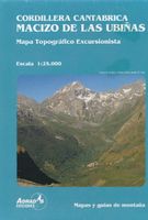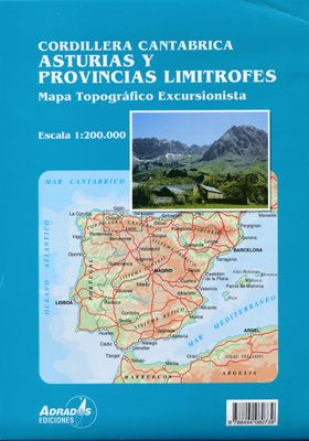

Wegenkaart - landkaart Cordillera Cantabrica - Asturias y provincias limitrofes | Adrados Ediciones

0
Gedetailleerde wegenkaart an de Cordillera Cantabrica met hoogtelijnen, hoogte verschillen in kleur en schaduw en UTM coördinaten. Met plaatsnamen index! Cordillera Cantabrica on a detailed road map from the Oviedo based Adrados Ediciones, presenting this mountainous region with contours at 100m intervals, altitude coluring, relief shading and UTM...

Alle aanbiedingen van dit product

Verkoper
Bezorging
Prijs
DeZwerver.nl logo
DeZwerver.nl
2,95
14,95

Anderen bekeken ook

Wegenkaart - landkaart Cordillera Cantabrica - Asturias y provincias limitrofes | Adrados Ediciones
Gedetailleerde wegenkaart an de Cordillera Cantabrica met hoogtelijnen, hoogte verschillen in kleur en schaduw en UTM coördinaten. Met plaatsnamen index! Cordillera Cantabrica on a detailed road map from the Oviedo based Adrados Ediciones, presenting this mountainous region with contours at 100m intervals, altitude coluring, relief shading and UTM coordinates. Since the publishers specialize in detailed hiking maps, including the best coverage of the Picos de Europa, the map includes an exceptionally large number of names of peaks, passes, etc. Symbols highlight best rock and ice climbing areas, huts and refuges, campsites, mountain rescue posts and information centres. Along the coast numerous beaches are named. Road network includes small country roads and tracks. Local railway lines are shown, although not very easy to see on the base map filled with so much information. The map has a 10km UTM grid. Map legend is in Spanish only. On the reverse is a panorama drawing of the area, lo…
14,95
Wandelkaart Sierra de Gredos | Adrados Ediciones
On one side is a detailed 1:25,000 walking map concentrating on the central sector of the Regional Park around the Almanzor and La Mira peaks. Detailed contours are at 10m intervals, walking trails are marked and springs & refuges are highlighted. On the reverse is a smaller scale map at 1:135,000 extending over a larger area - well beyond the limits of the Regional Park border, to Avila in the extreme north east of the sheet and to Jaraiz de la Vera in the south west. It shows the general topography of the region through contouring, altitude tinting and hill shading, and includes roads and paths with symbols for petrol stations, campsites, refuges and information offices. Map legend and explanatory notes for interpreting the maps are in Spanish only. UTM grid lines are printed over both maps.  
14,95
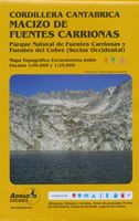
Wandelkaart Macizo de Fuentes Carrionas | Adrados Ediciones
Fuentes Carrionas Massif, just south of the Picos de Europa, on a detailed hiking map from Adrados Ediciones combining coverage at 1:60,000 of the western part of Fuentes Carrionas and Fuentes del Cobre Natural Park with more detailed mapping at 1:25,000 of Peña Prieta Massif. The main map at 1:50,000 has contours at 20m intervals with bold relief shading and altitude colouring. Numerous peaks and other topographical features are named. Hiking, mountain bike and ski trails are highlighted and symbols mark campsites, mountain shelters and cabins, viewpoints, climbing areas, tourist information centres, locations of petrol stations, etc. On the reverse the central part of the main map, the Peña Prieta Massif is shown at 1:25,000 with the excellent cartography used in the publishers’ coverage of the Picos de Europa. Contours are at 10, intervals with additional graphic relief for exposed rocky faces.  
14,95
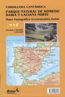
Wandelkaart Parque Natural de Somiedo Babia y Laciana Norte | Adrados Ediciones
Uitstekende topografische wandelkaart met hoogtelijnen van een klein wandelgebied ten Zuid Westen van Oviedo. Op de kaart zijn zowel gemarkeerde als niet gemarkeerde wandelroutes aangegeven alsmede campings en berghutten. Mapa del Parque Natural de Somiedo y su periferia, Teverga, Babia y Laciana. Impreso a dos caras, con un 50.000 de todo el área por una de ellas y un 25.000 de la zona central: Macizo de Peña Orníz y Macizo del Cornón con curvas de nivel cada 20 metros y colores hipsométricos en el 50.000 y curvas a 10 metros y representación de la geomorfología en el 25.000.    Se señalan en la simbología los campings, los albergues, zonas de escalada y otros puntos de interés para el excursionista y el montañero. También se señalan los senderos balizados (PR), seis rutas de BTT que se describen en una guía en PDF que se puede descargar en esta misma Web y las rutas de Esquí-Montaña que se reseñan en el segundo tomo de LA CORDILLERA CON ESQUÍS Y RAQUETAS DE NIEVE, de este mismo catá…
14,95
Wegenkaart - landkaart 572 Asturias - Cantabria - Oviedo - Santander | Michelin
Zoals je van Michelin mag verwachten zijn het onmisbare overzichtskaarten van een uitstekende kwaliteit: een duidelijk en goed leesbaar kaartbeeld.  Vrijwel alle berijdbare wegen staan er op ingetekend, in kleur verschillend voor grote en kleine wegen. Andere weginformatie omvat bijvoorbeeld kilometer-afstanden, tolwegen, helling-aanduiding, winterafsluitingen, tankstations maar ook de bekende groene routes: de mooiste wegen om te rijden.   Daarnaast geeft de kaart toeristische informatie met symbolen weer: bezienswaardigheden als kastelen, kloosters, musea, maar ook campings (niet allemaal overigens). De kaart is voorzien van een 4-talige legenda.   Toch hebben de makers door een beperkt gebruik van symbolen geen drukke kaart gemaakt. De kracht zit hem dan ook in de combinatie van meer dan voldoende informatie en goede leesbaarheid.  Part of the orange regional series from Michelin, this Asturia, Cantabria map shows this part of Spain in excellent detail. Primary & secondary road net…
12,95
Wegenkaart - landkaart Peru | ITMB
Een degelijke kaart met aanduidingen van o.a. nationale parken, vliegveld, dirt-roads en kleine plattegrond van hoofdstad. Als overzichtskaart goed te gebruiken. Peru at 1:1,500,000 on a double-sided, waterproof and tear-resistant, indexed map from ITMB, with large, clear street plans of central Lima and Cusco, highlighting accommodation, places of interest and various facilities. The map divides the country north/south, approximately along the line between the Cordillera Blanca and Cordillera Huyahuash, with very little overlap between the two sides. Topography is very effectively presented by altitude colouring, with spot heights and additional graphics for swamps and marshland, glaciers and volcanos. The map shows the country’s road network distinguishing between all-weather and seasonable roads and indicates driving distances on main routes. Railway lines, including the popular routes linking Cusco with Puno and Arequipa, are very clearly shown. The map also shows local airports a…
14,95
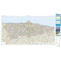
Wegenkaart - landkaart Mapa Provincial Asturias | CNIG - Instituto Geográfico Nacional
Deze kaart is zuiver gericht op de provincie als in de titel. Gebieden naast de kaart worden zonder kleur weergegeven. Ideale kaart als het gaat om het onderscheid in topografische details als hoogte, nationale parken, vegetatie en plaatsen. Met schaduwrelief wordt hoogte goed zichtbaar. Zeker geschikt voor fietsers, al heb je er soms wel veel nodig. Nadeel is het feit dat deze kaarten niet altijd even goed up-to-date zijn. Het komt soms wel voor dat bepaalde wegen inmiddels veel groter zijn geworden dan ingetekend op de kaart. Maar dan gaat het vooral om de grotere wegen: voor kleinere details is het een prima kaart. One of the titles in a series of contoured road maps from Spain's civilian survey organisation, each covering one administrative province, excellent in presenting the country’s topography and locations of its many national and natural parks. The maps have contours at 100-metre intervals enhanced by relief shading, plus spot heights. Additional colouring is used to indica…
9,95

Klanten-reviews van Wegenkaart - landkaart Cordillera Cantabrica - Asturias y provincias limitrofes | Adrados Ediciones

Er zijn nog geen beoordelingen voor dit productBen jij de eerste die een review plaatst?

Meer over Wegenkaart - landkaart Cordillera Cantabrica - Asturias y provincias limitrofes | Adrados Ediciones

Productomschrijving

Gedetailleerde wegenkaart an de Cordillera Cantabrica met hoogtelijnen, hoogte verschillen in kleur en schaduw en UTM coördinaten. Met plaatsnamen index!

Cordillera Cantabrica on a detailed road map from the Oviedo based Adrados Ediciones, presenting this mountainous region with contours at 100m intervals, altitude coluring, relief shading and UTM coordinates.

Since the publishers specialize in detailed hiking maps, including the best coverage of the Picos de Europa, the map includes an exceptionally large number of names of peaks, passes, etc. Symbols highlight best rock and ice climbing areas, huts and refuges, campsites, mountain rescue posts and information centres. Along the coast numerous beaches are named.

Road network includes small country roads and tracks. Local railway lines are shown, although not very easy to see on the base map filled with so much information. The map has a 10km UTM grid. Map legend is in Spanish only.

On the reverse is a panorama drawing of the area, looking south from the coast with León and Pontevedra in the background. Numerous towns and villages, as well as peaks of the Cordillera Cantabrica are named. An administrative map of the area shows its division into communes and highlights its many protected areas, accompanied by an index listing, where appropriate, each commune with its highest peak.

Also included is a very extensive list of all the peaks in the Cordillera Cantabrica over 1200m. Accompanying notes are in Spanish only.

Important - please note: All place names are in the local dialect, so Xixon for Gijón, Uvieu for Oviedo, etc. The map is printed on glossy paper and may not withstand repeated folding and unfolding whilst traveling by car, but it is ideal for finding out more about this fascinating region outside its main attraction, the Picos de Europa.

Productinformatie

    Verken gerelateerde categorieën

    Webshop.nl maakt gebruik van cookies. Ga je verder op onze website, ga dan akkoord met het plaatsen van cookies en de verwerking van deze data door ons en vermelde partners.