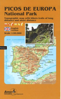
Wandelkaart Picos de Europa National | Adrados Ediciones

0
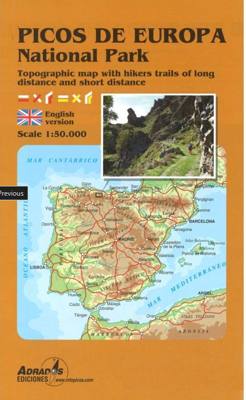
Picos de Europa National Park Short and Long-Distance Trails at 1:50,000 on an excellent, contoured and GPS compatible map from Adrados Ediciones highlighting three hiking routes which can be combined into a Tour of the Picos, plus English language descriptions of the routes and lists of mountain huts and refuges.   The map covers the whole of the...

Verkopers met dit product

Verkoper
Bezorging
Prijs
DeZwerver.nl logo
DeZwerver.nl
2,95
14,95

Anderen bekeken ook

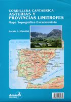
Wegenkaart - landkaart Cordillera Cantabrica - Asturias y provincias limitrofes | Adrados Ediciones
Gedetailleerde wegenkaart an de Cordillera Cantabrica met hoogtelijnen, hoogte verschillen in kleur en schaduw en UTM coördinaten. Met plaatsnamen index! Cordillera Cantabrica on a detailed road map from the Oviedo based Adrados Ediciones, presenting this mountainous region with contours at 100m intervals, altitude coluring, relief shading and UTM coordinates. Since the publishers specialize in detailed hiking maps, including the best coverage of the Picos de Europa, the map includes an exceptionally large number of names of peaks, passes, etc. Symbols highlight best rock and ice climbing areas, huts and refuges, campsites, mountain rescue posts and information centres. Along the coast numerous beaches are named. Road network includes small country roads and tracks. Local railway lines are shown, although not very easy to see on the base map filled with so much information. The map has a 10km UTM grid. Map legend is in Spanish only. On the reverse is a panorama drawing of the area, lo…
14,95
Wandelgids Picos de Europa | Sunflower books
Wandelgids: vele dagtochten worden degelijk beschreven met openbaar vervoer informatie, goede routebeschrijvingen en kaartmateriaal. Tevens enkele autotochten. Deze gids staat goed bekend! Engelstalig, want Nederlandstalige is uitverkocht en niet meer leverbaar. The go-to Picos de Europa travel guide for discovering the best walks and car tours. Strap on your boots and discover Picos de Europa on foot with the Sunflower Picos de Europa travel guide. And on the days when your feet may have had enough, enjoy some spectacular scenery on our recommended car tour.   The Sunflower Picos de Europa guide is indispensable for hiking in Picos de Europa or seeing Picos de Europa by car. The Picos de Europa, one of Europe's last mountain wilderness areas, are the high point of a long ridge of mountains which runs along the north coast of Spain, the Cordillera Cantabrica. Rising to 2648m, about 8700ft, the Picos are divided into three spectacular limestone massifs separated from one another, and f…
21,95
Wandelkaart Cabo de Gata / Nijar | Editorial Alpina
Zeer gedetailleerde wandelkaart van een klein gebied. Met ingetekende wandelroutes en andere informatie. Spaanstalig, maar uitstekende kaart. Coordinaten zijn weergegeven, dus GPS compatible met UTM grid.    Op de topografische wandelkaart worden o.a. berghutten, campings aangeduid en hoogtelijnen, ingetekende wandelroutes en de GR paden (doorgaande langeafstandswandelpaden).  Cabo da Gata-Níjar Natural Park in an extensive and very popular series of walking maps from Editorial Alpina covering the Pyrenees, Catalonia and other selected hiking areas in Spain, including Picos de Europa, Sierra Nevada and parts of Andalucía, Majorca, etc. Scales vary from 1:50,000 to 1:10,000, with the majority of the titles at 1:25,000. The maps have contours, usually at 20m or 10m intervals, with additional hill shading and spot heights. An overprint highlights hiking trails, long-distance footpaths, campsites, mountain huts, refuges, etc. Many maps also show climbing sites, potholing caves, mountain b…
17,95
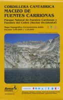
Wandelkaart Macizo de Fuentes Carrionas | Adrados Ediciones
Fuentes Carrionas Massif, just south of the Picos de Europa, on a detailed hiking map from Adrados Ediciones combining coverage at 1:60,000 of the western part of Fuentes Carrionas and Fuentes del Cobre Natural Park with more detailed mapping at 1:25,000 of Peña Prieta Massif. The main map at 1:50,000 has contours at 20m intervals with bold relief shading and altitude colouring. Numerous peaks and other topographical features are named. Hiking, mountain bike and ski trails are highlighted and symbols mark campsites, mountain shelters and cabins, viewpoints, climbing areas, tourist information centres, locations of petrol stations, etc. On the reverse the central part of the main map, the Peña Prieta Massif is shown at 1:25,000 with the excellent cartography used in the publishers’ coverage of the Picos de Europa. Contours are at 10, intervals with additional graphic relief for exposed rocky faces.  
14,95
Wandelkaart 11 Sierra y Cañones de Guara, Canyons National Park | Editorial Alpina
Zeer gedetailleerde wandelkaart van een klein gebied. Met ingetekende wandelroutes en andere informatie. Spaanstalig, maar uitstekende kaart. Coordinaten zijn weergegeven, dus GPS compatible met UTM grid.    Op de topografische wandelkaart worden o.a. berghutten, campings aangeduid en hoogtelijnen, ingetekende wandelroutes en de GR paden (doorgaande langeafstandswandelpaden). De kaart is inclusief een Spaanstalig boekje met extra informatie over aanwezige voorzieningen en enkele routes.   Gebied: Huesca, Urriales, Bárcabo, Alquézar, Buera, Adahuesca, Salas Altas, Ibieca, Bastarás, Chibluco, Pedruel, Otín, Lúsera, Arguis, Lúsera, Nueno, Igriés, Loporzano, Chibluco, Bara, Nocito, Used, Tozal de Guara, Tozal de la Cabeza A topographic tourist map and hiking guide with details of tourist attractions, hiking & sporting activities as well as transport information. An excellent folded map & booklet. Sierra de Guara in an extensive and very popular series of walking maps from Editorial Alpina…
19,95
Wandelkaart Tatry Zachodnie | Sygnatura
Goede wandelkaart van het grote westelijke deel van het Tatra gebergte, zowel aan de Poolse als aan de SLowaakse kant. Wandelpaden, campings, hutten, alles staat er op.  Western Tatra Mountains in Poland and Slovakia at 1:25,000 on a contoured and GPS compatible map from CartoMedia highlighting waymarked hiking trails, mountain huts and campsites, places of interest, etc, Coverage extends from Zakopane westwards to Habovka. On the reverse are panels with an overview of the waymarked hiking trails for planning longer routes, a road map showing access to this part of the Tatra Mountains from both sides of the border, a directory of local mountain huts and other useful tourist information, etc.   Maps in the Cartomedia hiking series present topography is by contours at 20m intervals, enhanced by relief shading and, where appropriate, graphic relief for exposed rocky areas. Waymarked hiking trails indicate approximate walking times in both directions and possible danger points. Most title…
9,95
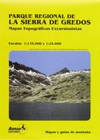
Wandelkaart Sierra de Gredos | Adrados Ediciones
On one side is a detailed 1:25,000 walking map concentrating on the central sector of the Regional Park around the Almanzor and La Mira peaks. Detailed contours are at 10m intervals, walking trails are marked and springs & refuges are highlighted. On the reverse is a smaller scale map at 1:135,000 extending over a larger area - well beyond the limits of the Regional Park border, to Avila in the extreme north east of the sheet and to Jaraiz de la Vera in the south west. It shows the general topography of the region through contouring, altitude tinting and hill shading, and includes roads and paths with symbols for petrol stations, campsites, refuges and information offices. Map legend and explanatory notes for interpreting the maps are in Spanish only. UTM grid lines are printed over both maps.  
14,95
Wandelgids Walking in the Picos de Europa | Cicerone
Guidebook to 38 walks and 4 short treks of 3-4 days in the stunning Picos de Europa mountains of northern Spain. The walking routes are between 8 and 24 km in length and are graded by difficulty, ranging from easy valley walks to difficult ascents of the high peaks. The walks cover the areas of Cangas de Onis, Cabrales, Liebana, Valdeon and Sajambre.   Alongside detailed route descriptions and 1:50k mapping, there is plenty of information on potential bases, manned refuges, local transport and facilities along the routes. There are also background notes on the area's rich geology, plants and wildlife. Spain's first national park, the Picos de Europa feature striking karst landscapes of jagged peaks and deeply incised gorges.   However, there are also beech woods and picturesque alpine lakes, and the diverse landscapes support a wide variety of plants, wildlife and birdlife. The walks showcase many of the region's highlights, including its high peaks, the Covadonga lakes and the breath…
24,95
Wandelkaart Picos de Europa National Park | Adrados Ediciones
Heldere overizchtskaart van de Picos de Europa: het dekt het hele gebied op schaal 1:50.000. De wandelpaden zijn gekleurd ingetekend, berghutten staan er ook goed op. De ondergrond is topografische met hoogtelijnen.  Voor de gewone wandelingen is dit een prima kaart. Als je echt de bergen in gaat, dan zjin de 2 delen van de Picos (west en oost) van dezelfde uitgever op schaal 1:25.000 nog beter! Van de uitgever: Mapa del Parque Nacional de los Picos de Europa, representando los tres macizos y sierras periféricas con curvas de nivel cada 20 metros y tintas hipsométricas. Información toponímica y topográfica muy completa y con el itinerario del ANILLO DE PICOS incluido.   En el dorso del mapa se ofrece la reseña detallada de todas las etapas de las tres modalidades de esta Alta Ruta, en la que colabora la Asociación de Guardas de Refugios y otros establecimientos hosteleros ubicados estratégicamente de los Valles.   Las dimensiones del mapa son 98x70 centímetros (23x14 cms plegado).    …
14,95
Wandelkaart Wanderkarte Schweiz - Zwitserland overzichtskaart | Kümmerly & Frey
Vanwege de schaal vooral geschikt als overzichtskaart. Hiking map with the official routes "Hiking in Switzerland" with hiking times and distances. More than 750 additional hiking routes. With index and a regional approach map. Water- and rip-proof map. Switzerland’s national and regional long-distance hiking paths on a waterproof and tear-resistant indexed map at 1:301,000 from Kümmerly + Frey, with numerous local trails, plus a list of all the long-distance routes. The departure and arrival points of each long-distance route are clearly marked, and each route is divided into stages by highlighting intermediate locations, with the distances and hiking times in both directions indicated for the individual sections. Symbols show mountain huts, campsites, youth hostels, Friends of Nature Houses and selected local hotels. On the reverse an extensive index includes lists of geographical features (peaks, passes, rivers, etc), huts, places of interest, etc. Also provided is a list of the si…
19,95

Klanten-reviews van Wandelkaart Picos de Europa National | Adrados Ediciones

Er zijn nog geen beoordelingen voor dit productBen jij de eerste die een review plaatst?

Meer over Wandelkaart Picos de Europa National | Adrados Ediciones

Productomschrijving

Picos de Europa National Park Short and Long-Distance Trails at 1:50,000 on an excellent, contoured and GPS compatible map from Adrados Ediciones highlighting three hiking routes which can be combined into a Tour of the Picos, plus English language descriptions of the routes and lists of mountain huts and refuges.   The map covers the whole of the National Park area and extends north and west beyond its borders to include Potes and other surrounding villages. Very fine cartography provides an excellent presentation of the terrain through contours at 20m intervals enhanced by relief shading and altitude colouring, numerous spot heights, and plenty of names of peaks and other topographic features. Symbols highlight locations of campsites, mountain huts, refuges and hostels, as well as petrol stations on local roads. The map has a 1-km UTM grid.   A special feature of this map is an overprint highlighting three long-distance hiking routes: a circuit of the western massif, a traverse of the central and the eastern massifs, plus additional stages which together with parts of the first two routes can be combined into a Tour of the Picos de Europa. On the reverse the three routes have stage-by-stage descriptions, illustrated with colour photos. Also provided are details of local mountain huts and refuges. Map legend and all the text are in English.

Verken gerelateerde categorieën

Webshop.nl maakt gebruik van cookies. Ga je verder op onze website, ga dan akkoord met het plaatsen van cookies en de verwerking van deze data door ons en vermelde partners.