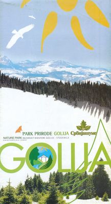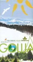
Wandelkaart Park prirode Golija | Geokarta

0
Gedetailleerde wandelkaart met hoogtelijnen, wandelroutes en toeristische informatie ingetekend van het biosfeerreservaat Golija in Dinaridi (Dinarische Alpen) zuidwest Servië Folded Map Includes a detailed map of the biosphere reserve famous for its skiing and walking   Useful information on the reserve in English and Serbian   Full Colour...

Verkopers met dit product

Verkoper
Bezorging
Prijs
DeZwerver.nl logo
DeZwerver.nl
niet bekend
2,95
12,95

Anderen bekeken ook

Wandelkaart Rajac suvoborski | Geokarta
Gedetailleerde wandelkaart met hoogtelijnen, wandelroutes en toeristische informatie ingetekend van het Suvobor Rajac gebergte in noord Servië. This map covers the popular tourist areas   Rajac is famous for it's limestone caverns, climbing, hiking routes and orienteering events   Very detailed full colour topographc mapping   Footpaths and hiking trails clearly marked   Spot heights and relief shading   Contours at 5m vertical intervals   Reverse on map includes useful local information in English and Serbian
12,95
Wandelkaart Suva Planina - Servië | Geokarta
One side topographic marked with footpaths, ski trails, ski lifts, camp sites, picnic sites, mountain huts, also notable features in the landscape. Other side further information, additional words and pics of notable features, mountain huts etc. Suva Mountains with the Gorges of the Jelašnicka River on a detailed contoured map at 1:55,000, plus extensive information on the tourist facilities in the area with colour photos of mountain shelters, notes on fauna and flora, etc. The map has contours at 20m intervals with relief shading and colouring for woodlands. Different levels of protection zones are marked and areas where hunting is allowed are indicated. An overprint highlights waymarked hiking trails including the 130km long-distance trail across the Niš range. Also marked are different types of tourist accommodation including campsites and hunting lodges, paragliding sites, skiing areas, etc. The map has latitude and longitude lines at intervals of 5’. Map legend includes English. …
13,95
Wandelkaart 901 Banff North National Park | National Geographic
Prachtige geplastificeerde kaart van het bekende nationaal park. Met alle recreatieve voorzieningen als campsites, maar ook met topografische details en wandelroutes ed. Door uitgekiend kleurgebruik zeer prettig in gebruik. Scheur en watervast! The front side of the Banff North map details the south side of the national park, from Siffleur Wilderness Area to the north, to Kootenay National Park to the south. This side also covers survival tips, area trails, entry fees and details both Kootenay and Yoho Nationals Parks. The reverse side of the map details the north side of the park, extending from Siffleur Wilderness area to the south, to White Goat Wilderness to the North. Insets show safe travel in Bear Country, and all the recreation the park has to offer with backpacking, camping, biking, hiking and horseback riding.  National Geographic's Trails Illustrated map of Banff North is a two-sided, waterproof map designed to meet the needs of outdoor enthusiasts with unmatched durability…
17,95
Wandelkaart - Topografische kaart 744 Adirondack Park - Northville - Raquette Lake | National Geographic
Prachtige geplastificeerde kaart van het bekende nationaal park. Met alle recreatieve voorzieningen als campsites, maar ook met topografische details en wandelroutes ed. Door uitgekiend kleurgebruik zeer prettig in gebruik. Scheur en watervast! National Geographic's Trails Illustrated map of Adirondack Park Northville/Raquette Lake is a two-sided, waterproof, topographic trail map designed to meet the needs of outdoor enthusiasts with unmatched durability and detail. This map was created in cooperation with the Adirondack Mountain Club and is loaded with valuable recreation information for boating, hiking, fishing, sailing, cycling, ice fishing, skiing, and snowmobiling. Trails and major roads are clearly distinguished, from the picturesque foothills to the northern peaks and around lakes of all sizes. Campgrounds, climbing areas, marinas, and museums are labeled and easy to find and boundaries for park lands, wilderness, primitive, forest, and protected areas are clearly marked. Disc…
17,95
Wandelkaart - Topografische kaart 210 Canyonlands National Park | National Geographic
Prachtige geplastificeerde kaart van het nationaal park. Met alle recreatieve voorzieningen als campsites, maar ook met topografische details en wandelroutes ed. Door uitgekiend kleurgebruik zeer prettig in gebruik. Scheur en watervast! Trails Illustrated maps are the most trusted and popular recreation maps available. Continually setting the standard for accuracy, each map is crafted in conjunction with local land managers, and undergoes rigorous review and enhancement before being printed on waterproof, tear-resistant material. Each Trails Illustrated map contains detailed topographic information, clearly marked and named trails, recreational points of interest, and navigational aids. National Park series maps contain useful details for planning your visit. State series titles cover popular recreation areas, ideal for done-in-a-day activities. Included on the map are Canyonlands National Park, the Island in the Sky district, the Needles district, and the Maze district. The map also …
16,95
Wandelkaart - Topografische kaart 211 Arches National Park | National Geographic
Prachtige geplastificeerde kaart van het nationaal park. Met alle recreatieve voorzieningen als campsites, maar ook met topografische details en wandelroutes ed. Door uitgekiend kleurgebruik zeer prettig in gebruik. Scheur en watervast! Trails Illustrated maps are the most trusted and popular recreation maps available. Continually setting the standard for accuracy, each map is crafted in conjunction with local land managers, and undergoes rigorous review and enhancement before being printed on waterproof, tear-resistant material. Each Trails Illustrated map contains detailed topographic information, clearly marked and named trails, recreational points of interest, and navigational aids. National Park series maps contain useful details for planning your visit. State series titles cover popular recreation areas, ideal for done-in-a-day activities. Included on the map are Arches National Park, The Highlands, Little Valley, Devils Garden, Lost Spring Canyon Wilderness area, Negro Bill Wil…
16,95

Klanten-reviews van Wandelkaart Park prirode Golija | Geokarta

Er zijn nog geen beoordelingen voor dit productBen jij de eerste die een review plaatst?

Meer over Wandelkaart Park prirode Golija | Geokarta

Productomschrijving

Gedetailleerde wandelkaart met hoogtelijnen, wandelroutes en toeristische informatie ingetekend van het biosfeerreservaat Golija in Dinaridi (Dinarische Alpen) zuidwest Servië

Folded Map Includes a detailed map of the biosphere reserve famous for its skiing and walking   Useful information on the reserve in English and Serbian   Full Colour

Productinformatie

    Verken gerelateerde categorieën

    Webshop.nl maakt gebruik van cookies. Ga je verder op onze website, ga dan akkoord met het plaatsen van cookies en de verwerking van deze data door ons en vermelde partners.