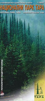
Wandelkaart National Park Tara - Tapa - Servië | Trimaks

0
Wandelkaart van het nationale park Tara. Met toeristische informatie. Meeste tekst in het Servisch, Engelse vertaling bij de legenda en Engelse informatie over het park. ...

Verkopers met dit product

Verkoper
Bezorging
Prijs
DeZwerver.nl logo
DeZwerver.nl
2,95
12,95

Anderen bekeken ook

Wandelkaart Osogovski Mountains - National park Macedonie | Trimaks
Eenvoudige wandelkaart van een nationaal park in Macedonie. De kaart is niet van het topografische nivo zoals wij kennen, maar toch geeft het wel de mogelijkheid om dit onbekende gebied te ontdekken; er isimmers gee nandere kaart van dit park. Enekel wandel- en fietsroutes worden weergegeven en met symbolen worden toeristische voorzieningen aangeduid als campings, zwemmogelijkheden, kayak-opties en mooie uitzichtspunten. Achterop de kaart staat de toeristische waarde van het gebied summier beschreven. Taal is o.a. engels.
9,95
Wandelkaart 200 Rocky Mountain National Park | National Geographic
Zeer gedetailleerde wandel- en trekkingkaart voor het Rocky Mountain Nationaal Park in Colorado. Met ingetekende wandelroutes, afstanden, kampeerplekken en toeristische informatie en vele handige tips. GPS geschikt door UTM Grid. Water en scheurvast. Coverage includes Rocky Mountain National Park, Arapaho and Roosevelt National Forest, Never Summer Wilderness, Arapaho National Recreation Area, and the cities of Granby and Estes Park. Revisions to this map include easy-to-read trail mileage and markers, hiking-only and hike and horse trails are easily distinguished, Federal, State and Private lands are clearly marked, the Continental Divide Trail is highlighted, and the map is keyed to the updated Rocky Mountain National Park Dayhiker's Guide. Includes UTM grids for use with your GPS unit.
16,95
Wandelkaart 10 Kootenay National Park | Gem Trek Maps
Kootenay National Park Wandelkaart – Gem Trek   Pluspunten & Minpunten Waterdicht en scheurvast – Ideaal voor gebruik in alle weersomstandigheden Zeer gedetailleerde cartografie – Inclusief hoogtelijnen, reliëfschaduw en hydrologische kenmerken Actuele en duidelijke wandelroutes – Met afstanden, namen en moeilijkheidsgraden Bevat populaire én minder bekende trails – Inclusief de volledige Rockwall Trail Extra informatie op de achterzijde – Trailbeschrijvingen, foto's, dagtochten, fietsroutes en contactgegevens Compact en praktisch formaat – Eén kaart dekt het hele park Inclusief Radium Hot Springs inzetkaart – Met wandelverbindingen naar bezienswaardigheden Geschikt voor zowel wandelaars als mountainbikers Kaart is Engelstalig – Niet alle gebruikers vinden dat prettig Bevat geen GPS-coördinaten – Minder geschikt voor gebruik met digitale navigatieapparatuur Schaal minder geschikt voor micro-navigatie – Voor zeer precieze terreinoriëntatie is aanvullend materiaal nodig On…
17,95
Wandelkaart Durmitor National Park - Montenegro | Magic Maps
Wandel- en klimgids voor het natuurgebied Durmitor in het noorden van Montenegro. Met Engelstalige legenda. Prima wandelkaart hoogtelijnen, ingetekende wandelpaden, skiliften Schaal 1:30.000 Gedetailleerde wandelkaart van het gebied Durmitor in Montenegro, regio ligt ten noorden van Podgorica.  De wandelroutes zijn duidelijk ingetekend. De kaart is voorzien van hoogtelijnen, berghutten, (schuil)hutten, skiliften, campings, en heeft een meertalige legenda.   Dubbelzijdige kaart Reliëf weergegeven door arcering en contouren Wandelpaden Accommodatie Wegennetwerk Algemene kaart van het Durmitor National Park op de achterzijde GPS-compatibel
14,95
Wandelkaart 231 Kenai Fjords National Park | National Geographic
Prachtige geplastificeerde kaart van het bekende nationaal park. Met alle recreatieve voorzieningen als campsites, maar ook met topografische details en wandelroutes ed. Door uitgekiend kleurgebruik zeer prettig in gebruik. Scheur en watervast! Map No. 231, Kenai Fjords National Park, AK, in an extensive series of GPS compatible, contoured hiking maps of USA’s national and state parks or forests and other popular recreational areas. Cartography based on the national topographic survey, with additional tourist information.
17,95
Wandelkaart 901 Banff North National Park | National Geographic
Prachtige geplastificeerde kaart van het bekende nationaal park. Met alle recreatieve voorzieningen als campsites, maar ook met topografische details en wandelroutes ed. Door uitgekiend kleurgebruik zeer prettig in gebruik. Scheur en watervast! The front side of the Banff North map details the south side of the national park, from Siffleur Wilderness Area to the north, to Kootenay National Park to the south. This side also covers survival tips, area trails, entry fees and details both Kootenay and Yoho Nationals Parks. The reverse side of the map details the north side of the park, extending from Siffleur Wilderness area to the south, to White Goat Wilderness to the North. Insets show safe travel in Bear Country, and all the recreation the park has to offer with backpacking, camping, biking, hiking and horseback riding.  National Geographic's Trails Illustrated map of Banff North is a two-sided, waterproof map designed to meet the needs of outdoor enthusiasts with unmatched durability…
17,95
Wandelkaart 230 Hawaii Volcanoes National Park | National Geographic
Prachtige geplastificeerde kaart van het bekende nationaal park. Met alle recreatieve voorzieningen als campsites, maar ook met topografische details en wandelroutes ed. Door uitgekiend kleurgebruik zeer prettig in gebruik. Scheur en watervast! Map No. 230, Hawaii Volcanoes National Park, HI, in an extensive series of GPS compatible, contoured hiking maps of USA’s national and state parks or forests and other popular recreational areas. Cartography based on the national topographic survey, with additional tourist information. The map, printed on light, waterproof and tear-resistant plastic paper, covers the whole park at 1:100,000 (contour interval 100 feet), plus its central section shown on the reverse at 1:50,000 (contour interval 50 feet) with the Kïlauea Caldera at 1:25,000 (contour interval 25 feet).
16,95

Klanten-reviews van Wandelkaart National Park Tara - Tapa - Servië | Trimaks

Er zijn nog geen beoordelingen voor dit productBen jij de eerste die een review plaatst?

Meer over Wandelkaart National Park Tara - Tapa - Servië | Trimaks

Productomschrijving

Wandelkaart van het nationale park Tara. Met toeristische informatie. Meeste tekst in het Servisch, Engelse vertaling bij de legenda en Engelse informatie over het park. 

Productinformatie

    Verken gerelateerde categorieën

    Webshop.nl maakt gebruik van cookies. Ga je verder op onze website, ga dan akkoord met het plaatsen van cookies en de verwerking van deze data door ons en vermelde partners.