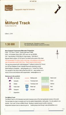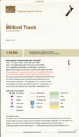
Wandelkaart Milford Track - Fiordland National Park | NewTopo NZ

0
Een kaartenserie van NewTopoNZ van vrijwel alle nationale parken, meerdaagse tochten en belangrijke wandelgebieden in Nieuw Zeeland. We hebben een selectie van de kaarten op voorraad.    Het zijn bijzonder leesbare kaarten met een helder kaartbeeld in goede kleurstelling. Alle belangrijke topografische details kun je er op terugvinden: hoogtelijne...

Verkopers met dit product

Verkoper
Bezorging
Prijs
DeZwerver.nl logo
DeZwerver.nl
2,95
15,95

Anderen bekeken ook

Wandelkaart Banks Peninsula - Port Hills and Te Ara Pataka | NewTopo NZ
Een kaartenserie van NewTopoNZ van vrijwel alle nationale parken, meerdaagse tochten en belangrijke wandelgebieden in Nieuw Zeeland. We hebben een selectie van de kaarten op voorraad.    Het zijn bijzonder leesbare kaarten met een helder kaartbeeld in goede kleurstelling. Alle belangrijke topografische details kun je er op terugvinden: hoogtelijnen, bergtoppen, stromen en rivieren, vegatatietype, gletsjers. De kaarten zijn bruikbaar samen met GPS.    Daarnaast is er toeristische informatie toegevoegd in de vorm van symbolen (zoals bruggen, stranden, watertaxi's, uitzichtspunten en parkeerplaatsen) en staan campings en hutten aangeduid. De wandelroutes zijn ingetekend met een rode lijn, verschillend naar gemarkeerd en ongemarkeerd, zelfs afstanden tussen hutten worden vaak vermeld.    This is the only topographic map to show the whole of the Banks Peninsula on one sheet at this scale, giving emphasis to the walking tracks in this popular Christchurch recreation area.  It is very easy …
15,95
Wandelkaart Ruapehu - Round the Mountain | NewTopo NZ
Een kaartenserie van NewTopoNZ van vrijwel alle nationale parken, meerdaagse tochten en belangrijke wandelgebieden in Nieuw Zeeland. We hebben een selectie van de kaarten op voorraad.    Het zijn bijzonder leesbare kaarten met een helder kaartbeeld in goede kleurstelling. Alle belangrijke topografische details kun je er op terugvinden: hoogtelijnen, bergtoppen, stromen en rivieren, vegatatietype, gletsjers. De kaarten zijn bruikbaar samen met GPS.    Daarnaast is er toeristische informatie toegevoegd in de vorm van symbolen (zoals bruggen, stranden, watertaxi's, uitzichtspunten en parkeerplaatsen) en staan campings en hutten aangeduid. De wandelroutes zijn ingetekend met een rode lijn, verschillend naar gemarkeerd en ongemarkeerd, zelfs afstanden tussen hutten worden vaak vermeld.    This map shows the tramping route circumnavigating Mount Ruapehu in Tongariro National Park and its unique volcanic mountain environment at a scale where all features can be identified increasing both the…
9,95
Wandelkaart Arthur's pass | NewTopo NZ
Een kaartenserie van NewTopoNZ van vrijwel alle nationale parken, meerdaagse tochten en belangrijke wandelgebieden in Nieuw Zeeland. We hebben een selectie van de kaarten op voorraad.    Het zijn bijzonder leesbare kaarten met een helder kaartbeeld in goede kleurstelling. Alle belangrijke topografische details kun je er op terugvinden: hoogtelijnen, bergtoppen, stromen en rivieren, vegatatietype, gletsjers. De kaarten zijn bruikbaar samen met GPS.    Daarnaast is er toeristische informatie toegevoegd in de vorm van symbolen (zoals bruggen, stranden, watertaxi's, uitzichtspunten en parkeerplaatsen) en staan campings en hutten aangeduid. De wandelroutes zijn ingetekend met een rode lijn, verschillend naar gemarkeerd en ongemarkeerd, zelfs afstanden tussen hutten worden vaak vermeld.    Arthurs Pass National Park has something for everyone – from easy tramps to difficult climbs and everything in between.  This new map encourages exploration of a variety of geographic environments and th…
15,95
Wandelkaart National 3 Peaks Challenge Map | Discovery Walking Guides
Goede scheur- en watervaste wandelkaart. National 3 Peaks Challenge Maps. Ben Nevis, Scafell Pike and Snowdon at 20k scale. Waterproof, tearproof and 100% recyclable 820mm by 420mm double sided map sheet.   Taking OS mapping at 50k scale we expand the mapping to produce 20k scale maps of the three challenge peaks, Ben Nevis, Scafell Pike and Snowdon. By expanding the OS mapping the features of names, roads, tracks and trails are more than doubled in size making them easier to read under Challenge conditions. We then add the Challenge Routes, specially highlighted to make them stand out against the OS map background information and add in additional information that will help your challenge.   Each map covers the region to show the access roads as well as the walking routes. Ben Nevis includes the Glen Nevis Information Centre starting point and Glen Nevis Youth Hostel starting point. Scafell Pike includes the Wasdale and Seathwaite Challenge Routes.   Snowdon includes the Pyg Track, M…
15,95
Wandelkaart 230 Hawaii Volcanoes National Park | National Geographic
Prachtige geplastificeerde kaart van het bekende nationaal park. Met alle recreatieve voorzieningen als campsites, maar ook met topografische details en wandelroutes ed. Door uitgekiend kleurgebruik zeer prettig in gebruik. Scheur en watervast! Map No. 230, Hawaii Volcanoes National Park, HI, in an extensive series of GPS compatible, contoured hiking maps of USA’s national and state parks or forests and other popular recreational areas. Cartography based on the national topographic survey, with additional tourist information. The map, printed on light, waterproof and tear-resistant plastic paper, covers the whole park at 1:100,000 (contour interval 100 feet), plus its central section shown on the reverse at 1:50,000 (contour interval 50 feet) with the Kïlauea Caldera at 1:25,000 (contour interval 25 feet).
16,95
Wandelgids The Overland Track | Cicerone
Uitstekende wandelgids, goed beschreven met veel praktische informatie om de route te kunnen lopen, inclusief redelijke kaarten. Guidebook to Tasmania's iconic Overland Track. Described over 7 stages, the 80km trail from Cradle Valley to Lake St Clair takes in glacier-carved valleys, vast buttongrass moorlands, mossy rainforests, rugged peaks, thundering waterfalls, alpine meadows and peaceful lakes. Adventurous side trips are also described. This guidebook covers the iconic Overland Track in Tasmania's stunning Cradle Mountain-Lake St Clair National Park. The well-maintained 80km route from Cradle Valley to Lake St Clair is described over seven stages, along with optional sidetrips to the area's many accessible peaks including Mt Ossa, Tasmania's highest mountain. The track can be completed in between 5 and 9 days, depending on fitness and whether hikers undertake sidetrips.   Each stage features clear 1:50,000 mapping and profiles alongside detailed route description. The guide also…
24,95
Elvis Presley - Retrospective Elvis '69 4CD Set
Ontdek Elvis Presley's iconische comeback uit 1969 met de "Retrospective Elvis '69" 4CD-set. Een onmisbare collectie van tijdloze hits en zeldzame opnames van de King of Rock 'n' Roll!Tracklist:CD1From The Draft Mix Tape: 01 This Is The Story (Backup Vocals Overdub) 02 Wearin' That Loved On Look (Unused Composite) 03 In The Ghetto (Backup Vocals Overdub / Unrepaired Vocals) 04 Rubberneckin' (Backup Vocals Overdub - Partial Backing Vocals) 05 Inherit The Wind (Unused Composite) 06 Mama Liked The Roses (Harmony Vocal Overdub By Elvis - Not Used) 07 Don't Cry Daddy (Harmony Vocal Overdub By Elvis) 08 From A Jack To A King (Backup Vocals Overdub) 09 Suspicious Minds (Harmony Vocal Overdub By Elvis - Not Used) 10 Gentle On My Mind (Track Replacement / Vocal Repair) 11 Come Out, Come Out (Wherever You Are) (Instrumental Take 2) 12 Poor Man's Gold (Instrumental Take) Vocal Overdub:13 Don't Cry Daddy (Vocal Only) Come out, Come Out (Wherever You Are: 14 Rehearsal Instrumental 15 Slow Tempo Reh…
69,99
Wandelkaart 01 Jasper National Park & Maligne Lake | Gem Trek Maps
Scheur- en Watervast papier Gem Trek’s JASPER AND MALIGNE LAKE MAP map is designed for outdoor enthusiasts looking to explore the section of Jasper National Park near the town and out to Maligne Lake. Whether you are touring along the roads or heading into the backcountry, you’ll find the waterproof and tear-resistant Jasper & Maligne Lake Map to be an invaluable tool.   This map features detailed cartography, accurate hiking trails with distances, and details such as campgrounds, equestrian routes, picnic areas, and fire lookouts. On the back of the map are trail descriptions and photos of 18 recommended day hikes, four overnight or multi-day trips, and six classic mountain bike rides. Each of these described trails is referenced and colour-coded to the map on the front. Also on the back is contact information for Jasper National Park, as well for as the three backcountry lodges located in the Tonquin Valley and on the Skyline Trail.   Jasper & Maligne Lake Map Coverage The Jas…
16,95
Reisgids Acadia National Park - New England | Moon Travel Guides
De Amerikaanse uitgever Moon is een vergelijkbare gids met uitgever Lonely Planet > veel praktische informatie met veel diepgang! Het feit dat het een Amerikaanse uitgever is, maken deze gidsen zeer aantrekkelijk voor de staten en nabije landen afzonderlijk. De Lonely Planet haalt dat nivo niet! Explore the pine-lined mountain trails, serene ponds, and rugged island coasts of Maine's stunning Acadia National Park with Moon. Inside you'll find:* Flexible itineraries for every season, from the best of Acadia in one day to a two-week road trip, designed for day hikers, campers, families, outdoor adventurers, and more* The best hikes in Acadia: Detailed descriptions, mileage and elevation gains, and difficulty ratings* Experience the outdoors: Embark on a whale-watching excursion to spot humpbacks, minke whales, porpoises, and puffins. Climb the pink granite steps to Huguenot Head or hike along the secluded rocky shore of Isle de Haut.   Sea kayak at sunset, take a leisurely bike ride thr…
19,95
Reisgids Banff National Park | Moon Travel Guides
Uitstekende Amerikaanse reisgids van uitgever Moon. De gids is vergelijkbaar met Lonely Planet en Rough guide en is voor de backpacker - zelfstandige reiziger geschreven; toch is deze door de grote mate van details en achtergronden geschikt voor alle reizigers! De gids onderscheidt zich door gedegen en uitgebreide achtergrondinformatie over bijvoorbeeld natuur en cultuur. Banff sparkles as the crown jewel of Canada's national parks. Explore the best of it with Moon Banff National Park. Inside you'll find: Strategic, flexible itineraries, including the Best of Banff and highlights for a day trip The Best Hikes in Banff: Find the right trek for you with details on length, elevation gains, difficulty levels, and trailheads Experience the Outdoors: Ride over the snow in a horse-drawn sleigh or through the sky in a mountain gondola. Follow the vast network of hiking trails along glacial valleys and discover alpine lakes and spectacular vistas. Soak in a natural hot spring, treat yoursel…
16,50

Klanten-reviews van Wandelkaart Milford Track - Fiordland National Park | NewTopo NZ

Er zijn nog geen beoordelingen voor dit productBen jij de eerste die een review plaatst?

Meer over Wandelkaart Milford Track - Fiordland National Park | NewTopo NZ

Productomschrijving

Een kaartenserie van NewTopoNZ van vrijwel alle nationale parken, meerdaagse tochten en belangrijke wandelgebieden in Nieuw Zeeland. We hebben een selectie van de kaarten op voorraad.    Het zijn bijzonder leesbare kaarten met een helder kaartbeeld in goede kleurstelling. Alle belangrijke topografische details kun je er op terugvinden: hoogtelijnen, bergtoppen, stromen en rivieren, vegatatietype, gletsjers. De kaarten zijn bruikbaar samen met GPS.    Daarnaast is er toeristische informatie toegevoegd in de vorm van symbolen (zoals bruggen, stranden, watertaxi's, uitzichtspunten en parkeerplaatsen) en staan campings en hutten aangeduid. De wandelroutes zijn ingetekend met een rode lijn, verschillend naar gemarkeerd en ongemarkeerd, zelfs afstanden tussen hutten worden vaak vermeld.    The internationally-known three-day Milford Track is set in some of Fiordland's most spectacular scenery.  On this map it is portrayed on a fully-detailed topographic background, which does justice to the environment.  The full track from its beginning at the head of Lake Te Anau to the destination at Milford Sound is shown.  A combination of contours and relief shading gives a realistic landform.

Verken gerelateerde categorieën

Webshop.nl maakt gebruik van cookies. Ga je verder op onze website, ga dan akkoord met het plaatsen van cookies en de verwerking van deze data door ons en vermelde partners.