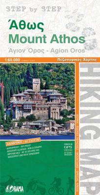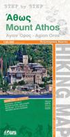
Wandelkaart 6 Mount Athos | Orama

0
  Wandelkaart  van dit bijzondere stukje Griekenland: de berg Athos.   Mount Athos - Agion Oros (Greece) 1:60,000 Hiking Map, waterproof, GPS compatible, ORAMA Mount Athos is a mountain and peninsula in Macedonia, Greece. A World Heritage Site, it is home to 20 Eastern Orthodox monasteries and forms a self-governed monastic state within the sovere...

Verkopers met dit product

Verkoper
Bezorging
Prijs
DeZwerver.nl logo
DeZwerver.nl
2,95
10,25

Anderen bekeken ook

Nieuw
Wandelkaart G1 Samos | Freytag & Berndt
Introducing the Samos Hiking and Leisure Map – your essential guide to exploring the stunning landscapes of Samos Island.   Discover detailed information on hiking trails across Samos, allowing you to plan your adventures with ease and learn about key attractions along the way.   Samos beckons hikers with its captivating diversity – from towering peaks like Mount Kerkis and deep gorges such as Kakoperato Gorge, to remote forests waiting to be explored. This Mediterranean hiking paradise boasts picturesque villages, hidden monasteries, ancient city walls, and medieval fortresses.   Key Features of the Samos Hiking and Leisure Map:   Scale 1:35,000 Extensive network of hiking trails Tourist information highlights Includes the Rother App for digital map access Waterproof and tear-resistant Dimensions: 99 x 61 cm Explore confidently with the linked free version of the Rother App, offering a digital map of Samos' complete hiking network and sample tours (free registration required).   Desi…
14,95
Reisverhaal Athos - the holy mountain | TPP
“It calls for a writer more able at words to picture the sheer beauty of the Mountain. To convey the altering feeling of morning, or high noon; of afternoon, and deep midnight; of the golden scores of stars puncturing the sky.”   Athos, the Holy Mountain of Greece, is one of the most mysterious places in the world. A rugged pyramid that rises up from the Aegean Sea, the mountain is wreathed in myth, legend and ancient traditions that, to this day, remain largely hidden from view. The heart of Athos started to beat at the dawn of Christianity and its community lays claim to being the oldest democracy in the world. An entirely autonomous region of the Hellenic Republic, it is home to twenty Eastern Orthodox monasteries that cling to its rocky flanks. No women are allowed to set foot upon the peninsula and the monks who inhabit this isolated place still use the Julian calendar, living on 'Byzantine Time', where each day starts at sunset. While living in the mountain's shadow, in Ouranopo…
16,95
Nieuw
Reisgids Eyewitness Top 10 Cyprus | Dorling Kindersley
Sun-soaked Cyprus, with its centuries of history, scenic villages, glorious beaches and superb watersports, is an ideal Mediterranean destination. Your DK Eyewitness Top 10 travel guide ensures you'll find your way around the Lake District with absolute ease.   Our updated Top 10 travel guide breaks down the best of Cyprus into helpful lists of ten - from our own selected highlights to the best beaches, villages, convents and monasteries, hikes and snorkelling spots. We've also worked hard to make sure our information is as up-to-date as possible following the COVID-19 outbreak   You'll discover:   - Seven easy-to-follow itineraries, perfect for a day trip, a weekend, or a week - Detailed Top 10 lists of Cyprus's must-sees, including comprehensive descriptions of Cyprus Museum, Nicosia, Ayia Napa, Pierides Museum, Larnaka, Ancient Amathous, Historic Limassol, Kourion, the Troodos Painted Churches, Kato Pafos Archaeological Park and Akamas Peninsula - Cyprus's most interesting areas, w…
12,50
Wandelkaart Tour & Trail Lefkada - Paxos - Antipaxos - Lefkas | Discovery Walking Guides
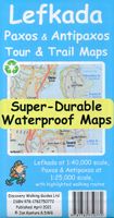
For your best adventures, use the best map. Water-proof, split-proof, tear-proof, adventure-proof. Lefkada, Paxos & Antipaxos Tour & Trail Super-Durable Maps are simply the toughest, most accurate, easy to read, easy to use maps of these Ionian islands that you can buy at any price.   A large 840mm by 690mm double sided map sheet has Lefkada at 1:40,000 scale on one side, with Paxos and Antipaxos islands at 1:25,000 scale on the other side. The Lefkada map sheet also covers Meganisi island and a large area of the adjacent mainland peninsula (as far as Voulkaria lake in the NE and Pogonias village in the SE) with its interesting castles and ancient sites. The peninsula is connected to Lefkada via a road bridge, which offers an additional 100km2 of the mainland for more touring and discovering. We have also included a street plan of the capital town Lefkada at 1:7,000 scale.   DWG's special concertina map fold makes our map easy to open and easy to refold to its 230mm by 120mm pocket si…
15,95
Wandelkaart Tour & Trail Western Crete - West Kreta | Discovery Walking Guides
Goede, scheur- en watervaste, wandelkaart van west Kreta, met name het wandelgebied rond Lefka Ori en de Samaria Kloof. For your best adventures, use the best map. Water-proof, split-proof, tear-proof. Western Crete Tour & Trail Super-Durable Map is simply the toughest, most accurate, easy to read, easy to use map that you can buy at any price. A large 960mm by 694mm double sided map sheet at 1:40,000 scale covers area of over 1600km2, from Paleochora in the west to Preveli beach in the east. The map covers the most important hiking regions in the western Crete, including the famous Samaria Gorge, Lefka Ori (White Mountains) and much more. Our legendary 'Tour & Trail' level of detail ranges from major roads to secondary roads to minor roads to streets and narrow country roads, plus dirt roads, tracks and walking trails. Place names are in English and Greek to aid your navigation. Altitude shading is designed to clearly show the altitude range when travelling across the island by car o…
15,95
Nieuw
Wandelkaart - Topografische kaart 318 Mount Rogers High Country - Grayson Highlands State Park | National Geographic
Prachtige geplastificeerde kaart van het bekende nationaal park. Met alle recreatieve voorzieningen als campsites, maar ook met topografische details en wandelroutes ed. Door uitgekiend kleurgebruik zeer prettig in gebruik. Scheur en watervast!   National Geographic's Trails Illustrated map of Mount Rogers High Country and Grayson Highlands State Park, Southwest Virginia, is a two-sided, waterproof, topographic trail map designed to meet the needs of outdoor enthusiasts with unmatched durability and detail. This map was created in cooperation with local land management agencies and is loaded with valuable recreation information for exploring the area's large rock formations, spruce-fir forests, and the highest peak in Virginia. Trails and major roads, including the Appalachian Trail, the Virginia Creeper Trail, and the Virginia Highland Horse Trail, are clearly distinguished. Places of interest include areas for camping, picnicking, fishing, hiking, mountain biking, horseback riding, …
17,95
Wandelkaart Kefalonia & Ithaca | Discovery Walking Guides
Scheur- en watervaste wandelkaart van Kefalonia en Ithaka met hoogtelijnen en graden. Kefalonia was popularised and made famous by "Captain Corelli's Mandolin". For your best adventures, use the best map. Water-proof, split-proof, tear-proof, adventure-proof.   Kefalonia & Ithaca Tour & Trail Super-Durable Map is simply the toughest, most accurate, easy to read, easy to use map of the island you can buy at any price. A large 960mm by 690mm double sided map sheet has both Kefalonia and Ithaca at 1:40,000 scale with the North-West of Kefalonia on the cover side and the South-East of Kefalonia with neighbouring island Ithaca on the reverse. A generous common overlap of Kefalonia reduces the need to turn the map over when navigating.   Our special concertina map fold makes your map easy to open and easy to refold to its 230mm by 120mm pocket size. Our legendary 'Tour & Trail' level of detail ranges from major roads to secondary roads to minor roads to streets and narrow country roads, plu…
15,95
Wandelkaart Tour & Trail Rhodes - Rodos | Discovery Walking Guides
A large 960mm by 700mm double sided map sheet covers Rhodes at 1:50,000 scale and includes Chalki and Symi islets. On the cover side is Rhodes South with Chalki and Symi, with Rhodes North and street plans of Rhodes Town on the reverse. We have two street plans of the capital town.   Rhodes Town greater area is at 12k scale, including Acropolis in the west and spanning beyond Rodini park in the south. The other street plan shows the fortified Old Town in great detail at 5k scale. DWG's special concertina map fold makes our map easy to open and easy to refold to its 233mm by 120mm pocket size.   Our legendary 'Tour & Trail' level of detail ranges from major roads to secondary roads to minor roads to streets and narrow country roads, plus dirt roads, tracks and walking trails. Place names are in English and Greek to aid your navigation. Altitude shading is designed to clearly show the altitude range when travelling across the island by car or on foot.   20 metre and 100 metre contours c…
17,95
Wandelkaart A06 Siniscola | Abies
Siniscola area at 1:25,000 in a series of contoured maps from Ed. Abies. Overprint highlights campsites and agriturismo accommodation, climbing sites, wild sheep and bird watching sites and archaeological remains. This title has no UTM grid. Main series at 1:60,000 (Nos. 1 to 12) The maps have contours at 100m intervals and colouring for woodlands and maquis shrubland. Local trails are highlighted, with additional overprint for selected hiking, mountain bike and kayaking routes listed on the reverse of the maps with brief notes and grading for the degree of difficulty. All the maps have a UTM grid for GPS users. Very extensive range of symbols highlight numerous places of interest and tourist facilities, including campsites and caravan parks, beaches, sport and recreational sites, archaeological remains and nuraghi, etc. The maps also indicate places where typical local products can be purchased. On the reverse each title has descriptions of its main places of interest, beaches, etc…
12,95
Wandelkaart Macizo de Fuentes Carrionas | Adrados Ediciones
Fuentes Carrionas Massif, just south of the Picos de Europa, on a detailed hiking map from Adrados Ediciones combining coverage at 1:60,000 of the western part of Fuentes Carrionas and Fuentes del Cobre Natural Park with more detailed mapping at 1:25,000 of Peña Prieta Massif. The main map at 1:50,000 has contours at 20m intervals with bold relief shading and altitude colouring. Numerous peaks and other topographical features are named. Hiking, mountain bike and ski trails are highlighted and symbols mark campsites, mountain shelters and cabins, viewpoints, climbing areas, tourist information centres, locations of petrol stations, etc. On the reverse the central part of the main map, the Peña Prieta Massif is shown at 1:25,000 with the excellent cartography used in the publishers’ coverage of the Picos de Europa. Contours are at 10, intervals with additional graphic relief for exposed rocky faces.  
14,95

Klanten-reviews van Wandelkaart 6 Mount Athos | Orama

Er zijn nog geen beoordelingen voor dit productBen jij de eerste die een review plaatst?

Meer over Wandelkaart 6 Mount Athos | Orama

Productomschrijving


Wandelkaart  van dit bijzondere stukje Griekenland: de berg Athos.   Mount Athos - Agion Oros (Greece) 1:60,000 Hiking Map, waterproof, GPS compatible, ORAMA Mount Athos is a mountain and peninsula in Macedonia, Greece. A World Heritage Site, it is home to 20 Eastern Orthodox monasteries and forms a self-governed monastic state within the sovereignty of Greece. Today, Greeks commonly refer to Mount Athos as the "Holy Mountain" ( Agion Oros).   This is a double sided, very detailed, topographic hiking map of the peninsula at 1:60,000. Relief colouring with spot heights and contours (20 m interval) indicate the terrain. Symbols mark churches, monasteries, archaeological sites, campsites, beaches, etc.   Reverse side features a simplified map of the southern end of the peninsula with hiking routes highlighted and described (in Greek and English).   Added is an index of villages. Place names are in both Greek and Latin script, multilingual legend includes English, printed on synthetic paper, waterproof and tearproof, sheet size 98 x 68 cm / 38.5 x 26.5 inches. Authentic Greek cartography.
Webshop.nl maakt gebruik van cookies. Ga je verder op onze website, ga dan akkoord met het plaatsen van cookies en de verwerking van deze data door ons en vermelde partners.