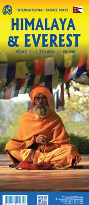
Wandelkaart Mount Everest - Himalaya | ITMB

0
Deelkaart van het Everest gebied: niet altijd even makkelijk kleurgebruik. Op de andere kant een grove kaart van de hele Himalaya! Roads by classification, check points, viewpoints, points of interest, camps, monasteries, lodging, stupas, airports, waterfalls, glaciers, health posts and other information. Mt Everest region at 1:90,000 from ITMB on...

Alle aanbiedingen van dit product

Verkoper
Bezorging
Prijs
DeZwerver.nl logo
DeZwerver.nl
2,95
14,95

Anderen bekeken ook

Wandelkaart Mount Everest - Himalaya | ITMB
Deelkaart van het Everest gebied: niet altijd even makkelijk kleurgebruik. Op de andere kant een grove kaart van de hele Himalaya! Roads by classification, check points, viewpoints, points of interest, camps, monasteries, lodging, stupas, airports, waterfalls, glaciers, health posts and other information. Mt Everest region at 1:90,000 from ITMB on a contoured map with tourist information but with somewhat unusual choice of colouring which makes the whole area appear more like a desert rather the highest mountain range covered in glaciers! Coverage extends from Lukla to beyond the North Base Camp on the Tibetan side. The map has contour lines at 100m intervals, plus additional altitude colouring and graphics for glaciers, moraine, scree, rock and vegetation. Numerous mountain ranges, glaciers, peaks and passes are named. Main Everest trekking routes are marked and symbols highlight various places of interest and tourist facilities. The map has latitude and longitude lines at intervals …
14,95
Wandelkaart NS504 Upper and Lower Dolpa - Dolpo | Himalayan Maphouse
Goede duidelijk leesbare  map voor trekkings in Dolpo. Van Juphal en Jejargaon in het westen tot Kagbeni in Mustang aan de oostkant van de kaart. De trekkingroutes staat goed ingetekend. Shey Phoksundo National Park staat er ook geheel op.  Large area centred on Dho Tarap, lying between the Upper and Lower Dolpa regions, in the Nepa Maps series which provides extensive coverage of trekking areas of Nepal on detailed contoured maps with trekking routes and hiking trails, huts and camp sites, local places of interest and other tourist information.   Cartography is based on the country’s topographic survey, with contours usually at 40m or 50m intervals, enhanced by relief shading, colouring and graphics to show various features of the terrain, including glaciers, forested or cultivated areas, etc. Numerous peaks, with additional spot heights, plus names of glaciers and mountain ranges are prominently shown. The network of rivers, streams and lakes is shown in great detail, with many smal…
12,95
Wegenkaart - landkaart Peru | ITMB
Een degelijke kaart met aanduidingen van o.a. nationale parken, vliegveld, dirt-roads en kleine plattegrond van hoofdstad. Als overzichtskaart goed te gebruiken. Peru at 1:1,500,000 on a double-sided, waterproof and tear-resistant, indexed map from ITMB, with large, clear street plans of central Lima and Cusco, highlighting accommodation, places of interest and various facilities. The map divides the country north/south, approximately along the line between the Cordillera Blanca and Cordillera Huyahuash, with very little overlap between the two sides. Topography is very effectively presented by altitude colouring, with spot heights and additional graphics for swamps and marshland, glaciers and volcanos. The map shows the country’s road network distinguishing between all-weather and seasonable roads and indicates driving distances on main routes. Railway lines, including the popular routes linking Cusco with Puno and Arequipa, are very clearly shown. The map also shows local airports a…
14,95
Wandelkaart 3001 Adventure Map trekking map Everest Base Camp | National Geographic
Mooie gedetailleerde topografische kaart, voorzien van veel extra info en gedrukt op water- en scheurvast materiaal. Each Adventure Map is highly detailed, incredibly durable, waterproof and tear-resistant. Stunning shaded relief brings each map to life, giving you the power to discover, plan and dream. Trail routes, villages, cultivated areas, park boundaries and points of interest make these maps essential gear. Each map includes a beautifully crafted map of the Kingdom of Nepal, inset maps of Kathmandu and Thamel, and a comprehensive index of villages, passages and peaks. The very name evokes majesty, mystery and magnificence! Earth's highest peaks soar above, beckoning adventurers to one of the world's most dramatic regions. Includes trail routes, villages, cultivated areas, park boundaries, and points of interest. Printed on waterproof, tear-resistant material that stands up to the rigors of travel. Follow National Geographic to one of the world's most exotic locations with this …
17,95
Wandelkaart 0/2 Alpenvereinskarte Mount Everest | Solo Khumbu | Chomolongma | Alpenverein
Klimkaart en Wandelkaart van de Mount Everest (8848 m) en omgeving. Zoals alle kaarten van de Alpenverien een fantastisch duidelijke kaart met heel veel topografische details. Kleurgebruik van schaduwen en allerlei blauw- en grijstinten: hierdoor een duidelijke dieptewerking. De kaart als het gaat om de beklimming van de Everest! Detailinformatie:    Darstellung: Photogrammetrische Aufnahme und Auswertung des Alpenvereins im Zuge der Internationalen Himalayaexpedition 1955. schwarze Haarstrichfelszeichnung Höhenlinienabstand: 20m Anzahl der Farben: 6 Format des Karteninhalts: 82cm x 73cm Gletscherstand: 1955
16,95
Wegenkaart - landkaart British Columbia South (Canada) | ITMB
Deze wegenkaart van British Columbia bestrijkt het gebied tussen Vancouver en Calgary, en is de perfecte toeristische kaart voor het verkennen van de regio Rocky Mountain. Alle wegen en spoorlijnen tussen de twee steden worden getoond, evenals campings en parken.   This map covers the area between Vancouver and Calgary, and is the perfect tourist map for exploring the Rocky Mountain region. All roads and rail lines between the two cities are shown, as well as camp grounds, parks. Legend Includes: Points of interests, airports, RV and camping sites, wilderness camps, picnic areas, waterfalls, tourist information, museums, golf courses, gas stations, outdoor activities and other information. Folded paper, road and travel map in color. Scale 1:900,000. Distinguishes roads ranging from divided highways to other roads-4WD/dry weather. Legend includes railways, trails, ferry routes, glaciers, points of interest, international airports, domestic airports, museums, mountain peaks, camping/rec…
14,95
Wandelgids Everest - A Trekker's Guide - Nepal | Cicerone
Trekkinggids met de gedetailleerde beschrijving van de klassieke Everest trek, maar ook vele varianten en dagtochten. Goede etappe-beschrijvingen met veel praktische info. Everest has an eternal appeal for mountain lovers and the classic trek to Everest Base Camp is high on the bucket-list of many trekkers. This guidebook covers the most popular route in the Khumbu Valley, from Lukla via Namche Bazaar and Gorakshep to Everest Base Camp and Kala Patthar, the best viewpoint for Everest. It also describes the classic route from Jiri to Lukla taken by Tenzing Norgay and Sir Edmund Hillary, as well as a trek north to Gokyo with its spectacular lakes and the peak of Gokyo Ri. Finally, the Three Passes Trek, also starting in Namche, links the region's major passes and valleys. The guidebook includes suggestions for side trips and time spent in Namche Bazaar, Pangboche, Dingboche and Gokyo, as well as one trek approaching Everest from Tibet – from Kharta to the Kangshung Face. It is packed wi…
24,95
Wandelkaart The Great Himalaya Trail | GHT
  Prachtige kaartenserie van één van 'swerelds mooiste wandeltochten.   The Far West is one of the least explored areas of Nepal. Its area is bounded to the east by mighty, turquoise Karnali river which flows from Tibet’s sacred Mount Kailash.   Myth and superstition remain part of the fabric of life here. Though the Nepali language originated here, it seems a distant world from ‘modern’ Nepal. One Nepali visitor described his visit as “fascinating, like travelling back to the 18th century.”   Along the trails you may meet a turbaned Dhami, a shaman, with silver-bangled limbs and gold-ringed ears, who are still depended on for treating sickness.   Organised tourism has so far been limited to Khaptad National Park, the only national park in the mid-hills of Nepal and held dearly by conservationists. Gentle hills, pristine forests and abundant wildlife with a snow-covered backdrop of the Nampa, Api and Saipal peaks make for beautiful trekking.   It’s also a holy place associated with Kh…
26,95
Wegenkaart - landkaart Ethiopia Ethiopië - Eritrea | ITMB
Een degelijke kaart met aanduidingen van o.a. nationale parken, vliegveld, benzinepomp, dirt-roads en kleine plattegrond van hoofdstad. Als overzichtskaart goed te gebruiken. This is the latest updating of one of the most interesting countries in Africa. There isn’t anything brilliantly innovative to report. We have tidied up the different layers of the artwork, have updated the road system, and have added more tourist information. We have also modernized the cover design and changed the ISBN – printed on paper, single-sided, inset map of Addis Ababa. Legend Includes: roads by classification, Airports, Ports, Gasolines, Polices, Post Offices, Bus Stations, Hospitals, Schools, Universities, Buildings, Point of Interests, Bridges, Lodgings, Campsites or Huts, Museums, and many more   Double-sided map from ITMB presenting on one side a road map of Ethiopia at 1:2,000,000 accompanied by a street plan of Addis Ababa, with on the reverse Eritrea at 1:900,000 with a plan of Asmara. Both roa…
14,95
Stadsplattegrond Hanoi & North Vietnam - Noord Vietnam | ITMB
Overzichtelijke stadsplattegrond met register, schaal 1:15700 en een kaart van  Noord Vietnam op schaal 1:920.000. Double-sided map with north Vietnam on one side and a street plan of Hanoi on the reverse. The road map at 1:920,000 shows the area’s road and rail networks and local airports. National parks, nature reserves, beaches and numerous places of interest are highlighted. Provincial boundaries are marked and names of administrative regions prominently shown. Topography is indicated by altitude colouring. Latitude and longitude lines are drawn at 30’ intervals. On the reverse is a street plan of Hanoi at 1:15,700 annotated with numerous places of interest, accommodation, and various facilities. An enlargement shows the Old Town at 1:10,000, and a further inset covers the city’s suburbs area at 1:920,000. Both the road map and the street plan are indexed. All place names are shown in the Roman alphabet but with scrupulous transliteration, since the map was prepared by a company w…
14,95

Klanten-reviews van Wandelkaart Mount Everest - Himalaya | ITMB

Er zijn nog geen beoordelingen voor dit productBen jij de eerste die een review plaatst?

Meer over Wandelkaart Mount Everest - Himalaya | ITMB

Productomschrijving

Deelkaart van het Everest gebied: niet altijd even makkelijk kleurgebruik. Op de andere kant een grove kaart van de hele Himalaya!

Roads by classification, check points, viewpoints, points of interest, camps, monasteries, lodging, stupas, airports, waterfalls, glaciers, health posts and other information.

Mt Everest region at 1:90,000 from ITMB on a contoured map with tourist information but with somewhat unusual choice of colouring which makes the whole area appear more like a desert rather the highest mountain range covered in glaciers!

Coverage extends from Lukla to beyond the North Base Camp on the Tibetan side. The map has contour lines at 100m intervals, plus additional altitude colouring and graphics for glaciers, moraine, scree, rock and vegetation. Numerous mountain ranges, glaciers, peaks and passes are named.

Main Everest trekking routes are marked and symbols highlight various places of interest and tourist facilities. The map has latitude and longitude lines at intervals of 5’ and an indexed of settlements.



Productinformatie

    Verken gerelateerde categorieën

    Webshop.nl maakt gebruik van cookies. Ga je verder op onze website, ga dan akkoord met het plaatsen van cookies en de verwerking van deze data door ons en vermelde partners.
