webshop.nl
Categorieën
  Sluiten

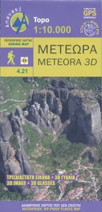
Wandelkaart 4.21 Meteora 3D | Anavasi

Wandelkaart van Meteora en directe omgeving. Op de achterzijde een 3D kaart waarbij het bijgeleverde brilletje tot z'n recht komt.   The hiking map of Meteora in scale 1:10 000 by Anavasi editions is a world first in the printed cartography with its the three-dimensional depiction. We provide the special glasses and we let wander back you back to M...
9,95

Webshops met dit product

Webshop
Bezorging
Prijs

Anderen bekeken ook

Wandelkaart 9.4 Corfu | Anavasi
Een nieuwe gedetailleerde wandelkaart voor Corfu met informatie over monumenten en stranden. De route van de Corfu Trail, een 220 km lange bewegwijzerde wandelroute langs de mooiste en authentieke plaatsen van het eiland, is op de kaart opgenomen. De kaarten van Anavasi zijn zeer gedetailleerd, beschikken over een helder kaartbeeld en zijn uitstekende kaarten voor diverse activiteiten. Ze beschikken over vele interessante punten voor wandelaars, fietsers of andere toeristen die het gebied bezichtigen. De wandelkaarten bevatten ook een uitzonderlijke reliefaanwijzing, verschillende vormen van gewassen en andere topografische details. A new detailed hiking map for Corfu by Anavasi editions with information on its monuments and beaches. The course of the Corfu Trail, a 220 km long waymarked hiking route passing by the most beautiful and authentic places of the island is recorded on the map. Printed on waterproof and rip-proof polyart paper.  
10,95
Wandelkaart 1.3 Mt. Penteli | Anavasi
Deze wandelkaart van berg Penteli door Anavasi nodigt u uit om één van de bergen nabij Athene te ontdekken via wandel- en fietspaden. Oude steengroeven, grotten en monumenten, en de beroemde 'lithagogische weg' zijn in de kaart opgenomen. De kaarten van Anavasi zijn zeer gedetailleerd, beschikken over een helder kaartbeeld en zijn uitstekende kaarten voor diverse activiteiten. Ze beschikken over vele interessante punten voor wandelaars, fietsers of andere toeristen die het gebied bezichtigen. De wandelkaarten bevatten ook een uitzonderlijke reliefaanwijzing, verschillende vormen van gewassen en andere topografische details.   The new hiking map of Mt Penteli [1.3] by Anavasi in a scale 1:16 000 invites you to discover one of the mountains that delimit the Athens plain through hiking and cycling trails. Old quarries, caves and monuments, including the famous "lithagogias road" from where the Parthenon marbles were transported to the Acropolis are recorded on the map The map is printed o…
9,95
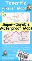
Wandelkaart Tour & Trail Tenerife | Discovery Walking Guides
Uitstekende wandelkaart, met ingetekende wandelroutes, voor specifieke wandelgebieden van Tenerife. Let op: dit is niet een kaart van het hele eiland, maar puur en alleen voor de wandelgebieden > daar is deze kaart de beste in! Our latest hiking research on Tenerife has resulted in new editions of Walk! Tenerife and Tenerife Hikers' Super-Durable Maps. Thanks to Jan Kostura's research we have several new hiking adventures described in detail in Walk! Tenerife. Jan's gps records of his research for new routes and updating of current routes has provided the detailed information to produce our new fourth edition of Tenerife Hiker's Super-Durable Maps. Note that Tenerife Hikers' Super-Durable Maps is a collection of four 30k scale map sections on a double sided sheet of 840mm by 600mm which folds up to 220mm by 120mm. It is not a map of all of Tenerife.  In this edition you will find 30k scale maps covering Valle de Orotava, West, Anaga and Adeje/Arona - Teide printed on a double sided …
17,95
Wandelkaart 10.00 Aigina | Anavasi
Egina eiland ligt heel dicht bij Athene, maar het heeft veel verborgen en wilde kanten. De Anavasi Aigina kaart is de beste manier om deze te ontdekken. De stranden van Egina variëren van zandstranden tot wilde rotsachtige kusten. Maar naast de charmante landschappen en stranden is het een plek die rijk is aan geschiedenis. Deze kaart nodigt u uit om Aigina te ontdekken en rond te lopen in het prachtige landschap. Aan de achterkant van de kaart vindt u voorgestelde wandelroutes en korte beschrijvingen van de belangrijkste bezienswaardigheden. De kaarten van Anavasi zijn zeer gedetailleerd, beschikken over een helder kaartbeeld en zijn uitstekende kaarten voor diverse activiteiten. Ze beschikken over vele interessante punten voor wandelaars, fietsers of andere toeristen die het gebied bezichtigen. De wandelkaarten bevatten ook een uitzonderlijke reliefaanwijzing, verschillende vormen van gewassen en andere topografische details. Aigina island is very close to Athens but it has many hidd…
9,95
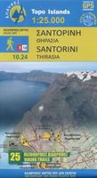
Wandelkaart - Wegenkaart - landkaart 10.24 Santorini | Anavasi
As you enter the caldera of Santorini by ferry sheer cliffs rise up dramatically, exposing richly coloured rock strata, crowned by the colored houses of the cliff-top settlements. Equally magnificent is the sunset from the heights of the caldera towards the sea and the remnants of prehistoric rounded island Strogyli, Thirasia, the New and Old Kameni. However, there is more than the visual excitement to discover and if you don’t take the time to walk the island you will have learnt little of Santorini.   The new Anavasi map will take hiking in every corner, beach and hill top of Santorini and Thirassia to discover landscapes with visible signs of the traditional rural culture, with orchards stonewalls, threshing floors, huts, chapels, inland villages with a well preserved medieval core (called Castelo), routes with wonderful vistas, lost beaches quiet even in the heart of summer.   On the reverse side of the map, there is a brief description of the 25 proposed hiking routes and a short …
10,95
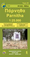
Wandelkaart 1.1 Mt. Parnitha | Anavasi
Parnitha, de hoogste berg in Attika, is een natuurreservaat waar de Atheners in contact komen met de natuur. Het sparrenbos, de ravijnen, het vele kreupelhout, herten en vogels maken dit stukje natuur ontzettend bijzonder. Het is een ideale bestemming om te wandelen, klimmen, mountainbiken, of om zelfs een sneeuwpop te maken. De kaarten van Anavasi zijn zeer gedetailleerd, beschikken over een helder kaartbeeld en zijn uitstekende kaarten voor diverse activiteiten. Ze beschikken over vele interessante punten voor wandelaars, fietsers of andere toeristen die het gebied bezichtigen. De wandelkaarten bevatten ook een uitzonderlijke reliefaanwijzing, verschillende vormen van gewassen en andere topografische details.   A new (7th) edition of Mt Parnitha hiking map. Parnitha, the highest mountain in Attica, is a natural reserve where the Athenians come in contact with nature. The fir forest, the ravines and endless, scrubland, deers and birds are the manifestations of the wildlife we come loo…
11,95
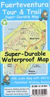
Wandelkaart Tour & Trail Fuerteventura | Discovery Walking Guides
For the best adventures, use the best map. Fuerteventura is a large, 1,660 square kilometres, island. At 65k scale Fuerteventura Tour & Trail Super-Durable Map is a large 960mm by 620mm, double sided map sheet, which folds down to its 220mm by 120mm pocket size.   A specialist concertina map fold means this map is easy to unfold for use and then refold to its pocket size. Super-Durable means that the Tour & Trail Map is printed on a plastic substrate using specially curing inks to produce a map that feels like silk but is tougher than any other map. Super-Durable is backed by a Discovery Walking Guides (DWG) 2-Year Guarantee against failure in the adventurous use for which the map is designed.   If your Super-Durable Map gets dirty then gently wipe clean with a soft wet cloth and allow to fully dry before refolding to pocket size. On one side of the map is the island's north with the south on the reverse side. There's a generous common overlap to minimise turning the map in use.   100 …
15,95
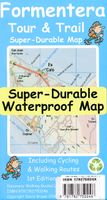
Wandelkaart Tour & Trail Formentera | Discovery Walking Guides
Goede, scheur- en watervaste, wandelkaart van Formentera.   Water-proof, split-proof, tear-proof, adventure-proof. Formentera Tour & Trail Super-Durable Map is simply the toughest, most accurate, easy to read, easy to use map of the island you can buy at any price. David & Ros Brawn surveyed this beautiful island in October 2015 carrying out their 'gps ground survey' pinpointing all the details needed to produce the definitive map of Formentera.   Large, 25k scale, easy to read map sheet includes a wealth of useful details. 20 metre and 100 metre contours combined with altitude shading bring the Formentera landscape to life. All of the legendary Tour & Trail attention to detail is included so that you will find those petrol stations, mirador viewpoints with parking, refreshment stops with parking and accurate road numbering that are so essential when adventuring by hire car; 'watts' new and unique to Formentera we have included the 'Electric hire car' recharging points making sure you …
15,95
Wandelkaart Ruka Oulanka Karhunkierros | Karttakeskus
Prachtige wandelkaart van dit mooie, wilde natuurgebied in Noordoost Finland. Gedetailleerde topografische wandelkaart van Finland met hoogtelijnen en aangegeven natuurparken. De kaart bevat ook ski- en wandelroutes, Loipen, kanoroutes en toeristische informatie als hutten, campings, hotels en bezienswaardigheden.   The outdoor map Ruka Oulanka Karhunkierros 1:50 000 / 1:25 000 is printed on synthetic material. The durable Finnish outdoor maps can be identified by the yellow marking on the cover.   The double-sided map covers the most beautiful trekking areas of Kuusamo. Included are the popular Karhunkierros (Bear's Trail) Hiking Trail, Oulanka National Park, the hiking trails and cross-country ski trails in the vicinity of Ruka Resort and the inviting fishing spots of the River Kuusinkijoki. The region is popular among cross-country skiers, hikers, fishers and snowmobilers.   The material of the map is fully waterproof and can withstand almost limitless folding, and it will not …
22,95
Wandelkaart - Topografische kaart 254 Chilkoot Trail | National Geographic
Prachtige geplastificeerde kaart van het nationaal park. Met alle recreatieve voorzieningen als campsites, maar ook met topografische details en wandelroutes ed. Door uitgekiend kleurgebruik zeer prettig in gebruik. Scheur en watervast!   National Geographic's Trails Illustrated map for Chilkoot Trail in Klondike Gold Rush National Historic Park in the Alaskan panhandle is perfect for hiking, camping, and wildlife viewing in this scenic, rugged frontier. Created in partnership with local land management agencies, this expertly researched map features key areas of interest including Chilkoot Trail National Historic Site; portions of the Klondike Highway; Happy Camp; Taiya Inlet; the town of Skagway; Klondike Gold Rush National Historical Park; Skagway River; Dyea; and Deep, Bennett, Crater, Long, and Lindeman lakes.   The print map includes insets of historic routes to the Klondike gold fields, Historic Dyea, and Skagway Historic District with some of the prominent gold rush-era buil…
16,95

Klanten-reviews van Wandelkaart 4.21 Meteora 3D | Anavasi

Er zijn nog geen beoordelingen voor dit productBen jij de eerste die een review plaatst?

Meer over Wandelkaart 4.21 Meteora 3D | Anavasi

Productomschrijving

Wandelkaart van Meteora en directe omgeving. Op de achterzijde een 3D kaart waarbij het bijgeleverde brilletje tot z'n recht komt.   The hiking map of Meteora in scale 1:10 000 by Anavasi editions is a world first in the printed cartography with its the three-dimensional depiction. We provide the special glasses and we let wander back you back to Meteora even when you are no longer there.   A monument of World Natural and Cultural Heritage of UNESCO, Meteora is a unique landscape of rocky spines and the second largest monastic complex in Greece. With the new map, Anavasi editions invites you to discover the transcendental scenery of Meteora through hiking trails. The map is printed on waterproof "polyart" paper 
Webshop.nl maakt gebruik van cookies. Ga je verder op onze website, ga dan akkoord met het plaatsen van cookies en de verwerking van deze data door ons en vermelde partners.