webshop.nl
Categorieën
  Sluiten

Wandelkaart 10.00 Aigina | Anavasi

Egina eiland ligt heel dicht bij Athene, maar het heeft veel verborgen en wilde kanten. De Anavasi Aigina kaart is de beste manier om deze te ontdekken. De stranden van Egina variëren van zandstranden tot wilde rotsachtige kusten. Maar naast de charmante landschappen en stranden is het een plek die rijk is aan geschiedenis. Deze kaart nodigt u uit ...
9,95

Webshops met dit product

Webshop
Bezorging
Prijs

Anderen bekeken ook

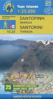
Wandelkaart - Wegenkaart - landkaart 10.24 Santorini | Anavasi
As you enter the caldera of Santorini by ferry sheer cliffs rise up dramatically, exposing richly coloured rock strata, crowned by the colored houses of the cliff-top settlements. Equally magnificent is the sunset from the heights of the caldera towards the sea and the remnants of prehistoric rounded island Strogyli, Thirasia, the New and Old Kameni. However, there is more than the visual excitement to discover and if you don’t take the time to walk the island you will have learnt little of Santorini.   The new Anavasi map will take hiking in every corner, beach and hill top of Santorini and Thirassia to discover landscapes with visible signs of the traditional rural culture, with orchards stonewalls, threshing floors, huts, chapels, inland villages with a well preserved medieval core (called Castelo), routes with wonderful vistas, lost beaches quiet even in the heart of summer.   On the reverse side of the map, there is a brief description of the 25 proposed hiking routes and a short …
10,95
Wandelkaart 4.21 Meteora 3D | Anavasi
Wandelkaart van Meteora en directe omgeving. Op de achterzijde een 3D kaart waarbij het bijgeleverde brilletje tot z'n recht komt.   The hiking map of Meteora in scale 1:10 000 by Anavasi editions is a world first in the printed cartography with its the three-dimensional depiction. We provide the special glasses and we let wander back you back to Meteora even when you are no longer there.   A monument of World Natural and Cultural Heritage of UNESCO, Meteora is a unique landscape of rocky spines and the second largest monastic complex in Greece. With the new map, Anavasi editions invites you to discover the transcendental scenery of Meteora through hiking trails. The map is printed on waterproof "polyart" paper 
9,95
Wandelkaart 1.3 Mt. Penteli | Anavasi
Deze wandelkaart van berg Penteli door Anavasi nodigt u uit om één van de bergen nabij Athene te ontdekken via wandel- en fietspaden. Oude steengroeven, grotten en monumenten, en de beroemde 'lithagogische weg' zijn in de kaart opgenomen. De kaarten van Anavasi zijn zeer gedetailleerd, beschikken over een helder kaartbeeld en zijn uitstekende kaarten voor diverse activiteiten. Ze beschikken over vele interessante punten voor wandelaars, fietsers of andere toeristen die het gebied bezichtigen. De wandelkaarten bevatten ook een uitzonderlijke reliefaanwijzing, verschillende vormen van gewassen en andere topografische details.   The new hiking map of Mt Penteli [1.3] by Anavasi in a scale 1:16 000 invites you to discover one of the mountains that delimit the Athens plain through hiking and cycling trails. Old quarries, caves and monuments, including the famous "lithagogias road" from where the Parthenon marbles were transported to the Acropolis are recorded on the map The map is printed o…
9,95
Wandelkaart 9.4 Corfu | Anavasi
Een nieuwe gedetailleerde wandelkaart voor Corfu met informatie over monumenten en stranden. De route van de Corfu Trail, een 220 km lange bewegwijzerde wandelroute langs de mooiste en authentieke plaatsen van het eiland, is op de kaart opgenomen. De kaarten van Anavasi zijn zeer gedetailleerd, beschikken over een helder kaartbeeld en zijn uitstekende kaarten voor diverse activiteiten. Ze beschikken over vele interessante punten voor wandelaars, fietsers of andere toeristen die het gebied bezichtigen. De wandelkaarten bevatten ook een uitzonderlijke reliefaanwijzing, verschillende vormen van gewassen en andere topografische details. A new detailed hiking map for Corfu by Anavasi editions with information on its monuments and beaches. The course of the Corfu Trail, a 220 km long waymarked hiking route passing by the most beautiful and authentic places of the island is recorded on the map. Printed on waterproof and rip-proof polyart paper.  
10,95
Wandelkaart 10.44 Kythnos | Anavasi
Het eiland Kithnos heeft twee charmante nederzettingen, Hora en Dryopida, wat zeker een bezoekje waard is. Ook heeft Kithnos prachtige stranden en een goed bewaard netwerk van paden.   De kaarten van Anavasi zijn zeer gedetailleerd, beschikken over een helder kaartbeeld en zijn uitstekende kaarten voor diverse activiteiten. Ze beschikken over vele interessante punten voor wandelaars, fietsers of andere toeristen die het gebied bezichtigen. De wandelkaarten bevatten ook een uitzonderlijke reliefaanwijzing, verschillende vormen van gewassen en andere topografische details.   Kythnos, the second in the series of the islands of the western Cyclades, after Kea, has two charming settlements, Hora and Dryopida, wonderful beaches and a well preserved network of trails, whose maintenance and waymarking has started. The new detailed map of Anavasi depicts as always with precision and detail roads and trails, while professor of archeology  Alexander Mazarakis Ainian and the great connoisseur of t…
9,95
Wandelkaart 10.50 Karpathos | Anavasi
Zeer goede kaart van Karpathos. Topografische details zijn goed uitgewerkt, zeer leesbare kaart met ook nog eens alle toeristisch interessante punten. Karpathos, a mountainous island with rugged terrain and magnificent landscapes, is one of the most authentic places in Greece. It has endless sandy beaches in the south and secluded coves with emerald-blue waters in the north. The more developped south of the island is popular to surfers while the north still keeps folkways alive especially in the magical village of Olymbos, perched on a saddle between two mountains and two seas. Off the northern tip of Kárpathos, separated from it by a narrow channel is the uninhabited island of Sariá with old agricultural settlements and remains of medieval houses at Palatia. This new detailed map of Anavasi proposes 12 hiking trails in the north and 6 in the south and presents the major highlights of the island.
9,95
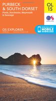
Wandelkaart - Topografische kaart OL15 OS Explorer Map Purbeck and South Dorset | Ordnance Survey
Gaze back through 185 million years of history as you explore the Jurassic Coast or go wildlife spotting in the South Dorset countryside. Sweeping golden beaches and spectacular cliff scenery await you on the Purbeck Peninsula as the South West Coast Path takes you from Chesil Beach to Europe’s largest natural bay at Poole.   - Hunt for fossils and dinosaur tracks on the unique Jurassic Coast beaches of Kimmeridge Bay, Lulworth Cove and the iconic sweeping shingle ridge of Chesil Beach - Discover the world-famous Sandbanks Beach in Poole, climb Europe’s largest Iron Age hillfort at Maiden Castle and relax in sunny Weymouth, home of the sailing at London 2012 - Explore the Purbeck Peninsula with its chalk cliffs, the magnificent ruin of Corfe Castle, Victorian pier at Swanage and Brownsea Island Een van de beste detailkaarten die er op de wereld gemaakt worden: zeer gedetailleerd, prachtig helder kleurgebruik, veel topografische aspecten en - zeer belangrijk - allerlei toeristische e…
19,50
Wandelkaart 313 Santorini | Terrain maps
Gedetailleerde wegenkaart en wandelkaart met alle kleine wegen, wandelpaden, hoogtelijnen en toeristische informatie aangegeven. Alle tekst is tweetalig in Engels en Grieks en de waterproof kaart is geschikt voor gebruik met GPS.   This is a detailled map of Santorini. Features: It is waterproof and rip-proof. You can fold and unfold it a thousand times, fold it in irregular ways, dunk it in the sea or leave it out in the rain. This map is indestructible!  It indicates the boundaries of NATURA 2000 areas so that you will know which parts of the island are of special environmental interest and beauty – thus you can enjoy traveling through them, but also take care to protect them.  The length of all trails is measured in kilometers, so you can estimate the duration of your hike no matter which trail / road combination you follow.  It features detailed descriptions of 2 trails on the back, including their total length in kilometers and the duration of the hike, and the wineries of San…
11,95
Wandelkaart 311 Naxos | Terrain maps
Erg goede wandelkaart van naxos, weerbestendig en volledig. Bezienswaardigheden, campings en andere praktische zaken staan op de kaart aangegeven. GPS toepasbaar. This map is great because: • It is waterproof and rip-proof. You can fold and unfold it a thousand times, fold it in irregular ways, dunk it in the sea or leave it out in the rain. This map is indestructible! • It is the first time the island’s entire coastline is mapped. Cartography was done with TERRAIN’s specially equipped and staffed cartographic vessel. This means that you can locate all beaches of the island, down to the tiniest cove! In fact, the special features of every single beach are recorded: whether it is sandy or pebbled, whether it features natural tree shade, water, a beach bar or organized water sports, whether the seabed in front of the beach is sandy or rocky (so that you will know where to anchor). • It indicates the boundaries of NATURA 2000 areas so that you will know which parts of the island are of sp…
11,95
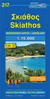
Wandelkaart 217 Skiathos | Road Editions
Gedetailleerde wegenkaart met aanduiding van de wandelwegen, lijst van hotels en toeristische informatie. Voor alle doeleinden een zeer geschikte kaart.   The features that make this and every other ROAD island map unique are: *The coastline, hydrography and precision geophysical background based on data provided by the Hellenic Military Geographic Service and electronically processed by us for clarity and legibility. We have highlighted the mountain masses in shades of brown between the contour lines (at 20m intervals on this map) to outline clearly the relief of the island. *The beaches are indicated by a special symbol next to which we have noted their names, as well as all the roads and footpaths leading to them (since most people primarily visit the islands for the beaches!). We have even included a short text in which the island’s best beaches are concisely referred to, to save you going on a wild goose hunt in search of them. *The road network is mapped out with impressive and e…
8,95

Klanten-reviews van Wandelkaart 10.00 Aigina | Anavasi

Er zijn nog geen beoordelingen voor dit productBen jij de eerste die een review plaatst?

Meer over Wandelkaart 10.00 Aigina | Anavasi

Productomschrijving

Egina eiland ligt heel dicht bij Athene, maar het heeft veel verborgen en wilde kanten. De Anavasi Aigina kaart is de beste manier om deze te ontdekken. De stranden van Egina variëren van zandstranden tot wilde rotsachtige kusten. Maar naast de charmante landschappen en stranden is het een plek die rijk is aan geschiedenis. Deze kaart nodigt u uit om Aigina te ontdekken en rond te lopen in het prachtige landschap. Aan de achterkant van de kaart vindt u voorgestelde wandelroutes en korte beschrijvingen van de belangrijkste bezienswaardigheden. De kaarten van Anavasi zijn zeer gedetailleerd, beschikken over een helder kaartbeeld en zijn uitstekende kaarten voor diverse activiteiten. Ze beschikken over vele interessante punten voor wandelaars, fietsers of andere toeristen die het gebied bezichtigen. De wandelkaarten bevatten ook een uitzonderlijke reliefaanwijzing, verschillende vormen van gewassen en andere topografische details. Aigina island is very close to Athens but it has many hidden and wild sides. The Anavasi Aigina map is the best way to discover them. Aigina beaches range from sandy beaches to wild rocky shores accessed by ladder. But besides the charming landscapes and beaches, it is a place rich in history that goes well back in time. You should visit the sanctuary of Aphaia, a temple of c. 500 BC. This map invites you to discover Aigina and to walk around its lovely countryside. On the back side of the map you will find proposed hiking routes and the short descriptions of the main sights.  
Webshop.nl maakt gebruik van cookies. Ga je verder op onze website, ga dan akkoord met het plaatsen van cookies en de verwerking van deze data door ons en vermelde partners.