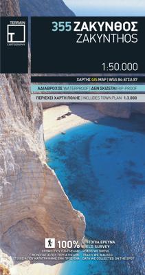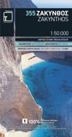
Wandelkaart 355 Zakynthos | Terrain maps

0
We walked all trails. We drove all roads. We sailed around each and every island. We recorded every single sight. And we proudly present the best maps ever made for travelers of Greece. Terrain maps are the only maps featuring:   100% field research Waterproof, rip-proof Polyart paper Highly detailed coastline mapping Climbing, biking, diving ...

Verkopers met dit product

Verkoper
Bezorging
Prijs
DeZwerver.nl logo
DeZwerver.nl
2,95
11,95

Anderen bekeken ook

Wandelkaart 355 Zakynthos | Terrain maps
We walked all trails. We drove all roads. We sailed around each and every island. We recorded every single sight. And we proudly present the best maps ever made for travelers of Greece. Terrain maps are the only maps featuring:   100% field research Waterproof, rip-proof Polyart paper Highly detailed coastline mapping Climbing, biking, diving and canyoning information The new era in cartography is here. It was made for you, the demanding traveler, explorer, and nature lover. Forget about compromises and pseudo-maps. Travel with the best. Travel with Terrain.
11,95
Wandelkaart - Wegenkaart - landkaart 412 Halkidiki - Chalkidiki | Terrain maps
Gedetailleerde wegenkaart en wandelkaart met alle kleine wegen, wandelpaden, hoogtelijnen en toeristische informatie aangegeven. Alle tekst is tweetalig in Engels en Grieks en de waterproof kaart is geschikt voor gebruik met GPS. We walked all trails. We drove all roads. We sailed around each and every island. We recorded every single sight. And we proudly present the best maps ever made for travelers of Greece. Terrain maps are the only maps featuring:   100% field research Waterproof, rip-proof Polyart paper Highly detailed coastline mapping Climbing, biking, diving and canyoning information The new era in cartography is here. It was made for you, the demanding traveler, explorer, and nature lover. Forget about compromises and pseudo-maps. Travel with the best. Travel with Terrain.
12,50
Wegenkaart - landkaart - Fietskaart 5 Touring Map Central Greece - Centraal Griekenland | Terrain maps
Landkaart van een deel van Griekenland met zeer veel plaatsen, kleine wegen, hoogtelijnen en toeristische informatie in symbolen aangegeven, met plaatsnamenregister - schaal 1:200.000. De kaart wordt veel gebruikt door fietsers vanwege de mate van detail, is watervast en GPS-geschikt.   We walked all trails. We drove all roads. We sailed around each and every island. We recorded every single sight. And we proudly present the best maps ever made for travelers of Greece. Terrain maps are the only maps featuring:   100% field research Waterproof, rip-proof Polyart paper Highly detailed coastline mapping Climbing, biking, diving and canyoning information The new era in cartography is here. It was made for you, the demanding traveler, explorer, and nature lover. Forget about compromises and pseudo-maps. Travel with the best. Travel with Terrain.  
13,50
Wegenkaart - landkaart - Fietskaart 4 Touring Map Thessaly - central Greece, centraal Griekenland | Terrain maps
Landkaart van een deel van Griekenland met zeer veel plaatsen, kleine wegen, hoogtelijnen en toeristische informatie in symbolen aangegeven, met plaatsnamenregister - schaal 1:200.000. De kaart wordt veel gebruikt door fietsers vanwege de mate van detail, is watervast en GPS-geschikt. We walked all trails. We drove all roads. We sailed around each and every island. We recorded every single sight. And we proudly present the best maps ever made for travelers of Greece. Terrain maps are the only maps featuring:   100% field research Waterproof, rip-proof Polyart paper Highly detailed coastline mapping Climbing, biking, diving and canyoning information The new era in cartography is here. It was made for you, the demanding traveler, explorer, and nature lover. Forget about compromises and pseudo-maps. Travel with the best. Travel with Terrain.
13,50
Wandelkaart Tour & Trail Zakynthos | Discovery Walking Guides
Goede scheur- en watervaste wandelkaart van Zakynthos. For the best adventures, use the best map. Water-proof, split-proof, tear-proof, adventure-proof. Zakynthos (Zante) Tour & Trail Super-Durable Map is simply the toughest, most accurate, easy to read, easy to use map of the island you can buy at any price.   Super-Durable Maps come with a 2 year adventurous use `Wear and Tear' guarantee. A large 840mm by 694mm double sided map sheet has Zakynthos (Zante) at 1:35,000 scale with the North-West of the island on the cover side and the South-East on the reverse. There is a very generous overlap between the two sides so the only time you need to turn the map over is if you are driving from Cape Skinari (NW) to Cape Gerakas (SE) at the opposite end of the island.   Our special concertina map fold makes our map easy to use and easy to refold to its 235mm by 120mm pocket size. You can also download the digital Custom Map edition of our Zakynthos Tour & Trail Map for use with Garmin gps unit…
15,95
Reisgids Mini Rough Guide Zakynthos | Rough Guides
Een kleinere versie in zakformaat van de grotere versies van de Rough Guides. Als altijd weer vol met goede informatie over cultuur en praktische zaken. Achterin kleine plattegronden. This pocket-sized travel guide to Zákynthos is a convenient, quick-reference companion to discovering what to do, what to see and how to get around the destination. It covers top attractions like Blue Caves of Zákynthos, Ássos, Sámi, Drogaráti as well as hidden gems, including Sea Turtle Rescue and Shipwreck Bay. Our Zákynthos guide book will save you time and enhance your exploration of this fascinating region. This Zákynthos travel guide has been fully updated post-COVID-19. This Mini Rough Guide to ZÁKYNTHOS covers: Zákynthos; Kefaloniá; Itháki. In this guide book to Zákynthos you will find: RECOMMENDATIONS FOR EVERY TYPE OF TRAVELLER Experiences selected for every kind of trip to Zákynthos, from cultural explorations in Melissáni to family activities in child-friendly places, like Mount Énos or ch…
12,50
Wandelkaart 304 Sifnos | Terrain maps
Erg goede wandelkaart van Sifnos, weerbestendig en volledig. Bezienswaardigheden, campings en andere praktische zaken staan op de kaart aangegeven. GPS toepasbaar. This is a great map of Sifnos because: It is waterproof and rip-proof. You can fold and unfold it a thousand times, fold it in irregular ways, dunk it in the sea or leave it out in the rain. This map is indestructible!  It features more trails than any other map of Sifnos on the market. For example, take a look at the area between Apollonia and Kastro, which is where most visitors choose to hike. The trail from Plakoto and the chapel of Aghia Anastasia to Kastro, the trail ascending to Exambela and the branch leading to Apollonia, the trail to Kato Petali, the trail from Aghios Loukas to Kastro and so many more, appear on a map of Sifnos for the first time – in fact, the length of all trails is measured in kilometers so you can estimate the duration of your hike. Also, unlike other hiking maps, SKAI maps do not depict any…
11,95
Wandelkaart 337 Kalymnos | Terrain maps
Gedetailleerde wegenkaart en wandelkaart met alle kleine wegen, wandelpaden, hoogtelijnen en toeristische informatie aangegeven. Alle tekst is tweetalig in Engels en Grieks en de waterproof kaart is geschikt voor gebruik met GPS. This is a great map because: It is the only map featuring the climbing crags of Kalymnos completely and accurately. Fabulous cliffs and impeccable organization have made Kalymnos the No 1 rock climbing destination worldwide. This is the first map of Kalymnos to accurately feature all climbing crags on the island, with no omissions or errors, including crags equipped through May of 2009! There are two more maps of Kalymnos in the market, but if you can compare them with the SKAI map of Kalymnos – you will immediately see how far ahead our map is. One of those maps features a few of the climbing crags with symbols on the back side. The other features climbing crags on the actual map but with several errors, inconsistencies and considerable omissions.  It is w…
11,95
Reisgids Zakynthos - Zakinthos | Marco Polo
  With the MARCO POLO travel guide Zákinthos, Itháki, Kefaloniá and Lefkáda explore enchanting villages, ancient castles, bathing beaches: the Ionian islands around Zákinthos do not need a filter to look paradisiacal. The bright blue sea, the white rock cliffs and green hills are made for your holiday photos.   The most beautiful photo spots and sightseeing highlights on Zákinthos, Itháki, Kefaloniá and Lefkáda can be found without a long search with the Marco Polo travel guide. Choose the best for you and go on a Greece holiday according to your taste.   Your shortcut to experience: with the Marco Polo adventure tours including free tour app. MARCO POLO insider tips from locals for sightseeing highlights, shopping spots, restaurants and party zones All-round worry-free package with tips on arrival, event calendar, phrasebook and holiday playlist. On the go with children, a small travel budget or in bad weather? Marco Polo has the best of tips! Never haphazard thanks to new cartograph…
18,50
Wandelkaart 329 Psara | Terrain maps
Gedetailleerde wegenkaart en wandelkaart met alle kleine wegen, wandelpaden, hoogtelijnen en toeristische informatie aangegeven. Alle tekst is tweetalig in Engels en Grieks en de waterproof kaart is geschikt voor gebruik met GPS.   This is a great map because: First and foremost, it is the only available map of Psara! So far, no other cartographer had taken interest in this historical but forgotten corner of Greece. It is made with data collected 100% through field survey and comes in the detailed scale of 1:15,000, showing everything very clearly.  For the first time, all the trails of Psara are shown with absolute accuracy. The length of all trails has been measured in kilometres, so you can estimate the duration of your hike. On the back side of the map you ‘ll find detailed descriptions of the 3 best hikes on the island, also labeled on the map itself, so you easily locate them.  The nearby uninhabited island of Antipsara as well as all the surrounding islets are also included,…
11,95

Klanten-reviews van Wandelkaart 355 Zakynthos | Terrain maps

Er zijn nog geen beoordelingen voor dit productBen jij de eerste die een review plaatst?

Meer over Wandelkaart 355 Zakynthos | Terrain maps

Productomschrijving

We walked all trails. We drove all roads. We sailed around each and every island. We recorded every single sight. And we proudly present the best maps ever made for travelers of Greece. Terrain maps are the only maps featuring:  
  • 100% field research
  • Waterproof, rip-proof Polyart paper
  • Highly detailed coastline mapping
  • Climbing, biking, diving and canyoning information
  • The new era in cartography is here. It was made for you, the demanding traveler, explorer, and nature lover. Forget about compromises and pseudo-maps. Travel with the best. Travel with Terrain.

Productinformatie

    Verken gerelateerde categorieën

    Webshop.nl maakt gebruik van cookies. Ga je verder op onze website, ga dan akkoord met het plaatsen van cookies en de verwerking van deze data door ons en vermelde partners.