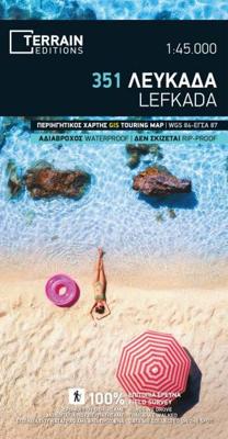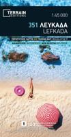
Wandelkaart 351 Lefkada | Terrain maps

0
Gedetailleerde wegenkaart en wandelkaart met alle kleine wegen, wandelpaden, hoogtelijnen en toeristische informatie aangegeven. Alle tekst is tweetalig in Engels en Grieks en de waterproof kaart is geschikt voor gebruik met GPS. This is a great map because: It is waterproof and rip-proof. You can fold and unfold it a thousand times, fold it in i...

Verkopers met dit product

Verkoper
Bezorging
Prijs
DeZwerver.nl logo
DeZwerver.nl
2,95
11,95

Anderen bekeken ook

Nieuw
Wandelkaart 315 Ios | Terrain maps
Gedetailleerde wegenkaart en wandelkaart met alle kleine wegen, wandelpaden, hoogtelijnen en toeristische informatie aangegeven. Alle tekst is tweetalig in Engels en Grieks en de waterproof kaart is geschikt voor gebruik met GPS. This is a great map because: It is the first GIS map of the island, meaning that this is the first time Ios is mapped with a topographic precision in proportion to the map scale.  It is waterproof and rip-proof. You can fold and unfold it a thousand times, fold it in irregular ways, dunk it in the sea or leave it out in the rain. This map is indestructible!  It is remarkably detailed, at a scale nearly twice as large as the competition’s, which makes everything crystal clear!  It is the first time the island’s entire coastline is mapped. Cartography was done with TERRAIN’s specially equipped and staffed cartographic vessel. This means that you can locate all beaches of the island, down to the tiniest cove! In fact, the special features of every single b…
11,95
Nieuw
Wandelkaart 341 Symi | Terrain maps
Gedetailleerde wegenkaart en wandelkaart met alle kleine wegen, wandelpaden, hoogtelijnen en toeristische informatie aangegeven. Alle tekst is tweetalig in Engels en Grieks en de waterproof kaart is geschikt voor gebruik met GPS. This is a great map because: For starters, it is the only map of Symi! No other cartographer had bothered creating a map of this remote Greek island in the Dodecanese … Finally, TERRAIN and SKAI created the first reliable map of Symi using GIS technology.  It is waterproof and rip-proof. You can fold and unfold it a thousand times, fold it in irregular ways, dunk it in the sea or leave it out in the rain. This map is indestructible!  It is remarkably detailed, as the 1:20.000 scale makes everything crystal clear!  It is the first time the island’s entire coastline is mapped. Cartography was done with TERRAIN’s specially equipped and staffed cartographic vessel. This means that you can locate all beaches of the island, down to the tiniest cove! In fact, th…
11,95
Nieuw
Wandelkaart 334 Arki - Lipsi - Aghathonisi | Terrain maps
Gedetailleerde wegenkaart en wandelkaart met alle kleine wegen, wandelpaden, hoogtelijnen en toeristische informatie aangegeven. Alle tekst is tweetalig in Engels en Grieks en de waterproof kaart is geschikt voor gebruik met GPS. This is a great map because: It is waterproof and rip-proof. You can fold and unfold it a thousand times, fold it in irregular ways, dunk it in the sea or leave it out in the rain. This map is indestructible!  It is the first GIS precision map of Agathonisi. This remote, stunning, and strategically important corner of our country is featured in a tourist map, in all its seductive detail, for the first time.  Its scale is the best available for these islands, nearly 3 times larger (i.e. more detailed) than the scale of your next map of choice.  It is the first time the island’s entire coastline is mapped. Cartography was done with TERRAIN’s specially equipped and staffed cartographic vessel. This means that you can locate all beaches of the island, down …
11,95
Nieuw
Wandelkaart - Wegenkaart - landkaart 338 Kos | Terrain maps
Gedetailleerde wegenkaart en wandelkaart met alle kleine wegen, wandelpaden, hoogtelijnen en toeristische informatie aangegeven. Alle tekst is tweetalig in Engels en Grieks en de waterproof kaart is geschikt voor gebruik met GPS. This is a great map because: It is the first GIS map of the island, meaning that this is the first time Kos is mapped with a topographic precision in proportion to the map scale.  The road network of Kos is featured so completely for the first time. Every road, down to the secondary dirt roads and dead-ends, is illustrated on the map with precision. Naturally the main road network is clearly depicted, along with residential areas, the airport, the ports and the entire tourist infrastructure of Kos.  It is waterproof and rip-proof. You can fold and unfold it a thousand times, fold it in irregular ways, dunk it in the sea or leave it out in the rain. This map is indestructible!  It is remarkably detailed, as its scale is much larger (i.e. more detailed) tha…
12,50
Nieuw
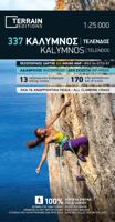
Wandelkaart 337 Kalymnos | Terrain maps
Gedetailleerde wegenkaart en wandelkaart met alle kleine wegen, wandelpaden, hoogtelijnen en toeristische informatie aangegeven. Alle tekst is tweetalig in Engels en Grieks en de waterproof kaart is geschikt voor gebruik met GPS. This is a great map because: It is the only map featuring the climbing crags of Kalymnos completely and accurately. Fabulous cliffs and impeccable organization have made Kalymnos the No 1 rock climbing destination worldwide. This is the first map of Kalymnos to accurately feature all climbing crags on the island, with no omissions or errors, including crags equipped through May of 2009! There are two more maps of Kalymnos in the market, but if you can compare them with the SKAI map of Kalymnos – you will immediately see how far ahead our map is. One of those maps features a few of the climbing crags with symbols on the back side. The other features climbing crags on the actual map but with several errors, inconsistencies and considerable omissions.  It is w…
11,95
Nieuw
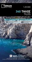
Wandelkaart 340 Tilos | Terrain maps
Gedetailleerde wegenkaart en wandelkaart met alle kleine wegen, wandelpaden, hoogtelijnen en toeristische informatie aangegeven. Alle tekst is tweetalig in Engels en Grieks en de waterproof kaart is geschikt voor gebruik met GPS. This is a great map because: For starters, it’s the only map of Tilos! This is the first time Tilos is mapped using GIS technology, hence it is the first reliable map of the island.  It is waterproof and rip-proof. You can fold and unfold it a thousand times, fold it in irregular ways, dunk it in the sea or leave it out in the rain. This map is indestructible!  It is the first time the island’s entire coastline is mapped. Cartography was done with TERRAIN’s specially equipped and staffed cartographic vessel. This means that you can locate all beaches of the island, down to the tiniest cove! In fact, the special features of every single beach are recorded: whether it is sandy or pebbled, whether it features natural tree shade, water, a beach bar or organize…
11,95
Nieuw
Wandelkaart - Wegenkaart - landkaart 342 Rhodes - Rhodos | Terrain maps
Gedetailleerde wegenkaart en wandelkaart met alle kleine wegen, wandelpaden, hoogtelijnen en toeristische informatie aangegeven. Alle tekst is tweetalig in Engels en Grieks en de waterproof kaart is geschikt voor gebruik met GPS. This is a great map because: It is the first and only –to date – GIS map of Rhodes, and the only one made with data collected 100% through field survey, making it the only truly accurate and GPS compatible map of the island. Also, It comes in the most detailed scale available (competitor maps are in the 1:100,000 scale)  It is printed on Polyart material, making it totally waterproof and rip-proof. You can fold it and unfold it a hundred times, fold it in irregular ways, dunk it in the sea or leave it out in the rain. This map is indestructible!  It features the most complete road network. Also, on the back side of the map there is a detailed plan of the town of Rhodes and an enlarged one of the old town, listing all sights, restaurants, hotels and bars.  …
12,50
Fietskaart 07 De Sterkste van de Regio Veluwe | Buijten & Schipperheijn
De actueelste Nederlandkaart met fietsknooppunten! Een vrijwel onverwoestbare kaart bovendien, met handige informatie over campings, veerdiensten etc. Regio Veluwe. Duidelijk kaartbeeld met royale letter Compleet netwerk van fietspaden en kleine wegen Alle bewegwijzerde fietsknoppunten Landelijke wandelroutes en streekwandelingen Webadressen van alle bed-and-breakfastlocaties en veerdiensten Precieze locaties van monumenten Groot formaat Groot schaal Compact gevouwen Zeer klein opgevouwen formaat van water- en scheurvast papier. Handig voor op de racefiets! An up-to-date cycle map, with wayfinding points clearly marked. This map is virtually indestructible, waterproof and tear-proof. Complete with useful information about camp sites, ferry locations, and long-distance bike routes, this map is a must-have for long and short distance cycling. Its handy pocket size means that it  can fold easily into a handlebar bag. A complete network of bicycle paths and small roads Bicyc…
12,90
Fietskaart 04 De Sterkste van de Regio Drenthe | Buijten & Schipperheijn
De actueelste Nederlandkaart met fietsknooppunten! Een vrijwel onverwoestbare kaart bovendien, met handige informatie over campings, veerdiensten etc. Regio Drenthe. Duidelijk kaartbeeld met royale letter Compleet netwerk van fietspaden en kleine wegen Alle bewegwijzerde fietsknoppunten Landelijke wandelroutes en streekwandelingen Webadressen van alle bed-and-breakfastlocaties en veerdiensten Precieze locaties van monumenten Groot formaat Groot schaal Compact gevouwen   Zeer klein opgevouwen formaat van water- en scheurvast papier. Handig voor op de racefiets!     An up-to-date cycle map, with wayfinding points clearly marked. This map is virtually indestructible, waterproof and tear-proof. Complete with useful information about camp sites, ferry locations, and long-distance bike routes, this map is a must-have for long and short distance cycling. Its handy pocket size means that it  can fold easily into a handlebar bag. A complete network of bicycle paths and small roads …
12,90
Fietskaart 02 De Sterkste van de Regio Friesland | Buijten & Schipperheijn
De actueelste Nederlandkaart met fietsknooppunten! Een vrijwel onverwoestbare kaart bovendien, met handige informatie over campings, veerdiensten etc. Regio Friesland. Duidelijk kaartbeeld met royale letter Compleet netwerk van fietspaden en kleine wegen Alle bewegwijzerde fietsknoppunten Landelijke wandelroutes en streekwandelingen Webadressen van alle bed-and-breakfastlocaties en veerdiensten Precieze locaties van monumenten Groot formaat Groot schaal Compact gevouwen Zeer klein opgevouwen formaat van water- en scheurvast papier. Handig voor op de racefiets! An up-to-date cycle map, with wayfinding points clearly marked. This map is virtually indestructible, waterproof and tear-proof. Complete with useful information about camp sites, ferry locations, and long-distance bike routes, this map is a must-have for long and short distance cycling. Its handy pocket size means that it  can fold easily into a handlebar bag. A complete network of bicycle paths and small roads Bicy…
11,90

Klanten-reviews van Wandelkaart 351 Lefkada | Terrain maps

Er zijn nog geen beoordelingen voor dit productBen jij de eerste die een review plaatst?

Meer over Wandelkaart 351 Lefkada | Terrain maps

Productomschrijving

Gedetailleerde wegenkaart en wandelkaart met alle kleine wegen, wandelpaden, hoogtelijnen en toeristische informatie aangegeven. Alle tekst is tweetalig in Engels en Grieks en de waterproof kaart is geschikt voor gebruik met GPS.

This is a great map because:

  • It is waterproof and rip-proof. You can fold and unfold it a thousand times, fold it in irregular ways, dunk it in the sea or leave it out in the rain. This map is indestructible! 
  • It features a map of the city including all important points of interest. 
  NOTE: Due to technical and other difficulties during the expedition, the coastline of Lefkada was not mapped by TERRAIN’s cartographic vessel. In this first edition of the map of Lefkada beaches were recorded by the cartographers of the ground team, hence some beaches accessible only by sea may not appear on the map.

Verken gerelateerde categorieën

Webshop.nl maakt gebruik van cookies. Ga je verder op onze website, ga dan akkoord met het plaatsen van cookies en de verwerking van deze data door ons en vermelde partners.