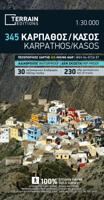
Wandelkaart 345 Karpathos - Kasos | Terrain maps

0
Gedetailleerde wegenkaart en wandelkaart met alle kleine wegen, wandelpaden, hoogtelijnen en toeristische informatie aangegeven. Alle tekst is tweetalig in Engels en Grieks en de waterproof kaart is geschikt voor gebruik met GPS. This is a great map because: • It is the first GIS map of the island, meaning that this is the first time Karpathos and...

Verkopers met dit product

Verkoper
Bezorging
Prijs
DeZwerver.nl logo
DeZwerver.nl
2,95
11,95

Anderen bekeken ook

Wandelkaart 345 Karpathos - Kasos | Terrain maps
Gedetailleerde wegenkaart en wandelkaart met alle kleine wegen, wandelpaden, hoogtelijnen en toeristische informatie aangegeven. Alle tekst is tweetalig in Engels en Grieks en de waterproof kaart is geschikt voor gebruik met GPS. This is a great map because: • It is the first GIS map of the island, meaning that this is the first time Karpathos and Kasos are mapped with a topographic precision in proportion to the map scale. • It is waterproof and rip-proof. You can fold and unfold it a thousand times, fold it in irregular ways, dunk it in the sea or leave it out in the rain. This map is indestructible! • It features the most complete road network. No matter which corner of the island on the SKAI map of Karpathos you compare with any other map on the market, you will see that it features many more roads –most importantly, they are depicted with accuracy. • It features the trails of Karpathos and Kasos for the first time, with total precision since the cartographers of TERRAIN walked th…
11,95
Wandelkaart 10.50 Karpathos | Anavasi
Zeer goede kaart van Karpathos. Topografische details zijn goed uitgewerkt, zeer leesbare kaart met ook nog eens alle toeristisch interessante punten. Karpathos, a mountainous island with rugged terrain and magnificent landscapes, is one of the most authentic places in Greece. It has endless sandy beaches in the south and secluded coves with emerald-blue waters in the north. The more developped south of the island is popular to surfers while the north still keeps folkways alive especially in the magical village of Olymbos, perched on a saddle between two mountains and two seas. Off the northern tip of Kárpathos, separated from it by a narrow channel is the uninhabited island of Sariá with old agricultural settlements and remains of medieval houses at Palatia. This new detailed map of Anavasi proposes 12 hiking trails in the north and 6 in the south and presents the major highlights of the island.
9,95
Wegenkaart - landkaart 201 Karpathos - Kassos | Road Editions
Gedetailleerde wegenkaart met aanduiding van de wandelwegen, lijst van hotels en toeristische informatie. Voor alle soorten vakanties, ook als wandel- en fietskaart goed te gebruiken. Easy to read map for Karpathos and Kassos with touristic information churches, monasteries, archaeological sites and castles as well as all the beaches, the altitudes of mountain peaks, the complete network of trails (footpaths), the lighthouses, the airport of course, and much more.
9,95
Wandelkaart 337 Kalymnos | Terrain maps
Gedetailleerde wegenkaart en wandelkaart met alle kleine wegen, wandelpaden, hoogtelijnen en toeristische informatie aangegeven. Alle tekst is tweetalig in Engels en Grieks en de waterproof kaart is geschikt voor gebruik met GPS. This is a great map because: It is the only map featuring the climbing crags of Kalymnos completely and accurately. Fabulous cliffs and impeccable organization have made Kalymnos the No 1 rock climbing destination worldwide. This is the first map of Kalymnos to accurately feature all climbing crags on the island, with no omissions or errors, including crags equipped through May of 2009! There are two more maps of Kalymnos in the market, but if you can compare them with the SKAI map of Kalymnos – you will immediately see how far ahead our map is. One of those maps features a few of the climbing crags with symbols on the back side. The other features climbing crags on the actual map but with several errors, inconsistencies and considerable omissions.  It is w…
11,95
Wandelkaart 311 Naxos | Terrain maps
Erg goede wandelkaart van naxos, weerbestendig en volledig. Bezienswaardigheden, campings en andere praktische zaken staan op de kaart aangegeven. GPS toepasbaar. This map is great because: • It is waterproof and rip-proof. You can fold and unfold it a thousand times, fold it in irregular ways, dunk it in the sea or leave it out in the rain. This map is indestructible! • It is the first time the island’s entire coastline is mapped. Cartography was done with TERRAIN’s specially equipped and staffed cartographic vessel. This means that you can locate all beaches of the island, down to the tiniest cove! In fact, the special features of every single beach are recorded: whether it is sandy or pebbled, whether it features natural tree shade, water, a beach bar or organized water sports, whether the seabed in front of the beach is sandy or rocky (so that you will know where to anchor). • It indicates the boundaries of NATURA 2000 areas so that you will know which parts of the island are of s…
11,95
Wandelgids Rhodos, Karpathos, Kos and southern Dodecanese | Graf editions
Engelstaige wandelgids. Rhodos, Karpathos, Kos en de zuidelijke Dodekanesos. van de uitgever   This book describes the loveliest old walking trails. With precise descriptions and route photos of outstanding points for better orientation. And lots of interesting facts worth knowing about the Dodecanese Islands. It is made for island hoppers who want to drift through the island world by ship and who would also like to hike and swim in this ancient cultural landscape. Ten to twelve islands, among them very small ones, are described in each book, except for Walking on Naxos and Walking on Samos with only one island respectively.   The walks are carefully selected so that places of cultural significance as well as lonesome beaches can be found along the way. Exploring the remaining ancient mule tracks and marble plated roads make the walks especially enjoyable. Each walk is characterized by a precise and plain text as well as a detailed map. Six to four photos of distinctive places a…
19,50
Wandelkaart 346 Kythera - Kythira | Terrain maps
Gedetailleerde wegenkaart en wandelkaart met alle kleine wegen, wandelpaden, hoogtelijnen en toeristische informatie aangegeven. Alle tekst is tweetalig in Engels en Grieks en de waterproof kaart is geschikt voor gebruik met GPS. De uitgever: THIS IS THE BEST MAP OF KYTHERA BECAUSE: • It is the first GIS map of the island, meaning that this is the first time Kythera is mapped with a topographic precision in proportion to the map scale. • It is waterproof and rip-proof. You can fold and unfold it a thousand times, fold it in irregular ways, dunk it in the sea or leave it out in the rain. This map is indestructible! • It is remarkably detailed, at a scale twice as large as the competition’s, which makes everything crystal clear! • It is the first time the island’s entire coastline is mapped. Cartography was done with TERRAIN’s specially equipped and staffed cartographic vessel. This means that you can locate all beaches of the island, down to the tiniest cove! In fact, the special featu…
11,95
Wandelkaart 304 Sifnos | Terrain maps
Erg goede wandelkaart van Sifnos, weerbestendig en volledig. Bezienswaardigheden, campings en andere praktische zaken staan op de kaart aangegeven. GPS toepasbaar. This is a great map of Sifnos because: It is waterproof and rip-proof. You can fold and unfold it a thousand times, fold it in irregular ways, dunk it in the sea or leave it out in the rain. This map is indestructible!  It features more trails than any other map of Sifnos on the market. For example, take a look at the area between Apollonia and Kastro, which is where most visitors choose to hike. The trail from Plakoto and the chapel of Aghia Anastasia to Kastro, the trail ascending to Exambela and the branch leading to Apollonia, the trail to Kato Petali, the trail from Aghios Loukas to Kastro and so many more, appear on a map of Sifnos for the first time – in fact, the length of all trails is measured in kilometers so you can estimate the duration of your hike. Also, unlike other hiking maps, SKAI maps do not depict any…
11,95
Wandelkaart 331 Samos | Terrain maps
Gedetailleerde wegenkaart en wandelkaart met alle kleine wegen, wandelpaden, hoogtelijnen en toeristische informatie aangegeven. Alle tekst is tweetalig in Engels en Grieks en de waterproof kaart is geschikt voor gebruik met GPS. This is a great map because: • It is waterproof and rip-proof. You can fold and unfold it a thousand times, fold it in irregular ways, dunk it in the sea or leave it out in the rain. This map is indestructible! • It is the first time the island’s entire coastline is mapped. Cartography was done with TERRAIN’s specially equipped and staffed cartographic vessel. This means that you can locate all beaches of the island, down to the tiniest cove! In fact, the special features of every single beach are recorded: whether it is sandy or pebbled, whether it features natural tree shade, water, a beach bar or organized water sports, whether the seabed in front of the beach is sandy or rocky (so that you will know where to anchor). • It features the most complete road n…
11,95
Wandelkaart 340 Tilos | Terrain maps
Gedetailleerde wegenkaart en wandelkaart met alle kleine wegen, wandelpaden, hoogtelijnen en toeristische informatie aangegeven. Alle tekst is tweetalig in Engels en Grieks en de waterproof kaart is geschikt voor gebruik met GPS. This is a great map because: For starters, it’s the only map of Tilos! This is the first time Tilos is mapped using GIS technology, hence it is the first reliable map of the island.  It is waterproof and rip-proof. You can fold and unfold it a thousand times, fold it in irregular ways, dunk it in the sea or leave it out in the rain. This map is indestructible!  It is the first time the island’s entire coastline is mapped. Cartography was done with TERRAIN’s specially equipped and staffed cartographic vessel. This means that you can locate all beaches of the island, down to the tiniest cove! In fact, the special features of every single beach are recorded: whether it is sandy or pebbled, whether it features natural tree shade, water, a beach bar or organize…
11,95

Klanten-reviews van Wandelkaart 345 Karpathos - Kasos | Terrain maps

Er zijn nog geen beoordelingen voor dit productBen jij de eerste die een review plaatst?

Meer over Wandelkaart 345 Karpathos - Kasos | Terrain maps

Productomschrijving

Gedetailleerde wegenkaart en wandelkaart met alle kleine wegen, wandelpaden, hoogtelijnen en toeristische informatie aangegeven. Alle tekst is tweetalig in Engels en Grieks en de waterproof kaart is geschikt voor gebruik met GPS.

This is a great map because:

• It is the first GIS map of the island, meaning that this is the first time Karpathos and Kasos are mapped with a topographic precision in proportion to the map scale.

• It is waterproof and rip-proof. You can fold and unfold it a thousand times, fold it in irregular ways, dunk it in the sea or leave it out in the rain. This map is indestructible!

• It features the most complete road network. No matter which corner of the island on the SKAI map of Karpathos you compare with any other map on the market, you will see that it features many more roads –most importantly, they are depicted with accuracy.

• It features the trails of Karpathos and Kasos for the first time, with total precision since the cartographers of TERRAIN walked them one-by-one. The length of all trails is measured in kilometers, allowing you to estimate the duration of your hike, plus detailed descriptions of the 6 most important trails of Karpathos and Kasos are featured on the back.

• It features biking routes through the prettiest remote dirt roads on the west coast, for mountain bike fans.

Productinformatie

    Verken gerelateerde categorieën

    Webshop.nl maakt gebruik van cookies. Ga je verder op onze website, ga dan akkoord met het plaatsen van cookies en de verwerking van deze data door ons en vermelde partners.