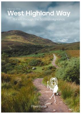
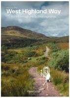
Wandelgids West Highland Way | Floor Denil

0

Verkopers met dit product

Verkoper
Bezorging
Prijs
DeZwerver.nl logo
DeZwerver.nl
2,95
20,-

Anderen bekeken ook

Nieuw
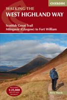
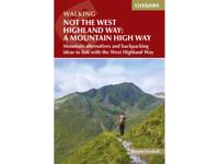
Wandelgids West Highland Way | Cicerone
Uitstekende wandelgids die in etappes de route nauwkeurig beschrijft; ook de zijtakken en alternatieve routes komen aan bod. Inclusief gidsje met topografische routekaarten van 1:25000  A guidebook to walking the West Highland Way, one of Scotland’s Great Trails. Covering 156km (96 miles) from Milngavie to Fort William, the route is suitable for walkers of most abilities and takes around a week to complete.   The trail is described from south to north in 7 stages of between 14 and 33km (9–20 miles).   Contains step-by-step description of the route alongside 1:100,000 maps GPX files available to download Includes a separate map booklet containing OS 1:25,000 mapping with the route line A handy trek planner highlights the availability of facilities and public transport along the route  
25,95
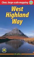
Wandelgids West Highland Way | Trailblazer Guides
All the information you need to enjoy your hiking adventure along the West Highland Way in this fully revised 8th edition.   The West Highland Way passes through some of the most spectacular scenery in all of Britain. From the outskirts of Glasgow it winds for 96 miles (154.5km) along the wooded banks of Loch Lomond, across the wilderness of Rannoch Moor, over the mountains above Glencoe to a dramatic finish passing Ben Nevis - Britain's highest mountain - into the centre of Fort William.   4 large-scale town plans, 8 overview maps and 53 large-scale walking maps, in NEW two-colour style - at just under 1:20,000 - showing route times, places to stay, places to eat, points of interest and much more. These are not general-purpose maps but fully-edited maps drawn by walkers for walkers. Itineraries for all walkers - whether walking the route in its entirety over a week to 10 days or sampling the highlights on day walks and short break. Practical information for all budgets - camping, …
19,95
Nieuw
Wandelgids West Highland Way | Rucksack Readers
Uitgevoerd in de vorm van een klapper, met ringband geeft deze gids een goede beschrijving van de lange afstands route. De kaarten zijn schetsmatig maar wel duidelijk. The West Highland Way is Scotland's most popular long-distance walk, running 96 miles (155 km) from Glasgow, Scotland's largest city, through its first National Park, across the western Highlands to the foot of its highest mountain, Ben Nevis. This fifth edition of the popular rucksack-friendly guidebook includes the "extra mile" into Fort William and has been fully revised for 2020. It contains all you need to plan and enjoy one of the world's finest walks. It includes detailed route description; background on Loch Lomond, history and wildlife; detailed mapping of the entire route at 1:42,500; practical information about transport and travel; lavishly illustrated with 120 colour photos; and printed on rainproof paper.
24,95
Wandelgids The West Highland Way | Birlinn
The West Highland Way Official Guide is de officiele gids met wandelroutekaart voor de meest beroemde lange afstandswandelroute door Schotland. Zeer handig is de bijgevoegde wandelkaart van Harvey. ‘If the objective of a guide book is to impart essential information, then this guide achieves that and famously; minute directional detail, location of campsites, bunkhouses, hostels, huts and bothies, services and supplies, equipment, training and preparation, countryside code, even a map ... But this guide exceeds that purpose. It is an evocation of all that is best about Scotland and its countryside’ – Bruce Sandison, The Herald   Opened in 1980, the West Highland Way was Scotland’s first Long Distance Route and remains the most popular, with more than 15,000 walkers tackling it each year. It runs from Milngavie, on the outskirts of Glasgow, to Fort William. The 152km route passes along the east of Loch Lomond, the largest expanse of fresh water in Britain, and across Rannoch Moor, Scot…
25,95
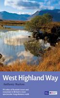
Wandelgids West Highland Way | Aurum Press
Gedegen routegids van het beroemdste pad van Schotland. Uitstekende kaarten, goede achtergronden, helaas wat beperkte praktische informatie. Engels. The 93-mile West Highland Way is indisputably Britain's most spectacular long-distance path. The first section, following the eastern shore of Loch Lomond, offers an idyllic waterside walk, with the full grandeur of the Highlands gradually revealing itself. Then, after crossing the barren wilderness of the Rannoch Moor, the walker climbs the Devil's Staircase above Glencoe and traverses classic Highland landscapes to reach Fort William and, if he or she wishes, a grand finale at the peak of Britain's highest mountain, Ben Nevis. This comprehensive, easy-to-use guide is an authoritative companion, packed with indispensable information. The West Highland Way recreational Path Guide by Anthony Burton is the definitive guide to Britain’s most spectacular long distance walk. This comprehensive, easy-to-use guide contains the entire route split…
20,95
Nieuw
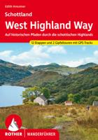
Wandelgids Schottland West Highland Way | Rother Bergverlag
Auf dem West Highland Way lernt man Schottlands schönste Seiten zu Fuß kennen: Von den bewohnten Ausläufern Glasgows in den Lowlands führt dieser 150 Kilometer lange Weitwanderweg bis ins Herz der Highlands bei Fort William. Die schottische Landschaft erscheint hier wie aus dem Bilderbuch: Der Weg führt durch unberührte Moore, über grüne Hügel und durch einsame Täler. Am Ende lässt sich die Tour mit der Besteigung des Ben Nevis, des höchsten Bergs Schottlands, krönen. Der West Highland Way ist ein idealer Einstieg ins Weitwandern. Dieser Rother Wanderführer stellt ihn mit allen wichtigen Infos für Weitwanderer vor.   Vom Loch Lomond, Schottlands größtem See, mit seiner beeindruckenden Kulisse und seinen tiefgrünen Eichenwäldern am fast unbewohnten Ostufer kommt man in die »wahren« Highlands: Majestätische Gipfel der höchsten Berge Schottlands rücken ins Blickfeld, und im Bereich des Rannoch Moor kann man die schiere Weite der Landschaft auf sich wirken lassen. Bei all den landschaftli…
19,50
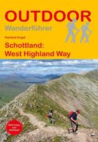
Wandelgids Schottland: West Highland Way | Conrad Stein Verlag
Handzaam boekje met de routebeschrijving inclusief een heleboel praktische informatie. De beschrijving is uitstekend, maar kaarten zijn beperkt en schetsmatig aanwezig. Duits. Der West Highland Way ist der schönste Langstreckenwanderweg Schottlands. 154 km führt er durch raues und zerklüftetes Gelände des südlichen und zentralen Hochlands. Es ist eine phantastische, aber streckenweise anstrengende Wanderung. Die Tour wird in 14 Einzeletappen beschrieben, so dass auch Wanderer, die nicht die ganze Strecke laufen wollen, gute Ein- bzw. Ausstiegsmöglichkeiten haben. Jede Etappenbeschreibung umfasst den Wegverlauf, wichtige Tipps wie Übernachtungsmöglichkeiten, Verkehrsverbindungen usw., Informationen zu wichtigen Aspekten von Natur, Landschaft, Kultur und Geschichte sowie eine Beschreibung lohnender Abstecher zu Zielen, die nicht direkt am Weg liegen. 026, 26, Balmaha, Bridge of Orchy, Fort William, Hartmut Engel, Highlands, Kinlochleven, Milngavie, Schottland, Trekking, Wandern, West Hi…
16,95

Klanten-reviews van Wandelgids West Highland Way | Floor Denil

Er zijn nog geen beoordelingen voor dit productBen jij de eerste die een review plaatst?

Meer over Wandelgids West Highland Way | Floor Denil

Verken gerelateerde categorieën

Webshop.nl maakt gebruik van cookies. Ga je verder op onze website, ga dan akkoord met het plaatsen van cookies en de verwerking van deze data door ons en vermelde partners.