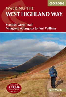

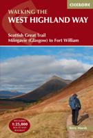
Wandelgids West Highland Way | Cicerone

0
Uitstekende wandelgids die in etappes de route nauwkeurig beschrijft; ook de zijtakken en alternatieve routes komen aan bod. Inclusief gidsje met topografische routekaarten van 1:25000  A guidebook to walking the West Highland Way, one of Scotland’s Great Trails. Covering 156km (96 miles) from Milngavie to Fort William, the route is suitable for ...

Alle aanbiedingen van dit product

Verkoper
Bezorging
Prijs
DeZwerver.nl logo
DeZwerver.nl
2,95
25,95

Anderen bekeken ook

Wandelgids West Highland Way | Cicerone
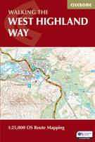
Uitstekende wandelgids die in etappes de route nauwkeurig beschrijft; ook de zijtakken en alternatieve routes komen aan bod. Inclusief gidsje met topografische routekaarten van 1:25000  A guidebook to walking the West Highland Way, one of Scotland’s Great Trails. Covering 156km (96 miles) from Milngavie to Fort William, the route is suitable for walkers of most abilities and takes around a week to complete.   The trail is described from south to north in 7 stages of between 14 and 33km (9–20 miles).   Contains step-by-step description of the route alongside 1:100,000 maps GPX files available to download Includes a separate map booklet containing OS 1:25,000 mapping with the route line A handy trek planner highlights the availability of facilities and public transport along the route  
25,95
Wandelgids West Highland Way | Trailblazer Guides
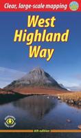
All the information you need to enjoy your hiking adventure along the West Highland Way in this fully revised 8th edition.   The West Highland Way passes through some of the most spectacular scenery in all of Britain. From the outskirts of Glasgow it winds for 96 miles (154.5km) along the wooded banks of Loch Lomond, across the wilderness of Rannoch Moor, over the mountains above Glencoe to a dramatic finish passing Ben Nevis - Britain's highest mountain - into the centre of Fort William.   4 large-scale town plans, 8 overview maps and 53 large-scale walking maps, in NEW two-colour style - at just under 1:20,000 - showing route times, places to stay, places to eat, points of interest and much more. These are not general-purpose maps but fully-edited maps drawn by walkers for walkers. Itineraries for all walkers - whether walking the route in its entirety over a week to 10 days or sampling the highlights on day walks and short break. Practical information for all budgets - camping, …
19,95
Wandelgids West Highland Way | Rucksack Readers
Uitgevoerd in de vorm van een klapper, met ringband geeft deze gids een goede beschrijving van de lange afstands route. De kaarten zijn schetsmatig maar wel duidelijk. The West Highland Way is Scotland's most popular long-distance walk, running 96 miles (155 km) from Glasgow, Scotland's largest city, through its first National Park, across the western Highlands to the foot of its highest mountain, Ben Nevis. This fifth edition of the popular rucksack-friendly guidebook includes the "extra mile" into Fort William and has been fully revised for 2020. It contains all you need to plan and enjoy one of the world's finest walks. It includes detailed route description; background on Loch Lomond, history and wildlife; detailed mapping of the entire route at 1:42,500; practical information about transport and travel; lavishly illustrated with 120 colour photos; and printed on rainproof paper.
24,95
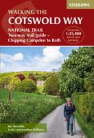
Wandelgids The Cotswold Way | England | Cicerone
Uitstekende wandelgids van de Cotswolds Way, waarbij naast alle noodzakelijke informatie ook gebruik gemaakt wordt van de echte topografische kaart. inclusief gidsje met routekaarten van 1:25000 (deze is hier ook los te bestellen) Guidebook to walking the 102 mile (163km) Cotswold Way National Trail between Chipping Campden and Bath, across the Cotswolds AONB. The guidebook - which includes both a guide to the route and a separate OS 1:25,000 map booklet - describes the route in both directions.   The route is described over 13 stages, each following the Cotswold escarpment, with dramatic and far-reaching views across the Severn Vale towards the Welsh hills, plunging down to visit honey-coloured villages, old market towns and the elegant and historic city of Bath. The longest of the 13 stages is 10 miles, the shortest 6 miles: these are dictated by the existence of overnight accommodation. For the determined, the trail can be walked in as little as five days.   The Cotswold Way offers…
24,95
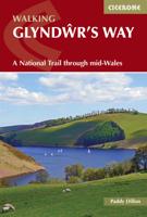
Wandelgids Glyndwr's Way - Wales | Cicerone
Een beschrijving van de Glyndwr's way, goede beschrijving met gedetailleerd kaartmateriaal..Ook praktische informatie en hoogteprofielen per etappe. Guidebook to walking Glyndwr's Way, a long-distance National Trail through mid-Wales. The 135 mile route from Knighton via Machynlleth to Welshpool takes 9 days to walk, and 2 days (29 miles) to complete the loop down the Offa's Dyke Path to create a circular trail. A lovely trail through quiet hills, forests and rolling countryside.   A complete guide to walking Glyndr's Way National Trail. This guidebook divides the 135 mile trail into nine day stages, starting at Knighton and ending at Welshpool. Days 10 and 11 follow the Offa's Dyke Path National Trail for those who prefer a circular route. The step-by-step route descriptions are accompanied by OS map extracts, photographs and lots of information on facilities available and historical points of interest along the way. Glyndr's Way is clearly waymarked throughout and there is accommoda…
23,95
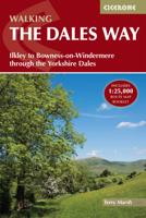
Wandelgids The Dales Way | Cicerone
A fully waymarked trail from Ilkley to Bowness-on-Windermere, the Dales Way links two of England's most celebrated national parks, the Yorkshire Dales and the Lake District. Well served for accommodation and facilities, and with easy walking on riverside paths, it is one of the gentlest multi-day walks in Britain and therefore an ideal introduction to long-distance walking. It can be comfortably completed in 6-8 days.   The guide offers comprehensive notes on local points of interest, as well as an overview of Dales geology, history, plants and wildlife to enhance the walking experience. The practical information is all there too, including when to go, how to get there and what to take, making for an ideal companion to enjoying this delightful route.   Presented in six daily stages of 7-19 miles (with suggestions for alternative schedules), this guide describes the Way in both directions, with the main route description running from south to north. Step-by-step route description is ac…
23,95
Wandelgids West Highland Way | Aurum Press
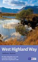
Gedegen routegids van het beroemdste pad van Schotland. Uitstekende kaarten, goede achtergronden, helaas wat beperkte praktische informatie. Engels. The 93-mile West Highland Way is indisputably Britain's most spectacular long-distance path. The first section, following the eastern shore of Loch Lomond, offers an idyllic waterside walk, with the full grandeur of the Highlands gradually revealing itself. Then, after crossing the barren wilderness of the Rannoch Moor, the walker climbs the Devil's Staircase above Glencoe and traverses classic Highland landscapes to reach Fort William and, if he or she wishes, a grand finale at the peak of Britain's highest mountain, Ben Nevis. This comprehensive, easy-to-use guide is an authoritative companion, packed with indispensable information. The West Highland Way recreational Path Guide by Anthony Burton is the definitive guide to Britain’s most spectacular long distance walk. This comprehensive, easy-to-use guide contains the entire route split…
20,95
Wandelgids South Downs Way | Cicerone
Uitstekende wandelgids van dit geweldige gebied. goed beschreven met veel praktische informatie om de route te kunnen lopen, inclusief een apart boekje met zeer gedetaileerde kaarten. The South Downs Way National Trail is a 100 mile (160km) walk between Eastbourne and Winchester, staying within the glorious South Downs National Park for its entire length. Presented here in 12 stages of up to 12 miles (19km), the route is described in both east-west and west-east. A waymarked trail with very few stiles, it can be walked at any time of year and makes a good introduction to long-distance walking. Step-by-step route descriptions are illustrated with extracts from OS 1:50,000 mapping for every stage, and a separate, conveniently sized booklet with 1:25,000 maps for the entire route is included. The guide provides detailed practical information on getting to the trail, and facilities and accommodation en route. The South Downs Way offers easy walking on ancient and historical tracks, and sh…
24,95
Wandelgids The Cleveland way and the Yorkshire Wolds way | Cicerone
Uitstekende wandelgids van de Cotswolds Way, waarbij naast alle noodzakelijke informatie ook gebruik gemaakt wordt van de echte topografische kaart. Inclusief gidsje met routekaarten van 1:25000 Guidebook to the Cleveland Way and Yorkshire Wolds Way National Trails, plus the Tabular Hills Walk link route. The guidebook also contains a 1:25,000 scale OS route map booklet of the Cleveland Way.   The Cleveland Way National Trail, described in seven day stages, is a fine 177km (110 miles) walk around the North York Moors National Park from Helmsley to Filey. The Yorkshire Wolds Way is one of the quietest of Britain's National Trails and wanders for 130km (80 miles) through gentle, cultivated and sparsely populated countryside. Described here in nine day stages, from Hessle near Redcar to Filey, it links end-to-end with the Cleveland Way on the coast. Also described is the three-day, 80km (50 mile) Tabular Hills Walk, a Regional Trail that allows walkers to close the loop of the Cleveland …
25,95
Wandelgids The Cathar Way | Cicerone
Guidebook to the GR367 Cathar Way (Sentier Cathare) in the Languedoc region of southern France. The 260km waymarked trail from Port la Nouvelle on the Mediterranean to Foix traces the history of the Cathars through the Eastern foothills of the Pyrenees. Split into 13 stages and offering a northern variant, the route takes about 2 weeks to complete. Two of the southernmost départements of France, the Pyrénées-Orientales and Ariège are inextricably linked with the history of the Cathars, a heretical Christian sect who were subjected to a crusade in the thirteenth century. Striking castles built on jagged rocky precipices are a highlight of the region and a reminder of those turbulent times. This guidebook describes the 260km Cathar Way (Sentier Cathare or GR367), a long-distance trail from Port-la-Nouvelle on the Mediterranean coast to Ariége's departmental capital Foix linking several of the impressive Cathar castles. The route follows ancient footpaths, jeep tracks and country lanes a…
24,95

Klanten-reviews van Wandelgids West Highland Way | Cicerone

Er zijn nog geen beoordelingen voor dit productBen jij de eerste die een review plaatst?

Meer over Wandelgids West Highland Way | Cicerone

Productomschrijving

Uitstekende wandelgids die in etappes de route nauwkeurig beschrijft; ook de zijtakken en alternatieve routes komen aan bod. Inclusief gidsje met topografische routekaarten van 1:25000 

A guidebook to walking the West Highland Way, one of Scotland’s Great Trails. Covering 156km (96 miles) from Milngavie to Fort William, the route is suitable for walkers of most abilities and takes around a week to complete.   The trail is described from south to north in 7 stages of between 14 and 33km (9–20 miles).   Contains step-by-step description of the route alongside 1:100,000 maps GPX files available to download Includes a separate map booklet containing OS 1:25,000 mapping with the route line A handy trek planner highlights the availability of facilities and public transport along the route


Productinformatie

    Verken gerelateerde categorieën

    Webshop.nl maakt gebruik van cookies. Ga je verder op onze website, ga dan akkoord met het plaatsen van cookies en de verwerking van deze data door ons en vermelde partners.