Wandelgids Walks Aviemore : Including Glenmore & Speyside | Hallewell Publications

0
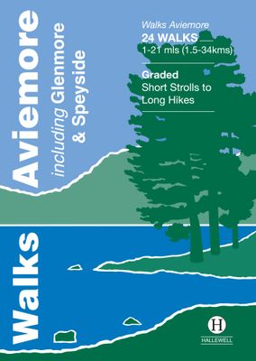
This guide covers an upper stretch of the Spey Valley, from Grantown-on-Spey in the north to Newtonmore in the south.  The main walking centres are Aviemore and Glenmore; the bulk of the walking is in the Cairngorm Mountains, the pine woods around Loch Morlich, and the low and rolling Monadhliaths.  Walks range from 1 mile to 21 miles (1.5-34kms)....

Verkopers met dit product

Webshop
Bezorging
Prijs
DeZwerver.nl logo
DeZwerver.nl
niet bekend
5,95

Anderen bekeken ook

Wandelgids Aviemore and the Cairngorms | Pocket Mountains
Handige compacte wandelgids met 40 dagwandelingen. Deze gids bevat kleine kaartjes en leuke uitgebreide informatie over wat er langs de route te zien is. Goede wandelkaarten zijn echter we noodzakelijk voor deze tochten: de Ordnance Survey explorer maps of Landanger maps zijn zeer geschikt. 'Aviemore and the Cairngorms' features 40 shorter walks, including many perfect for families, stretching from the ancient region of Badenoch and the uppermost reaches of the Spey Valley, through the outdoor hub of Aviemore to Grantown and Tomintoul, then over Ballater and Royal Deeside to Braemar. Plaatsen in het boekje Abernethy Forest, An Lochan Uaine, Anagach Woods, Aviemore, Badenoch Way, Ballater, Balmoral Estate, Balnagowan Wood, Black Wood, Boat of Garten, Braemar, Bridge of Brown, Burn o’Vat, Cairngorm Club Bridge, Cairngorm Ski Centre, Calder Bridge, Carn Daimh, Carrbridge, Castle Roy, Coire an t-Sneachda, Colonel’s Bed, Coylumbridge, Craigellachie Woods, Craigendarroch, Craigmore Wood, Cr…
10,95
Wandelgids Walks Loch Lomond & The Trossachs | Hallewell Publications
The area covered by this guide (much of it now a National Park) is one of the most popular walking districts in Scotland, and its hills, lochs, glens and woodlands provide an enormous range of routes within a small area.  Walks range from 0.5 miles to 15 miles (1-24km).  Routes include hill climbs such as Ben More & Stob Binnein, Ben Ledi, Ben A’an, The Cobbler and Ben Lomond, plus a number of shorter walks around the towns of Killin, Callander and Aberfoyle, routes by Lochs Katrine and Lomond and sections of the West Highland Way.  Previously published as Walks The Trossachs, the guide has been rewalked and the area covered expanded to inlcude west Loch Lomond.
5,95
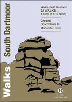
Wandelgids South Dartmoor | Hallewell Publications
Rewalked and revised in 2021, Walks South Dartmoor features walks in and around the southern half of the Dartmoor National Park - an area famous for its rolling moorland, ponies and dramatic tors (weathered granite outcrops rising from the moorland). This guide covers the area north of Ivybridge and south of an east-west line just north of Tavistock. (For the northern half of the area, see Walks North Dartmoor.) The 22 walks in the guide range from 1 to 8 miles (1.6 12.8km). The bulk of the high moorland walks are in the north of this area, passing such features as Great Mis Tor and Foxtor Mires (thought to be the inspiration for Grimpen Mire in The Hound of the Baskervilles). In the south there are more river and woodland walks, including paths from Burrator Reservoir and to the dramatic Dewterstone. Walks South Dartmoor is part of a popular series of A6 pocket walking guides which describe routes which are suitable for walkers of all abilities and to suit all tastes. Route descripti…
5,95
Wandelgids Stirling : Including Clackmannanshire & the Campsie Fells | Hallewell Publications
Rewalked and revised in 2021, Walks Stirling (a new edition of our previous guide to Stirling & District) features 24 walks, and now covers the Campsie Fells as well as the western Ochil Hills and the area around the head of the Forth Estuary. There are some fine hill walks, plus long distance paths and coastal walks. Walks range from 0.5 miles to 12 miles (1.2-20kms). Routes include: Dumyat, Ben Cleuch, Dollar to Auchterardar and Dumgoyne. Rewalked and revised 2010 this is part of a popular series of A6 pocket walking guides which describe routes which are suitable for walkers of all abilities and to suit all tastes. Route descriptions are accompanied by 2-colour sketch maps. The guides are illustrated with line illustrations, and will provide walkers with a good introduction to what each area covered has to offer.  
5,95
Wandelgids Inveraray & South Argyll : Including Kintyre | Hallewell Publications
Rewalked and updated in 2022, 'Walks Inveraray & South Argyll including Kintyre' covers the stretch of Scotland's west coast from Ardfern in the north to the Mull of Kintyre in the south. This is one of the quieter corners of Scotland, and though it lacks the high peaks of the north and west there are some marvellous and varied walks. Routes featured include the paths around historic Kilmartin and Dunadd, walks by the scenic Crinan Canal, and paths from Campbeltown and the coastal villages of Tayvallich and Inveraray. 28 routes (from 0.5-16kms/0.35-10 miles) are described. The guide is part of a popular series of A6 pocket walking guides describing routes suitable for walkers of all abilities and to suit all tastes. Route descriptions are accompanied by 2-colour sketch maps. The guides are illustrated with line illustrations, and will provide walkers with a good introduction to what each area covered has to offer.  
5,95
Wandelgids South Peak District : Including Bakewell and Dovedale | Hallewell Publications
Rewalked and updated in 2017/19, Walks South Peak District features walks in the gentler, southern half of the Peak District National Park; an area of low, green hills intersected by narrow valleys. The area's limestone is worked into numerous rock formations notably the famous spires and caves in Dovedale, and the long, low 'edges' above Curbar and Baslow. The main towns in the area are Buxton and Bakewell, but the walks pass numerous picturesque villages, as well as the splendid stately home of Chatsworth House. Walks range from 2 to 7.5 miles (3-12kms). Routes include Curbar Edge, Bakewell to Chatsworth, Thor's Cave & Wetton Hill, Dovedale and Mill Dale and The Roaches. This guide is part of a popular series of A6 pocket walking guides which describe routes which are suitable for walkers of all abilities and to suit all tastes. Route descriptions are accompanied by 2-colour sketch maps. The guides are illustrated with line illustrations, and will provide walkers with a good introdu…
5,95
Wandelgids 100 outstanding British Walks | Ordnance Survey
Beschrijving van de 100 mooiste Pathfinder wandelingen in Engeland, Wales en Schotland. Uitstekende beschrijving van de route met een zeer duidelijke topografische kaart waarop de route is ingetekend.  This magnificent compendium of outstanding British walks brings together the finest selection of Pathfinder Walks in Britain s officially designated places of scenic beauty and historic interest: National Parks, Areas of Outstanding Natural Beauty, National Scenic Areas, Heritage Coast, National Trails and UNESCO World Heritage Sites. There are 100 walking gems in this collection, recommended by a group of experienced authors and guides. The walks span a range of distances and degrees of challenge and are organised by region with coverage across England, Wales and Scotland. 100 Outstanding British Walks is lavishly illustrated with stunning landscape photography and informative introductions to each of the walks. It is designed to be enjoyed at home, while the OS Maps app provides the p…
27,95
Wandelgids Exmoor | Hallewell Publications
Rewalked and revised in 2021, Walks Exmoor features walks in the Exmoor National Park - a beautiful area including moorland, farmland, wooded valleys and stunning coastal scenery. (The major settlements - Minehead, Ilfracombe and Barnstaple - are all just outside the area.) The 20 walks in the guide range from 1 to 9 miles (1.6 14.4km). The bulk of the routes are in the northern coastal strip (the guide contains a number of short walks from the South West Coast Path), including the path from Lynmouth to the stunning Valley of Rocks and a group of linked walks on Bossington Hill (by Minehead). Elsewhere there is a fine riverside walk to the ancient footbridge of Tarr Steps. Walks Exmoor is part of a popular series of A6 pocket walking guides which describe routes which are suitable for walkers of all abilities and to suit all tastes. Route descriptions are accompanied by 2-colour sketch maps. The guides are illustrated with line illustrations, and will provide walkers with a good intro…
5,95
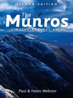
Wandelgids The Munros | Pocket Mountains
The Munros are mountains in Scotland with a height of over 3000ft and take their name from the first list of such hills published in 1891 by Victorian mountaineer Sir Hugh Munro, 4th Baronet of Lindertis. Revised several times in the years since, the official list now features 282 peaks. This guide is for anyone who wants to climb these mountains and aims to provide reliable routes and tips for ascending them safely.   The Munros will ensure you reach parts of Scotland you might otherwise overlook, spend memorable evenings in pubs, bothies and wild camps, and have encounters with other walkers, locals and wildlife that enhance the adventure regardless of whether you get to the top of one Munro or all of them. Plaatsen in het boekje A’ Bhuidheanach Bheag, A’ Chailleach (Fannichs), A’ Chailleach (Monadhliath), A’ Chralaig, Ghlas-bheinn, A’ Mhaighdean, A’ Mharconaich, Am Basteir, Am Bodach, Am Faochagach, An Caisteal, An Coileachan, An Gearanach, An Riabhachan, An Sgarsoch, An Socach (De…
20,95
Wandelgids Hawes and Wensleydale | Hallewell Publications
Rewalked and updated in 2016, Walks Hawes & Wensleydale covers the Northern part of the Yorkshire Dales National Park - an area of rolling green hills, dramatic limestone features and quaint villages. The guide features walks in Wensleydale, which includes the popular towns of Hawes and Leyburn. Although there are no high peaks in the area, there are some fine hill walks, as well as paths passing the area's numerous waterfalls. The 21 walks featured range from 1 mile to 11 miles (1.5-18km). Routes include: Aysgill Force, Hardraw Force & Sedbusk, Semer Water, Aysgarth to Castle Bolton and Leyburn Shawl. The guide is part of a popular series of A6 pocket walking guides which describe routes which are suitable for walkers of all abilities and to suit all tastes. Route descriptions are accompanied by 2-colour sketch maps. The guides are illustrated with line illustrations, and will provide walkers with a good introduction to what each area covered has to offer.  
5,95

Klanten-reviews van Wandelgids Walks Aviemore : Including Glenmore & Speyside | Hallewell Publications

Er zijn nog geen beoordelingen voor dit productBen jij de eerste die een review plaatst?

Meer over Wandelgids Walks Aviemore : Including Glenmore & Speyside | Hallewell Publications

Productomschrijving

This guide covers an upper stretch of the Spey Valley, from Grantown-on-Spey in the north to Newtonmore in the south.  The main walking centres are Aviemore and Glenmore; the bulk of the walking is in the Cairngorm Mountains, the pine woods around Loch Morlich, and the low and rolling Monadhliaths.  Walks range from 1 mile to 21 miles (1.5-34kms).  Routes include: Loch Garten, Cairn Gorm, Loch Morlich to Lairig Ghru, Loch an Eilein and Creag Bheag.  This book was previously published as Walks Speyside, but has been rewalked and revised.  

Verken gerelateerde categorieën

Webshop.nl maakt gebruik van cookies. Ga je verder op onze website, ga dan akkoord met het plaatsen van cookies en de verwerking van deze data door ons en vermelde partners.