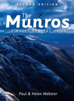
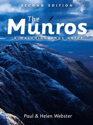
Wandelgids The Munros | Pocket Mountains

0
The Munros are mountains in Scotland with a height of over 3000ft and take their name from the first list of such hills published in 1891 by Victorian mountaineer Sir Hugh Munro, 4th Baronet of Lindertis. Revised several times in the years since, the official list now features 282 peaks. This guide is for anyone who wants to climb these mountains ...

Alle aanbiedingen van dit product

Verkoper
Bezorging
Prijs
DeZwerver.nl logo
DeZwerver.nl
5,95
20,95

Anderen bekeken ook

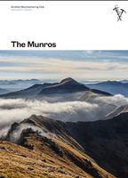
Wandelgids The Munros | Pocket Mountains
The Munros are mountains in Scotland with a height of over 3000ft and take their name from the first list of such hills published in 1891 by Victorian mountaineer Sir Hugh Munro, 4th Baronet of Lindertis. Revised several times in the years since, the official list now features 282 peaks. This guide is for anyone who wants to climb these mountains and aims to provide reliable routes and tips for ascending them safely.   The Munros will ensure you reach parts of Scotland you might otherwise overlook, spend memorable evenings in pubs, bothies and wild camps, and have encounters with other walkers, locals and wildlife that enhance the adventure regardless of whether you get to the top of one Munro or all of them. Plaatsen in het boekje A’ Bhuidheanach Bheag, A’ Chailleach (Fannichs), A’ Chailleach (Monadhliath), A’ Chralaig, Ghlas-bheinn, A’ Mhaighdean, A’ Mharconaich, Am Basteir, Am Bodach, Am Faochagach, An Caisteal, An Coileachan, An Gearanach, An Riabhachan, An Sgarsoch, An Socach (De…
20,95
Wandelgids 1 Walking The Munros Vol 1 Southern, Central and Western Highlands - Schotland | Cicerone
Uitstekende wandelgids van het zuiden, midden en westen van de Schotse Hooglanden. Goed beschreven met veel praktische informatie om de route te kunnen lopen, inclusief redelijke kaarten. Guidebook to walking the Munros in southern, central and western Highlands. Describes 69 challenging routes across 139 of the iconic 3000ft+ mountains covering areas such as Glencoe, Bridge of Orchy and Mull. Includes routes up Ben More, Ben Alder, Ben Lomond and Ben Nevis, the highest mountain in the British Isles. Volume 1 of two guidebooks.   Seasons The guide is intended for summer hillwalkers (usually April/May to October in Scotland). In winter conditions the routes become more serious mountaineering expeditions requiring appropriate skills, equipment and experience.   Centres Arrochar, Crianlarich, Killin, Pitlochry, Tyndrum, Glencoe, Fort William, Spean Bridge, Dalwhinnie, Braemar, Glenshee   Difficulty Most of the Munros are straightforward walks but some involve ridge walking, sc…
23,95
Wandelgids The Munros | SMC guide
Toonaangevend boek over alle Munros in Schotland, de bergen boven de 3000 feet. Er zijn talloze mensen die in hun leven alle Munros willen beklimmen; het is een hele cultus. This fully revised edition of the Scottish Mountaineering Club’s original and best-selling guidebook The Munros describes the best walking routes on Scotland’s 282 mountains above 3000ft.   Comprehensive descriptions in this definitive guide recommend ascent and descent routes for each of the Munros and their 226 subsidiary Tops, with maps of the peaks and principal surrounding hills to help you plan the most enjoyable journeys through Scotland’s wild landscape. The descriptions are brought to life throughout with vivid photography that illustrates the dramatic beauty of these much-loved mountains.   In addition to routes themselves the book contains Munros Tables, a complete list of the 508 Munros and subsidiary Tops, listed in height order. Whether you are an occasional walker looking for inspiration or a dedica…
37,95
Wandelgids Shetland | Pocket Mountains
Handige compacte wandelgids met 40 dagwandelingen. Deze gids bevat kleine kaartjes en leuke uitgebreide informatie over wat er langs de route te zien is. Goede wandelkaarten zijn echter we noodzakelijk voor deze tochten: de Ordnance Survey explorer maps of Landanger maps zijn zeer geschikt. The most northerly of Britain's island groups, Shetland is so far removed from the rest of the UK that it usually appears as an inset on maps. Although relatively little known to those from outside the islands, Shetland is a magnificent terrain for walkers, especially those who love to really explore and get away from the beaten track. The coastal walking here includes some of the finest in the country, with superb cliffs, towering sea stacks, caves and natural arches seemingly around every corner. Added to this is Shetland's better known claim to fame for its spectacular seabird colonies, huge gannetries, moorland packed with arctic and great skuas, arctic terns in the more sheltered spots, and ev…
10,95
Wandelgids 2 Walking The Munros vol. 2 | Cicerone
Uitstekende wandelgids van het noorden van de Schotse Hooglanden en Cairngorms. Goed beschreven met veel praktische informatie om de route te kunnen lopen, inclusief redelijke kaarten. Volume two of Walking the Munros, this guidebook describes 70 challenging and inspiring routes up Scotland's iconic 3000ft+ mountains within the Northern Highlands, the Cairngorms and the Isle of Skye. The routes, which range from 7 to 46km (with the option to reduce walking distance on some of the longer routes by cycling the approach), cover 143 Munro summits, offering half and full-day walk and scramble options.   Clear and concise route descriptions are accompanied by 1:100K mapping, together with invaluable practical information on access, parking, accommodation and more. Also included are two handy indexes of the Munros - listed alphabetically and by height - a perfect resource for peak-baggers.   This guide incorporates both popular and lesser-known routes, and celebrates the raw and rugged …
23,95
Wandelgids Outer Hebrides | Pocket Mountains
Handige compacte wandelgids met 40 dagwandelingen. Deze gids bevat kleine kaartjes en leuke uitgebreide informatie over wat er langs de route te zien is. Goede wandelkaarten zijn echter we noodzakelijk voor deze tochten: de Ordnance Survey explorer maps of Landanger maps zijn zeer geschikt. The Outer Hebrides are a place apart, an island chain stretching almost 200km from the Butt of Lewis to Barra Head with some of Britain's most mesmerising beaches, dramatic mountain ranges, wonderful wildlife, a long and fascinating history and a rich and vibrant Gaelic culture. This book features 40 mostly moderate walks, with many ideal for families, which take in magnificent sweeps of sand, soaring sea cliffs and memorable hill ascents, as well as celebrated cultural sights such as the haunting Standing Stones at Callanish and the blackhouse village of Na Gearrannan.
10,95
Wandelgids Southern Highlands | Pocket Mountains
Mooi uitgevoerde wandelgids in een handzaam formaat: 15 x 10 cm. De wandelingen zijn duidelijk beschreven, soms een beetje summier. This Pocket Mountains guide to the Southern Highlands of Scotland covers Glenlyon to Rannoch, Kinross to Callander, The Arrochar Alps, The Trossachs to the Mamlorn Hills, Hills of Crianlarich and Tyndrum -40 circular routes with 45 full colour maps -Each route is circular and takes into account the environmental impact of the walker -The routes vary in difficulty from easy half-day walks to longer, more challenging hikes -Original full colour maps for each route -Stunning colour photography throughout - Covers all the Munros (peaks over 3000 feet) and the best Corbetts (peaks over 2500 feet) in the area) - Designed in durable pocket format to take into the hills - Notes on history, geology and wildlife accompany each section of the book  
10,95
Wandelgids Southern Uplands | Pocket Mountains
Mooi uitgevoerde wandelgids in een handzaam formaat: 15 x 10 cm. De wandelingen zijn duidelijk beschreven, soms een beetje summier. This Pocket Mountains guide to the Southern Uplands of Scotland contains 40 hill walks, trademark photography and inventive circular routes. Each route is accompanied by a full colour photograph, contoured map and additional facts about the history, geology and wildlife. Coverage of The Galloway Hills, Lowther and Moffat Hills, Clyde and Tweed, Edinburgh and Lothian, Cheviot and Langholm Hills.  
10,95
Wandelgids Oban and North Argyll | Pocket Mountains
This guidebook covers a large swathe of Mid and North Argyll, sweeping inland from the fractured western seaboard between Crinan and Appin to Arrochar and Bridge of Orchy on the region’s eastern periphery. Between these four points lies a landscape awash with sea lochs, with Inveraray roughly at the geographical centre. There are no large urban areas here and Oban is the largest settlement. Although the road network and public transport infrastructure are good, many routes feel off the beaten track. This is not only down to the low scattered population but also to the indented coast and its many islands, the sea lochs encroaching deep inland, the elongated freshwater lochs and the mountainous interior – making road travel much more convoluted than direct ‘as-the-crow-flies’ distances would suggest. As well as many great sea lochs, tumbling rivers and iconic mountains, Oban and North Argyll also boasts ancient, wildlife-rich woodlands and several fine gardens. Add to this the Crinan Ca…
10,95
Wandelgids Mull and Iona | Pocket Mountains
Handige compacte wandelgids met 40 dagwandelingen. Deze gids bevat kleine kaartjes en leuke uitgebreide informatie over wat er langs de route te zien is. Goede wandelkaarten zijn echter we noodzakelijk voor deze tochten: de Ordnance Survey explorer maps of Landanger maps zijn zeer geschikt.   Mull is the second largest island of the Inner Hebrides. Perhaps best known for the colourful harbour of Tobermory at the northern end of the island, Mull has become very popular as a holiday destination, most particularly among wildlife enthusiasts.   In this volume you will find the best walking routes on Mull and the neighbouring islands of Iona and Ulva, both easily reached by short ferry journeys. Mull includes some of the wildest coastal scenery in the country as well as many grand mountains, pretty villages and stunning sandy beaches.
10,95

Klanten-reviews van Wandelgids The Munros | Pocket Mountains

Er zijn nog geen beoordelingen voor dit productBen jij de eerste die een review plaatst?

Meer over Wandelgids The Munros | Pocket Mountains

Productomschrijving

The Munros are mountains in Scotland with a height of over 3000ft and take their name from the first list of such hills published in 1891 by Victorian mountaineer Sir Hugh Munro, 4th Baronet of Lindertis. Revised several times in the years since, the official list now features 282 peaks. This guide is for anyone who wants to climb these mountains and aims to provide reliable routes and tips for ascending them safely.   The Munros will ensure you reach parts of Scotland you might otherwise overlook, spend memorable evenings in pubs, bothies and wild camps, and have encounters with other walkers, locals and wildlife that enhance the adventure regardless of whether you get to the top of one Munro or all of them.

Plaatsen in het boekje

A’ Bhuidheanach Bheag, A’ Chailleach (Fannichs), A’ Chailleach (Monadhliath), A’ Chralaig, Ghlas-bheinn, A’ Mhaighdean, A’ Mharconaich, Am Basteir, Am Bodach, Am Faochagach, An Caisteal, An Coileachan, An Gearanach, An Riabhachan, An Sgarsoch, An Socach (Deeside), An Socach (Affric), An Socach (Mullardoch), An Stuc, An Teallach, Aonach air Chrith, Aonach Beag (Alder), Aonach Beag (Glen Nevis), Aonach Eagach, Aonach Meadhoin, Aonach Mor, Beinn Achaladair, Beinn nan Aighenan, Ben Alder, Beinn Alligin, Ben Avon, Beinn a’ Bheithir, Beinn Bheoil, Beinn Bhreac, Beinn Bhrotain, Ben Bhuidhe, Beinn a’Bhuird, Beinn Chabhair, Ben Challum, Beinn a’ Chaorainn (Deeside), Beinn a’ Chaorainn (Glen Spean), Beinn a’Chlachair, Beinn a’Chleibh, Beinn a’Chochuill, Ben Chonzie, Beinn a’Chreachain, Beinn a’Chroin, Ben Cruachan, Beinn Dearg (Glen Tilt), Beinn Dearg (Ullapool), Beinn Dorain, Beinn an Dothaidh, Beinn Dubhchraig, Beinn Eibhinn, Beinn Eighe, Beinn Eunaich, Beinn Fhada (Ben Attow), Beinn Fhionnlaidh (Glen Affric), Beinn Fhionnlaidh (Glen Creran), Beinn Ghlas, Beinn a’Ghlo, Beinn Heasgarnich, Ben Hope, Beinn Ime, Beinn Iutharn Mhor, Ben Klibreck, Beinn na Lap, Ben Lawers, Beinn Liath Mhor, Beinn Liath Mhor Fannaich, Ben Lomond, Ben Lui (Beinn Laoigh), Ben Macdui, Beinn Mhanach, Beinn Mheadhoin, Ben More (Crianlarich), Ben More (Mull), Ben More Assynt, Beinn Narnain, Ben Nevis, Ben Oss, Beinn Sgritheall, Beinn Sgulaird, Ben Starav, Beinn Tarsuinn, Beinn Teallach, Beinn Tulaichean, Beinn Udlamain, Ben Vane, Ben Vorlich (Loch Lomond), Ben Vorlich (Loch Earn), Ben Wyvis, Bidean nam Bian, Bidein a’ Choire Sheasgaich, Bidein a’ Ghlas Thuill (An Teallach), Binnein Beag, Binnein Mor, Bla Bheinn, Braeriach, Braigh Coire Chruinn-bhalgain , (Beinn a’Ghlo), Broad Cairn, Brothers’ Ridge, The, Bruach na Frithe, Buachaille Etive Beag, Buachaille Etive Mor, Bynack More, Cairn Bannoch, Cairn of Claise, Cairn Gorm, Cairn Toul, Cairnwell, The, Carn Aosda, Carn Bhac, Carn na Caim, Carn a’Chlamain, Carn a’Choire Bhoidheach, Carn Dearg (Alder), Carn Dearg (Monadhliath), Carn Dearg (Loch Ossian), Carn Eige, Carn an Fhidhleir, Carn nan Gabhar (Beinn a’Ghlo), Carn a’Gheoidh, Carn Ghluasaid, Carn nan Gobhar (Mullardoch), Carn nan Gobhar (Strathfarrar), Carn Gorm, Carn Liath (Beinn a’Ghlo), Carn Liath (Loch Laggan), Carn Mairg, Carn a’Mhaim, Carn Mor Dearg, Carn an Righ, Carn an t-Sagairt Mor, Carn Sgulain, Carn an Tuirc, Chno Dearg, Ciste Dhubh, Cona’ Mheall, Conival, Creag nan Damh, Creag Leacach, Creag Meagaidh, Creag a’Mhaim, Creag Mhor, Creag Pitridh, Creise, Cruach Ardrain, Derry Cairngorm, Devil’s Point, The, Driesh, Druim Shionnach, Eididh nan Clach Geala, Fionn Bheinn, Fisherfield Round, The, Five Sisters of Kintail, The, Gairich, Garbh Chioch Mhor, Geal Charn (Drumochter), Geal-Charn (Alder), Geal Charn (Monadhliath), Geal Charn (Loch Laggan), Glas Bheinn Mhor, Glas Maol, Glas Tulaichean, Gleouraich, Grey Corries, The, Gulvain, Inaccessible Pinnacle, Ladhar Bheinn, Liathach, Lochnagar, Luinne Bheinn, Lurg Mhor, Mam Sodhail, Maoile Lunndaidh, Maol Chean-dearg (Torridon), Maol Chinn-dearg (Glen Shiel), Mayar, Meall nan Aighean, Meall a’Bhuiridh, Meall Buidhe (Glen Lyon), Meall Buidhe (Knoydart), Meall nan Ceapraichean, Meall a’Choire Leith, Meall a’Chrasgaidh, Meall Chuaich, Meall Corranaich, Meall Dearg (Aonach Eagach), Meall nan Eun, Meall Garbh (Glen Lyon), Meall Garbh (Lawers), Meall Ghaordaidh, Meall Glas, Meall Gorm, Meall Greigh, Meall nan Tarmachan, Meall na Teanga, Monadh Mor, Moruisg, Mount Keen, Mullach Clach a’Bhlair, Mullach Coire Mhic Fhearchair, Mullach nan Coirean, Mullach na Dheiragain, Mullach Fraoch-choire, Mullach an Rathain (Liathach), Mullardoch Munros, The, Na Gruagaichean, Ring of Steall, Ruadh Stac Mor (Fisherfield), Ruadh-stac Mor (Beinn Eighe), Saddle, The, Sail Chaorainn, Saileag, Schiehallion, Seana Bhraigh, Sgairneach Mhor, Sgiath Chuil, Sgor Gaibhre, Sgor Gaoith, Sgor na h-Ulaidh, Sgorr Dhearg (Beinn a’Bheithir), Sgorr Dhonuill (Beinn a’Bheithir), Sgorr nam Fiannaidh (Aonach Eagach), Sgor an Lochain Uaine, Sgorr Ruadh, Sgurr Alasdair, Sgurr Ban, Sgurr na Banachdich, Sgurr a’Bhealaich Dheirg, Sgurr Breac, Sgurr na Carnach, Sgurr nan Ceathreamhnan, Sgurr a’ Chaorachain, Sgurr Choinnich, Sgurr Choinnich Mor, Sgurr a’Choire Ghlais, Sgurr na Ciche, Sgurr na Ciste Duibhe, Sgurr nan Clach Geala, Sgurr nan Coireachan (Glen Finnan) , Sgurr nan Coireachan (Glen Dessary) , Sgurr nan Conbhairean, Sgurr an Doire Leathain, Sgurr Dubh Mor, Sgurr nan Each, Sgurr nan Eag, Sgurr Eilde Mor, Sgurr Fhuaran, Sgurr Fhuar-thuill, Sgurr Fiona (An Teallach), Sgurr a’Ghreadaidh, Sgurr nan Gillean, Sgurr na Lapaich, Sgurr an Lochain, Sgurr a’Mhadaidh, Sgurr a’ Mhaim, Sgurr a’ Mhaoraich, Sgurr Mhic Choinnich, Sgurr Mhor (Beinn Alligin), Sgurr Mor (Glen Dessary), Sgurr Mor (Fannichs), Sgurr na Ruaidhe, Sgurr na Sgine, Sgurr Thuilm, Slioch, South Glen Shiel Ridge, The, Spidean a’ Choire Leith (Liathach), Spidean Coire nan Clach , (Beinn Eighe), Spidean Mialach, Sron a’ Choire Ghairbh, Stob Ban (Grey Corries), Stob Ban (Glen Nevis), Stob Binnein, Stob na Broige (Buachaille Etive Mor), Stob Coir’an Albannaich, Stob Coire a’Chairn, Stob Choire Claurigh, Stob Coire Easain, Stob Coire an Laoigh, Stob a’Choire Mheadhoin, Stob a’Choire Odhair, Stob Coire Raineach , (Buachaille Etive Beag), Stob Coire Sgreamhach, Stob Coire Sgriodain, Stob Dearg (Buachaille Etive Mor), Stob Diamh, Stob Dubh (Buachaille Etive Beag), Stob Ghabhar, Stob Poite Coire Ardair, Strathfarrar Four, The, Stuc a’Chroin, Stuchd an Lochain, Toll Creagach, Tolmount, Tom Buidhe, Tom a’Choinich, Tom na Gruagaich (Beinn Alligin)

Productinformatie

    Verken gerelateerde categorieën

    Webshop.nl maakt gebruik van cookies. Ga je verder op onze website, ga dan akkoord met het plaatsen van cookies en de verwerking van deze data door ons en vermelde partners.