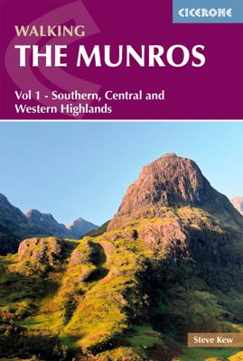
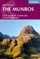
Wandelgids 1 Walking The Munros Vol 1 Southern, Central and Western Highlands - Schotland | Cicerone

0
Uitstekende wandelgids van het zuiden, midden en westen van de Schotse Hooglanden. Goed beschreven met veel praktische informatie om de route te kunnen lopen, inclusief redelijke kaarten. Guidebook to walking the Munros in southern, central and western Highlands. Describes 69 challenging routes across 139 of the iconic 3000ft+ mountains covering ...

Verkopers met dit product

Verkoper
Bezorging
Prijs
DeZwerver.nl logo
DeZwerver.nl
2,95
20,95

Anderen bekeken ook

Wandelgids The Munros | Pocket Mountains
The Munros are mountains in Scotland with a height of over 3000ft and take their name from the first list of such hills published in 1891 by Victorian mountaineer Sir Hugh Munro, 4th Baronet of Lindertis. Revised several times in the years since, the official list now features 282 peaks. This guide is for anyone who wants to climb these mountains and aims to provide reliable routes and tips for ascending them safely.   The Munros will ensure you reach parts of Scotland you might otherwise overlook, spend memorable evenings in pubs, bothies and wild camps, and have encounters with other walkers, locals and wildlife that enhance the adventure regardless of whether you get to the top of one Munro or all of them. Plaatsen in het boekje A’ Bhuidheanach Bheag, A’ Chailleach (Fannichs), A’ Chailleach (Monadhliath), A’ Chralaig, Ghlas-bheinn, A’ Mhaighdean, A’ Mharconaich, Am Basteir, Am Bodach, Am Faochagach, An Caisteal, An Coileachan, An Gearanach, An Riabhachan, An Sgarsoch, An Socach (De…
20,95
Wandelgids Loch Ness, Inverness, Black Isle and Affric | Pocket Mountains
Handige compacte wandelgids met 40 dagwandelingen. Deze gids bevat kleine kaartjes en leuke uitgebreide informatie over wat er langs de route te zien is. Goede wandelkaarten zijn echter we noodzakelijk voor deze tochten: de Ordnance Survey explorer maps of Landanger maps zijn zeer geschikt.   A guide to 40 favourite walks around Loch Ness, Inverness, Black Isle and Glen Affric. Loch Ness, with its legendary monster, is the most famous of all lochs. It holds more water than all the lakes of England and Wales combined and the countryside around it features an equally great variety of walks, with more waymarked trails and easy routes suitable for families than many other parts of the Highlands. Further north lies the magnificent Glen Affric - Scotland's most beautiful glen.   This is a wonderful area of the Highlands for walkers, having the highest mountains north of the Great Glen but also some splendid lower-level and forest walks. To the east is the fertile Black Isle, packed with cha…
10,95
Wandelgids Mountain Walks in Loch Lomond and the Trossachs | Northern Eye Books
One of four books in the popular Loch Lomond and The Trossachs: Top 10 Walks series. Handy, pocket-sized, full colour walking guides written by experts. The perfect impulse buy. The other titles in the series are: Lochside Walks, Hill Walks and Easy Summits and Pub Walks. This attractive and cleverly structured guide gives walkers ten of the finest short circular mountain walks in the Loch Lomond and The Trossachs National Park in a popular pocketable format. With clear information, an overview and introduction for each walk, expertly written numbered directions, large scale Ordnance Survey maps, superb eye-grabbing panoramic photographs, and interpretation of points of interest along the way, these guides set a new standard in clarity and ease-of-use. Featured walks include: Ben Lomond & Ptarmigan Ridge, Ben Donich, The Cobbler, Beinn Ime and Beinn Narnain, Ben Vorlich, An Caisteal & Beinn a¿ Chroin, Cruach Ardrain and Beinn Tulaichean, Beinn Odhar and Meall Buidhe, Stob Binnein, Ben…
10,95
Wandelgids Aviemore and the Cairngorms | Pocket Mountains
Handige compacte wandelgids met 40 dagwandelingen. Deze gids bevat kleine kaartjes en leuke uitgebreide informatie over wat er langs de route te zien is. Goede wandelkaarten zijn echter we noodzakelijk voor deze tochten: de Ordnance Survey explorer maps of Landanger maps zijn zeer geschikt. 'Aviemore and the Cairngorms' features 40 shorter walks, including many perfect for families, stretching from the ancient region of Badenoch and the uppermost reaches of the Spey Valley, through the outdoor hub of Aviemore to Grantown and Tomintoul, then over Ballater and Royal Deeside to Braemar. Plaatsen in het boekje Abernethy Forest, An Lochan Uaine, Anagach Woods, Aviemore, Badenoch Way, Ballater, Balmoral Estate, Balnagowan Wood, Black Wood, Boat of Garten, Braemar, Bridge of Brown, Burn o’Vat, Cairngorm Club Bridge, Cairngorm Ski Centre, Calder Bridge, Carn Daimh, Carrbridge, Castle Roy, Coire an t-Sneachda, Colonel’s Bed, Coylumbridge, Craigellachie Woods, Craigendarroch, Craigmore Wood, Cr…
10,95
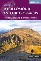
Wandelgids Walking Loch Lomond and The Trossachs | Cicerone
Uitstekende wandelgids, sommige meerdaags, voor dit uitdagende wandelgebied in Schotland. Guidebook to over 70 walking routes in the hills of Loch Lomond and the Trossachs National Park in Scotland's Southern Highlands. Including 21 Munros on less-popular routes, as well as plenty of Corbetts and Grahams. Hill summits of Ben Lomond, the Cobbler, Ben Lui and the Arrochar Alps have plenty of routes to explore. The routes in this guide range from 1 to 17 miles, and are clearly graded for distance and difficulty, as well as dividing between low-level, mid-level and mountain walks. From short, loch-side strolls suitable for all walkers, to long, challenging mountain routes with rocky scrambling, the Loch Lomond and Trossachs hills have plenty to offer.    The glens and mountains walks in this guide are divided into area: the Trossachs, Callander and Loch Lubnaig, Balquhidder and Lochearnhead, Crianlarich to Inveraran, Tyndrum, Ben Lomond, Loch Lomond West, Arrochar Alps and Glen Croe to Lo…
20,95
Wandelgids 100 outstanding British Walks | Ordnance Survey
Beschrijving van de 100 mooiste Pathfinder wandelingen in Engeland, Wales en Schotland. Uitstekende beschrijving van de route met een zeer duidelijke topografische kaart waarop de route is ingetekend.  This magnificent compendium of outstanding British walks brings together the finest selection of Pathfinder Walks in Britain s officially designated places of scenic beauty and historic interest: National Parks, Areas of Outstanding Natural Beauty, National Scenic Areas, Heritage Coast, National Trails and UNESCO World Heritage Sites. There are 100 walking gems in this collection, recommended by a group of experienced authors and guides. The walks span a range of distances and degrees of challenge and are organised by region with coverage across England, Wales and Scotland. 100 Outstanding British Walks is lavishly illustrated with stunning landscape photography and informative introductions to each of the walks. It is designed to be enjoyed at home, while the OS Maps app provides the p…
27,95
Wandelgids 083 Pathfinder Guides North Coast 500 and Northern Highlands | Ordnance Survey
Enhance your North Coast 500 tour with the only walking guidebook featuring routes based on or accessible from Scotland’s ultimate road trip. Discover Britain’s remotest sandy beaches, Scotland’s most northerly munro, some of the oldest rocks on Earth and more with 28 breathtaking walks accessed from the North Coast 500 as well as 32 unmissable stop-off-and-stroll recommendations.   Featured North Coast 500 and Northern Highlands walks include:   - Circle Loch Coulin where Beinn Eighe and Liathach are reflected in the still waters - Wander the astounding landscape of Knockan Crag, where some of the oldest rocks on Earth can be seen - Climb Ben Hope, Scotland’s most northerly munro, towering above the Flow Country - See the waterfalls and rocks walls of the Big Burn as you ascend Ben Bhraggie for views over the Dornoch Firth - Explore the landscape and history of the Applecross peninsula with sublime views of Raasay - Take a moorland and clifftop route to the vast golden sands of Sandw…
18,50
Wandelgids The Cape Wrath Trail | Cicerone
Uitstekende wandelgids die in etappes de route nauwkeurig beschijft.  A guidebook to the Cape Wrath Trail, a long-distance trek through the Scottish Highlands from Fort William to Cape Wrath. The Cape Wrath Trail is a 230-mile, three-week challenge through wild and magnificent landscapes, such as Morar, Knoydart, Torridon and Assynt. Crossing such empty country, it is for the experienced backpacker only. Activities Long-distance walking and backpacking   Seasons April, May and June are ideal months to walk the trail. September and October are also good, but there may be diversions due to deer stalking and military operations at the cape. In July and August the days are superbly long and the weather can be fine, but midges will be in full flight. The limited accommodation along the trail may also be booked up at this time of year   Centres Fort William, Glenfinnan, Barisdale, Kinloch Hourn, Shiel Bridge, Strathcarron, Kinlochewe, Dundonnell, Ullapool, Bridge of Orchy, Inchnadamph, Kyle…
25,95
Wandelgids Walking in Torridon, Fisherfield, Fannichs and An Teallach | Cicerone
Guide to 50 walks and easy scrambles in north-western Scotland, covering Southern Torridon, Northern Torridon, Letterewe and Fisherfield, and the Fannichs. Ascents of 27 Munros, 20 Corbetts and 14 Grahams are included, with highlights including Liathach, Beinn Eighe, Beinn Alligin, An Teallach and Slioch. The walks are suitable for those with good navigation skills who are competent in a mountain environment.   All the walks in the guide are graded, with summary statistics provided, and each includes clear route description and mapping. There's also a route summary table to help with choosing appropriate walks. Background information on local geology, wildlife and history, and planning details on when to go, where to stay and what to take are included to make the most out of any trip to Torridon.   The region boasts spectacular and distinctive landscapes and breathtaking views. Steep-sided rocky mountains rise above long winding lochs, both freshwater and sea. From the hills there are…
23,95
Wandelgids Walking the John o' Groats Trail | Cicerone
Guide to the John o' Groats Trail, a 233km walking route linking Inverness with John o' Groats on the northeast tip of mainland Britain. Much of the walking is coastal, with the northern half characterised by its spectacular seacliffs; however, there is some inland walking too, and the scenery is varied, ranging from dunes and deserted sandy beaches to beautiful woodland. With rough ground and some exposed clifftop walking, the route is suited to experienced hikers.   It takes around a fortnight to complete. The route is described in 14 stages, each of which includes: an overview map; step-by-step route description illustrated with custom mapping; details of accommodation, facilities and transport links; and information on local points of interest. While the main route description is from south to north, notes are supplied for southbound walkers.   Also included is a bonus route linking the trail with the Great Glen, for the benefit of walkers undertaking the Land's End to John o' Gro…
23,95

Klanten-reviews van Wandelgids 1 Walking The Munros Vol 1 Southern, Central and Western Highlands - Schotland | Cicerone

Er zijn nog geen beoordelingen voor dit productBen jij de eerste die een review plaatst?

Meer over Wandelgids 1 Walking The Munros Vol 1 Southern, Central and Western Highlands - Schotland | Cicerone

Productomschrijving

Uitstekende wandelgids van het zuiden, midden en westen van de Schotse Hooglanden. Goed beschreven met veel praktische informatie om de route te kunnen lopen, inclusief redelijke kaarten.

Guidebook to walking the Munros in southern, central and western Highlands. Describes 69 challenging routes across 139 of the iconic 3000ft+ mountains covering areas such as Glencoe, Bridge of Orchy and Mull. Includes routes up Ben More, Ben Alder, Ben Lomond and Ben Nevis, the highest mountain in the British Isles. Volume 1 of two guidebooks.   Seasons The guide is intended for summer hillwalkers (usually April/May to October in Scotland). In winter conditions the routes become more serious mountaineering expeditions requiring appropriate skills, equipment and experience.   Centres Arrochar, Crianlarich, Killin, Pitlochry, Tyndrum, Glencoe, Fort William, Spean Bridge, Dalwhinnie, Braemar, Glenshee   Difficulty Most of the Munros are straightforward walks but some involve ridge walking, scrambling, river crossing and, in one or two instances, climbing. Route difficulties are clearly described with an indication of the skills needed, although an ability to navigate and to adjust plans in light of prevailing weather is assumed.   Must See 69 routes in Glencoe, Glen Shee and the southern Cairngorms, the Mamores, Mull, Ben Alder, Ben Nevis and the Aonachs, Schiehallion, Ben Lawers, Ben Lomond and the 'Arrochar Alps'. The routes take you to Loch Tay, Loch Ericht, Loch Etive, Loch Lyon, Loch Lomond, Loch Earn, Loch Leven and others.   Half of a two-volume set describing challenging and inspiring routes to climb Scotland's 282 3000ft+ mountains, this guide covers the southern, central and western Highlands (south of the Great Glen), taking in stunning areas such as Glen Coe, Glen Shee, Lochaber and Mull.   69 demanding and inspiring routes are described, covering 139 Munro mountains. Including both popular and lesser-known routes, the guide is ideal both for Munro-baggers and those who simply love great mountain walking. This volume includes the iconic Ben Nevis, Buachaille Etive Mor and Aonach Eagach ridge as well as the Mamores, Grey Corries and Arrochar Alps. Volume 2 details the other 143 Munros, covering the northern Highlands, Cairngorms and Isle of Skye.   The half-day and full-day walks and scrambles range from 7km to 48km (with the option to reduce walking distance on some of the longer routes by cycling the approach). Detailed route description and 1:100K mapping is accompanied by information on difficulty, mapping, parking, access and nearby accommodation. The guide also includes handy lists of the Munros, by height and alphabetically - perfect for peak-baggers - as well as useful details on Gaelic names.   Contents Introduction Nevis Route 1 Ben Nevis, Carn Mor Dearg The Aonachs Route 2 Aonach Mor, Aonach Beag The Grey Corries Route 3 Stob Ban, Stob Choire Claurigh, Stob Coire an Laoigh Route 4 Sgurr Choinnich Mor The Mamores Route 5 Mullach nan Coirean, Stob Ban, Sgurr a’ Mhaim Route 6 Na Gruagaichean, An Gearanach, Stob Coire a’ Chairn, Am Bodach Route 7 Sgurr Eilde Mor, Binnein Beag, Binnein Mor Loch Treig Route 8 Stob a’ Choire Mheadhoin, Stob Coire Easain Route 9 Stob Coire Sgriodain, Chno Dearg Ardverikie Route 10 Beinn a’ Chlachair, Geal Charn, Creag Pitridh Loch Ossian Route 11 Beinn Eibhinn, Aonach Beag Route 12 Beinn na Lap Route 13 Carn Dearg, Sgor Gaibhre Ben Alder Route 14 Ben Alder, Beinn Bheoil Route 15 Geal Charn, Carn Dearg Drumochter Route 16 Sgairneach Mhor, Beinn Udlamain, A’ Mharconaich, Geal Charn Route 17 Meall Chuaich Route 18 A’ Bhuidheanach Bheag, Carn na Caim Atholl Route 19 Beinn Dearg Route 20 Carn a’ Chlamain Beinn A’ Ghlo Route 21 Carn Liath, Braigh Coire Chruinn-bhalgain, Carn nan Gabhar Glen Shee Route 22 Glas Tulaichean, Carn an Righ Route 23 Creag Leacach, Glas Maol, Cairn of Claise, Tom Buidhe, Tolmount, Carn an Tuirc Route 24 Carn a’ Gheoidh, The Cairnwell, Carn Aosda Route 25 An Socach The Lochnagar Hills Route 26 Cac Carn Beag, Carn a’ Choire Bhaidheach, Carn an t-Sagairt Mor, Cairn Bannoch, Broad Cairn Glen Clova Route 27 Mayar, Driesh Glen Esk Route 28 Mount Keen Mull Route 29 Ben More (Isle of Mull) Ballachulish Route 30 Beinn a’ Bheithir – Sgorr Dhonuill, Sgorr Dhearg Glen Coe Route 31 Aonach Eagach – Meall Dearg, Sgorr nam Fiannaidh Route 32 Bidean nam Bian, Stob Coire Sgreamhach Route 33 Buachaille Etive Mor – Stob Dearg, Stob na Broige Route 34 Buachaille Etive Beag – Stob Dubh, Stob Coire Raineach Appin Route 35 Beinn Sgulaird Route 36 Sgor na h-Ulaidh Route 37 Beinn Fhionnlaidh Etive Route 38 Ben Starav, Beinn nan Aighenan, Glas Bheinn Mhor Route 39 Stob Coir’ an Albannaich, Meall nan Eun Blackmount Route 40 Creise, Meall a’ Bhuiridh Route 41 Stob a’ Choire Odhair, Stob Ghabhar Bridge of Orchy Route 42 Beinn Achaladair, Beinn a’ Chreachain Route 43 Beinn Mhanach Route 44 Beinn Dorain, Beinn an Dothaidh Cruachan Route 45 Ben Cruachan, Stob Diamh Route 46 Beinn a’ Chochuill, Beinn Eunaich Tyndrum Route 47 Ben Lui, Beinn a’ Chleibh, Ben Oss, Beinn Dubhchraig Glen Lyon Route 48 Meall Buidhe Route 49 Stuchd an Lochain Route 50 Carn Gorm, Meall Garbh, Carn Mairg, Meall na Aighean (Creag Mhor) Route 51 Schiehallion Glen Lochay Route 52 Creag Mhor, Beinn Heasgarnich Route 53 Ben Challum Route 54 Meall Glas, Sgiath Chuil Route 55 Meall Ghaordaidh Loch Tay Route 56 Meall nan Tarmachan Route 57 Beinn Ghlas, Ben Lawers, An Stuc, Meall Garbh, Meall Greigh Route 58 Meall Corranaich, Meall a’ Choire Leith Glen Lednock Route 59 Ben Chonzie Crianlarich Route 60 Beinn Chabhair Route 61 An Caisteal, Beinn a’ Chroin Route 62 Cruach Ardrain, Beinn Tulaichean Route 63 Ben More, Stob Binnein Loch Earn Route 64 Ben Vorlich (Callander), Stuc a’ Chroin Arrochar Route 65 Beinn Bhuidhe Route 66 Ben Vorlich (Inveruglas) Route 67 Ben Vane Route 68 Beinn Narnain, Beinn Ime Lomond Route 69 Ben Lomond  
 

Productinformatie

    Verken gerelateerde categorieën

    Webshop.nl maakt gebruik van cookies. Ga je verder op onze website, ga dan akkoord met het plaatsen van cookies en de verwerking van deze data door ons en vermelde partners.