webshop.nl
Categorieën
  Sluiten

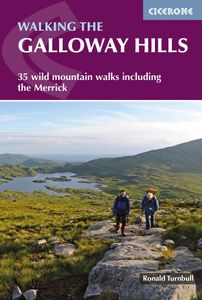
Wandelgids Walking the Galloway Hills | Cicerone

Uitstekende wandelgids van galloway!   This guide covers 35 day walks and one long-distance route in the wild and remote hills of Galloway. Although there are some shorter and easier routes, many of these hill walks are long and on rugged terrain, so are more suitable for experienced walkers. The walks cover the evocative areas of The Merrick, The ...
18,50

Webshops met dit product

Webshop
Bezorging
Prijs

Anderen bekeken ook

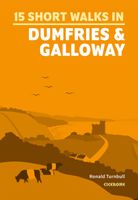
Wandelgids 15 Short Walks Dumfries and Galloway | Cicerone
Ronald Turnbull has chosen 15 of the best short walks around Dumfries and Galloway for you to explore. Our guide comes with easy-to-read Ordnance Survey maps and clear route descriptions, perfect if you're new to walking or are looking for something you can enjoy with the whole family. We've included information on local beauty spots and tasty refreshment stops, and most of the walks can be completed in under 4 hours.   We haven't included any walks with challenging terrain or complicated navigation, and all you'll need to take with you are a waterproof jacket and a pair of comfortable trainers.
13,95
Wandelgids Walking in the Thames Valley | Cicerone
Walking in the Thames Valley offers 25 challenging circular walks around the River Thames and River Kennet in the south of England, taking in the Southern Chilterns, the Berkshire and North Hampshire Downs, Southern Oxfordshire and the eastern edge of Wiltshire. All routes are within easy reach of Reading, Newbury, Abingdon and London. While some walks visit Iron Age hill forts, others pass more modern features such as Wilton Windmill and the Kennet and Avon Canal. Some follow sections of the Ridgeway, while others meander along the banks of the Thames. What they all have in common is that they take the keen rambler to some of the best parts of the Thames Valley – a patchwork of open chalk grassland, broadleaved woodland and farmland and home to two Areas of Outstanding Natural Beauty. • walks from 10 to 18 miles, including one 2-day route • shorter, less strenuous alternatives for many of the walks • detailed route descriptions with information on local points of interest, OS mapping …
18,50
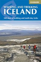
Wandelgids Walking and Trekking in Iceland - IJsland | Cicerone
Wandelgids met beschrijvingen, kaarten en praktische informatie zoals bussen, overnachten, etc. voor meerdaagse wandelroutes en dagwandeltochten op IJsland. A country of extraordinary beauty, Iceland’s incredible variety of volcanic and glacial landscapes makes it a unique destination for walking and trekking holidays. Its three national parks include the mighty Vatnajökull, largest national park in Europe.   The wide range of routes in this book introduce walkers and backpackers to this ‘Land of Ice and Fire’. There are 100 days of walking in this guidebook, stretching over 1722km, split between 49 day walks and 10 multi-stage treks. They climb mountains, cross glaciers, pass lakes and explore coastlines and geothermal areas, and range from easy nature trails to challenging treks. So, there is enough variation to satisfy all kinds of walkers. The routes are spread all around Iceland, grouped into twelve regions. Detailed information is given at the start of each route or trekking stag…
26,95
Wandelgids Walking in the Auvergne | Cicerone
Uitgebreide wandelgids van de Auvergne: goede beschrijvingen, veel keuze, kaarten wat minder goed. This handy guidebook offers the finest day walks in five different areas of the Auvergne, an often-forgotten region in central France perfect for accessible day walking in a unique and spectacular landscape. Towns such as Vichy, Clermont-Ferrand and Puy-en-Velay also offer delightful places to base yourself for that perfect walking holiday. The ridges, rocky peaks and verdant valleys of the Cantal supervolcano dominate south-western Auvergne. The centre of the region hosts the unique chain of 'puys' with their pudding bowl forms and the pristine crater lakes of the Sancy massif. In the north, the Montagne Bourbonnaise preserves a pastoral way of life which is quintessentially French while the Haute Loire's rivers and medieval abbeys reward those venturing further off the beaten track. Notes on the geology and history of points of interest passed en route help you to get the most out of yo…
19,95
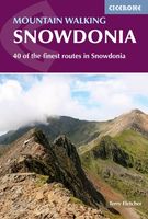
Wandelgids Mountain walking Snowdonia | Cicerone
Uitstekende wandelgids voor dit uitdagende wandelgebied in Wales. 38 dagtochten en een tweedaagse tocht. This guidebook describes 40 day walks exploring Snowdonia. It showcases some of the best mountain walks in the area, with routes up Snowdon and Tryfan alongside other classic peaks like Y Garn, Cadair Idris and the Glyders. Routes are graded easy to strenuous and include airy and pulse-quickening scrambles such as Crib Goch and Bristly Ridge as well as the Snowdon Horseshoe, the Nantlle Ridge and a 2-day traverse of all 15 of Snowdon’s peaks over 3000ft.   Walks range in distance from 4 miles (6km) to 16 miles (26km). Clear route descriptions are accompanied by OS mapping, and for each walk there is key information about distance, grade, ascent, terrain, access and parking. With useful advice on where to stay and when to go, and an English-Welsh glossary, this book is an invaluable guide to discovering both the popular and less well-trodden corners of Snowdonia.   Snowdonia can just…
23,50
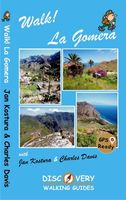
Wandelgids Walk! La Gomera | Discovery Walking Guides
La Gomera is the ultimate get-away-from-it-all island: easy-going, unspoilt, friendly, isolated from the hustle and bustle of modern living, and so laid back it’s virtually supine - even the volcanoes have been dormant for millions of years. The walks, however, are a bit more energetic. For the new 4th edition of Walk! La Gomera Charles Davis has teamed up with Jan Kostura. Jan brings his wide experience and passion for the Canaries, checking, re-walking and revising existing routes, and adding a couple of his own adventures, including a new Top Three Gomeran walk. Two routes have been dropped as having become too dangerous, but the good news is that many of the more harum-scarum walks have been improved through path clearing and the addition of railings to the vertiginous stretches. Other good news is that the devastating forest fires of 2012 have proved not nearly as damaging as we feared, leaving most of our itineraries unscathed. In short, there is every reason to take off and expl…
17,50
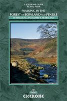
Wandelgids Walking in the Forest of Bowland and Pendle | Cicerone
This handy guidebook contains 40 diverse circular day walks suitable for walkers with navigational skills. There is a variety of terrain covered in the Forest of Bowland and Pendle which makes it perfect for those who wish to explore an AONB. Some of the routes covered include: Ward's Stone, Pendle Hill, Longridge Fell and Fair Snape Fell. The Forest of Bowland and Pendle provide vastly differing terrain – from the lush farmlands of the Ribble valley to the more rugged rough pastures of the Forest of Bowland uplands and the huge boggy uplifts of the main Bowland massif itself.   The walks in this guidebook are suitable for those who already have good navigational skills and range from 3 miles to 12.5. For walkers who like to ‘collect’ summits, there are six Marilyns within the area of the Forest of Bowland and Pendle, only two of which (White Hill and Easington Fell) are not included in any of the walks. However, this guidebook does offer information on how to access both for those who…
7,50
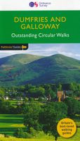
Wandelgids 19 Pathfinder Guides Dumfries & Galloway | Ordnance Survey
Wandelgids van het zuidwestenl van Schotland. Deze gids bevat 28 dagwandelingen, variërend van korte tochten tot pittige dagtochten. De bijbehorende kaarten zijn uitstekend: men heeft de topografische kaarten van Ordnance Survey gebruikt waarop de route is ingetekend. Daarnaast praktische informatie over de wandeling en wat beschrijvingen van het gebied. With 28 circular walks all created by experienced walkers, this Pathfinder walking guidebook for Dumfries and Galloway is ideal for both visitors and locals. The routes range from extended strolls to exhilarating hikes, so there is something for everyone. Each route includes a detailed description, a difficulty rating, the Ordnance Survey map for the route, GPS waypoints and key historical and landscape features to look out for.   Dumfries and Galloway form the south-west of Scotland; a broad wedge of land jutting out into the Irish Sea between the Solway Firth and the Firth of Clyde. The area is also part of Scotland's border country …
18,50
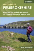
Wandelgids Walking in Pembrokeshire | Cicerone
Uitstekende wandelgids van dit mooie gebied aan de kust van Wales: het Pembrokeshire Coast national park. Goed beschreven met veel praktische informatie om de route te kunnen lopen, inclusief redelijke kaarten. Guidebook to 40 circular walks in Pembrokeshire in Wales. The routes, which range from 1 to 12 miles, take in the dramatic beauty of the national park and its coast, the Daugleddau and the Preseli Hills, while exploring wooded gorges, prehistoric hillforts and medieval castles.   Step-by-step route descriptions are accompanied by 1:50,000 mapping. For each route, information is also given regarding parking and public transport options, as well as toilets and refreshments available along the way. The guide also includes a useful route summary table, plus information on tides, the terrain, and weather in the region.   This collection of walks includes something for everyone, from novices to experienced ramblers. None of the walks demand technical skill and, in good weather, pose f…
18,50
Wandelgids 15 Short Walks in the Surrey Hills | Cicerone
Our authors have chosen 15 of the best short walks around the Surrey Hills for you to explore. Our guide comes with easy-to-read Ordnance Survey maps and clear route descriptions, perfect if you're new to walking or are looking for something you can enjoy with the whole family.   We've included information on local beauty spots and tasty refreshment stops, and most of the walks can be completed in under 3 hours.   We haven't included any walks with challenging terrain or complicated navigation, and all you'll need to take with you are a waterproof jacket and a pair of comfortable trainers.
13,95

Klanten-reviews van Wandelgids Walking the Galloway Hills | Cicerone

Er zijn nog geen beoordelingen voor dit productBen jij de eerste die een review plaatst?

Meer over Wandelgids Walking the Galloway Hills | Cicerone

Productomschrijving

Uitstekende wandelgids van galloway!   This guide covers 35 day walks and one long-distance route in the wild and remote hills of Galloway. Although there are some shorter and easier routes, many of these hill walks are long and on rugged terrain, so are more suitable for experienced walkers. The walks cover the evocative areas of The Merrick, The Awful Hand, The Rhinns of Kells, the Minnigaff hills and Cairnsmore of Fleet, among others.   The guide uses OS 1:50,000 maps with detailed route descriptions and inspirational photos accompanying each route. Key information such as distance, time, and ascent are given. A 'harshness' grade gives an indication of how rough the ground is expected to be, and suggestions of variants, shortcuts and ways to extend each walk are also given. Plenty of background information is given on the region's fascinating and important history.   If you like your wild landscape really wild… If you like your lakes to have whooper swans in the middle and no ice-cream vans around the edge… If you like to have one foot on bare rock and the other one deep in a peat bog… If you like your granite with goats on… Then Galloway is the place to go.   Steden en Dorpen Newton Stewart; Glen Trool (Glentrool village and Loch Trool); Dalmellington (Ayrshire); Carsphairn and St John's Town of Dalry (Glenkens).
Webshop.nl maakt gebruik van cookies. Ga je verder op onze website, ga dan akkoord met het plaatsen van cookies en de verwerking van deze data door ons en vermelde partners.