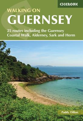
Wandelgids Walking on Guernsey, Alderney, Sark and Herm | Cicerone
Guidebook to 24 easy day walks on the Channel Islands of Guernsey, Alderney, Sark and Herm, and the 3-day Guernsey Coastal Walk. Making up part of the Channel Islands Way, the routes follow paths, tracks and quiet roads and total around 240km (150 miles). Uses detailed 1:15,000 scale States of Guernsey maps, with notes on travel, accommodation, plants and wildlife and the islands' fascinating history. Seasons all year round, but particularly good in spring when the wild flowers are at their most colourful; busy during the summer, with long, sunny days; quieter in autumn; sometimes bleak in the winter Centres St Peter Port; St Sampson Difficulty good paths and tracks are used, along with quiet country roads, avoiding main roads wherever possible; gradients are often gentle, but there are some rugged cliff paths and occasional steep slopes and flights of steps; short walks can be combined to make longer ones Must See excellent cliff coastline, rocky and sandy beaches; nature res…
19,95

