webshop.nl
Categorieën
  Sluiten

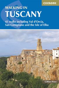
Wandelgids Walking in Tuscany - Toscane | Cicerone

Uitstekende wandelgids van Toscane. Goed beschreven met veel praktische informatie om de route te kunnen lopen, inclusief redelijke kaarten. Aanbevolen wandelkaarten De meeste wandelingen (maar lang niet allemaal!) in deze gids worden gedekt door wandelkaart: Wandelkaart - Fietskaart 2440 Toscana | Kompass Voor de andere gebieden staan de kaarten h...
23,95

Webshops met dit product

Webshop
Bezorging
Prijs

Anderen bekeken ook

Wandelgids Zuid-Toscane | Uitgeverij Elmar
Deze wandelgids is een vertaling van de oorspronkelijke duitse versie. Het zijn klassiekers onder de wandelgidsen. Uitstekende wandelgids met een groot aantal dagtochten in dal en hooggebergte. Met praktische informatie en beperkt kaartmateriaal!  Wandelingen in verschillende zwaarte weergegeven in rood/blauw/zwart.   De Rother wandelgids Zuid-Toscane bevat 50 prachtige wandelingen door het unieke natuurlijke en culturele landschap van het zuiden van Toscane, tussen Florence en de Maremma.   Zoals gebruikelijk zijn er verschillende wandelingen voor beginnende en ervaren wandelaars en is er onmisbare informatie over de streek, de bezienswaardigheden en recreatiemogelijkheden.   De betrouwbare routebeschrijvingen, gedetailleerde kaarten en hoogteprofielen zorgen voor een onvergetelijke wandelervaring.   Door de wijngaarden van de Chianti 1 2.30 uur Badia a Passignano   2 2.00 uur Pontignano   3 3.45 uur Van Volpaia de Monte San Michele, 892 m, op  4 2.00 uur Van Volpaia naar Castelv…
18,99
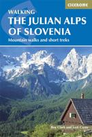
Wandelgids Julian Alps of Slovenia - Julische Alpen | Cicerone
Engelstalige wandelgids met 57 dagtochten en 4 trekkings door de Julische Alpen. Goede omschrijvingen van de tochten met alle noodzakelijke praktische info alsmede - beperkt - kaartmateriaal. Aanbevolen wandelkaarten bij deze gids Gebied 1 Wandelkaart 064 Julische Alpen - Alpi Giulie | Kompass 1:25.000 Wandelkaart Triglav - Kranjska Gora – Bohinj – Julische Alpen | Sidarta 1:25.000 Gebied 2 Wandelkaart Bohinj Triglav, Krn, Crna prst – Julische Alpen | Sidarta 1:25.000 Gebied 3 Wandelkaart Bovec Trenta - Julische Alpen | Sidarta Gebied 4 Wandelkaart 2 Pocketmap Bled | Kartografija Gebied 5 Wandelkaart - Fietskaart Posocje | Kartografija 1:40.000 Of Voor vrijwel het hele gebied beschreven in de gids. Wandelkaart 141 WK Julische Alpen | Freytag & Berndt  1:50.000   Over 60 walks which bring the best of Slovenia’s Julian Alps to the English-speaking walker. The walks are organized around five bases – Kranjska Gora, Bovec, Kobarid, Bled and Bohinj. The routes range from easy valley walks an…
26,95
Wandelgids Walks In The Valais | Cicerone
Uitstekende wandelgids van dit geweldige gebied. goed beschreven met veel praktische informatie om de route te kunnen lopen, inclusief redelijke kaarten. 120 routes throughout the Swiss Valais in the Pennine Alps, with such peaks as the Matterhorn, Dent Blanche and Monte Rosa providing a perfect background. Detailed coverage of Bettmeralp, Lötschental, Saastal, Mattertal, Turtmanntal, Val d’Annivers, Val d’Hérens, Val de Nendaz, Val de Bagnes, Val d’Entremont, Val ferret, Vallée de Trient. The Matterhorn, Monte Rosa, Zinarothorn, Ober Gabelhorn, Dent Blanche, Weisshorn, Bietschhorn, Grand Combin – these are some of the most dramatic mountains in Europe. Here they form a backdrop to a series of routes that should answer the dreams of any keen mountain walker. Best known, perhaps, for the resorts of Zermatt and Saas Fee, the Valais district of Switzerland is also the location of the Lötschental and Turtmanntal, the Vals d'Anniviers, Hérens, Bagnes and Ferret – valleys in which there are …
24,95
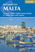
Wandelgids Walking on Malta | Cicerone
Wandelgids met 33 dagtochten op Malta, Gozo en Comino. Goede omschrijvingen, veel praktische informatie. Redelijk kaartmateriaal. (goede wandelkaart Kompass / zie landkaarten) The Maltese Islands of Malta, Gozo and Comino bask in sunshine at the heart of the Mediterranean, between Europe and Africa. History has ensured that the islands have been colonised time and time again, leaving them with a colourful and complex history and heritage. The islands are a popular tourist destination. They offer plenty of historic walks, stunningly beautiful and dramatic architecture, and a good amount of excellent scenery, especially around the cliffs and coastlines. This guidebook describes 33 walks on Malta and its neighbouring islands of Gozo and Comino. Walks generally range from 3 to 17 km, and include Valetta, heritage trails, coastal walks and explorations inland, including the 30km 'Victoria Lines' route between Mgarr and Bahar ic-Caghaq. Malta offers year-round walking. This guidebook describ…
21,95
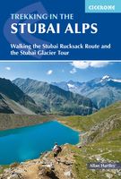
Wandelgids Trekking in the Stubaier Alps | Cicerone
Uitstekende wandelgids van Cicerone over de Stubaier Alpen, waarbij de nadruk ligt op een tweetal meerdaagse routes: Huttentochten voor een gemiddelde en wat meer gevorderde wandelaar. Goede praktische informatie, kaartmateriaal beperkt. Aanbevolen wandelkaarten bij deze gids Schaal 1:25.000 Wandelkaart 31/1 Alpenvereinskarte Stubaier Alpen - Hochstubai Wandelkaart 31/2 Alpenvereinskarte Stubaier Alpen - Sellrain Of schaal 1:50.000 Wandelkaart 83 Stubaier Alpen Kompass Of all the many Alpine areas, few can match the Stubai in the Austrian Tyrol as a venue for a first Alpine season. Shapely peaks, good paths and some of the best huts in the Alps make it ideal for the novice who wants to extend their experience beyond Britain. Of all the many Alpine areas, few can match the Stubai in the Austrian Tyrol as a venue for a first Alpine season. Shapely peaks, good paths and some of the best huts in the Alps make it ideal for the novice who wants to extend their experience beyond Britain. This…
21,95
Wandelgids Corsica | Uitgeverij Elmar
De Rother wandelgids Corsica telt maar liefst zeventig wandelingen. Corsica is een populaire vakantiebestemming vanwege het gunstige klimaat, de kilometer lange zandstranden, gezellige dorpjes, uitgestrekte wouden en kristalheldere meren en beken. Maar het zijn vooral de imposante berglandschappen die Corsica bij wandelaars populair maakt. De Rother wandelgids Corsica bevat een rijke keus aan wandelingen. Van eenvoudige strandwandelingen tot zwaardere hoogtetochten voor de gevorderde wandelaar. De wandelingen zijn voorzien van betrouwbare routebeschrijvingen, gedetailleerde wandelkaarten en informatieve hoogteprofielen. Aanbevolen wandelkaarten bij deze gids:  In het noorden van Corsica (wandeling 1 t/m 14): IGN kaarten 1:25.000 Wandelkaart - Topografische kaart 4347OT Cap Corse | IGN Wandelkaart - Topografische kaart 4348OT Bastia | IGN Wandelkaart - Topografische kaart 4349OT Vescovato | IGN Wandelkaart - Topografische kaart 4351OT Cervione | IGN Wandelkaart - Topografische kaart 414…
19,99
Wandelgids Walking on the Costa Blanca Walks | Cicerone
Uitstekende wandelgids van dit geweldige gebied. Goed beschreven met veel praktische informatie om de route te kunnen lopen, inclusief redelijke kaarten. This guidebook describes 50 circular walks and scrambles exploring the Costa Blanca mountains, around the resorts of Alicante, Benidorm and Calp. These routes range from gentle strolls to demanding days with steep climbs, and from 3-20km in distance. The Mediterranean coast is one of Europe's most popular winter sun adventure destinations. In general UK visitors are best suited to the heat from late autumn to early spring. Beyond the beaches and high rises lies a completely different world of accessible, rocky mountains and knife-edge ridges that stretch away in long chains of gleaming white limestone pinnacles, and the range of walks ensures that everyone can enjoy this spectacular Spanish landscape. Walking on Costa Blanca also includes background information on local geology, wildlife and history, and planning details on where to g…
23,50
Wandelgids Walking the mountains of Ronda and Grazalema | Cicerone
Eén van de mooiste wandelgebieden van Europa: de zuidelijke Sierras van Spanje. Geweldige natuur met veel planten en vogels en bijzondere witte dorpen met een lekkere culinair hoogstaande keuken. De ideale combinatie voor een mooie week in voor- en najaar.  Deze wandelgids is dan ook een schot in de roos: veel dagtochten in genoemde parken, goed beschreven met veel praktische informatie. Kaartmateriaal is beperkt. Aanbevolen wandelkaarten bij deze gids: Wandelkaart Sierra de Grazalema | Editorial Penibetica Wandelkaart Sierra de las Nieves | Editorial Penibetica The dramatically situated town of Ronda can make a great base for a walking holiday in the mountains of Andalucia, as can any one of the picturesque 'pueblos blancos' (white villages) that nestle among the surrounding hills. This guidebook presents 32 mainly circular walks in the Ronda region, covering the town and its environs, the Natural Parks of La Sierra de Grazalema and La Sierra de las Nieves (both UNESCO biosphere reser…
23,95
Wandelgids Walking in Italy's Stelvio National Park | Cicerone
Wandelgids voor de Stelvio Nationaal Park in de Rätische Alpen ( Alpi Retiche ) ten zuiden van de Splügenpas op de grens met het Zwitserse Graubünden. Engelstalige beschrijving van 38 dagwandelingen.   Aanbevolen wandelkaarten 1:25.000 voor deze gids Wandelkaart 008 Ortles - Cevedale - Ortlergebiet | Tabacco Editrice   Wandelkaart 045 Latsch - Martell - Schlanders- Laces - Val Martello - Silandro | Tabacco Editrice   Wandelkaart 048 Val di Peio - Val di Rabbi - Val di Sole | Tabacco Editrice   The wide range of 38 summer day walks in this guide explore the renowned Stelvio National Park in the Italian Rhaetian Alps. Bordering the Dolomites to the east, and Switzerland to the west, the Stelvio is one of the largest protected areas in all of the Alps. Its unspoilt landscape ranges from valley farmland to forested hillsides and alpine meadows, and up to a wilderness of rugged glaciated summits and ridges, the highest of which is Ortler, at 3905m.   The walks, a selection of routes from ea…
20,95
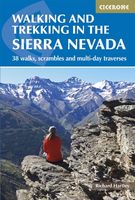
Wandelgids Walking and trekking in the Sierra Nevada | Cicerone
Uitstekende wandelgids voor de Sierra Nevada. Goed beschreven met veel praktische informatie om de route te kunnen lopen, inclusief redelijke kaarten. Aanbevolen wandelkaarten Wandelkaart NP Sierra Nevada met Alpujarras | Editorial Penibetica 1:40.000 of Wandelkaart Sierra Nevada en Alpujarras | Editorial Alpina - 1:40.000 Wandelkaart Sierra Nevada - la integral de los 3000 | Editorial Piolet 1:25.000   This guidebook presents 33 graded walks and 5 high mountain scrambles in the striking Sierra Nevada, the highest mountain range in mainland Spain and in western Europe outside the Alps. Easily accessible from Granada and Málaga, it is a world of soaring, snow-clad peaks and deep valleys, far removed from the crowded beaches of the Costa del Sol just two hours away. The routes are spread across the national park, with attractive towns and villages such as Trevélez, Lanjarón, Hoya de la Mora and Cumbres Verdes serving as potential bases for a walking holiday.   The walks have been careful…
20,95

Klanten-reviews van Wandelgids Walking in Tuscany - Toscane | Cicerone

Er zijn nog geen beoordelingen voor dit productBen jij de eerste die een review plaatst?

Meer over Wandelgids Walking in Tuscany - Toscane | Cicerone

Productomschrijving

Uitstekende wandelgids van Toscane. Goed beschreven met veel praktische informatie om de route te kunnen lopen, inclusief redelijke kaarten. Aanbevolen wandelkaarten De meeste wandelingen (maar lang niet allemaal!) in deze gids worden gedekt door wandelkaart: Wandelkaart - Fietskaart 2440 Toscana | Kompass Voor de andere gebieden staan de kaarten hier onder per gebied genoemd. A guidebook to walks in the Italian region of Tuscany. 43 graded routes range from 2.5 to 18km, and take in the Renaissance splendour of Florence and Siena, the World Heritage scenery of Val d'Orcia and San Gimignano and the stunning island of Elba. Alongside detailed route descriptions and clear mapping there is essential practical information on public transport and food and drink, as well as a comprehensive list of accommodation, and a useful Italian–English glossary. The guide is packed with interesting details about the area’s wildlife, landscape, culture and history, making it a perfect companion to getting to know this beautiful region.   Tuscany is justifiably renowned for its glorious landscapes. Romantic hilltop villages clinging to rolling hills contrast with dense forests, rugged mountains and long, sandy beaches. This is a region that resonates with history - Etruscan remains, Medici villas, Renaissance towns and landscapes that inspired Leonardo da Vinci, Michelangelo and Dante. Add in the climate and superb food and wine and you have a perfect walking destination.   Steden en Dorpen Florence, Fiesole, Siena, Elba, San Quirico d'Orcia, Pienza, Montepulciano, Cortona, Montalcino, Radda in Chianti, Volterra, San Gimignano, Castelnuovo di Garfagnana, Abetone, Pitigliano, Chiusi della Verna   The walks 1 The environs of Florence Walk 1 Fiesole to Settignano Walk 2 Around Artimino Walk 3 The hills of Vinci   Aanbevolen wandelkaarten bij gebied no 1: Wandelkaart 2458 Firenze - Siena - Chianti | Kompass Wandelkaart 2457 Pisa - Livorno - San Miniato - Empoli | Kompass   2 The foothills and high Apennines Walk 4 Collodi and Pescia Walk 5 Le Piastre to Pontepetri Walk 6 Lago Scaffaiolo Walk 7 Libro Aperto Walk 8 San Pellegrino and Giro del Diavolo Walk 9 Monte Prado   Aanbevolen wandelkaarten bij gebied no 2: Er zijn geen wandelkaarten voor dit gebied.   3 Alpi Apuane Walk 10 Monte Forato loop Walk 11 Monte Croce Walk 12 Around Monte Procinto   Aanbevolen wandelkaarten bij gebied no 3: Er zijn geen wandelkaarten voor dit gebied.   4 Pratomagno and the Foreste Casentinesi Walk 13 Vallombrosa Walk 14 Monte Falco, Monte Falterona, Lago degli Idoli Walk 15 Eremo di Camaldoli loop Walk 16 Monte Penna Walk 17 Cortona   Aanbevolen wandelkaarten bij gebied no 4: Wandelkaart 3 Carta-guida Foreste Casentinesi, Monte Falterona e Campigna | Touring Club Italiano    5 Chianti Walk 18 Gaiole and Badia a Coltibuono Walk 19 Castellina to Radda in Chianti Walk 20 Volpaia loop Walk 21 Poggio San Polo   Aanbevolen wandelkaarten bij gebied no 5: Wandelkaart Chianti | Global Map   6 West of Siena Walk 22 Sovicille loop Walk 23 Monteriggioni circuit Walk 24 San Gimignano Walk 25 Volterra to Saline di Volterra   Aanbevolen wandelkaarten bij gebied no 6: Wandelkaart 2462 Siena - Volterra - Massa Marittima - Roccastrada | Kompass   7 The Crete and Val d’Orcia Walk 26 Chiusure and San Giovanni d’Asso Walk 27 Montalcino to Sant’Antimo Walk 28 San Quirico d’Orcia to Pienza Walk 29 San Quirico d’Orcia to Bagno Vignoni Walk 30 Bagno Vignoni circuit Walk 31 Montepulciano loop Walk 32 Radicofani   Aanbevolen wandelkaarten bij gebied no 7: Wandelkaart 2463 Lago Trasimeno - Area Protetta Val d'Orcia | Kompass   8 Elba and the Tyrrhenian coast Walk 33 The Enfola promontory Walk 34 Marciana Marina circuit Walk 35 Marciana to Pomonte Walk 36 Porto Azzurro Walk 37 Baratti and the Populonia headland Walk 38 Campiglia Marittima–Suvereto circuit   Aanbevolen wandelkaarten bij gebied no 8: Wandelkaart 2468 Isola d'Elba | Kompass Wandelkaart 2469 Costa della Maremma | Kompass   9 The Maremma coast and hinterland Walk 39 Le Torri loop Walk 40 San Rabano circuit Walk 41 Feniglia Walk 42 Pitigliano to Sovana Walk 43 Sorano to San Quirico   Aanbevolen wandelkaarten bij gebied no 9: Wandelkaart 2470 Maremma - Grosseto - Monte Argentario - Isola del Giglio | Kompass Wandelkaart 2471 Lago di Bolsena | Kompass
Webshop.nl maakt gebruik van cookies. Ga je verder op onze website, ga dan akkoord met het plaatsen van cookies en de verwerking van deze data door ons en vermelde partners.