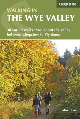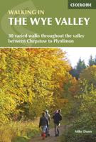
Wandelgids Walking in the Wye Valley | Cicerone

0
This guidebook includes 30 day walks in the stunning and varied lands of the Wye Valley. From its source on Plynlimon in the Welsh Cambrian mountains, down along the Wales-England border through Hay-on-Why, Hereford and Chepstow to the Severn Estuary.    The routes in this guide are circular, and range in length between 5 and 15km. Every route des...

Verkopers met dit product

Verkoper
Bezorging
Prijs
DeZwerver.nl logo
DeZwerver.nl
2,95
19,95

Anderen bekeken ook

Wandelgids Walking in the Wye Valley | Cicerone
This guidebook includes 30 day walks in the stunning and varied lands of the Wye Valley. From its source on Plynlimon in the Welsh Cambrian mountains, down along the Wales-England border through Hay-on-Why, Hereford and Chepstow to the Severn Estuary.    The routes in this guide are circular, and range in length between 5 and 15km. Every route description is accompanied by an annotated OS map, and includes details on points of interest along the way to enhance your wandering.    The Wye Valley is known for its beauty and wide range of scenery; a walkers' paradise at any time of year. From the high moorland near the source, down through gentle green hills, before diving into the woods and limestone gorge near the sea.    Practical details such as the amount of ascent and timings information are included for every walk, as are details on public transport and parking facilities. Other useful information on the river's history, geology and wildlife ensure that this is an ideal companion t…
19,95
Wandelgids Walking in the Thames Valley | Cicerone
Walking in the Thames Valley offers 25 challenging circular walks around the River Thames and River Kennet in the south of England, taking in the Southern Chilterns, the Berkshire and North Hampshire Downs, Southern Oxfordshire and the eastern edge of Wiltshire. All routes are within easy reach of Reading, Newbury, Abingdon and London. While some walks visit Iron Age hill forts, others pass more modern features such as Wilton Windmill and the Kennet and Avon Canal. Some follow sections of the Ridgeway, while others meander along the banks of the Thames. What they all have in common is that they take the keen rambler to some of the best parts of the Thames Valley – a patchwork of open chalk grassland, broadleaved woodland and farmland and home to two Areas of Outstanding Natural Beauty. • walks from 10 to 18 miles, including one 2-day route • shorter, less strenuous alternatives for many of the walks • detailed route descriptions with information on local points of interest, OS mapping…
18,50
Wandelgids Walking in the Aosta Valley | Cicerone
Uitstekende wandelgids van Aosta en omgeving. Goed beschreven met veel praktische informatie om de routes te kunnen lopen, inclusief redelijke kaarten. Guidebook to hiking in the Aosta Valley, a stunning, autonomous region in the Italian Alps. Describes 32 scenic routes (ranging from 4 to 20km) within both the main valley and those to the north, including the Lys valley, Valpelline, Valtournenche, and Grand St Bernard. Also provides info on the via ferrata and trail running options in the region. A stunning, autonomous region in the Italian Alps, the Aosta valley is a walker's paradise. This guidebook describes 32 varied and scenic routes both within the main valley and those to the north (including the Lys valley, Valpelline, Valtournenche and Grand St Bernard). The routes vary in difficulty and distance, offering something for walkers of all ability. 1:50K mapping together with gradient profiles complement clear and concise route descriptions. Also included is invaluable practical i…
22,95
Wandelgids Walking in the Cairngorms | Cicerone
Uitstekende wandelgids, sommige meerdaags, voor dit uitdagende wandelgebied in Schotland. This guidebook contains over 100 routes for walking in the Scottish Cairngorms. It includes 18 Munro summits and smaller viewpoint hills. Walks range in length from 1 to 26 miles and are graded for difficulty.    For the adventurous there are the best of the area's rocky scrambles, and the classic through-routes including the Lairig Ghru. For those looking for a more gentle alternative, there are easy, sandy trails wandering among the tall pines and along the banks of the great rivers Spey, Nethy and Dee.    Britain's biggest mountain range is home to exceptional and varied scenery - from the ancient Caledonian forest to the granite plateau, the glacial glens and high corries where green lochans lie below great crags of the plateau rim.  Along with the main Cairngorm range between Speyside and Deeside, the guidebook covers Lochnagar. It includes practical information on snack stops, public …
20,95
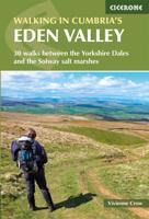
Wandelgids Walking in Cumbria's Eden Valley - Lake district | Cicerone
Uitstekende Engelstalige wandelgids van dit prachtige gebied op de grens van Engeland en Schotland. Guidebook to 30 of the best walks in Cumbria's enchanting Eden Valley. The graded routes, which range from 3 to 15 miles, explore the region's diverse landscapes and offer dramatic views, either of the Pennines, the Lake District or the Scottish hills.  The walks, which work well from bases such as Kirkby Steven, Dufton and Appleby, are predominantly circular. Some of the linear routes link with the Settle-Carlisle railway. Map extracts from the 1:50K OS Landranger series accompany route description, and the handy route summary table makes it easy for walkers to compare routes. Invaluable information on transport, accommodation, clothing, equipment and safety is included, as are notes on the region's geology, wildlife and history.   Situated next to the iconic Lake District, the Eden Valley is often overlooked as a walking destination. This works in its favour - it is as quiet as it is …
18,50
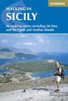
Wandelgids Walking in Sicily - Sicilie | Cicerone
Uitstekende wandelgids van Abruzzo. Goed beschreven met veel praktische informatie om de routes te kunnen lopen, inclusief redelijke kaarten. Exploring this breathtaking island on foot is a journey through time. Sicily offers wild valleys pitted with Greek and Roman temples and ancient ruins - reminders of long-gone peoples. Mule tracks and age-old pathways have survived and reserve a wealth of surprises, starting with the carpets of brilliant wildflowers. Landscapes are grandiose. Olive groves thrive alongside citrus orchards, never far from snow-clad mountain ranges presided over by imposing volcanoes - ranging from extinct and visitable, through to placidly smoking, and to constantly active giants Etna and Stromboli from which fiery rivers of lava issue. In dramatic contrast is the string of peaceful offshore islands set in turquoise waters, which are pure Mediterranean in character.Sicily's stunning range of scenery, combined with its mild winters and hot dry summers, make rewardi…
20,95
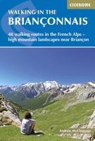
Wandelgids Walking in the Briançonnais | Cicerone
Handige duidelijke wandelgids van een mooi wandelgebied. De routes zijn accuraat beschreven met praktische informatie erbij. Kaartmateriaal is redelijk, soms wat schetsmatig. In berggebieden zijn wandelkaarten wel belangrijk! Bij de routes worden de juiste kaartnummers gegeven.    This guidebook presents 40 walks exploring the area around Briançon in France. The walks are divided into 6 sections covering the valleys of Clarée, Cerveyrette, Ayes, Durance and Guisane, as well as the area around Vallouise and Montgenèvre. The walks are circular and range in distance from 4 to 21 km. Graded easy to very hard, there is a walk to suit all abilities.    Dominated on all sides by jagged peaks, and perched on a rocky spur at the nucleus of five beautiful valleys, the city of Briançon lies almost at the southernmost tip of the main Alpine range. The Briançonnais, the surrounding region to which it gives its name, is a stunning mountain wilderness packed with everything one would expect from a h…
23,95
Wandelgids Walking in the Algarve | Cicerone
Uitstekende wandelgids van de Algarve. Goed beschreven met veel praktische informatie om de routes te kunnen lopen, inclusief redelijke kaarten. This guidebook describes 33 walks in the beautiful Algarve in southern Portugal. Boasting good weather, easy access, stunning scenery and some great hiking trails, the region is a perfect destination for a walking holiday. It is best known for its spectacular coastline: the coastal trails presented here afford ample opportunity to admire the plunging sinkholes, striking sea-cliffs and rock-hugged beaches. However, the interior is every bit as beautiful and other walks explore the forested slopes of Monchique and the tranquil countryside between the mountains and coast.   The routes range from 3.5 to 17km and cover the sun-kissed south coast, the rugged Vicentina Coast, the Monchique mountains and traditional villages of the eastern Algarve. Many can be accessed by public transport and details, along with tips on refreshment opportunities on r…
23,95
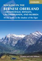
Wandelgids Walking in the Bernese Oberland | Cicerone
A guidebook to 50 day walks in Switzerland's Jungfrau region from the main bases of Grindelwald, Wengen, the Lauterbrunnen valley and Murren. These graded walks range from grade 1 almost level short walks through to grade 4 challenging Alpine routes, however, most are grades 2 or 3 and are suitable for walkers with some experience. Ranging in length from 5 to 23.5km the routes visit valleys, waterfalls and alpine huts.   Many also take advantage of the widespread public transport and lifts around the Bernese Oberland to provide options for walks at a higher altitude. Along with a detailed route description, each walk has 1:50,000 mapping and information on public transport access to the start and end points. Details of accommodation, alpine huts and facilities are also provided.
24,95
Wandelgids Walking in the Auvergne | Cicerone
Uitgebreide wandelgids van de Auvergne: goede beschrijvingen, veel keuze, kaarten wat minder goed. This handy guidebook offers the finest day walks in five different areas of the Auvergne, an often-forgotten region in central France perfect for accessible day walking in a unique and spectacular landscape. Towns such as Vichy, Clermont-Ferrand and Puy-en-Velay also offer delightful places to base yourself for that perfect walking holiday. The ridges, rocky peaks and verdant valleys of the Cantal supervolcano dominate south-western Auvergne. The centre of the region hosts the unique chain of 'puys' with their pudding bowl forms and the pristine crater lakes of the Sancy massif. In the north, the Montagne Bourbonnaise preserves a pastoral way of life which is quintessentially French while the Haute Loire's rivers and medieval abbeys reward those venturing further off the beaten track. Notes on the geology and history of points of interest passed en route help you to get the most out of y…
19,95

Klanten-reviews van Wandelgids Walking in the Wye Valley | Cicerone

Er zijn nog geen beoordelingen voor dit productBen jij de eerste die een review plaatst?

Meer over Wandelgids Walking in the Wye Valley | Cicerone

Productomschrijving

This guidebook includes 30 day walks in the stunning and varied lands of the Wye Valley. From its source on Plynlimon in the Welsh Cambrian mountains, down along the Wales-England border through Hay-on-Why, Hereford and Chepstow to the Severn Estuary.    The routes in this guide are circular, and range in length between 5 and 15km. Every route description is accompanied by an annotated OS map, and includes details on points of interest along the way to enhance your wandering.    The Wye Valley is known for its beauty and wide range of scenery; a walkers' paradise at any time of year. From the high moorland near the source, down through gentle green hills, before diving into the woods and limestone gorge near the sea.    Practical details such as the amount of ascent and timings information are included for every walk, as are details on public transport and parking facilities. Other useful information on the river's history, geology and wildlife ensure that this is an ideal companion to exploring the impressive range of walking the Wye Valley offers.

Productinformatie

    Verken gerelateerde categorieën

    Webshop.nl maakt gebruik van cookies. Ga je verder op onze website, ga dan akkoord met het plaatsen van cookies en de verwerking van deze data door ons en vermelde partners.