webshop.nl
Categorieën
  Sluiten

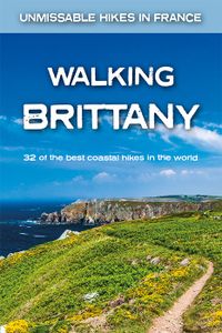
Wandelgids Walking Brittany - Bretagne | Knife Edge Outdoor

Wild coastline: endless towering cliffs, remote rocky headlands, almost forgotten islands and stunning beaches which would not be out of place on a Caribbean island.   Explore a region packed with beauty and historical interest: megalithic sites, World War 2 fortifications, ancient villages and much more. Real IGN Maps inside: 1:25,000.   Also incl...
19,50

Webshops met dit product

Webshop
Bezorging
Prijs

Anderen bekeken ook

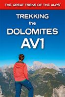
Wandelgids Trekking the Dolomites Av1 | Knife Edge Outdoor
Superhandige wandelgids voor de Alta Via 1 in de Dolomieten. Met deze gids heb je verder niks nodig: alle benodigde Tabacco wandelkaarten zitten in deze gids! The only guidebook exclusively for the AV1.Everything you need to know to plan and walk Italy's most popular long distance route.Real maps inside (Tabacco 1:25,000): the finest maps available for the Dolomites. This makes navigation easy and there is no need to carry additional maps. Also includes:* Numbered waypoints linking maps to text* Unique Itinerary Planner: plan a bespoke itinerary to match your ability and vacation schedule. All difficult calculations of time, distance and altitude gain are done for you* 7 Proposed Itineraries of between 6 and 11 days* Everything the trekker needs to know to plan the route: route descriptions, costs, budget, difficulty, weather, how to get there, and more* Full accommodation listings: spectacularly situated mountain huts* Section on Camping* Exciting variants to the main route* Informati…
19,95
Wandelgids Walk! Costa del Sol: Axarquia | Discovery Walking Guides
Goede wandelgids van een uitermate geschikt wandelgebied aan de Costa del Sol: het binnenland boven Nerja rond Competa en andere bergdorpen. De beschrijvingen zijn prima, zo ook de praktische informatie en de kaarten. We celebrate a Costa del Sol that does not correspond to the cliches, a Costa del Sol that is all right rather than all wrong, a playground of green valleys and gilded mountain tops, a hidden idyll unknown to most visitors, a haven for dedicated walkers and adventurous tourists alike, a place in which every nook is graced with some gratifying discovery and every outing is a great adventure. The majority of walks are aimed at the adventurous leisure walker, people who will on the whole have some experience of hiking in mountains, are happy to invest a certain amount of effort for a corresponding reward. Covering the best preserved stretch of coastline, the prettiest villages, and most spectacular mountains, Walk! Costa del Sol explores the Axarquia region east of Malaga, a…
18,50
Wandelgids Karawanken - Slovenie - Walking in the Karavanke | Cicerone
Goede wandelgids met veel dagtochten; redelijk kaartmateriaal en goede praktische informatie. This guidebook offers 23 walking routes set across the magnificent 120km-long Karavanke mountain range, which forms a natural border between Austria and Slovenia. Commonly known as 'the way the Alps used to be', as it is yet to experience the extent of commercial development known by the Western Alps, it is one of the longest ranges in Western Europe but it remains genuinely unspoilt and relatively unvisited by English-speaking hillwalkers. The guide's walks begin in pretty towns and villages, and most of them access the peaks from the relatively more gentle Slovenian side of the range, where forest-clad slopes lead to grassy summits where spectacular views can be enjoyed. Arranged by peak from west to east along the range, most of the summits can be reached by waymarked paths and trails. The guide gives all the practical details you need on transport, accessing the routes, accommodation and a…
20,95
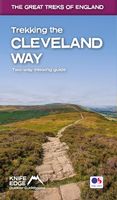
Wandelgids Trekking the Cleveland Way | Knife Edge Outdoor
The definitive two-way guide to the Cleveland Way, one of England's epic National Trails: both eastbound and westbound routes are described in full.   Real Maps: Full Ordnance Survey mapping inside (1:25,000). All accommodation is numbered and marked on the maps. 20 different itineraries: schedules of 5, 6, 7, 8, 9, 10 and 11 days for hikers and runners. Includes both eastbound and westbound itineraries. Difficult calculations of time, distance and altitude gain/loss are done for you.   Also includes: - Detailed information on equipment and travelling light - Full accommodation listings: the best pubs, B&Bs and hotels - Detailed section on camping, including wild camping - Everything the trekker needs to know: route, costs, difficulty, weather, travel, and more - Essential info for both self-guided and guided trekkers - Information on plants and wildlife - Numbered waypoints linking the Real Maps to our clear descriptions   Yorkshire's Cleveland Way is one of the most beautiful long-di…
23,95
Wandelgids Walk! Sierra de Aracena | Discovery Walking Guides
Introducing you to the beautiful region of Sierra de Aracena, this guidebook has 27 detailed walking routes backed by useful information. Every route has 1:40,000 scale colour mapping from Tour & Trail Map, plus GPS Waypoints for pinpoint navigational accuracy. A hundred kilometres northwest of Seville lies a region of truly unspoilt rural Spain. Once a province of Portugal the Sierra de Aracena encapsulates almost everything that we look for as the idyllic walking destination; rural beauty in flora and fauna, breathtaking landscapes, unspoilt towns and villages linked by old donkey trails. All it lacks are high mountains.   The Spanish have known about this isolated region for sometime and arrive at weekends and in mid-summer, but on weekdays and out of season it returns to peaceful tranquility. Few 'outsiders' know of this delightful region and you can be the first to read about it in English. We first discovered the region five years ago, when we thought it too isolated to justify a…
16,50
Reisgids Brittany and Normandy - Bretagne en Normandië | Rough Guides
Zeer goede reisgids voor zowel de georganiseerde maar vooral voor de zelfstandige reiziger. Boordevol informatie over reizen, slapen, eten, maar ook musea en cultuur. Voor Europese landen meestal completer en beter dan de Lonely Planet ! Practical travel guide to Brittany and Normandy with a free eBook featuring points-of-interest structured lists of all sights and off-the-beaten-track treasures, with detailed colour-coded maps, practical details about what to see and to do in Brittany and Normandy, how to get there and around, pre-departure information, as well as top time-saving tips, like a visual list of things not to miss in Brittany and Normandy, expert author picks and itineraries to help you plan your trip. The Rough Guide to Brittany and Normandy covers: Seine-Maritime; The Lower Normandy Coast; Inland Normandy; The North Coast and Rennes; Finistere; Inland Brittany: The Nantes-Brest Canal; The South Coast. Inside this travel guide you'll find:RECOMMENDATIONS FOR EVERY TYPE OF…
22,50
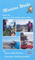
Wandelgids 2 Madeira Walks | Discovery Walking Guides
Engelstalige wandelgids Madeira, met uitgebreide beschrijvingen van wandelroutes, routekaartjes en praktische informatie zoals bussen en accommodatie. In dit tweede deel staan de wat uitdagendere routes. As a walker's paradise, Madeira has it all - majestic mountains, rugged coastline, ancient forests, a unique levada network and verdant flora; easy to see why so many walkers return year after year. In 2015 Madeira was voted the "World's Best Island Destination" by the World Travel Awards the final accolade from the previous two years when it was voted "Europe's Leading Island Destination". Quite an achievement, brought about largely by the substantial EU investment over the past decade in the improvement and development of the island's infrastructure and facilities.   One of the initiatives focused on improving and creating new walking trails which has resulted in Madeira now being regarded as one of Europe's top hiking destinations.To date, around thirty routes on Madeira have been d…
19,95
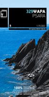
Wandelkaart 329 Psara | Terrain maps
Gedetailleerde wegenkaart en wandelkaart met alle kleine wegen, wandelpaden, hoogtelijnen en toeristische informatie aangegeven. Alle tekst is tweetalig in Engels en Grieks en de waterproof kaart is geschikt voor gebruik met GPS.   This is a great map because: First and foremost, it is the only available map of Psara! So far, no other cartographer had taken interest in this historical but forgotten corner of Greece. It is made with data collected 100% through field survey and comes in the detailed scale of 1:15,000, showing everything very clearly.  For the first time, all the trails of Psara are shown with absolute accuracy. The length of all trails has been measured in kilometres, so you can estimate the duration of your hike. On the back side of the map you ‘ll find detailed descriptions of the 3 best hikes on the island, also labeled on the map itself, so you easily locate them.  The nearby uninhabited island of Antipsara as well as all the surrounding islets are also included, …
11,95
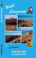
Wandelgids Walk! Lanzarote | Discovery Walking Guides
Engelstalige wandelgids Lanzarote, met uitgebreide beschrijvingen van wandelroutes, routekaartjes, praktische informatie zoals bussen en accommodatie. Walk! Lanzarote 5th edition builds on the reputation of our earlier editions with more walks and comprehensive updating so that it caters for the needs of the increasing number of people who would like to combine some walking with a holiday on the Fire island. Walk Lanzarote explodes the myth that there is nowhere worth walking on the island as we range through strolling on coastal promenades, walking across alpine style meadows, striding over the lava sea, dropping into volcanoes, sitting on high mountain seats - quite simply you will be amazed at the wide variety of stunning landscapes the Fire island has to offer the adventurous leisure walker.   new extended coastal route from Arrieta to Los Cocoteros to Costa Teguise, new Playa Blanca to Las Brenas to Yaiza on the GR131, which also updates our Yaiza to Las Brenas circular, newly rev…
18,50
Wandelkaart 321 Alonissos | Terrain maps
Gedetailleerde wegenkaart en wandelkaart met alle kleine wegen, wandelpaden, hoogtelijnen en toeristische informatie aangegeven. Alle tekst is tweetalig in Engels en Grieks en de waterproof kaart is geschikt voor gebruik met GPS. De uitgever: THIS IS THE BEST MAP OF ALONNISOS BECAUSE: • It is the only GIS map of Alonnisos made with data collected 100% through field survey. • It shows the entire trail network of Alonnisos, with impeccable accuracy. All trails are measured in kilometers so you can estimate the duration of your hike. On the back side 16 of the island’s hikes are presented in detail, also distinctly labeled on the map so you can easily locate them. • It includes maps of the neighboring islands of Peristera and Kyra Panaghia, with fully mapped coastline (all beaches are shown). • It includes a detailed town plan of Patitiri, in the scale of 1:5.500 as well as a map of the National Marine Park region. • It is printed on Polyart plastic “paper”, making it totally waterproof a…
11,95

Klanten-reviews van Wandelgids Walking Brittany - Bretagne | Knife Edge Outdoor

Er zijn nog geen beoordelingen voor dit productBen jij de eerste die een review plaatst?

Meer over Wandelgids Walking Brittany - Bretagne | Knife Edge Outdoor

Productomschrijving

Wild coastline: endless towering cliffs, remote rocky headlands, almost forgotten islands and stunning beaches which would not be out of place on a Caribbean island.   Explore a region packed with beauty and historical interest: megalithic sites, World War 2 fortifications, ancient villages and much more. Real IGN Maps inside: 1:25,000.   Also includes:   ▶ Numbered waypoints linking the Real Maps to our clear descriptions ▶ Graded routes to suit all abilities ▶ Everything the hiker needs to know: route descriptions,  difficulty, weather, how to get there, and more ▶ Information on Wildlife and Plants ▶ Carnac and other Megalithic sites  ▶ Section on World War 2 and the 'Atlantic Wall'   France is a large country with a huge and varied coastline. This coastline is very wild and very beautiful but rarely is it both wilder and more beautiful than in Brittany. This stunning part of the world's most visited country has around 3,000 km of sea frontage so you could spend a lifetime here walking along the tops of the spectacular and seemingly endless cliffs; around the remote rocky headlands and peninsulas jutting out into the Atlantic; and across innumerable white sand beaches which would not be out of place on a Caribbean island.   With so much coast on offer, it is understandable that Brittany, and its people, have a strong connection with the sea: evidenced by the countless yachts, fishing boats and other watercraft which are moored in the ports, harbours, bays and estuaries.   In fact, there are many who would argue, with much justification, that Brittany has the finest stretch of coastline in Europe. Of course, that is a subjective matter but it is indisputable that the coast of Brittany is vast. So vast that it is not possible to see everything on a single trip. So vast, in fact, that it is difficult to know where to start and that is where this guidebook comes in. To make planning easy for you, we have included here only the very finest of the thousands of possible walks on Brittany's coast. There are no 'fillers': only the most spectacular routes made the cut. We have 'sifted the wheat from the chaff' so that you do not have to.  
Webshop.nl maakt gebruik van cookies. Ga je verder op onze website, ga dan akkoord met het plaatsen van cookies en de verwerking van deze data door ons en vermelde partners.