webshop.nl
Categorieën
  Sluiten

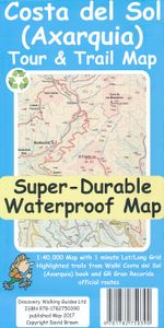
Wandelkaart Tour & Trail Costa de Sol - Axarquia | Discovery Walking Guides

Goede wandelkaart van de omgeving Nerja - Competa in het binnenland. For better adventures, use the best map. Costa del Sol (Axarquia) Tour & Trail Super-Durable Map comes with a 2 year adventurous use wear and tear guarantee against splitting or falling apart, see Discovery Walking Guides website for details. From 1 April 2020 a free Custom Map d...
15,95

Webshops met dit product

Webshop
Bezorging
Prijs

Anderen bekeken ook

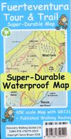
Wandelkaart Tour & Trail Fuerteventura | Discovery Walking Guides
For the best adventures, use the best map. Fuerteventura is a large, 1,660 square kilometres, island. At 65k scale Fuerteventura Tour & Trail Super-Durable Map is a large 960mm by 620mm, double sided map sheet, which folds down to its 220mm by 120mm pocket size.   A specialist concertina map fold means this map is easy to unfold for use and then refold to its pocket size. Super-Durable means that the Tour & Trail Map is printed on a plastic substrate using specially curing inks to produce a map that feels like silk but is tougher than any other map. Super-Durable is backed by a Discovery Walking Guides (DWG) 2-Year Guarantee against failure in the adventurous use for which the map is designed.   If your Super-Durable Map gets dirty then gently wipe clean with a soft wet cloth and allow to fully dry before refolding to pocket size. On one side of the map is the island's north with the south on the reverse side. There's a generous common overlap to minimise turning the map in use.   100 …
15,95
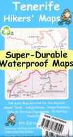
Wandelkaart Tour & Trail Tenerife | Discovery Walking Guides
Uitstekende wandelkaart, met ingetekende wandelroutes, voor specifieke wandelgebieden van Tenerife. Let op: dit is niet een kaart van het hele eiland, maar puur en alleen voor de wandelgebieden > daar is deze kaart de beste in! Our latest hiking research on Tenerife has resulted in new editions of Walk! Tenerife and Tenerife Hikers' Super-Durable Maps. Thanks to Jan Kostura's research we have several new hiking adventures described in detail in Walk! Tenerife. Jan's gps records of his research for new routes and updating of current routes has provided the detailed information to produce our new fourth edition of Tenerife Hiker's Super-Durable Maps. Note that Tenerife Hikers' Super-Durable Maps is a collection of four 30k scale map sections on a double sided sheet of 840mm by 600mm which folds up to 220mm by 120mm. It is not a map of all of Tenerife.  In this edition you will find 30k scale maps covering Valle de Orotava, West, Anaga and Adeje/Arona - Teide printed on a double sided …
17,95
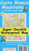
Wandelkaart Tour & Trail Costa Blanca mountains | Discovery Walking Guides
Thanks to all the walking research carried out by Charles Davis for his new Walk! the Costa Blanca Mountains guide book plus gps ground surveys carried out by David & Ros Brawn we have been able to a new Costa Blanca Mountains Tour & Trail Super-Durable Map. This new Costa Blanca Mountains Tour & Trail Super-Durable Map is the essential purchase for everyone looking to explore the exciting mountainous hinterland on the Costa Blanca. Whether you are exploring on foot, bike or horse this is your first choice map for accurate navigation on roads and as soon as you leave the tarmac. Scale 1:40,000 2.5cms = 1km. Map size; double-sided 780mm by 600mm folded to 21cm by 12cm. Roads; Motorway, major roads, secondary roads, minor roads & tarmacked lanes including latest road numbering system. Tracks & Trails; Unsurfaced (dirt) roads and walking trails. Heights; 100 & 20 metre contours, height & trig points in metres, height background colours in 200 metre colour bands. UTM 1km Grid with WGS84 Da…
15,95
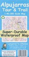
Wandelkaart Tour & Trail Alpujarras | Discovery Walking Guides
Scheur- en watervaste wandelkaart van de Alpujarras met hoogtelijnen en graden. For the best adventures, use the best map. The Moorish white villages of the Alpujarras are well known to day trippers from the Costa del Sol. For walkers this is an idyllic region with stone-laid donkey trails linking the tipico villages and stretching up the southern slopes of the Sierra Nevada to Mulhacen; at 3,483 metres the highest mountain peak on mainland Spain. From Spring to the end of Autumn this is a paradise for hikers, whether you are walking from village to village sampling the local delicacies or tackling the challenging major ascents. One thing you will know is that using the Alpujarras Tour & Trail Map will help you plan, and get the best out of, your adventures.   On a large 960mm by 700mm, double sided, map sheet at 40k scale this map has all the detail you need. 20 and 100 metre contours, combined with altitude shading, giving you a true feel to this impressive landscape.  Stretc…
15,95
Wandelkaart Tour & Trail La Palma | Discovery Walking Guides
Goede, scheur- en watervaste, wandelkaart van La Palma. Water-proof, split-proof, tear-proof, adventure-proof.  La Palma Tour & Trail Super-Durable Map is simply the toughest, most accurate, easy to read, easy to use map of the island you can buy at any price.  Super-Durable Maps now come with a 2 year adventurous use wear and tear guarantee, see Discovery Walking Guides website for details.    7th Edition of our La Palma Tour & Trail Super-Durable Map is a large 1:40,000 scale map, splitting the island into a North (Landscape view) and South (Portrait view) with a generous overlap, produces double sided map of 840mm by 600mm and folds to 235mm by 120mm. Our legendary 'Tour & Trail' level of detail ranges from major roads to secondary roads to minor roads to streets and camino rural narrow country roads, plus dirt roads and walking trails.  Altitude background colouring is designed to clearly show the altitude range when travelling across the island by car or on foot. 100 metre and 50 …
15,95
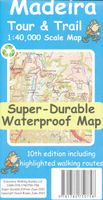
Wandelkaart Tour & Trail Madeira | Discovery Walking Guides
Goed gedetallieerde wandelkaart van Madeira, schaal 1:40.000, scheur en watervast papier. Wandelroutes staan ingetekend. Our large 1:40,000 scale, combined with splitting the island into East and West with a generous overlap, produces double sided map whose total size is 840mm by 600mm and folds to 235mm by 120mm. You get the most detailed map of Madeira that is produced including our 'Tour & Trail' level of detail ranging from major roads to secondary roads to minor roads to streets and camino rural narrow country roads, plus dirt roads and walking trails. Altitude background colouring is designed to clearly show the altitude range when travelling across the island by car or on foot. 100 metre and 50 metre contours are clearly shown on the map along with a large number of individual height points and all of the official 'Trig' points. Tour & Trail attention to detail is legendary as is our useful symbol range including miradors, picnic areas, petrol stations, bar/restaurants and parki…
15,95
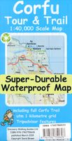
Wandelkaart Tour & Trail Corfu - Korfoe | Discovery Walking Guides
Goede wandelkaart van Korfoe. Scheur- en watervast. Corfu Tour & Trail Super-Durable Map is the most detailed, accurate, toughest, large scale map of the island that you can buy. Super-Durable Maps now come with a 2 year adventurous use wear and tear guarantee, see Discovery Walking Guides website for details. Our large 1:40,000 scale produces a double sided map sheet of 840mm by 680mm; big enough to show masses of detail but compact enough to use in the car or on the trail.   Corfu North is on the facing sheet of the map with Corfu South on the reverse side, including a generous overlap between the two sides. Our special concertina map fold means your map is easy to unfold, and more importantly easy to refold back to its pocket size. You get the most detailed map of Corfu that is produced including our 'Tour & Trail' level of detail ranging from major roads to secondary roads to minor roads to streets and narrow country roads, plus dirt roads and walking trails.   We have a new method…
15,95
Wandelkaart Tour & Trail Zakynthos | Discovery Walking Guides
Goede scheur- en watervaste wandelkaart van Zakynthos. For the best adventures, use the best map. Water-proof, split-proof, tear-proof, adventure-proof. Zakynthos (Zante) Tour & Trail Super-Durable Map is simply the toughest, most accurate, easy to read, easy to use map of the island you can buy at any price.   Super-Durable Maps come with a 2 year adventurous use `Wear and Tear' guarantee. A large 840mm by 694mm double sided map sheet has Zakynthos (Zante) at 1:35,000 scale with the North-West of the island on the cover side and the South-East on the reverse. There is a very generous overlap between the two sides so the only time you need to turn the map over is if you are driving from Cape Skinari (NW) to Cape Gerakas (SE) at the opposite end of the island.   Our special concertina map fold makes our map easy to use and easy to refold to its 235mm by 120mm pocket size. You can also download the digital Custom Map edition of our Zakynthos Tour & Trail Map for use with Garmin gps units…
15,95
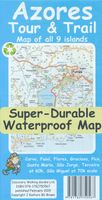
Wandelkaart Tour & Trail Azores - Azoren | Discovery Walking Guides
Gedetailleerde kaart van de Azoren. Met heel veel wandelroutes, al dan niet gemarkeerd. For the best adventures, use the best map. Azores Tour & Trail Super-Durable Map is the most detailed, accurate, toughest, large scale map of these 9 islands that you can buy.    1:60,000 scale for each island, Sao Miguel at 70,000 scale, produces a double sided map sheet of 960mm by 694mm; big enough to show masses of detail but compact enough to use in the car or on the trail. Faial, Pico, Santa Maria and Sao Jorge are on the facing sheet of the map with Corvo, Flores, Graciosa, Sao Miguel and Terceira are on the reverse side. Our special concertina map fold means your map is easy to unfold, and more importantly easy to refold back to its pocket size.   You get the most detailed map of the Azores islands that is produced including our 'Tour & Trail' level of detail ranging from major roads to secondary roads to minor roads to streets and narrow country roads, plus dirt roads and walking trails. We…
15,95
Wandelkaart Tour & Trail Malta & Gozo | Discovery Walking Guides
Goede scheur- en watervaste wandelkaart van Malta & Gozo. For the best adventures, use the best map. Water-proof, split-proof, tear-proof, adventure-proof. Malta and Gozo Tour & Trail Super-Durable Map is simply the toughest, most accurate, easy to read, easy to use map of the island you can buy at any price.   Super-Durable Maps come with a 2 year adventurous use `Wear and Tear' guarantee. A large 840mm by 694mm double sided map sheet has Malta at 1:32,000 scale on one side, with Gozo at 1:20,000 scale on the reverse. Our special concertina map fold makes our map easy to use and easy to refold to its 235mm by 120mm pocket size.   Our legendary 'Tour & Trail' level of detail ranges from major roads to secondary roads to minor roads to streets and narrow country roads, plus dirt roads and walking trails. Altitude background colouring is designed to clearly show the altitude range when travelling across the islands by car or on foot. 100 metre and 20 metre contours are clearly shown on t…
15,95

Klanten-reviews van Wandelkaart Tour & Trail Costa de Sol - Axarquia | Discovery Walking Guides

Er zijn nog geen beoordelingen voor dit productBen jij de eerste die een review plaatst?

Meer over Wandelkaart Tour & Trail Costa de Sol - Axarquia | Discovery Walking Guides

Productomschrijving

Goede wandelkaart van de omgeving Nerja - Competa in het binnenland. For better adventures, use the best map. Costa del Sol (Axarquia) Tour & Trail Super-Durable Map comes with a 2 year adventurous use wear and tear guarantee against splitting or falling apart, see Discovery Walking Guides website for details. From 1 April 2020 a free Custom Map digital edition for Garmin users is available to download from the Discovery Walking Guides website.   Our large 1:40,000 scale, combined with splitting the region into West and East sections with a generous overlap, produces double sided map whose total size is 840mm by 700mm that folds to a pocketable 240mm by 120mm. Costa del Sol (Axarquia) covers the region from Ventas de Zafarraya in the North-West to Almunecar in the South-East; approx 3 42'W to 4 08'W and 36 43'N to 36 58'N. You get the most detailed map of the region that is produced including our 'Tour & Trail' level of detail ranging from major roads to secondary roads to minor roads to streets and narrow rural country roads, plus dirt roads and walking trails.   Altitude background colouring is designed to clearly show the altitude range when travelling across the region by car or on foot. 100 metre and 50 metre contours are clearly shown on the map along with a large number of individual height points. Tour & Trail attention to detail is legendary as is our useful symbol range including miradors, picnic areas, petrol stations, bar/restaurants and parking areas where you can pull off the road safely.   You will easily identify springs, caves, quarrys, sports grounds, cemeterys, churchs, chapels, lighthouses, towers and forts, camping areas, wind turbines, hotels and golf courses. For adventurers on foot Tour & Trail Maps are researched and designed by hikers for use by hikers. Our comprehensive gps ground surveys produce the best road mapping available but the value of this on the ground research becomes even more important when you leave the tarmac.   All of our DWG walking routes are accurately gps surveyed giving you confidence in the accuracy of our Tour & Trail Maps. Costa del Sol (Axarquia) Tour & Trail Super-Durable Map includes all the walking routes from Walk! the Costa del Sol (Axarquia) which are specially highlighted (red outline) while the official GR (Gran Recorido) long distance trails are also specially highlighted (green outline) along with other local hiking routes. It all adds up to the most detailed, most durable, most useful map of the Costa del Sol (Axarquia) that you can buy anywhere.   Super-Durable Maps are printed with 100% oxygenation inks on Polyart by the UK's leading map printer, which produces a map that feels like silk but will stand up to the roughest treatment of outdoor adventuring and yet fold up like new at the end of your adventure. 'Special Concertina Map Fold' makes Tour & Trail Maps easy to use, and more importantly easy to fold back to their handy pocket size. Polyart is made of high-density polyethylene (HDPE) and is therefore 100% recyclable in category 2 HDPE.  
Webshop.nl maakt gebruik van cookies. Ga je verder op onze website, ga dan akkoord met het plaatsen van cookies en de verwerking van deze data door ons en vermelde partners.