webshop.nl
Categorieën
  Sluiten

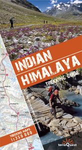
Wandelgids Trekking Guide Indian Himalaya | TerraQuest

Gids met uitgebreide omschrijvingen van 22 wandelroutes. Inclusief detailkaarten, schaal 1:350.000, met gemarkeerde routes en hoogtelijnen. Verder informatie over eten en drinken, aanbevolen uitrusting, vervoer ter plaatse en informatie over afstand en tijd van de trektochten. De omschreven tochten zijn in de volgende gebieden: Kashmir, Ladakh, Zan...
30,95

Webshops met dit product

Webshop
Bezorging
Prijs

Anderen bekeken ook

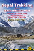
Wandelgids Nepal Trekking and the Great Himalaya Trail: A Route and Planning Guide | Trailblazer Guides
With extensive sections to help you choose your trekking region, this is a route and planning guide for anyone organising a trekking holiday in Nepal. It includes the most popular routes as well as the newest trekking areas plus the most extreme route of all, the Great Himalaya Trail. There are route guides to the following regions: Kanchenjunga, Makalu, Rolwaling, Solu-Khumbu (Everest Region), Helambu & Langtang, Ganesh & Manaslu Annapurna, Naar & Phu, Mustang Dolpo, The Far West The guide covers: Visas, permits, fees and equipment Choosing a trek – independent tea-house trekking or guided treks arranged through trekking agencies; choosing a guide and crew; when to go; trekking grades and duration Kathmandu & Pokhara city guides – hotels, restaurants, what to see Nepal background – people, religions, festivals and etiquette Health, safety and responsible tourism Colour mapping – showing the main trekking routes in Nepal The Great Himalaya Trail Running the entire 4500 km length of the…
23,50
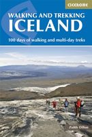
Wandelgids Walking and Trekking in Iceland - IJsland | Cicerone
Wandelgids met beschrijvingen, kaarten en praktische informatie zoals bussen, overnachten, etc. voor meerdaagse wandelroutes en dagwandeltochten op IJsland. A country of extraordinary beauty, Iceland’s incredible variety of volcanic and glacial landscapes makes it a unique destination for walking and trekking holidays. Its three national parks include the mighty Vatnajökull, largest national park in Europe.   The wide range of routes in this book introduce walkers and backpackers to this ‘Land of Ice and Fire’. There are 100 days of walking in this guidebook, stretching over 1722km, split between 49 day walks and 10 multi-stage treks. They climb mountains, cross glaciers, pass lakes and explore coastlines and geothermal areas, and range from easy nature trails to challenging treks. So, there is enough variation to satisfy all kinds of walkers. The routes are spread all around Iceland, grouped into twelve regions. Detailed information is given at the start of each route or trekking stag…
26,95
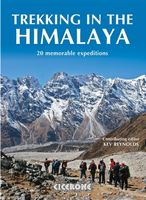
Wandelgids Trekking in the Himalaya | Cicerone
Cicerone wandelgids van Himalaya met 20 uitdagende trekkingen.  The Himalaya have always fed the dreams and called to those who love wild places. Stretching from Pakistan through Northern India, Nepal, Tibet and Bhutan, this book includes 20 descriptions of the best, and most spectacular treks in the range. From glaciers to jungle, snow-swept passes to plunging valleys, remote plateaus to bustling base camps, the Himalaya offer an unparalleled wealth of landscapes and trekking opportunities.   This inspirational guide was edited by trekking specialist Kev Reynolds, and written by a team of eight experienced authors, writers and guides. A compilation of the best walking in the Himalaya, it looks at each trek in turn, and discovers what makes the trek special, and entices with vivid accounts and breathtaking photography.   The Treks:   Pakistan K2 and Concordia Snow Lake Nanga Parbat India Zanskar Dream Trek (Ladakh) Nanda Devi (Garhwal and Kumaon) Kanchenjunga: Singalila Ridge and…
30,95
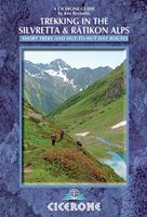
Wandelgids Trekking in the Silvretta and Ratikon Alps | Cicerone
Aanbevolen wandelkaarten bij deze gids: Schaal 1:60.000 Wandelkaart 14 Unterengadin | Kümmerly & Frey Wandelkaart 13 Davos - Arosa | Kümmerly & Frey Of schaal 1:25.000 Wandelkaart 26 Alpenvereinskarte Silvrettagruppe This guide describes three treks, between 5 and 8 days, in the Silvretta and Rätikon Alps starting near Klosters, and 12 half-day hut-to-hut routes. These contrasting ranges form a line on the borders of Switzerland, Austria and Liechtenstein. The Tour of the Silvretta, the Prättigauer Höhenweg and the Rätikon Höhenweg. Straddling the borders of Austria, Switzerland and Liechtenstein, the limestone Rätikon Alps reach into the snow-bound and glacier-hung Silvretta Alps to provide a richly diverse series of landscapes. The Tour of the Silvretta, the Prättigauer Höhenweg and the Rätikon Höhenweg, all within easy reach of Klosters, have been devised to help trekkers explore the best of the region. Given sifficient time they can also be combined to create a continuous 2-week to…
25,95
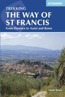
Wandelgids - Pelgrimsroute The Way of St Francis - Via Francigena | Cicerone
This guidebook to the Way of St Francis describes a 550km month-long pilgrim trail through the green heart of Italy. The route begins at Florence and goes through Assisi before its climax in Rome, exploring the mountains of Umbria, Tuscany and Lazio on the way. The route is split into 28 stages, each graded from 'easy' to 'hard'. Some stages include steep climbs and descents, but no special gear is required. Alongside a detailed route description, colour maps and accommodation information, the guidebook contains a concise biography of Francis of Assissi and stories of his life that relate to each location visited. Also included is a walking tour of the Seven Pilgrim Churches of Rome. This book is a trove of information that makes a perfect companion for anyone setting out to walk the Way of St Francis. The Way of St Francis is one of the most popular pilgrim routes in Italy, and it offers a great range of sights: olive groves, vineyards, Renaissance Florence, the Casentino National For…
24,95
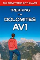
Wandelgids Trekking the Dolomites Av1 | Knife Edge Outdoor
Superhandige wandelgids voor de Alta Via 1 in de Dolomieten. Met deze gids heb je verder niks nodig: alle benodigde Tabacco wandelkaarten zitten in deze gids! The only guidebook exclusively for the AV1.Everything you need to know to plan and walk Italy's most popular long distance route.Real maps inside (Tabacco 1:25,000): the finest maps available for the Dolomites. This makes navigation easy and there is no need to carry additional maps. Also includes:* Numbered waypoints linking maps to text* Unique Itinerary Planner: plan a bespoke itinerary to match your ability and vacation schedule. All difficult calculations of time, distance and altitude gain are done for you* 7 Proposed Itineraries of between 6 and 11 days* Everything the trekker needs to know to plan the route: route descriptions, costs, budget, difficulty, weather, how to get there, and more* Full accommodation listings: spectacularly situated mountain huts* Section on Camping* Exciting variants to the main route* Informati…
19,95
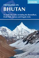
Wandelgids Trekking in Bhutan | Cicerone
Bijzondere uitgave van deze gerenommeerde wandelgidsen-uitgever: vol met dagtochten en meerdaagse trekkings in dit fascinerende koninkrijk. Praktische informatie als route, zwaarte etc en schetsmatig kaartmateriaal. A guidebook to 22 multi-day treks in the Himalayan Kingdom of Bhutan, including the Jhomolhari, Druk Path and Dagala treks. The trails vary from 2 to 23 days long. The routes are mostly in western and central Bhutan, and range from easy to strenuous depending on the length, altitude and difficulty. Includes advice on cultural awareness. Boasting soaring snow-clad peaks and tranquil valleys, and a rich Buddhist culture, Bhutan is an ideal destination for trekkers wishing to experience the magic of the Himalaya without the commercialism. Although independent trekking is not permitted, it can nonetheless prove difficult to obtain information. This guide describes 22 official treks and a handful of trek variants, with comprehensive advice about planning and preparation and plen…
27,95
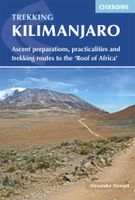
Wandelgids Kilimanjaro trekking | Cicerone
Goede trekking - wandelgids van de Kilimanjaro. Beklimmingen kunnen van alle kanten in vele vormen en vrijwel alle routes staan goed beschreven  in deze gids. Veel praktische informatie en een duidelijke routebeschrijving, duidelijke enigszins schetsmatige kaarten en een uitgebreide inleiding over wat je wel en niet moet meenemen, regelen en voorbereiden. At 5895m, Kilimanjaro is Africa's highest point and the highest freestanding mountain in the world, yet it is possible to reach its summit, Uhuru Peak, without any technical climbing ability. However, that is not to say that it is an easy undertaking: each year, many people fail in their attempt, often due to poor preparation or insufficient acclimatisation. Those who do make it to 'the Roof of Africa' are richly rewarded, enjoying outstanding views, the unique experience of being 'on top of the world' and, of course, a tremendous sense of achievement.   Guidebook describing all the trekking routes on Kilimanjaro (5895m), one of the S…
23,95
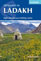
Wandelgids Trekking in Ladakh | Cicerone
Cicerone wandelgids van Ladakh met acht uitdagende trekkingen.    This trekking guidebook gives detailed descriptions of eight different treks across the Ladakh, Zanskar and Markha Valley in northern India. Ranging from moderate difficulty to very demanding, each trek is broken down into multiple stages, and has information on difficulty, available accommodation and access, as well as the many combinations and alternative routes open to exploration.    Known as Little Tibet; for both its landscape and culture, Ladakh lies at the northern tip of India. The region is bisected by the great River Indus and neighbours Tibet and Kashmir. This quiet corner of the Himalaya has developed a strong trekking culture over recent years for adventurous trekkers. Trekking in this remote, high-altitude region is extremely challenging, as paths are not signed and there are only a limited number of villages. However, its magnificent landscape (a huge area full of limitless trekking possibilities), hos…
33,95
Wandelgids Trekking in the Apennines - Apennijnen | Cicerone
Uitstekende wandelgids die in etappes de route nauwkeurig beschijft; ook de zijtakken en alternatieve routes koman aan bod. Kaarten zijn schetsmatig en in onze ogen onvoldoende bij slechte weersomstandigheden. Wij raden dan ook om er losse kaarten bij te kopen, voor zover verkrijgbaar! Guidebook to the Grand Apennines Trek, or Grande Escursione Appenninica (GEA). Through Tuscany and Emilia-Romagna and two National Parks, this 400km, 23 day trail explores the mountains, forests and hills of central Italy. Suitable for a range of walkers, it can be split into shorter sections or day walks if needed. This guidebook describes the Grande Escursione Appenninica (GEA), a nearly 400km long, three week trek crossing the Appenines in 23 stages, from Bocca Trabaria to Passo Due Santi on the edge of Liguria. The route dips in and out of Tuscany and Emilia-Romagna, never dropping below 400 metres. Best walked between spring and autumn, it is suitable for any reasonably fit walker. Highlights includ…
22,95

Klanten-reviews van Wandelgids Trekking Guide Indian Himalaya | TerraQuest

Er zijn nog geen beoordelingen voor dit productBen jij de eerste die een review plaatst?

Meer over Wandelgids Trekking Guide Indian Himalaya | TerraQuest

Productomschrijving

Gids met uitgebreide omschrijvingen van 22 wandelroutes. Inclusief detailkaarten, schaal 1:350.000, met gemarkeerde routes en hoogtelijnen. Verder informatie over eten en drinken, aanbevolen uitrusting, vervoer ter plaatse en informatie over afstand en tijd van de trektochten. De omschreven tochten zijn in de volgende gebieden: Kashmir, Ladakh, Zanskar, Lahul, Rupshu, Spiti, Kinnaur, Garhwal, Kumaon en Sikim.   This guidebook is unique in presenting detailed descriptions of 22 trekking itineraries in the Indian Himalaya. The routes have been especially devised to pass through the most scenic and culturally interesting regions of northern India. The information on the distance and time needed to cover particular route sections makes it easy for experienced trekkers and trekking novices alike to plan their trip in great detail.    Maps and height profiles Each trek description includes a 1:350 000-scale map (with the route marked on it) and a height profile diagram that reflects landform features. This is what makes the guidebook unique and – even more importantly – invaluably useful when trekking the Himalaya mountains.   Practical information The guidebook offers all kinds of indispensable tips: from food and drink, through recommended equipment, to transportation. You will find it priceless to learn which time of the year to choose for your expedition, and what to look out for to make it safe.   Exceptional part of the Himalaya The Indian Himalaya are less frequented than Nepal, another famous expanse of the highest mountains in the world. It is a truly extraordinary place, untouched by Western civilization. The region's allure is its amazing wildlife, as well as the inimitable culture and traditions of its native people.
Webshop.nl maakt gebruik van cookies. Ga je verder op onze website, ga dan akkoord met het plaatsen van cookies en de verwerking van deze data door ons en vermelde partners.