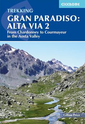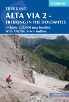
Wandelgids Trekking Gran Paradiso: Alta Via 2 : From Chardonney to Courmayeur in the Aosta Valley | Cicerone

0
A guidebook to trekking Alta Via 2, a route of 148km, from Chardonney and Courmayeur in the Gran Paradiso National Park. While not high on the difficulty scale, Alta Via 2 is strenuous, and best suited to trekkers with some alpine experience. Fittingly perfectly into a two-week time slot, the route is best undertaken between late June and late Sep...

Verkopers met dit product

Webshop
Bezorging
Prijs
DeZwerver.nl logo
DeZwerver.nl
niet bekend
27,50

Anderen bekeken ook

Nieuw
Wandelgids Walking the Via Francigena part 3 Lucca to Rome | Cicerone
Guidebook to the final 400km of the Via Francigena pilgrim route from Lucca to Rome. Crossing Tuscany in the heartland of Italy, the route goes through two of the region's most important cities, Lucca and Siena, and visits San Gimignano, Monteriggioni, and Radicofani. Described in 18 stages, with information on facilities and pilgrim hostels. Certified by the Council of Europe as an official Cultural Route, the Via Francigena from Canterbury to Rome brings to the modern pilgrim the cultural heritage of four nations--England, France, Switzerland, and Italy--and highlights their natural beauty and their history. Each stage has route directions and 1:100,000 mapping, which shows the route line and the facilities available at different locations. The book details accommodation along the route, including invaluable information on low-cost pilgrim hostels. There are city maps for Lucca, Siena, Rome, and Viterbi, and a stage planning guide that lists intermediate distances between pilgrim ac…
24,95
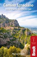
Wandelgids Camino Ignaciano Loyola - Manresa 675 km | Bradt Travel Guides
In 1522 Ignatius of Loyola made a pilgrimage from his home in Spain's Basque country to Montserrat and Manresa. This new guide from Bradt provides all the information needed to follow in his footsteps in a neat, easy-to-carry portable format, including an essential mix of practicalities, such as when to go, where to stay along the route, national parks and public transport, and a detailed breakdown of the route's 27 stages. Start and finish points, level of difficulty, duration, distance, ascent and descent, and route descriptions are all included, as well as elevation charts, maps and what to see along the way. This is a unique secular walking guide to a religious-themed walk which takes intrepid hikers from the imposing tower house and sanctuary of Loyola in the Basque Country, up through the stunning Basque mountains and down to the beautiful town of Laguardia with its myriad wine caves. Through the vineyards of Alava and world-famous La Rioja, the trail visits lively Logroño and f…
23,95
Wandelgids Alpe-Adria Trail | Bradt Travel Guides
Goede wandelgids met heel veel praktische informatie. Naast een duidelijke beschrijving van de route veel adressen om te kunnen overnachten. Per etappe wordt er een hoogteprofiel gegeven, kaartmateriaal is iets minder van kwaliteit, per deel van de route wordt verwezen naar de echte wandelkaarten.  This is the first English-language guide to the epic new 750-km hiking route through the mountains of Austria, Slovenia and Italy, from the foot of the Grossglockner (at 3,798m, the highest peak in Austria and the Eastern Alps) to Muggia near Trieste on the Adriatic coast. Detailed maps and route descriptions for all 44 stages of the route are included, with a clear breakdown of time, distance and ascent for each stage. Published in a small, handy-sized format which is easy to pack and carry, it is written by an expert who has authored over half a dozen hiking guides and who specialises in Eastern and Central Europe. He has been a regular visitor to the borderlands of Slovenia, Austria and …
20,95
Nieuw
Wandelgids Portugal's Rota Vicentina | Cicerone
This guidebook follows the Rota Vicentina, a 224km walking route along the marvellous Atlantic coastline in the Alentejo and Algarve regions of Portugal. The 12-stage trek combines two well-marked routes, the Caminho Histórico (the Historical Way) and the Trilho dos Pescadores (the Fishermen's Trail), to create a hike starting in Santiago do Cacém and ending at Cabo de São Vicente. The guide also describes an alternative circular route for those who would prefer an 11-stage loop, moving inland from Odeceixe and back up to Santiago de Cacém. Whichever route is chosen, the Rota Vicentina is ideal for a two-week holiday in spring or late summer to autumn, offering walkers a remarkable range of landscapes from coastal fishing villages to wooded river valleys. The guidebook includes advice about accommodation options along the route, information about the surrounding area, and a glossary of Portuguese terms to aid with reading signs and maps. Along the Rota Vicentina are many delights fo…
24,95
Wandelgids Camino Sanabrés & Camino Invierno | Camino Guides Brierley
140 pages paperback in full colour including:   Overview route planners Daily stage maps Contour guides Alternative routes & detours Detailed town plans List of all pilgrim hostels & hotels Historical notes Myths and Legends…   This guidebook combines two ancient routes into Santiago that remain largely undiscovered despite their historic significance. Each route offers a very different camino experience but are combined in one volume as they join in A Laxe for the final stages. Each provides the minimum distance required for a pilgrim to apply for a Compostela; but that is not the purpose of this guidebook which seeks to off er alternatives to the busy routes through Sarria and Tui which account for over 80% of all pilgrims to Santiago; by contrast the Camino Invierno currently carries less than 1%.    Camino Sanabrés offers a link from the Via de le Plata. This guide offers the last 5 stages of that itinerary commencing in Ourense with its rich Roman heritage and extant thermal bath…
21,50
Wandelgids Across the eastern alps: E5 | Cicerone
Launched on the shores of beautiful Lake Constance, this well-established long-distance European pathway (600km) takes 30 days to make its way through a remarkable kaleidoscope of landscapes and culture spanning rural alpine regions in Germany, Switzerland, Austria and Italy. Passes as high as 2900m above sea level are crossed en route to the northern Italian city of Bolzano. Gentler gradients follow as the E5 bears south parallel to the mighty Adige river through the Lagorai, Pasubio and Lessini groups. The final destination is marvellous Verona, romantic city par excellence. A well-organised network of alpine refuges and cosy guesthouses welcome walkers along the route, and convenient transport links make it possible to join or leave the trek at virtually every stage to fit in with individual holiday needs. Traverses the Allgauer, Lechtaler and Ötztaler Alps Visits spectacular geological sites and First World War remains Can be easily split into shorter stages
21,95
Wandelgids Via Egnatia on Foot 2 | Via Egnatia Foundation
Via Egnatia on foot, Part 2, covers a distance of more than 550 kilometers. The book starts just as our first book with practical tips for travellers (chapter 1) and a description of the history of the Via Egnatia (chapter 2). In chapter 3 all relevant aspects of the trail are described in a general way. For instance conditions of the road, description of the landscape and the practical use of the maps. In chapter 4 you will find detailed information on the original Via Egnatia stages of the trail; long distances are cut up into separate walking sections. Each stage/section provides a description and a map of the track, interesting historical and cultural facts and monuments, illustrated with beautiful pictures. At the end we present the traveller two options to enter Turkey: one leads you to Edirne, the other one crosses the border to Ipsala.   In general this trail is not difficult for walkers, although after heavy rain it may be less easy and circumstances may differ considerably, …
22,95
Wandelgids Trekking in the Everest Region | Trailblazer Guides
Een groot aantal trekkings worden per etappe beschreven. Veel praktische informatie. Een uitstekende reisgids, kaarten zijn soms wat beperkt. Fully revised six edition of this practical guide with 60 detailed route maps covering not only the classic treks but also the wild routes: Everest expedition route Rolwaling Trekking from Lukla Salpa-Arun The Gokyo trek High passes Trekking peaks - including Mera and Island Peak Information for all budgets and trekking styles Ranging from lush terraced fields to the highest mountain on earth, the scenery is breath-taking. There are trekking possibilities to suit all budgets - from independent trekkers on a shoestring staying in simple lodges with Sherpa families to travelers on all-inclusive guided treks with every luxury provided. Getting to Nepal from Europe, North America and Australasia Kathmandu -- trekking preparations and what to see Where to stay and eat -- Kathmandu and along the trails Employing a guide or porter in Nepal The environm…
23,50
Wandelgids Trekking in the Karakoram | Cicerone
A guidebook to 3 high-altitude treks in Pakistan’s Karakoram mountains, plus 2 shorter routes on the flanks of Nanga Parbat in the neighbouring Himalaya. With the exception of the Fairy Meadows trek, all the routes are strenuous and are recommended for experienced trekkers.   The guide includes 3 treks of 12 days each (excluding rest days): Biafo to Hispar via Snow Lake; a K2 Base Camp Trek; and a crossing of Gondogoro La. The Nanga Parbat routes visit Fairy Meadows (3 days) and Diamir or West Face (5 days).   Route description illustrated with 1:100,000 mapping and elevation profiles Advice on planning and preparation, including trek operators Safety considerations History of mountaineering and exploration in the Karakoram Offers views of 5 of the world’s 8000m peaks
34,95
Wandelgids GR221 Mallorca's Long Distance Trail | Discovery Walking Guides
Gedetailleerde beschrijving van de GR 221 op Mallorca, met veel praktische informatie, hoogteprofielen, goed kaartmateriaal etc. Achterin ook nog eens veel GPS - waypoints. Bijna onmisbaar bij het lopen van de route! Walk! GR221 Mallorca's Long Distance Trail - The Dry Stone Way. If you want to get away from it all , there is no surer way than strapping on your boots, shouldering your backpack, and embarking on a long distance path; and there are few long distance paths more beguiling and more crammed with adventure than Mallorca s GR221, La Ruta de Pedra en Sec or The Dry Stone Way. Anybody who has visited Mallorca will appreciate the justice of the GR221's title. Following ancient bridleways along the length of the Tramuntana range, from Port d'Andratx in the southwest to Pollenca in the northeast, the GR221 touches on dry stone in its every manifestation, from the raw rock of the peaks and sweeping fields of karst to the tailored stones that have always been the island's building m…
18,50

Klanten-reviews van Wandelgids Trekking Gran Paradiso: Alta Via 2 : From Chardonney to Courmayeur in the Aosta Valley | Cicerone

Er zijn nog geen beoordelingen voor dit productBen jij de eerste die een review plaatst?

Meer over Wandelgids Trekking Gran Paradiso: Alta Via 2 : From Chardonney to Courmayeur in the Aosta Valley | Cicerone

Productomschrijving

A guidebook to trekking Alta Via 2, a route of 148km, from Chardonney and Courmayeur in the Gran Paradiso National Park. While not high on the difficulty scale, Alta Via 2 is strenuous, and best suited to trekkers with some alpine experience. Fittingly perfectly into a two-week time slot, the route is best undertaken between late June and late September.   The route is described across 12 stages (with a 4-stage extension option in place of Stages 6 and 7). Stages range from 5 to 18km, with stage ascent varying from 50m (Stage 8) to 1400m (Stage 9). Net ascent is 9630m. The route is described east to west so trekkers are rewarded with the beauty of Mont Blanc at the journey's end.   GPX files available to download Detailed information on travel logistics, the mountain hut network, as well as kit requirements Trek-specific Italian-English glossary included Information given on local alpine flora and wildlife Sized to easily fit in a jacket pocket

Verken gerelateerde categorieën

Webshop.nl maakt gebruik van cookies. Ga je verder op onze website, ga dan akkoord met het plaatsen van cookies en de verwerking van deze data door ons en vermelde partners.