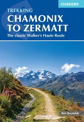

Wandelgids Chamonix to Zermatt | Cicerone

0
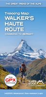
Uitstekende wandelgids die in etappes de route nauwkeurig beschrijft; ook de zijtakken en alternatieve routes koman aan bod. Kaarten zijn schetsmatig en in onze ogen onvoldoende, zeker bij slechte weersomstandigheden. Wij raden dan ook om er losse kaarten bij te kopen. A guidebook to the classic Chamonix to Zermatt trek from Mont Blanc to the Matt...

Alle aanbiedingen van dit product

Verkoper
Bezorging
Prijs
DeZwerver.nl logo
DeZwerver.nl
2,95
25,95

Anderen bekeken ook

Wandelgids Chamonix to Zermatt | Cicerone
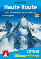
Uitstekende wandelgids die in etappes de route nauwkeurig beschrijft; ook de zijtakken en alternatieve routes koman aan bod. Kaarten zijn schetsmatig en in onze ogen onvoldoende, zeker bij slechte weersomstandigheden. Wij raden dan ook om er losse kaarten bij te kopen. A guidebook to the classic Chamonix to Zermatt trek from Mont Blanc to the Matterhorn. The 225km Walker's Haute Route through the French and Swiss Alps crosses 11 passes, gains more than 14,000m in height and is a strong contender for the title of Most Beautiful Walk in Europe. The high-level route is described in 14 day stages, with optional variants, and is suitable for walkers with a good level of fitness and some previous alpine trekking experience. The final approach to Zermatt adopts the dramatic Europaweg, a high-level traverse of the east wall of the Mattertal, crossing the 500-metre suspension bridge at Randa. An alternative valley route to Zermatt can be taken if this does not appeal. Alongside clear route des…
25,95
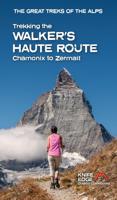
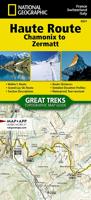
Wandelatlas 4001 Haute Route Chamonix to Zermatt | National Geographic
- Waterproof - Tear-Resistant - Topographic Map The Haute Route--aka the High Route or Mountaineers' Route--traverses the French and Swiss Alps. It was conceived as a summer mountaineering route in the mid-nineteenth century by members of the English Alpine Club. Though originally called The High-Level Route by members of the Alpine Club, in 1911, a group first successfully established a winter route from Bourg St. Pierre to Zermatt on skis and afterwards the name of the route was translated into French. As a result of their success, the French term stuck, and the journey gained a reputation amid skiers and ski mountaineers as a classic must-do winter/spring tour. There is also a non-technical Walker's Haute Route that has gained in popularity and become a classic in and of itself. This Topographic Map Guide outlines two different variations of the Haute Route from Chamonix, France to Zermatt, Switzerland: one for hikers and one for skiers. The northernmost route or, Walker's Route, d…
17,95
Klimgids - Klettersteiggids Chamonix Mountain Adventures | Cicerone
This is a comprehensive guidebook to the many outdoor activities available in the mountains surrounding Chamonix in the French Alps. Routes include walking, mountain biking, road cycling, via ferratas, rock climbing and mountaineering. There is something for everyone, from families to veteran mountain adventurers.   The Chamonix valley in the Haute Savoie region of the French Alps is a perfect base for a whole range of alpine adventures. The routes in this guide range from short walks and cycle rides for the whole family to long mountaineering routes to the highest summits, including Mont Blanc. Activities covered in detail include walks, treks, mountaineering routes, road cycling, MTBing, rock climbing, bouldering and via ferratas, all within easy reach of Chamonix – with suggestions for other outdoor options in the valley, too, from rafting to paragliding. Whether you and your holiday companions are adrenalin junkies or Alpine ramblers, or a mixture of both, there’s plenty to keep e…
25,95
Wandelgids Trekking in the Alps | Cicerone
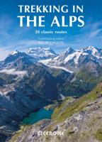
All the rich scenic diversity for which the Alps are renowned is celebrated here, while the 20 treks described include well-known classics as well as newly-created multi-day routes. The eight talented writers and photographers brought together to produce this book are among the most experienced of Alpine trekkers. Between them they have explored every corner of Europe’s premier mountain range, written dozens of guides and, in some cases, led trekking holidays there in order to share their enthusiasm for the Alps with other walkers. And that is the prime motivation for Trekking in the Alps – an inspiration and a celebration of the very best of these mountains. Best-known treks Tour of Mont Blanc; Tour of the Matterhorn; Tour of Monte Rosa; Walker’s Haute Route; Tour of the Jungfrau Region; Tour of the Vanoise; Dolomites AV 1 & 2 Longer trans-Alpine treks GR5 (Lake Geneva to Nice); Eastern Alps E5; Italian Alps GTA; Traverse of the Slovenian Alps For the Alpine adventurer Alpine Pass Ro…
31,95
Wandelgids The Swiss Alps | Cicerone
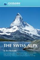
  The Swiss Alps are home to the highest and most spectacular mountains in Western Europe. This stunning guidebook describes each mountain area throughout Switzerland – the peaks, passes, valleys and bases – to help you identify the best destinations to plan your trip.   Questions such as ‘Where to walk, climb or ski?’, ‘What multi-day treks are available’ and ‘Where do they go?’, ‘Where are the mountain huts, what are their facilities, which peaks do they serve?’ And where are the most suitable valley bases?’ – all these and more are addressed in detail in this essential guidebook.   The Swiss Alps does not give detailed route directions but information is given about all the guides and maps available for every region.   The Swiss Alps by Kev Reynolds is the third book in Cicerone’s World Mountain Ranges series, which include The Pyrenees and Scotland.   descriptions of all the Swiss Alps, area-by-area from the Chablais Alps in the south west to the Silvretta in the north east classi…
34,95
Wandelgids Mont Blanc Walks | Cicerone
Uitstekende wandelgids van dit geweldige gebied. goed beschreven met veel praktische informatie om de route te kunnen lopen, inclusief redelijke kaarten. A guide to walking and trekking routes, on both the French and Italian sides of Mont Blanc (Monte Bianco), from Chamonix or Courmayeur. Includes 50 day walks and 4 short multi-day treks for Vallorcine to Plaine Joux, Tour des Aiguilles Rouges, Vallorcine to Servoz and a circuit of the Italian Val Ferret. New, updated edition with 50 new route maps. Seasons Mid-June to mid-September is the main season; before this there will be snow at higher and possibly lower levels, and earlier and later the huts will not be open. Centres St Gervais, Les Contamines, Servoz, Les Houches, Chamonix, Argentiere, Vallorcine and Courmayeur on the Italian side Difficulty mainly day walks, with some shorter walks and 4 short treks; ranges from easy to tough routes for experienced high-mountain walkers Must See Lac Blanc, the balcony routes, the Chamonix Ai…
25,95
Wandelgids Trekking the Tour du Mont Blanc | Cicerone
Uitstekende wandelgids die in etappes de route nauwkeurig beschijft; ook de zijtakken en alternatieve routes koman aan bod. Kaarten zijn schetsmatig en in onze ogen onvoldoende bij slechte weersomstandigheden. Wij raden dan ook om er losse kaarten bij te kopen. A guidebook to hiking the Tour du Mont Blanc (TMB), a spectacular circuit around Mont Blanc, Western Europe's highest mountain. Covering 170km (105 miles), the TMB takes around 11 days to walk from its official start at Les Houches (France), passing through Courmayeur (Italy) and Champex (Switzerland) before returning to France via the Chamonix valley. A well-serviced introduction to high-level mountain trekking for walkers with good levels of fitness, it can also be run, fastpacked or hiked in 5–9 days.   The route is described in both directions in 11 daily stages between 7 and 21km (5–13 miles) in length. Variant routes and alternative stages are also provided, giving the option of visiting cols, refuges and viewpoints no…
25,95
Wandelgids Hadrian's Wall Path | Cicerone
Meest duidelijke wandelgids van de route: veel details in kaarten en informatie, beide kanten op beschreven! The essential guidebook to walking the 84-mile Hadrian’s Wall Path. One of the UK's most visited National Trails, it runs the length of the Roman Wall from Bowness-on-Solway in Cumbria to Wallsend, Newcastle.   Begun in AD122 and stretching from the River Tyne to the Solway Firth, Hadrian’s Wall was a massive feat of engineering and is the best preserved frontier from the classical Roman Empire. Today it is a World Heritage Site, with iconic scenery and fascinating archaeological remains like Birdoswald, Housesteads and Vindolanda, giving a glimpse into Roman life and power. The trail is presented here in 10 stages, with suggestions for five and eight-day itineraries. It is suitable for beginners, although a reasonable level of fitness is required if doing it as a multi-day trek. The route is described both west to east and east to west, and the guidebook also features extensio…
24,95
Wandelkaart - Topografische kaart 1348 Zermatt | Swisstopo
Zeer gedetailleerde wandelkaart van een deel van Zwitserland. De topografische details van deze kaarten zijn onovertroffen; de werkelijkheid is perfect weergegeven op deze kaart van uitzonderlijk hoog niveau. Ze zijn geschikt voor alle soorten gebruik: voor eenvoudige wandeltochten in simpel terrein tot zware bergtochten en beklimmingen van de grote toppen in de Alpen. Bedenk wel dat de kaart in uiterlijk beperkt blijft tot de topografische details: er is geen toeristische informatie ingetekend als camping of gemarkeerde paden. Wandelpaden staan er wel op in gestippelde zwarte lijnen, maar zijn ondergeschikt aan de topografie. Als kaart is het de meest gedetailleerde die er te vinden is en - zoals gezegd - van topkwaliteit. De kaarten worden gemiddeld om de 3 tot 4 jaar vernieuwd, maar er zijn ook oudere kaarten die gewoon nog de laatste editie zijn. Voor de 'gewone' bergwandelaar zijn de Kompass-wandelkaarten die inmiddels bijna heel Zwitserland dekken wellicht nuttiger: schaal 1:50.…
15,95
Wandelgids The Cathar Way | Cicerone
Guidebook to the GR367 Cathar Way (Sentier Cathare) in the Languedoc region of southern France. The 260km waymarked trail from Port la Nouvelle on the Mediterranean to Foix traces the history of the Cathars through the Eastern foothills of the Pyrenees. Split into 13 stages and offering a northern variant, the route takes about 2 weeks to complete. Two of the southernmost départements of France, the Pyrénées-Orientales and Ariège are inextricably linked with the history of the Cathars, a heretical Christian sect who were subjected to a crusade in the thirteenth century. Striking castles built on jagged rocky precipices are a highlight of the region and a reminder of those turbulent times. This guidebook describes the 260km Cathar Way (Sentier Cathare or GR367), a long-distance trail from Port-la-Nouvelle on the Mediterranean coast to Ariége's departmental capital Foix linking several of the impressive Cathar castles. The route follows ancient footpaths, jeep tracks and country lanes a…
24,95

Klanten-reviews van Wandelgids Chamonix to Zermatt | Cicerone

Er zijn nog geen beoordelingen voor dit productBen jij de eerste die een review plaatst?

Meer over Wandelgids Chamonix to Zermatt | Cicerone

Productomschrijving

Uitstekende wandelgids die in etappes de route nauwkeurig beschrijft; ook de zijtakken en alternatieve routes koman aan bod. Kaarten zijn schetsmatig en in onze ogen onvoldoende, zeker bij slechte weersomstandigheden. Wij raden dan ook om er losse kaarten bij te kopen.

A guidebook to the classic Chamonix to Zermatt trek from Mont Blanc to the Matterhorn. The 225km Walker's Haute Route through the French and Swiss Alps crosses 11 passes, gains more than 14,000m in height and is a strong contender for the title of Most Beautiful Walk in Europe. The high-level route is described in 14 day stages, with optional variants, and is suitable for walkers with a good level of fitness and some previous alpine trekking experience. The final approach to Zermatt adopts the dramatic Europaweg, a high-level traverse of the east wall of the Mattertal, crossing the 500-metre suspension bridge at Randa. An alternative valley route to Zermatt can be taken if this does not appeal. Alongside clear route descriptions and mapping for each stage of the trek, there is essential practical information on travel to Chamonix and return from Zermatt, as well as advice on accommodation in alpine villages and mountain refuges, trekking safety, equipment, itinerary planning and preparation.  Taking 2 weeks to complete, this challenging but rewarding trek encompasses the greatest collection of 4000 metre peaks in the Alps – Mont Blanc, the Grand Combin, Dent Blanche, Weisshorn and the Matterhorn – and visits some of the most spectacular valleys, including the Val d’Hérens, Val d’Annivers and the Mattertal.   Steden en Dorpen Chamonix, Argentière, Trient, Champex, Sembrancher, Le Chable, Verbier, Arolla, Les Haudères, La Sage, Zinal, Gruben, St Niklaus, Zermatt

Productinformatie

    Verken gerelateerde categorieën

    Webshop.nl maakt gebruik van cookies. Ga je verder op onze website, ga dan akkoord met het plaatsen van cookies en de verwerking van deze data door ons en vermelde partners.