webshop.nl
Categorieën
  Sluiten

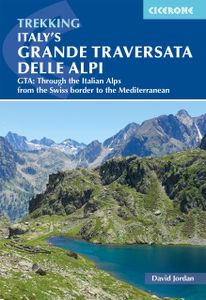
Wandelgids Italy's Grande Traversata delle Alpi GTA | Cicerone

Uitstekende beschrijving van de Grande Traversata della Alpi, een doorgaande meerdaagse wandeltocht door de Italiaanse ALpen aan de westkant. Goede routebeschrijving, schetsmatige kaarten, vol met nuttige en praktische informatie. A guidebook to Italy's Grande Traversata Delle Alpi (GTA) trek through the western Italian Alps. The 809km (503 mile) r...
26,50

Webshops met dit product

Webshop
Bezorging
Prijs

Anderen bekeken ook

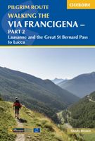
Wandelgids - Pelgrimsroute Via Francigena part 2 | Cicerone
Guidebook to the Via Francigena pilgrim route from Lausanne to Lucca. Starting at Lake Geneva (Lac Léman), the 725km route crosses the Alps at historic Great Saint Bernard Pass, descends the Po Valley, then climbs to cross the Cisa Pass into Tuscany. Described in 32 stages, with information on facilities and pilgrim hostels.   Seasons Suitable for walking in spring, summer and autumn. The Great Saint Bernard Pass is fully open to hikers only in August and September.   Centres Lausanne, Martigny, Great Saint Bernard Pass, Aosta, Ivrea, Vercelli, Pavia, Piacenza, Pontremoli, Pietrasanta, Lucca.   Difficulty Each stage is graded for difficulty (1-4). A few mountainous stages include steep and slippery slopes. No special gear is required to walk the Via Francigena in season, but off-season crossings of the Great Saint Bernard Pass require winter mountain gear and careful attention to changing mountain conditions.   Must See Dazzling Lake Geneva, the 1500-year-old Abbey of Saint…
22,95
Wandelgids Trekking in the Stubaier Alps | Cicerone
Uitstekende wandelgids van Cicerone over de Stubaier Alpen, waarbij de nadruk ligt op een tweetal meerdaagse routes: Huttentochten voor een gemiddelde en wat meer gevorderde wandelaar. Goede praktische informatie, kaartmateriaal beperkt. Aanbevolen wandelkaarten bij deze gids Schaal 1:25.000 Wandelkaart 31/1 Alpenvereinskarte Stubaier Alpen - Hochstubai Wandelkaart 31/2 Alpenvereinskarte Stubaier Alpen - Sellrain Of schaal 1:50.000 Wandelkaart 83 Stubaier Alpen Kompass Of all the many Alpine areas, few can match the Stubai in the Austrian Tyrol as a venue for a first Alpine season. Shapely peaks, good paths and some of the best huts in the Alps make it ideal for the novice who wants to extend their experience beyond Britain. Of all the many Alpine areas, few can match the Stubai in the Austrian Tyrol as a venue for a first Alpine season. Shapely peaks, good paths and some of the best huts in the Alps make it ideal for the novice who wants to extend their experience beyond Britain. This…
21,95
Wandelatlas 1 Grande traversata delle Alpi - GTA Noord. | National Geographic
De GTA, Great Crossing of the Alps, is een wandelroute die de hele westelijke Alpenboog van Piemonte en Ligurië/Frankrijk verenigt en is opgedeeld in een dicht netwerk van paden en tussenstops. De totale route van de GTA vormt een route van ongeveer 1000 km, een geweldige tocht in de bergen van de noordwestelijke grens van Italië.   De bundel bevat: - 315 km parcours - 21 etappes - 8 varianten - 13.000 m hoogte - Altimetrische profielen - Gedetailleerde cartografie schaal 1: 25 000 - De geschiedenis en geografie van de route. La collaborazione tra Libreria Geografica e National Geographic per la realizzazione del volume sulla Grande Traversata delle Alpi, parte nord, che accompagna gli amanti del trekking lungo magnifici sentieri per riscoprire la bellezza delle Alpi. La Grande Traversata delle Alpi è un itinerario escursionistico che unisce tutto l'arco alpino occidentale nella regione Piemonte e si articola su una fitta rete di sentieri e di posti tappa. 1000 chilometri di sentieri, …
18,95
Wandelatlas 2 Grande traversata delle Alpi - GTA Centro | National Geographic
De GTA, Great Crossing of the Alps, is een wandelroute die de hele westelijke Alpenboog van Piemonte en Ligurië/Frankrijk verenigt en is opgedeeld in een dicht netwerk van paden en tussenstops. De totale route van de GTA vormt een route van ongeveer 1000 km, een geweldige trekking in de bergen van de noordwestelijke grens van Italië.   De bundel bevat: - 418 km parcours - 22 etappes - 5 varianten - 58.000 m hoogte - Altimetrische profielen - Gedetailleerde cartografie schaal 1: 25 000 - De geschiedenis en geografie van de route.
18,95
Wandelatlas 3 Grande traversata delle Alpi - GTA Zuid | National Geographic
De GTA, Great Crossing of the Alps, is een wandelroute die de hele westelijke Alpenboog van Piemonte en Ligurië/Frankrijk verenigt en is opgedeeld in een dicht netwerk van paden en tussenstops. De totale route van de GTA vormt een route van ongeveer 1000 km, een geweldige tocht in de bergen van de noordwestelijke grens van Italië.   De bundel bevat: - 478 km parcours - 26 etappes - 7 varianten - 57.000 m hoogte - Altimetrische profielen - Gedetailleerde cartografie schaal 1: 25 000 - De geschiedenis en geografie van de route. Circa 1000 chilometri di sentiero, divisi in oltre 60 tappe, che attraversano le Alpi Occidentali sino a raggiungere il mare di Ventimiglia. Un saliscendi da una valle all'altra che attraversa piccoli paesi e alpeggi e permette di scoprire non solo culture alpine diverse, dai Walser ai Brigaschi, ma di ammirare molteplici paesaggi, dalle colline fino alle aree perennemente coperte di neve. Un'avventura e una sfida per gli escursionisti che inevitabilmente si innam…
18,95
Wandelgids Trekking in the Alps | Cicerone
All the rich scenic diversity for which the Alps are renowned is celebrated here, while the 20 treks described include well-known classics as well as newly-created multi-day routes. The eight talented writers and photographers brought together to produce this book are among the most experienced of Alpine trekkers. Between them they have explored every corner of Europe’s premier mountain range, written dozens of guides and, in some cases, led trekking holidays there in order to share their enthusiasm for the Alps with other walkers. And that is the prime motivation for Trekking in the Alps – an inspiration and a celebration of the very best of these mountains. Best-known treks Tour of Mont Blanc; Tour of the Matterhorn; Tour of Monte Rosa; Walker’s Haute Route; Tour of the Jungfrau Region; Tour of the Vanoise; Dolomites AV 1 & 2 Longer trans-Alpine treks GR5 (Lake Geneva to Nice); Eastern Alps E5; Italian Alps GTA; Traverse of the Slovenian Alps For the Alpine adventurer Alpine Pass Rou…
25,95
Wandelgids Lleyn Peninsula Coastal Path | Cicerone
Guidebook that describes a walkers’ route along the 95-mile coastal path that runs around the Lleyn Peninsula of north Wales from Caernarfon to Porthmadoc. Options for mountain and road bikes along the coastal path. Also includes circular walks and rides suitable for day excursions.  The western coastline of England and Wales has three peninsulas pushing out into the sea. The Cornish and Pembroke peninsulas have famous coast paths but the Lleyn peninsula of North Wales is less well known. Although the Lleyn cannot match the sheer scale of its bigger brothers it has no trouble competing when the grandeur of scenery is compared. The route connects the pilgrim sites leading to the remote island of Bardsey, dating back to the 6th century. In doing so its 95 miles cross a variety of landscapes from rocky cliffs to secluded bays. The nature of the landscape means that diversions inland have to be made, but although the route crosses hills and rises to over 1000ft in places the coast is alway…
18,50
Wandelgids Munich to Venice, The Traumpfad | Cicerone
Uitstekende wandelgids die in etappes de route nauwkeurig beschijft. This guidebook describes the 570km (354 mile) Traumpfad or 'Dream Way', an Alpine trek from Munich's Mariënplatz to the Piazza San Marco in Venice. The route is broken into 30 stages of between 5hrs 30mins and 9hrs, graded according to difficulty, with 5 alternative stages and the option to spend a day traversing a section of Italy's famous via ferrata in the Dolomites. Previous experience of Alpine trekking is not necessary as the route is suitable for most able walkers: however, a head for heights is essential.    Known as 'Europe’s playground', the Alps boast an unrivalled walking infrastructure and breath-taking views of angular peaks, flower-strewn valleys and verdant slopes. Hugely popular with German trekkers but little-known in the English-speaking world, Der Traumpfad revels in this stunning scenery. The route passes through German Bavaria then Austria before entering the Italian Tyrol, taking advantage of th…
23,95
Wandelgids The Pennine Way | Cicerone
Uitstekende wandelgids van de Pennine Way, waarbij naast alle noodzakelijke informatie ook gebruik gemaakt wordt van de echte topografische kaart. inclusief gidsje met routekaarten van 1:25000  Guidebook to the Pennine Way National Trail with OS map booklet. The 270 mile route from Edale to Kirk Yetholm takes three weeks to walk and is suitable for fit and experienced long distance walkers. The route crosses the Peak District, Yorkshire Dales and North Pennines National Parks. Includes separate OS 1:25,000 map booklet of the route. The Pennine Way is Britain's oldest, toughest long-distance footpath – and arguably its most iconic. Now a National Trail, the 427km (265½ mile) route from Edale in Derbyshire to Kirk Yetholm in the Scottish Borders offers wayfarers the opportunity to immerse themselves in wild beauty of the North. The Pennines boast rolling hills, sweeping moorland and wide glacial valleys, and the Pennine Way has come to embody personal challenge and adventure.    This gui…
23,95
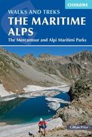
Wandelgids Walks and Treks in the Maritime Alps - Alpes Maritime | Cicerone
Uitstekende wandelgids van dit geweldige gebied. goed beschreven met veel praktische informatie om de route te kunnen lopen, inclusief redelijke kaarten. Guidebook to walking and trekking in the Maritime Alps on the border of Italy and France, just north of Nice. It includes 18 graded day walks, on both the French and the Italian sides, ranging from 6km to 20km in length and suitable for a range of abilities. There are also 6 long treks, including a 5-day traverse of the Parc National du Mercantour and a 7-day traverse of the Parco Naturale delle Alpi Marittime.   Detailed route descriptions sit alongside colour maps, and there is full information about accommodation options down in the valleys and up in the mountains. Useful French-English and Italian-English glossaries of walking terminology are included, too.    Rising to over 3000m above the sun-drenched French Riviera, the Maritime Alps form the western edge of the mighty Alpine chain. Wildflower lovers will also appreciate the re…
25,95

Klanten-reviews van Wandelgids Italy's Grande Traversata delle Alpi GTA | Cicerone

Er zijn nog geen beoordelingen voor dit productBen jij de eerste die een review plaatst?

Meer over Wandelgids Italy's Grande Traversata delle Alpi GTA | Cicerone

Productomschrijving

Uitstekende beschrijving van de Grande Traversata della Alpi, een doorgaande meerdaagse wandeltocht door de Italiaanse ALpen aan de westkant. Goede routebeschrijving, schetsmatige kaarten, vol met nuttige en praktische informatie. A guidebook to Italy's Grande Traversata Delle Alpi (GTA) trek through the western Italian Alps. The 809km (503 mile) route is presented in 55 stages with each stage ranging from 7-26km (4-16 miles). Beginning at the Nufenen pass at the Swiss border the route traverses the Lepontine, Pennine, Graian, Cottian and Maritime Alps to finish at Ventimiglia on the Mediterranean coast. With nearly 60,000m of ascent this route is suitable for fit and experienced alpine trekkers. This guidebook contains route description and 1:00,000 mapping for each stage as well as information on the region's history, culture and wildlife. Accommodation, facilities and public transport information is also given to help with trek planning. Italy's western Alps is an area of high mountain passes, sparkling lakes, clean air, and alpine meadows rich in wildflowers. With a network of paths that enabled travel long before the motor car, the region is ideally suited to exploring on foot. From Switzerland to the Mediterranean, the GTA enables the visitor to travel the old ways through the mountains, hearing the stories, sampling the regional specialties in food and wine, and experiencing the famously warm welcome of the Italian people. Content: Introduction The GTA Trek Italy’s Western Alps Piedmont Walking the GTA When to Go Getting There Local Transport How to Use this Guide Dos and Don’ts Emergencies Waymarking and Maps What to Take Accommodation Telephones Food and Drink Vegetation Wildlife GTA Route Description Part I: The Ligurian and Maritime Alps Part II: The Cottian Alps Part III: The Graian Alps Part IV: The Pennine Alps Route Summary Appendix I: Tourist Information Appendix II: Main Peaks along the GTA Appendix III: Italian–English Glossary Appendix IV: Further Reading  
Webshop.nl maakt gebruik van cookies. Ga je verder op onze website, ga dan akkoord met het plaatsen van cookies en de verwerking van deze data door ons en vermelde partners.