Wandelgids The Thames Path | Cicerone

0
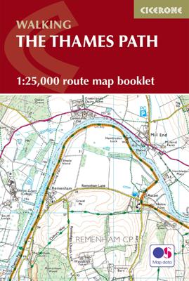
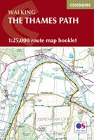
All the mapping you need to complete the 182 mile (290km) Thames Path National Trail, from the Woolwich Foot Tunnel in London to the river's source in Gloucestershire. This booklet is included with the Cicerone guidebook to the Thames Path, where the route is divided into 20 stages, with each stage ranging from 4 to 16 miles. This gentle riverside...

Verkopers met dit product

Verkoper
Bezorging
Prijs
DeZwerver.nl logo
DeZwerver.nl
2,95
18,50

Anderen bekeken ook

Wandelgids Thames Path | Trailblazer Guides
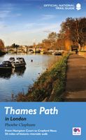
This book follows the Thames Path National Trail from the river's source in Gloucestershire to the Thames Barrier in London. Officially 184 miles (294km) in length (although the actual distance you walk will depend on a number of decisions you make en route), the path meanders, accompanied by its watery muse, through pristine and tranquil countryside, past historic sites and buildings, via pub, lock, weir, and the occasional scattering of waterfowl, to a city, once the fulcrum of an empire, and now the heart of modern day England. The river, responsible for the metropolis' very being, tells tales, inspires artists, accommodates swans, geese, and water voles, reflects the silhouettes of red kites and kingfishers, provides employment, entices adventure, and allows time for carefree pilgrims to procrastinate and think. Following its banks is a grand way to go for a ramble. The path begins, as the river does, in a meadow in the Cotswolds; its upper reaches lonely and wild, the meadows and…
19,95
Nieuw
Wandelgids Walking The Thames Path: From the Sea to the Source | Cicerone
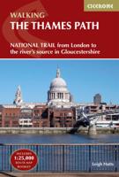
Engelstalige beschrijving van een van de mooiste wandeltochten in Engeland: een stuk boordevol cultuur en geschiedenis!. De gids voldoet aan alle verwachtingen die je kunt hebben. Met apart gidjes met prima wandelkaarten.  A guidebook to walking the Thames Path, a 182-mile National Trail from the Woolwich Foot Tunnel in London to the river's source in near Cirencester, passing from central London through Windsor, Henley, and Oxford, and rural countryside. Described in 20 sections, of between 4 and 16 miles (6.5-32km), it is an mainly flat route with good access by public transport and typically takes two weeks to walk. On its way it passes historic sites such as Greenwich, Kew Gardens, Hampton Court, Runnymede, Windsor Castle and Oxford.   This guidebook features complete OS 1:50,000 scale mapping of the route and comprehensive information about accommodation, facilities, refreshments and transport links for each stage of the route. It is crammed with fascinating details about the …
24,95
Nieuw
Wandelgids Walking in the Thames Valley | Cicerone
Walking in the Thames Valley offers 25 challenging circular walks around the River Thames and River Kennet in the south of England, taking in the Southern Chilterns, the Berkshire and North Hampshire Downs, Southern Oxfordshire and the eastern edge of Wiltshire. All routes are within easy reach of Reading, Newbury, Abingdon and London. While some walks visit Iron Age hill forts, others pass more modern features such as Wilton Windmill and the Kennet and Avon Canal. Some follow sections of the Ridgeway, while others meander along the banks of the Thames. What they all have in common is that they take the keen rambler to some of the best parts of the Thames Valley – a patchwork of open chalk grassland, broadleaved woodland and farmland and home to two Areas of Outstanding Natural Beauty. • walks from 10 to 18 miles, including one 2-day route • shorter, less strenuous alternatives for many of the walks • detailed route descriptions with information on local points of interest, OS mapping…
18,50
Nieuw
Wandelgids Walking the Pembrokeshire Coast Path | Cicerone
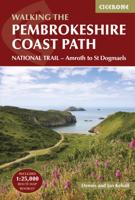
Engelstalige beschrijving van een mooie wandeltocht in Wales. De gids voldoet aan alle verwachtingen die je kunt hebben. Met apart gidsje met prima wandelkaarten.  This guidebook describes the Pembrokeshire Coast Path National Trail, a scenic 180-mile long-distance walk from Amroth, near Tenby, to St Dogmaels, north of Newport. The route, which takes roughly two weeks to complete, is divided into 14 stages of between 9 and 16 miles. Neither technically demanding nor difficult to navigate, the trail is suitable both for experienced distance walkers and those looking to cut their teeth on a long-distance route.   Detailed two-way route instructions are accompanied by 1:100,000 OS mapping. A route summary table and comprehensive trek planner are also included, with invaluable information on transport, accommodation and facilities en route. The guidebook is packed with interesting snippets of information about the places, landscapes and wildlife encountered along the way. It also includes…
25,95
Nieuw
Wandelkaart Thames Path | Harvey Maps
Mooie, duidelijke kaart van het Thames Path in Engeland. Geplastificeerd met veel extra informatie en uitsnedes van de route.   Thames Path National Trail   The Thames Path follows the banks of the river for 184 miles (294KM) from the flood barrier at Woolwich in South East London to Kemble Gloucestershire. It is a long distance walking route, most of it cannot be cycled. The Trail passes through water meadows, historic towns & lovely villages. The path is flat which makes for easy walking. Jos Joslin National Trails Manager (Marketing & Projects) said of this map "Really beneficial to have the whole length of the Thames Path upstream of London on just one map. Clear mapping and useful information makes this a very practical map"   XT40 New generation of tough polyethylene maps   The HARVEY series of Long Distance Route maps is an established success. Now the advanced technology used in the creation of our best-selling British Mountain Maps is also applied to the route maps.   These m…
25,95
Nieuw
Wandelgids The Offa's Dyke Path - Wales | Cicerone
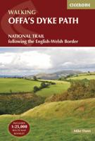
Engelstalige beschrijving van de mooiste wandeltocht in Wales. De gids voldoet aan alle verwachtingen die je kunt hebben, het enige dat je mist is een overzichtskaart. Inclusief gidsje met routekaarten van 1:25000 (deze is hier ook los te bestellen) This guidebook - which includes both a guide to the route and a separate OS map booklet - describes Offa's Dyke Path National Trail from south to north, following the longest linear earthwork in Britain, running 177 miles along the English-Welsh border between Sedbury (near Chepstow) and Prestatyn on the north Wales Coast. It links the Severn Estuary and the Irish Sea, following the longest linear earthwork in Britain, contouring above the Wye and Dee, visiting hillforts and Norman castles and exploring the hidden heritage of the Marches. The route is exceptional in all seasons, although the Black Mountains and Clwydian range deserve respect in winter conditions.   The guidebook splits one of Britain's classic trails into 12 stages, with s…
25,95
Nieuw
Wandelgids Walking the Pembrokeshire Coast Path map booklet | Cicerone
A booklet of all the mapping needed to walk the Pembrokeshire Coast Path National Trail between Amroth near Tenby and St Dogmaels by Cardigan. Covering 290km (180 miles) and over 10,500m of ascent, this trail takes around 2 weeks to complete. The full route is shown on 1:25,000 OS maps The map booklet can be used to walk the trail in either direction Sized to easily fit in a jacket pocket or rucksack The relevant extract from the OS Explorer map legend is includedHigh tide and military range closure alternate routes are providedAn accompanying Cicerone guidebook – Walking the Pembrokeshire Coast Path is also available, which includes a copy of this map booklet   Both native Lancastrians, Dennis and Jan Kelsall have long held a passion for countryside and hill walking. Since their first Cicerone title was published in 1995, they have written and illustrated around 35 guides covering some of Britain’s most popular walking areas and have become regular contributors to various outdoor ma…
15,95
Nieuw
Wandelatlas 3 Adventure Atlas South West Coast Path South Cornwall | A-Z Map Company
AZ heeft de meest gedetailleerde wandelkaarten van delen van het South West Coast Path  gebundeld in een atlasje. Daardoor is het heel handig qua formaat. De kaarten zelf zijn perfect voor het wandelen. Schaal 1:25.000 Plan your next adventure along the South Cornwall section of the South West Coast Path with trusted mapping from A-Z The perfect companion for those who love the great outdoors, the A-Z Adventure Series features 1:25000 Ordnance Survey mapping in a convenient book, complete with index. The South West Coast Path is a National Trail along the Somerset, Devon, Cornwall and Dorset coasts. This stunning walk from Minehead, Somerset covers 630 miles to South Haven Point in Poole Harbour, passing through two World Heritage Sites (the Jurassic Coast and the Cornwall and West Devon Mining Landscape), Exmoor National Park, Land's End and many areas of outstanding natural beauty.   A series of five A-Z Adventure Atlases together cover the South West Coast Path: South West Coast…
17,95
Nieuw
Wandelkaart Offa's Dyke Path - Wales | Cicerone
Handzaam gidsje met alleen de topografische routekaarten van 1:25000. De uitgebreide wandelgids (inclusief dit gidsje) is hier te bestellen. All the mapping you need to complete the Offa's Dyke Path National Trail, the longest linear earthwork in Britain, running 177 miles along the English–Welsh border between Sedbury (near Chepstow) and Prestatyn on the north Wales Coast   NOTE: An accompanying Cicerone guidebook - Offa's Dyke Path - describes the full route with lots of other practical and historical information. The accompanying guidebook includes a copy of this map booklet.   This booklet of Ordnance Survey 1:25,000 Explorer maps has been designed for convenient use on the trail. It shows the full and up-to-date line of the Offa's Dyke Path, along with the relevant extract from the OS Explorer map legend. It is conveniently sized for slipping into a jacket pocket or top of a rucksack and comes in a clear PVC sleeve.   The walk is astonishingly varied, taking in the lower Wye gorg…
14,95
Wandelatlas Hadrian's Wall Path Map Booklet | Cicerone
All the mapping you need to walk the 84 mile (135km) Hadrian's Wall Path from Bowness-on-Solway in Cumbria to Wallsend, Newcastle. This booklet of Ordnance Survey 1:25,000 Explorer maps has been designed for convenient use on the trail. It shows the full and up-to-date line of the Hadrian's Wall Path, along with the relevant extract from the OS Explorer map legend. It can be used when walking the trail west-east or east-west, and includes an extension to the east coast at South Shields. It is conveniently sized for slipping into a jacket pocket or top of a rucksack. This booklet is included with the Cicerone guidebook to Hadrian's Wall Path National Trail.
17,95

Klanten-reviews van Wandelgids The Thames Path | Cicerone

Er zijn nog geen beoordelingen voor dit productBen jij de eerste die een review plaatst?

Meer over Wandelgids The Thames Path | Cicerone

Productomschrijving

All the mapping you need to complete the 182 mile (290km) Thames Path National Trail, from the Woolwich Foot Tunnel in London to the river's source in Gloucestershire. This booklet is included with the Cicerone guidebook to the Thames Path, where the route is divided into 20 stages, with each stage ranging from 4 to 16 miles. This gentle riverside walk takes roughly two weeks to complete.   This booklet of Ordnance Survey 1:25,000 Explorer maps has been designed for convenient use on the trail. It shows the full and up-to-date line of the National Trail, along with the relevant extract from the OS Explorer map legend. Conveniently sized for slipping into a jacket pocket or top of a rucksack and provides all the mapping needed to complete the trail.   Passing through London, Windsor and Oxford as well as rural countryside, this National Trail offers walkers a diverse range of landscapes and scenery. With excellent public transport services at each stage, this trail can also be completed in bite-size pieces - why not relish the route over several weekends throughout the year and discover the many moods of the Thames with the passing seasons?  

Verken gerelateerde categorieën

Webshop.nl maakt gebruik van cookies. Ga je verder op onze website, ga dan akkoord met het plaatsen van cookies en de verwerking van deze data door ons en vermelde partners.