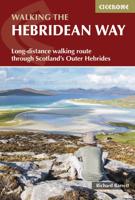
Wandelgids The Hebridean Way | Cicerone

0
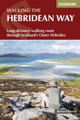
Uitstekende wandelgids van de Hebridean Way, waarbij naast alle noodzakelijke informatie ook gebruik gemaakt wordt van de echte topografische kaart. Officially launched in 2017, the Hebridean Way offers walkers the opportunity to experience the magic of Scotland's Outer Hebrides in one inspirational journey. The waymarked route stretches 247km (1...

Verkopers met dit product

Verkoper
Bezorging
Prijs
DeZwerver.nl logo
DeZwerver.nl
2,95
20,95

Anderen bekeken ook

Wandelgids The Hebridean Way | Cicerone
Uitstekende wandelgids van de Hebridean Way, waarbij naast alle noodzakelijke informatie ook gebruik gemaakt wordt van de echte topografische kaart. Officially launched in 2017, the Hebridean Way offers walkers the opportunity to experience the magic of Scotland's Outer Hebrides in one inspirational journey. The waymarked route stretches 247km (155 miles) from Vatersay to Stornaway, linking ten major islands of the archipelago by means of causeways and two ferry crossings: Vatersay, Barra, Eriskay, South Uist, Benbecula, Grimsay, North Uist, Berneray, Harris and Lewis. Suitable for most walkers with a moderate level of fitness, it can be completed in 8-14 days and is rich in natural, historical and cultural interest.   This guidebook presents the Hebridean Way in 10 stages of 16-35km (10-22 miles), plus two additional stages to extend the route to the Butt of Lewis in line with future plans. Detailed route description is accompanied by 1:50,000 OS mapping, stunning photography to w…
20,95
Wandelgids The Hebrides - De Hebriden Schotland | Cicerone
This inspirational guide offers 50 varied hiking and backpacking routes on the Scottish Hebrides islands, set out in a large guidebook to be savoured. The hikes highlight all the very best landscapes and scenery to be found on the spectacular islands of the Hebrides, a wonderland for adventurous walkers to return to time and time again. Inspirational guidebook to walking in Scotland's Hebrides islands. 50 adventurous walks on well-known and remote islands; from Syke, Mull, Rum, the Uists and Barra, Ulva, Iona, Eigg and Muck and more besides. Most of the walks provide a full day for experienced walkers, with a few multi-day adventures as well as some shorter routes. The terrain is often rough, rugged and pathless, while waymarking and public transport can, in many places, be hard to find. The challenge of wild walking, and the self-reliance needed to discover the best of the Hebrides, make the islands all the more appealing for adventurous walkers.   The walks also include Hebrides cla…
28,50
Fietsgids Cycling in the Hebrides - Schotland | Cicerone
Prachtige fietsgids, zeer inspirerend , van een bijzonder fietsgebied. goede routesuggesties, Veel informatie, met hoogteprofielen en praktische zaken. The 37 day routes and 22 link routes brought together in this guide offer cyclists of all abilities the opportunity to island-hop by bike across the Hebrides, visiting over 20 islands in six sections: Clyde and Kintyre; Colonsay, Islay and Jura; Mull, Coll and Tiree; Skye and Raasay; Barra and the Uists; and Harris and Lewis. From Skye's majestic Cuillin mountains to the palm trees of Bute and the white sands of Tiree and Harris, there is nowhere better to indulge your sense of adventure and experience the thrill of travelling under your own steam in the fresh air. The Hebrides from Islay in the south up to Lewis in the north are all included, along with Arran and its neighbouring islands in the Firth of Clyde, and this comprehensive guide contains all the information you need - from ferry schedules to refreshment stops and bike repair…
22,50
Wandelgids Harris and Lewis - Outer Hebrides, Hebriden Schotland | Cicerone
Uitstekende wandelgids van dit geweldige gebied. goed beschreven met veel praktische informatie om de route te kunnen lopen, inclusief goede kaarten. This guidebook describes 30 day walks all over the Isles of Harris and Lewis, in the Outer Hebrides. The walks range from 2 and 14 miles (4 to 22km) in length, and are easily accessible from Stornaway or Tarbet.   Routes vary from short strolls to long wilderness hikes, high-level and low-level, and include the An Cliseam horseshoe, visits to ancient historic monuments like the stone circles of Calanais and the famous Butt of Lewis lighthouse, all illustrated with OS 1:50,000 maps and dramatic photography.   The routes take in most of the main summits as well as historical and geographical places of interest. A list of all the Marilyns (British hills of any height with a drop of at least 150m on all sides) on Harris, Lewis and St Kilda is included at the back. Tips are also included about walking on St Kilda, Berneray, Taransay, The…
23,95
Wandelgids 85 Pathfinder Guides Outer Hebrides | Ordnance Survey
This new title to the Outer Hebrides represents a very welcome addition to our Pathfinder® Guide series: 28 outstanding walks – 23 circular and five there-and-back routes visiting ten islands. The size and nature of the islands lend themselves best to short and half-day walks where unhurried and free-range walking is encouraged and the endless distractions of scenery, wildlife, history and Gaelic cultural heritage are best appreciated and enjoyed at a relaxed pace.   Featured Outer Hebrides walks include:   This wonderful collection of island walks is divided into three chapters: Lewis and Harris Berneray, North Uist, Benbecula, South Uist and Eriskay Barra and Vatersay There is an illustrated introduction to each of these island groups and planning information on ferries from the mainland and inter-island connections. Walks are presented sequentially geographically, starting in Stornoway, heading up to the Butt of Lewis and then working southwards along the main touring route down th…
18,50
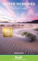
Reisgids Outer Hebrides - Hebriden - Schotland | Bradt Travel Guides
Voor vele landen en streken net zo goed, zo niet beter dan de Planet. soberder uitgevoerd, maar ook met veel informatie voor backpackers en met veel kaartmateriaal. Een aanrader! Voor de Hebriden is dit echt een unieke gids ... er is weinig beschkbaar met zulke goede informatie. This new, thoroughly updated third edition of Bradt's Outer Hebrides is the only up-to-date guidebook to focus solely on Scotland's Western Isles: the islands of Lewis, Harris, St Kilda, Berneray, North Uist, Benbecula, South Uist, Eriskay, Barra and Vatersay. Informed and intimate, this guidebook is ideal for people who travel with curious minds to discover places of great cultural, historical and wildlife interest. The Outer Hebrides is an archipelago of 15 inhabited islands and more than 50 others that are free of human footprint.   It is perfect for a staycation where you can get off the beaten track, switching off from the modern world. Huge variations in landscape are found across the islands - from L…
26,50
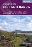
Wandelgids Walking on Uist and Barra - Schotland | Cicerone
This guide offers 40 varied and graded walking routes on the unique 100km cluster of islands that make up Uist and Barra. From short, flat beach walks beside crystal clear waters to long excursions across wild mountainous terrain, the routes visit all the major islands from Berneray to Vatersay but also those smaller and offshore such as Eriskay and Mingulay. Walking across these landscapes, especially the hill country, gives a sense of remoteness and peaceful solitude that cannot be found in the mainland's National Parks or on the Munros busy with peak baggers. Despite a relatively narrow area, Uist and Barra's diverse islands offer a contrasting walking terrain and many ancient historic sites such as chambered cairns and standing stones as well as lots of local wildlife. Upland areas are home to red deer and golden and white-tailed eagles, while along the coast grey seals are common and thousands of birds set up their breeding grounds in the machair. Daily flights between Glasgow an…
23,95
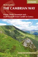
Wandelgids The Cambrian Way | Cicerone
Uitstekende wandelgids van de Cambrian Way, waarbij naast alle noodzakelijke informatie ook gebruik gemaakt wordt van de echte topografische kaart.  Dubbed 'the mountain connoisseurs' walk', the Cambrian Way stretches 479km between the mighty castles of Cardiff in the south and Conwy on the north coast. Traversing the heartland of Wales, the challenging route crosses the Brecon Beacons, the Cambrian Mountains and Snowdonia, passing through two national parks and visiting many of the country's iconic summits, including Pen y Fan, Pumlumon, Cadair Idris and Snowdon itself. It can be walked in three weeks (or in shorter sections) and is suitable for experienced hillwalkers with sound navigational skills.   The guide presents the route in 21 stages, offering comprehensive route description illustrated with OS 1:50,000 mapping and elevation profiles. Details of accommodation and facilities are provided, along with a helpful trek planner showing their distribution along the route: although …
20,95
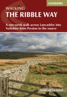
Wandelgids The Ribble Way | Cicerone
The 72 mile (116km) Ribble Way is described in seven stages, ranging from 8.25 to 17 miles (13.3 to 27.4km). The route follows the Ribble valley, from the estuary mouth near Preston to the river's source on Cam Fell in the Yorkshire Dales. The route might not be the most challenging of Long Distance routes, but the contrast through a succession of different landscapes can be immensely satisfying for novice and experienced walkers alike.   The guide provides detailed route descriptions, OS mapping and a route summary table, with variants included for day walkers. Information is included on points of interest along the route, plus there's also background information on the landscape, wildlife, and history, and planning details on when to go, where to stay and what to take. The River Ribble springs from the limestone of the Yorkshire Dales, high on Cam Fell in the heart of Three Peak country.   Initially forcing a passage between high, rugged moorland hills, it then breaks free to w…
23,95
Wandelgids The Cotswold Way | Cicerone
Uitstekende wandelgids van de Cotswolds Way, waarbij naast alle noodzakelijke informatie ook gebruik gemaakt wordt van de echte topografische kaart. inclusief gidsje met routekaarten van 1:25000 (deze is hier ook los te bestellen) Guidebook to walking the 102 mile (163km) Cotswold Way National Trail between Chipping Campden and Bath, across the Cotswolds AONB. The guidebook - which includes both a guide to the route and a separate OS 1:25,000 map booklet - describes the route in both directions.   The route is described over 13 stages, each following the Cotswold escarpment, with dramatic and far-reaching views across the Severn Vale towards the Welsh hills, plunging down to visit honey-coloured villages, old market towns and the elegant and historic city of Bath. The longest of the 13 stages is 10 miles, the shortest 6 miles: these are dictated by the existence of overnight accommodation. For the determined, the trail can be walked in as little as five days.   The Cotswold Way offers…
23,50

Klanten-reviews van Wandelgids The Hebridean Way | Cicerone

Er zijn nog geen beoordelingen voor dit productBen jij de eerste die een review plaatst?

Meer over Wandelgids The Hebridean Way | Cicerone

Productomschrijving

Uitstekende wandelgids van de Hebridean Way, waarbij naast alle noodzakelijke informatie ook gebruik gemaakt wordt van de echte topografische kaart.

Officially launched in 2017, the Hebridean Way offers walkers the opportunity to experience the magic of Scotland's Outer Hebrides in one inspirational journey. The waymarked route stretches 247km (155 miles) from Vatersay to Stornaway, linking ten major islands of the archipelago by means of causeways and two ferry crossings: Vatersay, Barra, Eriskay, South Uist, Benbecula, Grimsay, North Uist, Berneray, Harris and Lewis. Suitable for most walkers with a moderate level of fitness, it can be completed in 8-14 days and is rich in natural, historical and cultural interest.   This guidebook presents the Hebridean Way in 10 stages of 16-35km (10-22 miles), plus two additional stages to extend the route to the Butt of Lewis in line with future plans. Detailed route description is accompanied by 1:50,000 OS mapping, stunning photography to whet your appetite and a wealth of information about local points of interest. The introduction offers an overview of the islands' geology, history, plants and wildlife as well as comprehensive practical advice for walking the route, such as when to go, how to get there (and back) and what to take.   Accommodation listings can be found in the appendices. The route is a celebration of the diverse landscapes of the Hebrides, from dazzling white shell beaches to wild moorland and flower-strewn machair. It visits Neolithic and Bronze Age remains, ruined forts and castles and monuments commemorating Bonnie Prince Charlie and the Highland Land Struggle.   The islands are also a great location to spot seabirds, raptors and a number of migratory species. Informative and inspiring, Richard Barrett's guidebook is an ideal companion to discovering this captivating route.   Starting at Vatersay, the routes crosses Barra, Eriskay, South Uist, Benbecula, Grimsay, North Uist, Berneray, Harris and Lewis to its current end in Stornoway.


Productinformatie

    Verken gerelateerde categorieën

    Webshop.nl maakt gebruik van cookies. Ga je verder op onze website, ga dan akkoord met het plaatsen van cookies en de verwerking van deze data door ons en vermelde partners.