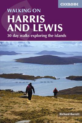

Wandelgids Harris and Lewis - Outer Hebrides, Hebriden Schotland | Cicerone

0
Uitstekende wandelgids van dit geweldige gebied. goed beschreven met veel praktische informatie om de route te kunnen lopen, inclusief goede kaarten. This guidebook describes 30 day walks all over the Isles of Harris and Lewis, in the Outer Hebrides. The walks range from 2 and 14 miles (4 to 22km) in length, and are easily accessible from Stornaw...

Alle aanbiedingen van dit product

Verkoper
Bezorging
Prijs
DeZwerver.nl logo
DeZwerver.nl
2,95
23,95

Anderen bekeken ook

Wandelgids Harris and Lewis - Outer Hebrides, Hebriden Schotland | Cicerone
Uitstekende wandelgids van dit geweldige gebied. goed beschreven met veel praktische informatie om de route te kunnen lopen, inclusief goede kaarten. This guidebook describes 30 day walks all over the Isles of Harris and Lewis, in the Outer Hebrides. The walks range from 2 and 14 miles (4 to 22km) in length, and are easily accessible from Stornaway or Tarbet.   Routes vary from short strolls to long wilderness hikes, high-level and low-level, and include the An Cliseam horseshoe, visits to ancient historic monuments like the stone circles of Calanais and the famous Butt of Lewis lighthouse, all illustrated with OS 1:50,000 maps and dramatic photography.   The routes take in most of the main summits as well as historical and geographical places of interest. A list of all the Marilyns (British hills of any height with a drop of at least 150m on all sides) on Harris, Lewis and St Kilda is included at the back. Tips are also included about walking on St Kilda, Berneray, Taransay, The…
23,95
Wandelgids 85 Pathfinder Guides Outer Hebrides | Ordnance Survey
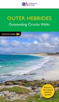
This new title to the Outer Hebrides represents a very welcome addition to our Pathfinder® Guide series: 28 outstanding walks – 23 circular and five there-and-back routes visiting ten islands. The size and nature of the islands lend themselves best to short and half-day walks where unhurried and free-range walking is encouraged and the endless distractions of scenery, wildlife, history and Gaelic cultural heritage are best appreciated and enjoyed at a relaxed pace.   Featured Outer Hebrides walks include:   This wonderful collection of island walks is divided into three chapters: Lewis and Harris Berneray, North Uist, Benbecula, South Uist and Eriskay Barra and Vatersay There is an illustrated introduction to each of these island groups and planning information on ferries from the mainland and inter-island connections. Walks are presented sequentially geographically, starting in Stornoway, heading up to the Butt of Lewis and then working southwards along the main touring route down th…
18,95
Wandelgids Outer Hebrides | Pocket Mountains
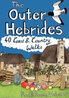
Handige compacte wandelgids met 40 dagwandelingen. Deze gids bevat kleine kaartjes en leuke uitgebreide informatie over wat er langs de route te zien is. Goede wandelkaarten zijn echter we noodzakelijk voor deze tochten: de Ordnance Survey explorer maps of Landanger maps zijn zeer geschikt. The Outer Hebrides are a place apart, an island chain stretching almost 200km from the Butt of Lewis to Barra Head with some of Britain's most mesmerising beaches, dramatic mountain ranges, wonderful wildlife, a long and fascinating history and a rich and vibrant Gaelic culture. This book features 40 mostly moderate walks, with many ideal for families, which take in magnificent sweeps of sand, soaring sea cliffs and memorable hill ascents, as well as celebrated cultural sights such as the haunting Standing Stones at Callanish and the blackhouse village of Na Gearrannan.
10,95
Wandelgids Walking on Uist and Barra - Schotland | Cicerone
This guide offers 40 varied and graded walking routes on the unique 100km cluster of islands that make up Uist and Barra. From short, flat beach walks beside crystal clear waters to long excursions across wild mountainous terrain, the routes visit all the major islands from Berneray to Vatersay but also those smaller and offshore such as Eriskay and Mingulay. Walking across these landscapes, especially the hill country, gives a sense of remoteness and peaceful solitude that cannot be found in the mainland's National Parks or on the Munros busy with peak baggers. Despite a relatively narrow area, Uist and Barra's diverse islands offer a contrasting walking terrain and many ancient historic sites such as chambered cairns and standing stones as well as lots of local wildlife. Upland areas are home to red deer and golden and white-tailed eagles, while along the coast grey seals are common and thousands of birds set up their breeding grounds in the machair. Daily flights between Glasgow an…
23,95
Wandelgids 2 Walking the Corbetts: Volume 2 | Cicerone
Uitstekende wandelgids, goed beschreven met veel praktische informatie om de route te kunnen lopen, inclusief redelijke kaarten. This guide describes routes up all 109 Corbetts north of the Great Glen. The Corbetts offer challenging ascents and descents on steep slopes. The Corbetts (Scotland's 2500-2999ft mountains) are every bit as interesting as the Munros (3000ft and over), often clear when the Munros are in cloud, walkable on short winter days, free of the peak-bagging crowds of their taller neighbours.   Walking the Corbetts is divided into two volumes. The guide covers the Corbetts to the north of the Great Glen, which runs from Fort William to Inverness and includes those in Knoydart, Applecross, Torridon and the isles of Skye, Mull, Rum and Harris. Choosing the best, rather than the quickest, routes up each summit the author covers 109 peaks in 90 routes, illustrated with custom 1:100,000 mapping.   South of the Great Glen it is the Munros which attract most attention, but al…
24,95
Wandelgids 1 Walking The Munros Vol 1 Southern, Central and Western Highlands - Schotland | Cicerone
Uitstekende wandelgids van het zuiden, midden en westen van de Schotse Hooglanden. Goed beschreven met veel praktische informatie om de route te kunnen lopen, inclusief redelijke kaarten. Guidebook to walking the Munros in southern, central and western Highlands. Describes 69 challenging routes across 139 of the iconic 3000ft+ mountains covering areas such as Glencoe, Bridge of Orchy and Mull. Includes routes up Ben More, Ben Alder, Ben Lomond and Ben Nevis, the highest mountain in the British Isles. Volume 1 of two guidebooks.   Seasons The guide is intended for summer hillwalkers (usually April/May to October in Scotland). In winter conditions the routes become more serious mountaineering expeditions requiring appropriate skills, equipment and experience.   Centres Arrochar, Crianlarich, Killin, Pitlochry, Tyndrum, Glencoe, Fort William, Spean Bridge, Dalwhinnie, Braemar, Glenshee   Difficulty Most of the Munros are straightforward walks but some involve ridge walking, sc…
23,95
Wandelgids Walking and Trekking in Iceland - IJsland | Cicerone
Wandelgids met beschrijvingen, kaarten en praktische informatie zoals bussen, overnachten, etc. voor meerdaagse wandelroutes en dagwandeltochten op IJsland. A country of extraordinary beauty, Iceland’s incredible variety of volcanic and glacial landscapes makes it a unique destination for walking and trekking holidays. Its three national parks include the mighty Vatnajökull, largest national park in Europe.   The wide range of routes in this book introduce walkers and backpackers to this ‘Land of Ice and Fire’. There are 100 days of walking in this guidebook, stretching over 1722km, split between 49 day walks and 10 multi-stage treks. They climb mountains, cross glaciers, pass lakes and explore coastlines and geothermal areas, and range from easy nature trails to challenging treks. So, there is enough variation to satisfy all kinds of walkers. The routes are spread all around Iceland, grouped into twelve regions. Detailed information is given at the start of each route or trekking sta…
27,95
Wandelgids Walking on Arran | Cicerone
Uitstekende wandelgids voor dit uitdagende wandelgebied in Schotland. Dagtochten. The 45 walking routes in this Isle of Arran guidebook range from easy 3km (2 miles) nature trails to long arduous mountain routes with scrambles (up to 32km) providing thorough coverage of Arran, including the ascent of Goatfell and nearby Holy Isle. Most routes are 10km to 15km long but many give opportunities to create longer cross island walks. This guidebook presents a selection of 45 day walks on the popular and accessible Isle of Arran. The routes are between 2 miles (3km) and 20 miles (32km) in length, from easy waymarked forest trails to more arduous mountain walks, exposed ridge routes and scrambles. There are linear and circular walks to choose from, and opportunities to link routes together and create longer walks across the length and breadth of the island. With highlights including Goatfell, Beinn Tarsuinn, the Sannox Horseshoe, Glen Rosa and the Cock of Arran, there's something here to suit…
23,95
Wandelgids Walking in the Isles of Scilly | Cicerone
Uitstekende wandelgids van dit geweldige gebied. goed beschreven met veel praktische informatie om de route te kunnen lopen, inclusief redelijke kaarten. This guidebook to walking on the Scilly Isles at the south-western edge of Britain includes 11 day walks and 4 boat trips, perfect for a fortnight away from it all. The walks are between 2 and 16km long, and explore the larger islands such as Tresco, St Martin's, St Mary's, St Agnes and Bryher as well as smaller islands in the archipelago. Alongside the walks, which are suitable for walkers of all abilities, are 4 Boat Trips which explore Annet and the Western Rocks, the Norrard Rocks, St Helens and Teän as well as the Eastern Isles.   With their mild climate and relaxing atmosphere, the Isles make an ideal destination for a retreat, with stunning scenery, rich bird life and myriad wildflowers. Basking in sunshine, rising green and pleasant from the blue Atlantic Ocean, fringed by rugged cliffs and sandy beaches, they reveal their ch…
13,95
Wandelgids Walking on Tenerife | Cicerone
  From easy strolls to hands-on scrambling and from simple day walks to long-distance routes along the GR131, Tenerife offers a variety of year round walking routes, all set in stunning natural scenery. Paddy Dillon's latest book in his Canary Islands series features 45 of the best - suitable for a wide range of abilities and easily combined to form longer expeditions.   The largest of the Canary Islands, Tenerife is dominated by the highest mountain on Spanish territory, El Teide, which rises up dramatically right in the centre of the island. The whole central area surrounding it is protected as a national park and packed with diverse and interesting trails. The altitude on these routes is generally above 2000m and the island's central high-altitude region is often blessed with blue skies and sunny conditions, even when other areas are covered in cloud or experiencing rain.   Terrain includes volcanic cones, lava flows and ash slopes, while the landscape ranges from semi-desert to lu…
24,95

Klanten-reviews van Wandelgids Harris and Lewis - Outer Hebrides, Hebriden Schotland | Cicerone

Er zijn nog geen beoordelingen voor dit productBen jij de eerste die een review plaatst?

Meer over Wandelgids Harris and Lewis - Outer Hebrides, Hebriden Schotland | Cicerone

Productomschrijving

Uitstekende wandelgids van dit geweldige gebied. goed beschreven met veel praktische informatie om de route te kunnen lopen, inclusief goede kaarten.

This guidebook describes 30 day walks all over the Isles of Harris and Lewis, in the Outer Hebrides. The walks range from 2 and 14 miles (4 to 22km) in length, and are easily accessible from Stornaway or Tarbet.   Routes vary from short strolls to long wilderness hikes, high-level and low-level, and include the An Cliseam horseshoe, visits to ancient historic monuments like the stone circles of Calanais and the famous Butt of Lewis lighthouse, all illustrated with OS 1:50,000 maps and dramatic photography.   The routes take in most of the main summits as well as historical and geographical places of interest. A list of all the Marilyns (British hills of any height with a drop of at least 150m on all sides) on Harris, Lewis and St Kilda is included at the back. Tips are also included about walking on St Kilda, Berneray, Taransay, The Shiant Islands and The Flannan Isles, along with a short Gaelic glossary and route summary table, and advice on practicalities to make the most out of any walking trip on Harris and Lewis.


Productinformatie

    Verken gerelateerde categorieën

    Webshop.nl maakt gebruik van cookies. Ga je verder op onze website, ga dan akkoord met het plaatsen van cookies en de verwerking van deze data door ons en vermelde partners.