webshop.nl
Categorieën
  Sluiten

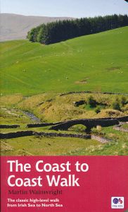
Wandelgids Coast to Coast Walk - van Ierse Zee tot Noordzee | Aurum Press

Goede gids over dit inmiddels beroemde pad. Kaartmateriaal is perfect, alsmede achtergrondinformatie. Praktische info wat minder, maar die is op de ramblerssite op internet te vinden! The Coast to Coast Walk is unique among Britain's long-distance footpaths in that it was the invention of one man, the legendary Alfred Wainwright, and enjoys no offi...
20,95

Webshops met dit product

Webshop
Bezorging
Prijs

Anderen bekeken ook

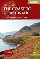
Wandelgids Coast to Coast Walk, From St Bees to Robin Hood's Bay | Cicerone
De beschrijving van de klassieke kust naar kust wandeling in het noorden van Engeland. Een van de mooiste en meest afwisselende wandeltochten van heel Engeland. Inclusief gidsje met routekaarten van 1:25000 First devised by Alfred Wainwright, the Coast to Coast Walk has emerged as a favourite among long-distance walkers. The route stretches some 185 miles (296km) from St Bees, an historic seaside village on Cumbria's west coast to Robin Hood's Bay in North Yorkshire. It is suitable for most fit walkers and can be comfortably walked in around a fortnight.   This guidebook presents the full route from west to east in 13 stages of 10½-20¾ miles (16.8-33.2km), with summaries covering the opposite direction. Alongside step-by-step route description, 1:100,000 mapping and fascinating notes about points of interest along the way, a comprehensive trek planner offers a helpful overview of facilities on route, and full accommodation listings and useful contacts can be found in the appendices. Th…
23,95
Wandelgids Coast to Coast the Wainwright Route | Rucksack Readers
Lange afstandswandelgids van de Coast to Coast wandeling. Wandelgids met kaarten en beschrijving. op waterbestendig papier, in spiraalbinding. This challenging walk of 184 miles (296 km) crosses the north of England from St Bees on the Cumbria coast to Robin Hood’s Bay on the North Sea. It passes through three National Parks – the Lake District, Yorkshire Dales and North York Moors – with splendidly varied scenery. Many walkers complete it within 12 to 16 days, although some divide it into two separate week-long walks.   Devised by the legendary Alfred Wainwright, the Coast to Coast is justly famous as England's most popular walk. It is waymarked, has plenty of accommodation and features welcoming pubs. Both its ends and two midpoints (Kirkby Stephen and Richmond) are accessible by public transport.   The new edition features many photographs by the award-winning landscape photographer Karen Frenkel. It also has freshly commissioned mapping, which appears on 25 of its 126 pages. It cov…
22,50
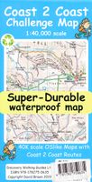
Wandelkaart Coast 2 Coast | Discovery Walking Guides
Goede scheur- en watervaste wandelkaart. The whole Coast 2 Coast on one double sided, 960mm by 694mm, map sheet. All 193 miles (308 kilometres) of the Wainwright route along with its alternatives are highlighted across 9 map sections at 40k scale. Ordnance Survey accuracy is combined with Tour & Trail map design to produce 40k scale map sections which are easy to read.   OS 50k Landranger mapping is expanded to 40k scale making the text and features over 40% larger making them easy to read and understand. Wainwright's C2C walking routes, and their alternatives, are specially highlighted in Tour & Trail style making the routes easy to find on the map and on the ground. Public `Rights of Way' paths and bridleways are also highlighted in Tour & Trail style making them easy to recognise and find.   Coast 2 Coast Challenge Map design is then printed on Polyart using 100% oxygenation inks to produce a lightweight, Super-Durable, waterproof map that is tough enough to shrug off the worst that…
15,95
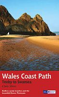
Wandelgids Wales Coast Path: Tenby-Swansea | Aurum Press
Wales Coast Path National Trail Guide is een wandelgids voor meerdaagse wandeltochten - De opzet van deze gidsen is heel duidelijk met kaartmateriaal van Ordnance Survey waarop de tocht is ingetekend.   2012 saw the opening of the entire Welsh coastline as an official long-distance footpath. Now, to complement its existing National Trail Guide to the Pembrokeshire Coast Path, which makes up the section of the Path from Fishguard to just beyond Tenby, Aurum publishes a completely new guide to the other most scenic and popular stretch of the Wales coast – the section eastwards from Tenby to Swansea.   Starting in the superbly picturesque tourism centre of Tenby itself, Chris Moss’s guide follows the coast through Laugharne, famous as the birthplace of Dylan Thomas, Pendine Sands, whose vast level beach was the historic venue for the early attempts on the world land-speed record by buccaneering drivers like Parry-Thomas and Sir Henry Segrave, before winding right round the beautiful Gower…
19,50
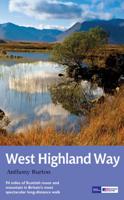
Wandelgids West Highland Way | Aurum Press
Gedegen routegids van het beroemdste pad van Schotland. Uitstekende kaarten, goede achtergronden, helaas wat beperkte praktische informatie. Engels. The 93-mile West Highland Way is indisputably Britain's most spectacular long-distance path. The first section, following the eastern shore of Loch Lomond, offers an idyllic waterside walk, with the full grandeur of the Highlands gradually revealing itself. Then, after crossing the barren wilderness of the Rannoch Moor, the walker climbs the Devil's Staircase above Glencoe and traverses classic Highland landscapes to reach Fort William and, if he or she wishes, a grand finale at the peak of Britain's highest mountain, Ben Nevis. This comprehensive, easy-to-use guide is an authoritative companion, packed with indispensable information. The West Highland Way recreational Path Guide by Anthony Burton is the definitive guide to Britain’s most spectacular long distance walk. This comprehensive, easy-to-use guide contains the entire route split …
20,95
Wandelgids The Andalucian Coast to Coast Walk - Andalusie | Cicerone
Wandelgids met goed beschreven etappes met veel praktische informatie om de route te kunnen lopen, inclusief redelijke kaarten. Kaartmateriaal is vrij beperkt, maar het is moeilijk om deze route geheel met kaarten te dekken, dan heb je er wel erg veel nodig. De beschrijvinen zijn echter best goed, met wat gepuzzel ter plekke is het prima te doen.  Guidebook to the Andalucian Coast to Coast Walk, a 440km, 21-day route from Maro on the Mediterranean coast to Bolonia, on the Atlantic. The route, which passes through 7 Natural Parks, links some of Andalucía's most beautiful villages and passes historical sites of both Roman and Moorish origins, including Ronda and Tarifa.   Seasons Seasons Andalucía's mild winter climate means that this is a region that is suited to year-round walking, apart from July and August when temperatures are generally too hot for comfortable hiking.   Centres Centres Frigiliana, Cómpeta, Alcaucín, Riogordo, Villanueva de la Concepción, El Chorro, Carratraca, El Bu…
20,95
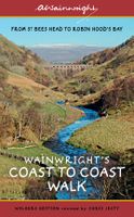
Wandelgids Wainwright's Coast to Coast Walk | Frances Lincoln
This is the first fully revised and updated edition of A. Wainwright's pocket-sized guide to the Coast to Coast Walk which he devised in the early 1970s. Over the years, this 190-mile walk -- from St. Bees Head on the Irish Sea by way of the Lake District, the Pennines, Swaledale, and the North York Moors, ending at Robin Hood's Bay on the North Sea -- has become one of the best-loved long-distance routes in the world. It has prompted countless enthusiasts to lace up their walking boots and follow Wainwright's example, and inspired a TV series, too. This brand-new edition of the Pictorial Guide contains Wainwright's hand-drawn route maps and his inimitable commentary, completely revised where necessary by Chris Jesty. The route is picked out in red for greater visibility on the page, and every step of the walk has been checked and updated.
23,50
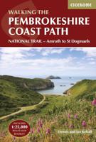
Wandelgids Walking the Pembrokeshire Coast Path | Cicerone
Engelstalige beschrijving van een mooie wandeltocht in Wales. De gids voldoet aan alle verwachtingen die je kunt hebben. Met apart gidsje met prima wandelkaarten.  This guidebook describes the Pembrokeshire Coast Path National Trail, a scenic 180-mile long-distance walk from Amroth, near Tenby, to St Dogmaels, north of Newport. The route, which takes roughly two weeks to complete, is divided into 14 stages of between 9 and 16 miles. Neither technically demanding nor difficult to navigate, the trail is suitable both for experienced distance walkers and those looking to cut their teeth on a long-distance route.   Detailed two-way route instructions are accompanied by 1:100,000 OS mapping. A route summary table and comprehensive trek planner are also included, with invaluable information on transport, accommodation and facilities en route. The guidebook is packed with interesting snippets of information about the places, landscapes and wildlife encountered along the way. It also includes …
25,95
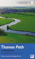
Wandelgids Thames Path | Aurum Press
Een mooie wandelgids met een goede beschrijving en hele duidelijke kaarten met ingetekende route. The official guide to the riverside path from its Gloucestershire source all the way to the outskirts of London. With the London Thames now covered by Aurum's separate new guide, a companion volume can concentrate on the appeal of the full 150 miles of the country Thames, which winds all the way from its Gloucestershire source near Cirencester to Hampton Court on the edge of the London conurbation. This new edition has a wealth of new information about the many sights and places of interest along the way, from Wittenham Clumps that Paul Nash used to paint to Heston Blumenthal's Fat Duck restaurant at Bray, as well as full walking tours of historic Oxford and Windsor & Eton. There are sections on Stanley Spencer at Cookham, and Cliveden and the Cliveden Set, as well as on handsome and interesting towns like Henley and Abingdon. There is also a new section on the wildlife and natural history…
20,95
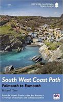
Wandelgids 10 The South West Coast Path National Trail Guide | Aurum Press
Goede beschrijving van een deel van het beroemde South West Coast path in Cornwall. Men heeft gebruik gemaakt van zeer gedetailleerde kaarten van Ordnance Survey. The South West Coast Path follows Britain's stunning coastline for 630 miles around the southern tip of Britain. This volume covers the 172 miles of the National Trail along the south Cornwall and Devon coast from Falmouth to the mouth of the Exe. It takes in some of Britain's most popular beaches and resorts, as well as arresting clifftop scenery, romantic coves and the spectacular 'drowned' estuaries of the Fal, the Yealm and the Dart. Whether you want golden sands, the steep streets of picturesque fishing villages, or a sight of the rare cirl bunting, this book is all you need as your guide to this wonderful walk. This new edition has been fully revised and updated for 2015 and completely resdesigned to feature many more colour photographs and much added information on the history, wildlife and cultural asociations of the …
20,95

Klanten-reviews van Wandelgids Coast to Coast Walk - van Ierse Zee tot Noordzee | Aurum Press

Er zijn nog geen beoordelingen voor dit productBen jij de eerste die een review plaatst?

Meer over Wandelgids Coast to Coast Walk - van Ierse Zee tot Noordzee | Aurum Press

Productomschrijving

Goede gids over dit inmiddels beroemde pad. Kaartmateriaal is perfect, alsmede achtergrondinformatie. Praktische info wat minder, maar die is op de ramblerssite op internet te vinden! The Coast to Coast Walk is unique among Britain's long-distance footpaths in that it was the invention of one man, the legendary Alfred Wainwright, and enjoys no official status like, for example, the National trails in England and Wales. Nevertheless, it has become one of Britain's most popular long-distance walks, which is hardly surprising as it traverses some of the finest walking territory in the country. Starting at St Bees on the Cumbrian coast, the route runs for 192 miles (307 km) to Robin Hood's Bay on the North Sea and lies, for the most part, within the boundaries of three of Britain's loveliest National Parks - the Lake District, the Yorkshire Dales and the North York Moors. As well as the main route there are also alternatives available at several points. Martin Wainwright's description of the route is divided into fifteen chapters, each covering one day's walk (though alternative stopping places are identified for those who wish to spread their journey over a longer period) and each section of the route is described in detail with accompanying Ordnance Survey 1:25 000 mapping and colour photographs. There are also brief feature essays on features or places of particular historical or landscape interest and a Useful Information section at the end which gives details of organisations which provide advice or information on matters such as travel and accommodation. Martin Wainwright (no relation) is Northern Editor of the Guardian. He recently edited A Lifetime of Mountains, a selection from the writings of the Guardian's much-loved Country Diarist, also published by Aurum. A keen rambler, he lives in Leeds
Webshop.nl maakt gebruik van cookies. Ga je verder op onze website, ga dan akkoord met het plaatsen van cookies en de verwerking van deze data door ons en vermelde partners.