webshop.nl
Categorieën
  Sluiten

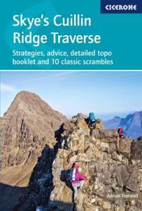
Wandelgids Skye's Cuillin Ridge Traverse | Cicerone

A guidebook to the Isle of Skye’s Cuillin Ridge Traverse. This 2-volume set is a comprehensive guide to planning and completing this challenging and technical 12km scramble. With a route that includes scrambling sections to Grade 3, technical climbs to Severe and a handful of abseils, a head for heights, technical skill and mental and physical stam...
27,95

Webshops met dit product

Webshop
Bezorging
Prijs

Anderen bekeken ook

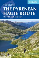
Wandelgids Pyrenean Haute Route - a high level trail, Pyreneeën HRP | Cicerone
Beschrijving van de klassieke HRP, Haute Randonnee Pyreneen. Goede beschrijving van de route met hoogteprofielen en andere praktische informatie. Kaartmateriaal is voor deze zware route onvoldoende aanwezig in de gids.  Aanbevolen wandelkaarten voor de hele of een deel van de route: Wandelkaarten van Rando Editions op Schaal 1:50.000 There are three main trekking routes across the Pyrenees from coast to coast: of these, the Pyrenean Haute Route (or HRP for Haute Route Pyrénéenne) is the most challenging - and arguably, the most spectacular. Unlike the GR10 and GR11, it is not waymarked and borders on mountaineering at times, sticking as closely as possible to the main ridge. It stretches 750km from the Atlantic resort of Hendaye to Banyuls-sur-Mer on the Mediterranean, crossing the French-Spanish border many times on its traverse. The hike calls for experience, navigational competence and self-reliance, but offers rich rewards as you pass through some of the most stunning landscapes th…
24,95
Wandelgids Karawanken - Slovenie - Walking in the Karavanke | Cicerone
Goede wandelgids met veel dagtochten; redelijk kaartmateriaal en goede praktische informatie. This guidebook offers 23 walking routes set across the magnificent 120km-long Karavanke mountain range, which forms a natural border between Austria and Slovenia. Commonly known as 'the way the Alps used to be', as it is yet to experience the extent of commercial development known by the Western Alps, it is one of the longest ranges in Western Europe but it remains genuinely unspoilt and relatively unvisited by English-speaking hillwalkers. The guide's walks begin in pretty towns and villages, and most of them access the peaks from the relatively more gentle Slovenian side of the range, where forest-clad slopes lead to grassy summits where spectacular views can be enjoyed. Arranged by peak from west to east along the range, most of the summits can be reached by waymarked paths and trails. The guide gives all the practical details you need on transport, accessing the routes, accommodation and a…
20,95
Wandelgids Scrambles in Snowdonia | Cicerone
This revised edition of Steve Ashton's classic guide presents 80 scrambles in the stunning Snowdonia National Park, offering challenge, adventure and exhilaration, but also breathtaking scenery and an unparalleled opportunity to connect with the mountains of North Wales. The graded routes range from introductory traverses to demanding climbs involving technicality and exposure, recommended only for those with considerable experience, a strong head for heights and solid grounding in basic rope technique.   It is now easier than ever to explore the Carneddau, Glyders and Snowdon Group, plus the finest scrambling in Eifionydd, the Moelwyns, Rhinogs and Cadair Idris. The favourites are all here – the Snowdon Horseshoe, North Ridge of Tryfan, Bristly Ridge and Cneifion and Cyfrwy Arêtes – as well as a number of lesser-known routes, including 16 not included in the previous guide.    Photo topos illustrate the ascent routes, alongside comprehensive route description detailing the preferred l…
20,95
Wandelgids Trekking in the Vanoise | Cicerone
Uitstekende wandelgids van dit geweldige gebied. goed beschreven met veel praktische informatie om de route te kunnen lopen, inclusief redelijke kaarten. This guide describes the eleven-day 163km Tour of the Vanoise and the five-day 72km Tour des Glaciers de la Vanoise, two fantastic hut-to-hut treks through the pristine Alpine landscapes of France's Vanoise National Park. Three other short treks - the Tour of the Eastern Vanoise, the Tour of the Western Vanoise and a Traverse of the Vanoise via the GR5 and GR55 - are also summarised. The routes tackle several passes in excess of 2500m but there are no glacier crossings, no significant scrambling and no lengthy paths exposed to either stonefall or vertigo-inspiring exposure (though optional variants may involve some slightly more challenging sections), and waymarking is usually clear - making this an ideal route for those new to Alpine trekking.   The guide contains everything you need to plan and walk the routes, with advice on travel…
23,95
Wandelgids Trekking the Karnischer Höhenweg | Cicerone
Uitstekende wandelgids van deze mooie route. goed beschreven met veel praktische informatie om de route te kunnen lopen, inclusief redelijke kaarten This guidebook describes the Karnischer Höhenweg, a 169km long-distance walk through the beautiful Carnic Alps which straddle the border between Austria and Italy. Following a high Alpine trail along the main ridge, the route is clearly waymarked and requires a reasonable level of fitness, a sense of adventure and a head for heights, but no special equipment or technical expertise. It can be walked between mid-July and the end of September and takes up to a fortnight, though it is possible to devise shorter itineraries taking in the highlights. The guide describes the full route of the Karnischer Höhenweg from Arnbach, near Sillian, to Arnoldstein, near Villach, and includes plenty of practical information to help you prepare for the walk. Each stage features comprehensive route description, clear mapping and fascinating insights into the…
22,50
Wandelgids Walking The Munros Vol 1 Southern, Central and Western Highlands - Schotland | Cicerone
Uitstekende wandelgids van het zuiden, midden en westen van de Schotse Hooglanden. Goed beschreven met veel praktische informatie om de route te kunnen lopen, inclusief redelijke kaarten. Guidebook to walking the Munros in southern, central and western Highlands. Describes 69 challenging routes across 139 of the iconic 3000ft+ mountains covering areas such as Glencoe, Bridge of Orchy and Mull. Includes routes up Ben More, Ben Alder, Ben Lomond and Ben Nevis, the highest mountain in the British Isles. Volume 1 of two guidebooks.   Seasons The guide is intended for summer hillwalkers (usually April/May to October in Scotland). In winter conditions the routes become more serious mountaineering expeditions requiring appropriate skills, equipment and experience.   Centres Arrochar, Crianlarich, Killin, Pitlochry, Tyndrum, Glencoe, Fort William, Spean Bridge, Dalwhinnie, Braemar, Glenshee   Difficulty Most of the Munros are straightforward walks but some involve ridge walking, scr…
20,95
Wandelgids The Skye Trail | Cicerone
Guidebook to the Skye Trail, a challenging 80-mile (128km) trek that snakes its way north–south across the largest island in Scotland’s Inner Hebrides. This unofficial, week-long route is ideal for backpacking, camping wild each night, but can also be walked between overnight accommodation.   Unwaymarked route on sometimes-pathless terrain requires navigational skill, fitness and self-reliance, so is suitable for experienced mountain walkers Seven daily stages of 7–18 miles (11–29km) in length, with an optional 6-mile (11km) alternative route via the summit of Bla Bheinn, one of Skye’s most spectacular Munros Starts at Rubha Hunish at the northern tip of Skye, visits the capital Portree, follows Glen Sligachan between the Black Cuillin and Red Hills, before finishing in the south at Broadford Highlights include the Trotternish Ridge, the Quiraing, the Old Man of Storr, the mighty Cuillin and the abandoned village of Boreraig Clear route descriptions with full 1:50,000 OS mapping and el…
20,95
Wandelgids Walking in Provence - West | Cicerone
This guide offers 30 circular day walks in the western half of Provence, the large sun-kissed coastal region of south-east France. Spanning from the Baronnies in the north to the Ste-Baume ridge in the south, the walks are set in the areas of the Drôme Provençale, Vaucluse and the Var. Provence’s sunshine and Mediterranean charm attract many visitors to its coast, yet the area also has much more to offer the walker. The countryside inland boasts a range of scenery from remote mountaintops to spectacular gorges. History is everywhere, in medieval villages, arcaded streets, abbeys, churches and castles.    This guide covers the western regions, with its companion volume, Walking in Provence: East, covering the rest of this fascinating and historic landscape. The walking is incredibly diverse; from the green waves of the Barronies hills in Drôme Provençale, to the unforgettable silhouette of Mont Ventoux giving way to limestone plateaux cut with ravines in the Vauclause. Further south lie…
21,95
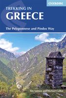
Wandelgids Trekking in Greece - Griekenland | Cicerone
Duidelijke wandelgids van twee belangrijke meerdaagse tochten in Griekenland: the Peloponnese and Pindos Way. Daarnaast een beschrijving van enkele dagtochten in het gebied van Mount Olympos. De beschrijvingen zijn heel goed, met veel praktische informatie. Kaartmateriaal is redelijk. Guidebook describing challenging treks in the mountains of Greece, traversing the Pindhos Range, near Athens, and the Peloponnese, plus a handful of shorter routes including Mount Olympus. The treks demand a high level of commitment and fitness due to their remoteness and difficult terrain, and boast stunning unspoilt scenery. This guidebook presents four specially devised treks in the mountains of Greece, showcasing its beautiful scenery, rich flora and cultural interest. The Peloponnese Way crosses the Peloponnese peninsula from Dhiakoftó in the north to Pantazí beach in the south, via Trípoli. Taking in alpine meadows, a dramatic gorge and forest-clad slopes, the 220km route can be walked in around a f…
24,95
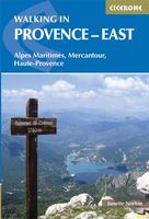
Wandelgids Walking in Provence - East | Cicerone
This guide offers 30 circular day walks in the eastern half of Provence, the large sun-kissed coastal region of south-east France. Spanning from the red rocks in the Ésterel on the Mediterranean to high mountains inland, the walks are set in the areas of the Alpes Maritimes, the Alpes de Haute-Provence and the Mercantour. Provence’s sunshine and Mediterranean charm attract many visitors to its coast, yet the area also has much more to offer the walker. The countryside inland boasts a range of scenery from remote mountaintops to spectacular gorges. History is everywhere, in medieval villages, arcaded streets, abbeys, churches and castles.    This guide covers the eastern regions, with its companion volume, Walking in Provence: West, covering the rest of this fascinating and historic landscape. The walking is incredibly diverse, and explores the country that hugs the Côte d'Azur and Italian border. The Alpes Maritimes rise craggy and wild above towns as unique as Grasse, Cannes and Monac…
21,95

Klanten-reviews van Wandelgids Skye's Cuillin Ridge Traverse | Cicerone

Er zijn nog geen beoordelingen voor dit productBen jij de eerste die een review plaatst?

Meer over Wandelgids Skye's Cuillin Ridge Traverse | Cicerone

Productomschrijving

A guidebook to the Isle of Skye’s Cuillin Ridge Traverse. This 2-volume set is a comprehensive guide to planning and completing this challenging and technical 12km scramble. With a route that includes scrambling sections to Grade 3, technical climbs to Severe and a handful of abseils, a head for heights, technical skill and mental and physical stamina are needed.   Volume 1 contains planning and logistics information, training notes, recommended gear list and safety tips. This volume also includes in-depth route description and advice for completing the traverse in winter Volume 2 focuses on the traverse itself, across 10 sections a step-by-step guide to traversing the ridge is given with full route description, Harvey mapping and photo topos. This volume is the perfect size to carry with you during the traverse The traverse is typically completed over 1-2 days 10 classic Cuillin scrambles are also included that can be used as practice routes Easier climbing alternatives (Cuillin Ridge Light) have been provided for the harder climbing sections
Webshop.nl maakt gebruik van cookies. Ga je verder op onze website, ga dan akkoord met het plaatsen van cookies en de verwerking van deze data door ons en vermelde partners.