webshop.nl
Categorieën
  Sluiten

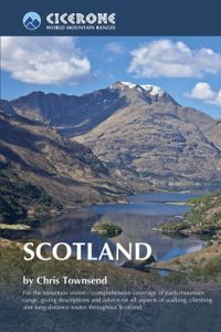
Wandelgids Scotland | Cicerone

Als je wilt wandelen in Schotland is dit het ultieme naslagwerk. A resource book covering the finest walks and climbs in Scotland, with its variety of wild landscapes ranging from the Southern Uplands to the great granite plateaus of the Cairngorms to the jagged arêtes of the Cuillin hills on the Isle of Skye. Whatever activity you are planning thi...
35,95

Webshops met dit product

Webshop
Bezorging
Prijs

Anderen bekeken ook

Wandelgids Walking The Munros Vol 1 Southern, Central and Western Highlands - Schotland | Cicerone
Uitstekende wandelgids van het zuiden, midden en westen van de Schotse Hooglanden. Goed beschreven met veel praktische informatie om de route te kunnen lopen, inclusief redelijke kaarten. Guidebook to walking the Munros in southern, central and western Highlands. Describes 69 challenging routes across 139 of the iconic 3000ft+ mountains covering areas such as Glencoe, Bridge of Orchy and Mull. Includes routes up Ben More, Ben Alder, Ben Lomond and Ben Nevis, the highest mountain in the British Isles. Volume 1 of two guidebooks.   Seasons The guide is intended for summer hillwalkers (usually April/May to October in Scotland). In winter conditions the routes become more serious mountaineering expeditions requiring appropriate skills, equipment and experience.   Centres Arrochar, Crianlarich, Killin, Pitlochry, Tyndrum, Glencoe, Fort William, Spean Bridge, Dalwhinnie, Braemar, Glenshee   Difficulty Most of the Munros are straightforward walks but some involve ridge walking, scr…
20,95
Wandelgids The Cathar Way | Cicerone
Guidebook to the GR367 Cathar Way (Sentier Cathare) in the Languedoc region of southern France. The 260km waymarked trail from Port la Nouvelle on the Mediterranean to Foix traces the history of the Cathars through the Eastern foothills of the Pyrenees. Split into 13 stages and offering a northern variant, the route takes about 2 weeks to complete. Two of the southernmost départements of France, the Pyrénées-Orientales and Ariège are inextricably linked with the history of the Cathars, a heretical Christian sect who were subjected to a crusade in the thirteenth century. Striking castles built on jagged rocky precipices are a highlight of the region and a reminder of those turbulent times. This guidebook describes the 260km Cathar Way (Sentier Cathare or GR367), a long-distance trail from Port-la-Nouvelle on the Mediterranean coast to Ariége's departmental capital Foix linking several of the impressive Cathar castles. The route follows ancient footpaths, jeep tracks and country lanes an…
22,95
Wandelgids Walking in Torridon, Fisherfield, Fannichs and An Teallach | Cicerone
Guide to 50 walks and easy scrambles in north-western Scotland, covering Southern Torridon, Northern Torridon, Letterewe and Fisherfield, and the Fannichs. Ascents of 27 Munros, 20 Corbetts and 14 Grahams are included, with highlights including Liathach, Beinn Eighe, Beinn Alligin, An Teallach and Slioch. The walks are suitable for those with good navigation skills who are competent in a mountain environment.   All the walks in the guide are graded, with summary statistics provided, and each includes clear route description and mapping. There's also a route summary table to help with choosing appropriate walks. Background information on local geology, wildlife and history, and planning details on when to go, where to stay and what to take are included to make the most out of any trip to Torridon.   The region boasts spectacular and distinctive landscapes and breathtaking views. Steep-sided rocky mountains rise above long winding lochs, both freshwater and sea. From the hills there are …
23,95
Wandelgids The Southern Upland Way | Cicerone
Uitstekende wandelgids van de Southern Upland Way, waarbij naast alle noodzakelijke informatie ook gebruik gemaakt wordt van de echte topografische kaart.   The Southern Upland Way is Scotland's coast-to-coast walk and the longest of the nation's Great Trails. 215 miles long, it links the pretty harbour village of Portpatrick on the west coast with Cockburnspath, a little south of Dunbar, in the east. The walk is at times a strenuous one, crossing the remote high moorland of the Galloway Hills, Carsphairn range, Lowthers, Ettrick Hills and Lammermuirs, calling for competence, fitness and self-reliance.    This guide presents advice on how best to plan and tackle this challenging but highly rewarding journey. The waymarked trail is presented in fourteen stages of 9–19 miles and suggestions for a rest day exploring Moffat and its environs are also included. It is possible either to backpack, taking advantage of five bothies and unlimited wild camping possibilities, or to stay in towns…
20,95
Fietsgids - Mountainbikegids Mountain Biking in West and North West Scotland | Cicerone
Degelijke fietsgids met 25 mountainbike routes in west en noord-west Schotland. Goede beschrijvingen en duidelijke kaarten.   This guidebook to  mountain biking routes in North and North West Scotland describes 25 MTB routes north of the Great Glen, Covering a large geographical area,including Fort William, Rannoch Moor, Glen Spean, Ben Nevis, Sutherland, Torridon and Skye, the routes give a real flavour of the variety of different bike riding available. The routes range from 19.5km to 73.25km, graded moderate to very hard. Many are long and committing, so good preparation and fitness are essential, and in some cases a willingness to “hike and bike”.   Each route has a clear and detailed route description along with 1:50,000 OS mapping and a height profile. All routes have key information, including distance on and off-road, ascent, grade, time and the nearest pub and cafe.  There is also advice on equipment, planning and preparation, before you hit the trails.   Scotland is rightly re…
24,95
Wandelgids Shorter Treks in the Pyrenees | Cicerone
Uitstekende wandelgids van dit geweldige gebied. Goed beschreven met veel praktische informatie om de route te kunnen lopen, inclusief redelijke kaarten. A guidebook to seven circular treks exploring the Pyrenees of France and Spain. Seven 1 or 2 week routes in dramatic mountain scenery, including the Pic du Midi d'Ossau, Vignemale, Ordesa Canyon, Gavernie, Puigmal and Canigou. Using mostly waymarked mountain paths, with some boulderfield or easy scrambling, the treks are designed with accommodation in mountain refuges or mountain villages at the end of each stage, though there are plenty of options to camp for those who prefer to backpack. Detailed descriptions for each stage of the route are accompanied by sketch maps and elevation profiles, and there are notes on planning, equipment and access. The Pyrenees stretch 400km from Atlantic to Mediterranean, forming a barrier rising to over 3000m between France and Spain. The steep rolling hills of the Basque Country give way to the spe…
23,95
Wandelgids Skye's Cuillin Ridge Traverse | Cicerone
A guidebook to the Isle of Skye’s Cuillin Ridge Traverse. This 2-volume set is a comprehensive guide to planning and completing this challenging and technical 12km scramble. With a route that includes scrambling sections to Grade 3, technical climbs to Severe and a handful of abseils, a head for heights, technical skill and mental and physical stamina are needed.   Volume 1 contains planning and logistics information, training notes, recommended gear list and safety tips. This volume also includes in-depth route description and advice for completing the traverse in winter Volume 2 focuses on the traverse itself, across 10 sections a step-by-step guide to traversing the ridge is given with full route description, Harvey mapping and photo topos. This volume is the perfect size to carry with you during the traverse The traverse is typically completed over 1-2 days 10 classic Cuillin scrambles are also included that can be used as practice routes Easier climbing alternatives (Cuillin Ridge…
27,95
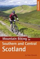
Fietsgids - Mountainbikegids Mountain Biking in Southern and Central Scotland | Cicerone
Degelijke fietsgids met 21 mountainbike routes in zuid en midden Schotland. Goede beschrijvingen en duidelijke kaarten.   This guidebook describes 21 mountain biking routes in central and southern Scotland. It includes the 7stanes trail centre in Dumfries and Galloway, as well as cross-country routes in the Campsie Fells, Pentland Hills and Lammermuirs, the Galloway Forest, Tweed Valley, Cheviots and Lowther Hills. The routes range from 16.5 to 66km and are graded from moderate to very hard. Taking between 2 and 7 hours to complete, they are intended for reasonably fit mountain bikers with at least some experience.   Detailed route descriptions are accompanied by 1:50,000 OS mapping, and the selected routes set out from various points across the area, including Greenock, Glentrool, Peebles and Milngavie, with good access from both Glasgow and Edinburgh. The guidebook also gives an overview of what the region's MTB trail centres have to offer, including the famous 7stanes trail centr…
24,95
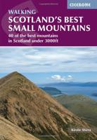
Wandelgids Scotland's Best Small Mountains | Cicerone
A guidebook to 40 of the best small mountains in Scotland under 3000ft. Explore the beautiful scenery of Sutherland and the far north, Torridon, Lochaber, the Great Glen, the Cairngorms, Glencoe, Arrochar, the Trossachs and the islands (Skye, Eigg, Mull, Arran). Routes for all seasons and all abilities.   Walks range from 5-25km and can be enjoyed in 2-8 hours Highlights include Suilven, Quinag, the Pap of Glencoe, Beinn Damh, the Storr, Goatfell and the Cobbler One main ascent described for each with several alternatives for traverses, circuits and short-cuts Glossary of Gaelic words for mountain features and summary table for selecting your walk 1:50,000 OS mapping and beautiful photos are included for each route Detailed information on planning, access and profiles of the history and character of each mountains
23,95
Wandelgids Great Mountain Days in Scotland | Cicerone
The 50 testing routes in this larger-format guidebook are spread across an epic mountainous landscape that is one of the wildest areas in Europe. These routes show the rich diversity and the sheer quality of Scotland's finest peaks. Some of the 50 hikes described are well known classic challenges, while others approach a favourite mountain in a novel way or combine several in a testing round; they can be crammed into a single hard day or backpacked over two. The collection spans Scotland, right across its magnificent upland areas and dramatic peaks. Routes range from 12 to 25 miles and many would make a good two-day adventure. Some can be approached by kayak or mountain bike. Over 270 ranges and summits feature in settings as varied as the snowbound Cairngorm plateaus and the land-sea jigsaw of the Hebrides, where rugged peaks rise from clear water. Few walking destinations are better suited to routes at the longer, tougher end of the scale.
26,50

Klanten-reviews van Wandelgids Scotland | Cicerone

Er zijn nog geen beoordelingen voor dit productBen jij de eerste die een review plaatst?

Meer over Wandelgids Scotland | Cicerone

Productomschrijving

Als je wilt wandelen in Schotland is dit het ultieme naslagwerk. A resource book covering the finest walks and climbs in Scotland, with its variety of wild landscapes ranging from the Southern Uplands to the great granite plateaus of the Cairngorms to the jagged arêtes of the Cuillin hills on the Isle of Skye. Whatever activity you are planning this guide has the information the independent mountain lover needs. Scotland is a mountainous country with a wide variety of wild landscapes: there are the rolling hills of the Southern Uplands, the great granite plateaus of the Cairngorms, the steep castellated rock peaks of Torridon and the jagged narrow aretes and spires of the Cuillin hills on the Isle of Skye. Of the many majestic summits, 284 reach 3000ft or more; these are the Munros, the ascent of which is the aim of many walkers. Below them lie splendid pine forests, beautiful lochs, deep glens, rushing rivers; a magnificent northern landscape. Whether you are planning a day scramble or a long-distance walk, Scotland World’s Mountain Range guide has the information the independent mountain lover needs. • area-by-area descriptions of the Scottish mountains from south to north to help you identify the best locations for hill walking, mountaineering and ski touring • classic ascents and walks described, from scrambles up Ben Nevis to ski tours in the Cairngorms • information on accommodation, maps and guides • a planning tool for long-distance treks in Scotland  
Webshop.nl maakt gebruik van cookies. Ga je verder op onze website, ga dan akkoord met het plaatsen van cookies en de verwerking van deze data door ons en vermelde partners.