Wandelgids Munich to Venice, The Traumpfad | Cicerone

0
Uitstekende wandelgids die in etappes de route nauwkeurig beschijft. This guidebook describes the 570km (354 mile) Traumpfad or 'Dream Way', an Alpine trek from Munich's Mariënplatz to the Piazza San Marco in Venice. The route is broken into 30 stages of between 5hrs 30mins and 9hrs, graded according to difficulty, with 5 alternative stages and th...

Verkopers met dit product

Verkoper
Bezorging
Prijs
DeZwerver.nl logo
DeZwerver.nl
niet bekend
2,95
23,95

Anderen bekeken ook

Wandelgids Munich to Venice, The Traumpfad | Cicerone
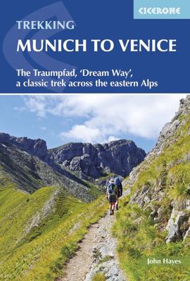
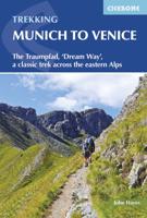
Uitstekende wandelgids die in etappes de route nauwkeurig beschijft. This guidebook describes the 570km (354 mile) Traumpfad or 'Dream Way', an Alpine trek from Munich's Mariënplatz to the Piazza San Marco in Venice. The route is broken into 30 stages of between 5hrs 30mins and 9hrs, graded according to difficulty, with 5 alternative stages and the option to spend a day traversing a section of Italy's famous via ferrata in the Dolomites. Previous experience of Alpine trekking is not necessary as the route is suitable for most able walkers: however, a head for heights is essential.    Known as 'Europe’s playground', the Alps boast an unrivalled walking infrastructure and breath-taking views of angular peaks, flower-strewn valleys and verdant slopes. Hugely popular with German trekkers but little-known in the English-speaking world, Der Traumpfad revels in this stunning scenery. The route passes through German Bavaria then Austria before entering the Italian Tyrol, taking advantage of t…
23,95
Wandelgids Traumpfade & Traumpfädchen - Eifel | IdeeMedia
Wunderschön wandern: 21 aktuelle Traumpfade und die neuen kürzeren Traumpfädchen locken zu Wandertouren in der Eifel. In Verbindung mit neuesten GPS-Daten, direkter App-Anbindung und Navigationsmöglichkeit zu den Ausgangspunkten macht die Lektüre die Wege nahezu unverlaufbar. Traumpfade & Traumpfädchen Band 2 macht die Entdeckung der Eifel noch einfacher: 21 kurze, mittlere und längere Premium-Rundwege zwischen 3,5 und 16 Kilometern Länge lassen jeden Ausflug zu einem besonderen Erlebnis werden - und die Eifel zwischen malerischen See- und Flusspfaden und herausragenden Vulkankegeln neu entdecken. Übersichtliche Detailkarten (für jeden Weg einzeln) sowie eine Direktanbindung via QR-Code an die Gratis-App "Traumtouren" machen auch hier sowohl die Navigation zu den teils versteckt liegenden Parkplätzen als auch die Streckenführung auf schmalen Pfaden unterwegs einfach möglich. Zusätzlich gibt es alle aktuellen GPS-Daten zum Download. Vorgestellt werden auch die vier neuen Traumpfädchen,…
14,95
Wandelgids The Westweg | Cicerone
Uitstekende wandelgids van een meerdaagse tocht in het Zwarte Woud in Duitsland. Goede beschrijvingen, veel praktische informatie en redelijke kaarten al zullen deze niet helemaal voldoende zijn. Guidebook to the Westweg (Westway), a 285km walk across Germany's Black Forest from Pforzheim to Basel. This classic route, which includes Feldberg, Black Forest's highest peak, takes 13 to 14 days, each day stage ranging from 15 to 28km. Two variants are described, both well way-marked and suitable for those new to long distance walking. This guidebook is all you need to discover The Westweg, a 285km walk along the length Germany's Black Forest from Pforzheim to Basel. This classic long-distance trail takes around two weeks to walk, in stages of 15-28km. The route is well way-marked and suitable for experienced hikers and those new to long distance walking, though some sections are steep. The Westweg incorporates many of the region's highlights, such the Schwarzwald National Park, the source…
23,95
Wandelgids The Cathar Way | Cicerone
Guidebook to the GR367 Cathar Way (Sentier Cathare) in the Languedoc region of southern France. The 260km waymarked trail from Port la Nouvelle on the Mediterranean to Foix traces the history of the Cathars through the Eastern foothills of the Pyrenees. Split into 13 stages and offering a northern variant, the route takes about 2 weeks to complete. Two of the southernmost départements of France, the Pyrénées-Orientales and Ariège are inextricably linked with the history of the Cathars, a heretical Christian sect who were subjected to a crusade in the thirteenth century. Striking castles built on jagged rocky precipices are a highlight of the region and a reminder of those turbulent times. This guidebook describes the 260km Cathar Way (Sentier Cathare or GR367), a long-distance trail from Port-la-Nouvelle on the Mediterranean coast to Ariége's departmental capital Foix linking several of the impressive Cathar castles. The route follows ancient footpaths, jeep tracks and country lanes a…
22,95
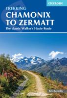
Wandelgids Chamonix to Zermatt | Cicerone
Uitstekende wandelgids die in etappes de route nauwkeurig beschrijft; ook de zijtakken en alternatieve routes koman aan bod. Kaarten zijn schetsmatig en in onze ogen onvoldoende, zeker bij slechte weersomstandigheden. Wij raden dan ook om er losse kaarten bij te kopen. A guidebook to the classic Chamonix to Zermatt trek from Mont Blanc to the Matterhorn. The 225km Walker's Haute Route through the French and Swiss Alps crosses 11 passes, gains more than 14,000m in height and is a strong contender for the title of Most Beautiful Walk in Europe. The high-level route is described in 14 day stages, with optional variants, and is suitable for walkers with a good level of fitness and some previous alpine trekking experience. The final approach to Zermatt adopts the dramatic Europaweg, a high-level traverse of the east wall of the Mattertal, crossing the 500-metre suspension bridge at Randa. An alternative valley route to Zermatt can be taken if this does not appeal. Alongside clear route des…
22,95
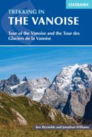
Wandelgids Trekking in the Vanoise | Cicerone
Uitstekende wandelgids van dit geweldige gebied. goed beschreven met veel praktische informatie om de route te kunnen lopen, inclusief redelijke kaarten. This guide describes the eleven-day 163km Tour of the Vanoise and the five-day 72km Tour des Glaciers de la Vanoise, two fantastic hut-to-hut treks through the pristine Alpine landscapes of France's Vanoise National Park. Three other short treks - the Tour of the Eastern Vanoise, the Tour of the Western Vanoise and a Traverse of the Vanoise via the GR5 and GR55 - are also summarised. The routes tackle several passes in excess of 2500m but there are no glacier crossings, no significant scrambling and no lengthy paths exposed to either stonefall or vertigo-inspiring exposure (though optional variants may involve some slightly more challenging sections), and waymarking is usually clear - making this an ideal route for those new to Alpine trekking.   The guide contains everything you need to plan and walk the routes, with advice on trave…
23,95
Wandelgids Mallorca o.a. GR221 | Cicerone
Uitstekende wandelgids, goed beschreven met veel praktische informatie om de route te kunnen lopen, inclusief redelijke kaarten.   This guidebook describes the GR221, a 140km (87 mile) long-distance trail through northwestern Mallorca, from Port d'Andratx to Pollença. Also known as the 'Ruta de Pedra en Sec' ('the Drystone Route'), the GR221 is a celebration of Mallorca's limestone heritage, taking in many historic drystone structures as it traverses the rocky peaks of the Serra de Tramuntana. Following old stone-paved paths and mule trails, it showcases the region's beautiful landscape of mountains, forests and cultivated terraces, as well as its spectacular coastline.    The GR221 can be walked in 1–2 weeks, although the guide also covers 3 alternative start-points and 3 alternative finishes, which would allow for a shorter trek. The main route is presented in 10 stages of 8.5–20.5km (5–13 miles), with a handful of optional detours to bag neighbouring summits. Detailed route descrip…
23,95
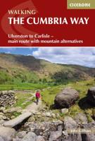
Wandelgids The Cumbria Way | Cicerone
A guidebook to the Cumbria Way, a 73-mile long distance path through the heart of the English Lake District from Ulverston to Carlisle. The route is largely low-level, and accessible to new trekkers, but this guide offers alternative mountain days to climb some of the famous fells en route.   The guide divides the route into 5 stages of between 12 and 16 miles, but there is plenty of opportunity to plan your itinerary for a more easy-going 7 to 8 days. The Lake District is a walkers paradise, and there is no better way to experience the fells, lakes and woodlands of the Lake District than by trekking through their midst.    This guidebook also provides useful information for every stage, from accommodation to available facilities en route, as well as an annotated OS map and details on points of interest. The result is a guidebook that enhances a walk on the Cumbria Way, as well as providing the walker with the tools to complete the trek.   Steden en Dorpen Ulverston, Torver, Coniston,…
20,95
Wandelgids The Hebridean Way | Cicerone
Uitstekende wandelgids van de Hebridean Way, waarbij naast alle noodzakelijke informatie ook gebruik gemaakt wordt van de echte topografische kaart. Officially launched in 2017, the Hebridean Way offers walkers the opportunity to experience the magic of Scotland's Outer Hebrides in one inspirational journey. The waymarked route stretches 247km (155 miles) from Vatersay to Stornaway, linking ten major islands of the archipelago by means of causeways and two ferry crossings: Vatersay, Barra, Eriskay, South Uist, Benbecula, Grimsay, North Uist, Berneray, Harris and Lewis. Suitable for most walkers with a moderate level of fitness, it can be completed in 8-14 days and is rich in natural, historical and cultural interest.   This guidebook presents the Hebridean Way in 10 stages of 16-35km (10-22 miles), plus two additional stages to extend the route to the Butt of Lewis in line with future plans. Detailed route description is accompanied by 1:50,000 OS mapping, stunning photography to w…
20,95
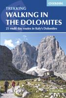
Wandelgids Walking in the Dolomites - Dolomieten | Cicerone
Uitstekende wandelgids van een gerenommeerde Engelse uitgever. De tochten zijn met zorg beschreven en voorzien van allerhande nuttige informatie. Guidebook to 25 multi day walks in the Dolomites mountains of northeast of Italy. The walks are mostly circular and 2 to 4 days long, and take in the Marmarole, Marmolada, Civet, Sella and Cortina Dolomites among others. Includes notes on accommodation, wildlife, transport, equipment, a glossary and other practical information. This guidebook describes 25 hut-to-hut treks in the Dolomites of northern Italy, covering 15 regions including Cortina, Sella, Sesto, Marmolada and Latemar. Ranging from 11.3km to 40.8km and from two to four days, the graded routes are suitable for walkers with a reasonable level of fitness and experience of mountain terrain, and some feature exposed sections which demand a good head for heights. They take advantage of the region's network of mountain refuges and efficient public transport system, with the majority of…
23,95

Klanten-reviews van Wandelgids Munich to Venice, The Traumpfad | Cicerone

Er zijn nog geen beoordelingen voor dit productBen jij de eerste die een review plaatst?

Meer over Wandelgids Munich to Venice, The Traumpfad | Cicerone

Productomschrijving

Uitstekende wandelgids die in etappes de route nauwkeurig beschijft.

This guidebook describes the 570km (354 mile) Traumpfad or 'Dream Way', an Alpine trek from Munich's Mariënplatz to the Piazza San Marco in Venice. The route is broken into 30 stages of between 5hrs 30mins and 9hrs, graded according to difficulty, with 5 alternative stages and the option to spend a day traversing a section of Italy's famous via ferrata in the Dolomites. Previous experience of Alpine trekking is not necessary as the route is suitable for most able walkers: however, a head for heights is essential.    Known as 'Europe’s playground', the Alps boast an unrivalled walking infrastructure and breath-taking views of angular peaks, flower-strewn valleys and verdant slopes. Hugely popular with German trekkers but little-known in the English-speaking world, Der Traumpfad revels in this stunning scenery. The route passes through German Bavaria then Austria before entering the Italian Tyrol, taking advantage of the region's extensive network of mountain huts for accommodation en route.    With custom-designed mapping and stunning colour photography, the guide has all you need to get the best from your trek. Alongside detailed route descriptions, there is useful practical advice on when to go, what to take and refreshment stops, background information on the region's fascinating history, plants and wildlife and full contact details for over 80 places to stay. The result is an ideal companion to discovering this amazing route, regarded by many German trekkers as 'the hiking experience of a lifetime'.   Dorpen en Steden Munchen, Hall, Pfunders, Alleghe, Belluno, Venetie

Productinformatie

    Verken gerelateerde categorieën

    Webshop.nl maakt gebruik van cookies. Ga je verder op onze website, ga dan akkoord met het plaatsen van cookies en de verwerking van deze data door ons en vermelde partners.