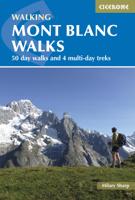
Wandelgids Mont Blanc Walks | Cicerone

0
Uitstekende wandelgids van dit geweldige gebied. goed beschreven met veel praktische informatie om de route te kunnen lopen, inclusief redelijke kaarten. A guide to walking and trekking routes, on both the French and Italian sides of Mont Blanc (Monte Bianco), from Chamonix or Courmayeur. Includes 50 day walks and 4 short multi-day treks for Vallo...

Verkopers met dit product

Verkoper
Bezorging
Prijs
DeZwerver.nl logo
DeZwerver.nl
2,95
22,95

Anderen bekeken ook

Wandelgids 100 Hut Walks In The Alps | Cicerone
This guidebook has route descriptions for 100 day walks to suit alpine walkers of all abilities, with suggestions for some hut-to-hut tours. These routes take you through breathtaking scenery in the Maritime Alps, Julian Alps, Gran Paradiso, the Turnitzer Alps, Bernese Oberland, the Kitzbuheler Alps and the Dolomites of South Tirol. Extending in huge arc of more than 1000km (620 miles) from the Mediterranean coast near Nice to the low, wooded foothills outside Vienna, the Alps display the full gamut of mountain landscape features. All of the routes in this guide have been specially selected to show the amazing diversity of this wonderful mountain chain.   There are walks to suit every taste: gentle and undemanding, long and tough, and everything in between. Most of the routes avoid climbing of a technical nature except the odd scramble aided by a fixed rope. Glacier crossings where crevasses lurk for the unwary have also been avoided in the main, although just a small handful of walks…
22,95
Wandelgids Trekking the Tour du Mont Blanc | Cicerone
Uitstekende wandelgids die in etappes de route nauwkeurig beschijft; ook de zijtakken en alternatieve routes koman aan bod. Kaarten zijn schetsmatig en in onze ogen onvoldoende bij slechte weersomstandigheden. Wij raden dan ook om er losse kaarten bij te kopen. A guidebook to hiking the Tour du Mont Blanc (TMB), a spectacular circuit around Mont Blanc, Western Europe's highest mountain. Covering 170km (105 miles), the TMB takes around 11 days to walk from its official start at Les Houches (France), passing through Courmayeur (Italy) and Champex (Switzerland) before returning to France via the Chamonix valley. A well-serviced introduction to high-level mountain trekking for walkers with good levels of fitness, it can also be run, fastpacked or hiked in 5–9 days.   The route is described in both directions in 11 daily stages between 7 and 21km (5–13 miles) in length. Variant routes and alternative stages are also provided, giving the option of visiting cols, refuges and viewpoints no…
25,95
Wandelgids Walking in Italy's Stelvio National Park | Cicerone
Wandelgids voor de Stelvio Nationaal Park in de Rätische Alpen ( Alpi Retiche ) ten zuiden van de Splügenpas op de grens met het Zwitserse Graubünden. Engelstalige beschrijving van 38 dagwandelingen.   Aanbevolen wandelkaarten 1:25.000 voor deze gids Wandelkaart 008 Ortles - Cevedale - Ortlergebiet | Tabacco Editrice   Wandelkaart 045 Latsch - Martell - Schlanders- Laces - Val Martello - Silandro | Tabacco Editrice   Wandelkaart 048 Val di Peio - Val di Rabbi - Val di Sole | Tabacco Editrice   The wide range of 38 summer day walks in this guide explore the renowned Stelvio National Park in the Italian Rhaetian Alps. Bordering the Dolomites to the east, and Switzerland to the west, the Stelvio is one of the largest protected areas in all of the Alps. Its unspoilt landscape ranges from valley farmland to forested hillsides and alpine meadows, and up to a wilderness of rugged glaciated summits and ridges, the highest of which is Ortler, at 3905m.   The walks, a selection of routes from e…
20,95
Wandelgids Walking in Provence - East | Cicerone
This guide offers 30 circular day walks in the eastern half of Provence, the large sun-kissed coastal region of south-east France. Spanning from the red rocks in the Ésterel on the Mediterranean to high mountains inland, the walks are set in the areas of the Alpes Maritimes, the Alpes de Haute-Provence and the Mercantour. Provence’s sunshine and Mediterranean charm attract many visitors to its coast, yet the area also has much more to offer the walker. The countryside inland boasts a range of scenery from remote mountaintops to spectacular gorges. History is everywhere, in medieval villages, arcaded streets, abbeys, churches and castles.    This guide covers the eastern regions, with its companion volume, Walking in Provence: West, covering the rest of this fascinating and historic landscape. The walking is incredibly diverse, and explores the country that hugs the Côte d'Azur and Italian border. The Alpes Maritimes rise craggy and wild above towns as unique as Grasse, Cannes and Mona…
21,95
Wandelgids Walking in the Thames Valley | Cicerone
Walking in the Thames Valley offers 25 challenging circular walks around the River Thames and River Kennet in the south of England, taking in the Southern Chilterns, the Berkshire and North Hampshire Downs, Southern Oxfordshire and the eastern edge of Wiltshire. All routes are within easy reach of Reading, Newbury, Abingdon and London. While some walks visit Iron Age hill forts, others pass more modern features such as Wilton Windmill and the Kennet and Avon Canal. Some follow sections of the Ridgeway, while others meander along the banks of the Thames. What they all have in common is that they take the keen rambler to some of the best parts of the Thames Valley – a patchwork of open chalk grassland, broadleaved woodland and farmland and home to two Areas of Outstanding Natural Beauty. • walks from 10 to 18 miles, including one 2-day route • shorter, less strenuous alternatives for many of the walks • detailed route descriptions with information on local points of interest, OS mapping…
18,50
Klimgids - Klettersteiggids Chamonix Mountain Adventures | Cicerone
This is a comprehensive guidebook to the many outdoor activities available in the mountains surrounding Chamonix in the French Alps. Routes include walking, mountain biking, road cycling, via ferratas, rock climbing and mountaineering. There is something for everyone, from families to veteran mountain adventurers.   The Chamonix valley in the Haute Savoie region of the French Alps is a perfect base for a whole range of alpine adventures. The routes in this guide range from short walks and cycle rides for the whole family to long mountaineering routes to the highest summits, including Mont Blanc. Activities covered in detail include walks, treks, mountaineering routes, road cycling, MTBing, rock climbing, bouldering and via ferratas, all within easy reach of Chamonix – with suggestions for other outdoor options in the valley, too, from rafting to paragliding. Whether you and your holiday companions are adrenalin junkies or Alpine ramblers, or a mixture of both, there’s plenty to keep e…
21,95
Wandelgids Trekking in the Apennines - Apennijnen | Cicerone
Uitstekende wandelgids die in etappes de route nauwkeurig beschijft; ook de zijtakken en alternatieve routes koman aan bod. Kaarten zijn schetsmatig en in onze ogen onvoldoende bij slechte weersomstandigheden. Wij raden dan ook om er losse kaarten bij te kopen, voor zover verkrijgbaar! Guidebook to the Grand Apennines Trek, or Grande Escursione Appenninica (GEA). Through Tuscany and Emilia-Romagna and two National Parks, this 400km, 23 day trail explores the mountains, forests and hills of central Italy. Suitable for a range of walkers, it can be split into shorter sections or day walks if needed. This guidebook describes the Grande Escursione Appenninica (GEA), a nearly 400km long, three week trek crossing the Appenines in 23 stages, from Bocca Trabaria to Passo Due Santi on the edge of Liguria. The route dips in and out of Tuscany and Emilia-Romagna, never dropping below 400 metres. Best walked between spring and autumn, it is suitable for any reasonably fit walker. Highlights inclu…
22,95
Wandelatlas Tour du Mont Blanc | Cicerone
A booklet of all the mapping needed to complete the Tour du Mont Blanc (TMB), a spectacular circuit around Mont Blanc, Western Europe's highest mountain. Covering 170km (105 miles), the TMB takes around 11 days to walk from its official start at Les Houches (France), passing through Courmayeur (Italy) and Champex (Switzerland) before returning to France via the Chamonix valley. A well-serviced introduction to high-level mountain trekking for walkers with good levels of fitness, it can also be run, fastpacked or hiked in 5–9 days.   The full route line is shown on 1:25,000 IGN maps The map booklet can be used to walk the TMB in either direction Handy facilities planner, route summary tables and accommodation listings help you plan your itinerary Includes urban maps of Les Houches, Les Contamines, Courmayeur, Champex and Chamonix Alternative stages via Col de Tricot (Stage 1A) and Fenêtre d'Arpette (Stage 8A) are also provided An accompanying Cicerone guidebook – Trekking the Tour du Mo…
21,95
Wandelgids Lake Como and Maggiore | Cicerone
Uitstekende wandelgids van dit geweldige gebied. goed beschreven met veel praktische informatie om de route te kunnen lopen, inclusief redelijke kaarten. This guidebook describes 28 day walks and the Sentiero del Viandante trek around Lakes Como and Maggiore in Northern Italy. The day routes range from 3 to 20km in length are graded 1 to 3. The mini trek up the eastern shore of Lago di Como from Lecco to Colicocan can also be cut into one-day stages if desired.   There is something for everyone, from easy leisurely strolls for first-time walkers to strenuous climbs up panoramic peaks. The clear maps, inspirational photographs and information about accommodation and public transport options help to make this guidebook an ideal companion to exploring the exceptional scenery, views and culture of the Italian Lakes. A basic English-Italian glossary is also included.   Picturesque Lago Maggiore has been working its magic on writers and visitors for centuries. Blessed with a mild clima…
20,95
Wandelgids Great Walks on the England Coast Path | Cicerone
Guidebook to 30 routes celebrating the best day and weekend walks on the England Coast Path, a new National Trail. Includes a varied selection of walks along the country's diverse shoreline, on cliff paths, estuaries, beaches and saltmarsh. Routes from 9 to 45km to suit all ages and abilities, many of which can be enjoyed all year round. At around 4500km (2800 miles), the England Coast Path is the longest coastal trail in the world. This inspirational large-format guide presents a handpicked selection of 30 highlight sections, offering a taste of England's stunning and diverse shoreline. Routes range from 9 to 45km, spanning between 3 hours and 2 days, offering options to suit all abilities. They can be accessed by public transport and are walkable year round (weather permitting!). Route descriptions are accompanied by 1:50,000 OS map extracts. Included in each walk are comprehensive listings of public transport, toilets and places to eat and drink, which highlight the excellent walki…
27,95

Klanten-reviews van Wandelgids Mont Blanc Walks | Cicerone

Er zijn nog geen beoordelingen voor dit productBen jij de eerste die een review plaatst?

Meer over Wandelgids Mont Blanc Walks | Cicerone

Productomschrijving

Uitstekende wandelgids van dit geweldige gebied. goed beschreven met veel praktische informatie om de route te kunnen lopen, inclusief redelijke kaarten.

A guide to walking and trekking routes, on both the French and Italian sides of Mont Blanc (Monte Bianco), from Chamonix or Courmayeur. Includes 50 day walks and 4 short multi-day treks for Vallorcine to Plaine Joux, Tour des Aiguilles Rouges, Vallorcine to Servoz and a circuit of the Italian Val Ferret. New, updated edition with 50 new route maps.
Seasons
Mid-June to mid-September is the main season; before this there will be snow at higher and possibly lower levels, and earlier and later the huts will not be open.
Centres
St Gervais, Les Contamines, Servoz, Les Houches, Chamonix, Argentiere, Vallorcine and Courmayeur on the Italian side
Difficulty
mainly day walks, with some shorter walks and 4 short treks; ranges from easy to tough routes for experienced high-mountain walkers
Must See
Lac Blanc, the balcony routes, the Chamonix Aiguilles, Mont Blanc on clear days and (even better) clear evenings; Alpine flowers and wildlife

Productinformatie

    Verken gerelateerde categorieën

    Webshop.nl maakt gebruik van cookies. Ga je verder op onze website, ga dan akkoord met het plaatsen van cookies en de verwerking van deze data door ons en vermelde partners.