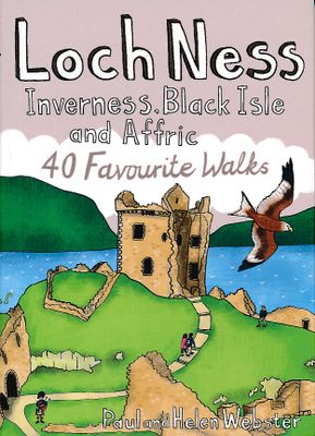
Wandelgids Loch Ness, Inverness, Black Isle and Affric | Pocket Mountains

0
Handige compacte wandelgids met 40 dagwandelingen. Deze gids bevat kleine kaartjes en leuke uitgebreide informatie over wat er langs de route te zien is. Goede wandelkaarten zijn echter we noodzakelijk voor deze tochten: de Ordnance Survey explorer maps of Landanger maps zijn zeer geschikt.   A guide to 40 favourite walks around Loch Ness, Inverne...

Verkopers met dit product

Verkoper
Bezorging
Prijs
DeZwerver.nl logo
DeZwerver.nl
2,95
10,95

Anderen bekeken ook

Wandelgids Loch Ness, Inverness, Black Isle and Affric | Pocket Mountains
Handige compacte wandelgids met 40 dagwandelingen. Deze gids bevat kleine kaartjes en leuke uitgebreide informatie over wat er langs de route te zien is. Goede wandelkaarten zijn echter we noodzakelijk voor deze tochten: de Ordnance Survey explorer maps of Landanger maps zijn zeer geschikt.   A guide to 40 favourite walks around Loch Ness, Inverness, Black Isle and Glen Affric. Loch Ness, with its legendary monster, is the most famous of all lochs. It holds more water than all the lakes of England and Wales combined and the countryside around it features an equally great variety of walks, with more waymarked trails and easy routes suitable for families than many other parts of the Highlands. Further north lies the magnificent Glen Affric - Scotland's most beautiful glen.   This is a wonderful area of the Highlands for walkers, having the highest mountains north of the Great Glen but also some splendid lower-level and forest walks. To the east is the fertile Black Isle, packed with cha…
10,95
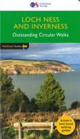
Wandelgids 030 Pathfinder Guides Loch Ness and Inverness | Ordnance Survey
Explore 28 beautiful walks across Loch Ness & Inverness with the OS Pathfinder Guidebooks, graded by length and ranging from 2 to 16 miles.   The routes range from extended strolls to longer hikes, so there's something for all levels! Discover the Highland 'capital' of Inverness, the dramatic shore of Loch Ness, Ben Wyvis, and much more with this guidebook.   Each walk includes a detailed description, an OS map, GPS waypoints, and notes of key features and things to see.   This is one of a series of books with great walking routes covering the most popular and scenic areas of Britain.
18,50
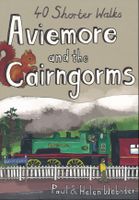
Wandelgids Aviemore and the Cairngorms | Pocket Mountains
Handige compacte wandelgids met 40 dagwandelingen. Deze gids bevat kleine kaartjes en leuke uitgebreide informatie over wat er langs de route te zien is. Goede wandelkaarten zijn echter we noodzakelijk voor deze tochten: de Ordnance Survey explorer maps of Landanger maps zijn zeer geschikt. 'Aviemore and the Cairngorms' features 40 shorter walks, including many perfect for families, stretching from the ancient region of Badenoch and the uppermost reaches of the Spey Valley, through the outdoor hub of Aviemore to Grantown and Tomintoul, then over Ballater and Royal Deeside to Braemar. Plaatsen in het boekje Abernethy Forest, An Lochan Uaine, Anagach Woods, Aviemore, Badenoch Way, Ballater, Balmoral Estate, Balnagowan Wood, Black Wood, Boat of Garten, Braemar, Bridge of Brown, Burn o’Vat, Cairngorm Club Bridge, Cairngorm Ski Centre, Calder Bridge, Carn Daimh, Carrbridge, Castle Roy, Coire an t-Sneachda, Colonel’s Bed, Coylumbridge, Craigellachie Woods, Craigendarroch, Craigmore Wood, Cr…
10,95
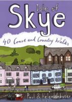
Wandelgids Isle of Skye | Pocket Mountains
The Isle of Skye (or Ant-Eilean Sgitheanach in its native Gaelic tongue) occupies an almost mythical place in the minds of many Scots. Romantic castles, magnificent sea-scapes, the alpine peaks of the Cuillin Ridge, marching pipe bands, scattered white crofters' cottages and a bloody history; the island has all these and more. This book features 40 moderate walks that take in much of this celebrated landscape, but reveal hidden gems too.   In spite of its popularity Skye is still rich in undiscovered treasures, from coastal caves and arches, ruined villages cruelly cleared of their inhabitants, to fossilised dinosaur footprints and a rich array of wildlife. Written by Skye residents Paul and Helen Webster, these walks will reveal both the wild and gentler sides of this dramatic landscape.   Plaatsen in het boekje An Aird, An Corran, Ardnish, Armadale, Arnish, Bearreraig Bay, Bioda Buidhe, Boreraig, The Braes, Broadford, Brochel Castle, Brothers' Point, Burma Road, Caisteal Maol, Calum…
10,95
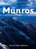
Wandelgids The Munros | Pocket Mountains
The Munros are mountains in Scotland with a height of over 3000ft and take their name from the first list of such hills published in 1891 by Victorian mountaineer Sir Hugh Munro, 4th Baronet of Lindertis. Revised several times in the years since, the official list now features 282 peaks. This guide is for anyone who wants to climb these mountains and aims to provide reliable routes and tips for ascending them safely.   The Munros will ensure you reach parts of Scotland you might otherwise overlook, spend memorable evenings in pubs, bothies and wild camps, and have encounters with other walkers, locals and wildlife that enhance the adventure regardless of whether you get to the top of one Munro or all of them. Plaatsen in het boekje A’ Bhuidheanach Bheag, A’ Chailleach (Fannichs), A’ Chailleach (Monadhliath), A’ Chralaig, Ghlas-bheinn, A’ Mhaighdean, A’ Mharconaich, Am Basteir, Am Bodach, Am Faochagach, An Caisteal, An Coileachan, An Gearanach, An Riabhachan, An Sgarsoch, An Socach (De…
20,95
Wandelkaart Affric Kintail Way | Harvey Maps
Mooie, duidelijke kaart van de Affric Kintail way in Schotland. Geplastificeerd met veel extra informatie en uitsnedes van de route. De hele rote op 1 kaart, erg handig! The Affric Kintail Way is a superb cross-country route for walkers, mountain bikers and horse riders stretching almost 44 miles from Drumnadrochit by Loch Ness to Morvich in Kintail by Loch Duich. The trail is in close proximity to the Great Glen at Drumnadrochit thus offering the traveller the opportunity of extending their journey. The Way has been created by linking a number of rights of way, forest trails and footpaths that have existed in some cases for centuries.Compact and light - the map itself weighs just 60gms - a third of the weight of a laminated map, and much less bulky. And you can fold or refold it time and again, or stuff it in your back pocket and it won't fall to pieces. Shows the entire route on one sheet.
16,55
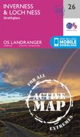
Wandelkaart - Topografische kaart 26 Landranger Active Inverness / Loch Ness | Ordnance Survey
Zeer goede detailkaart met topografische ondergrond. Kleurgebruik is goed over nagedacht: bijzonder goed leesbaar en helder kaartbeeld. Hierop zijn toeristische symbolen van bezienswaardigheden ingetekend, daarnaast staan bijvoorbeeld campings en jeugdherbergen vermeld en - voor wandelaars het belangrijkst - alle right of way paden en Lange afstands Wandelpaden zijn er op te vinden. De ideale kaart voor het wandelen in Engeland, Wales of Schotland. De kaarten zijn te gebruiken met GPS (UTM OSGB36), de legenda is in het Engels, Frans en Duits.    Plaatsen op deze kaart: Inverness, Dingwall, Strathpeffer, Contin, Marybank, Conon Bridge, Alcaig, Culbokie, Munlochy, North Kessock, Muir of Ord, Beauly, Kilmorack, Erchless Castle, Kirkhill, Kiltarlity, Dochgarroch, Ardendrain, Abriachan, Dores, Balnain, Cannich, Tomich, Bunloit, Drumnadrochit, Foyers, Errogie, East Croachy. 
25,95
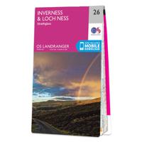
Wandelkaart - Topografische kaart 026 Landranger Inverness & Loch Ness, Strathglass | Ordnance Survey
Zeer goede detailkaart met topografische ondergrond. Kleurgebruik is goed over nagedacht: bijzonder goed leesbaar en helder kaartbeeld. Hierop zijn toeristische symbolen van bezienswaardigheden ingetekend, daarnaast staan bijvoorbeeld campings en jeugdherbergen vermeld en - voor wandelaars het belangrijkst - alle right of way paden en Lange afstands Wandelpaden zijn er op te vinden. De ideale kaart voor het wandelen in Engeland, Wales of Schotland. De kaarten zijn te gebruiken met GPS (UTM OSGB36), de legenda is in het Engels, Frans en Duits.    Plaatsen op deze kaart: Inverness, Dingwall, Strathpeffer, Contin, Marybank, Conon Bridge, Alcaig, Culbokie, Munlochy, North Kessock, Muir of Ord, Beauly, Kilmorack, Erchless Castle, Kirkhill, Kiltarlity, Dochgarroch, Ardendrain, Abriachan, Dores, Balnain, Cannich, Tomich, Bunloit, Drumnadrochit, Foyers, Errogie, East Croachy. 
19,50

Klanten-reviews van Wandelgids Loch Ness, Inverness, Black Isle and Affric | Pocket Mountains

Er zijn nog geen beoordelingen voor dit productBen jij de eerste die een review plaatst?

Meer over Wandelgids Loch Ness, Inverness, Black Isle and Affric | Pocket Mountains

Productomschrijving

Handige compacte wandelgids met 40 dagwandelingen. Deze gids bevat kleine kaartjes en leuke uitgebreide informatie over wat er langs de route te zien is. Goede wandelkaarten zijn echter we noodzakelijk voor deze tochten: de Ordnance Survey explorer maps of Landanger maps zijn zeer geschikt.  

A guide to 40 favourite walks around Loch Ness, Inverness, Black Isle and Glen Affric.

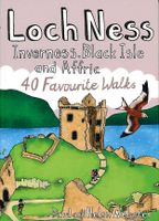
Loch Ness, with its legendary monster, is the most famous of all lochs. It holds more water than all the lakes of England and Wales combined and the countryside around it features an equally great variety of walks, with more waymarked trails and easy routes suitable for families than many other parts of the Highlands. Further north lies the magnificent Glen Affric - Scotland's most beautiful glen.   This is a wonderful area of the Highlands for walkers, having the highest mountains north of the Great Glen but also some splendid lower-level and forest walks. To the east is the fertile Black Isle, packed with charming villages and some fine beaches, whilst further north still is Dingwall, a gateway to the spectacular Northern Highlands.   Plaatsen in het boekje Abriachan, Aldourie, Allt na Criche, Am Meallan, An Ire Mhor, Avoch, Beauly, Belladrum, Black Isle, Black Rock Gorge, Black Water, Blackmuir Wood, Bridge of Oich, Caledonian Canal, Carn na Leitire, Change House, Chanonry Point, Cnoc Fyrish, Cnoc Mor, Coffin Road, Coire Loch, Contin, Craig Phadrig, Craigmonie, Cromarty, Dingwall , Dog Falls, Dores, Drumnadrochit, Dunglass Island, Easter Ross, Eathie Coast, Evanton, Fairy Glen, Falls of Divach, Falls of Foyers, Fort Augustus, Fortrose, Foyers, Fyrish Monument, Garve, Glen Affric, Great Glen Way, Inverfarigaig, Inverness, Knockfarrel, Loch Affric, Loch Duntelchaig, Loch Kinellan, Loch Laide, Macdonald Monument, Maryburgh, Meall Fuar-mhonaidh, Moniack Burn, Muir of Ord, North Kessock, Ord Hill (Muir of Ord), Ord Hill (North Kessock), Ord Wood, Ormond Castle, Phoineas Hill, Plodda Falls, Reelig Glen, River Affric, River Beauly, River Conon, River Glass,River Oich Rogie Falls, Rosemarkie, Silverbridge, South Loch Ness Trail, Strath Nairn, Strathpeffer, Swallows Den, Tomich, Torrachilty Forest, Tulloch Castle, Tweedmouth Walk, Urquhart Castle, View Rock,
Productinformatie

    Verken gerelateerde categorieën

    Webshop.nl maakt gebruik van cookies. Ga je verder op onze website, ga dan akkoord met het plaatsen van cookies en de verwerking van deze data door ons en vermelde partners.