webshop.nl
Categorieën
  Sluiten

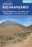
Wandelgids Kilimanjaro - A Trekking Guide to Africa's Highest Mountain | Trailblazer Guides

Dat dit boek je met de planning helpt is geen loze kreet. Werkelijk alle facetten van de berg en zijn omgeving komen aan bod. De auteur geeft informatie over hoe je een reis naar de Kili kunt boeken, hoe je er komt, wat je er kunt verwachten en hoe je vervolgens de top kunt bereiken. Maar hij is ook erg duidelijk voor wat betreft het bereiken van d...
21,95

Webshops met dit product

Webshop
Bezorging
Prijs

Anderen bekeken ook

Wandelgids Kilimanjaro trekking | Cicerone
Goede trekking - wandelgids van de Kilimanjaro. Beklimmingen kunnen van alle kanten in vele vormen en vrijwel alle routes staan goed beschreven  in deze gids. Veel praktische informatie en een duidelijke routebeschrijving, duidelijke enigszins schetsmatige kaarten en een uitgebreide inleiding over wat je wel en niet moet meenemen, regelen en voorbereiden. At 5895m, Kilimanjaro is Africa's highest point and the highest freestanding mountain in the world, yet it is possible to reach its summit, Uhuru Peak, without any technical climbing ability. However, that is not to say that it is an easy undertaking: each year, many people fail in their attempt, often due to poor preparation or insufficient acclimatisation. Those who do make it to 'the Roof of Africa' are richly rewarded, enjoying outstanding views, the unique experience of being 'on top of the world' and, of course, a tremendous sense of achievement.   Guidebook describing all the trekking routes on Kilimanjaro (5895m), one of the S…
23,95
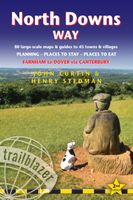
Wandelgids North Downs Way | Trailblazer Guides
A 131-mile National Trail, the North Downs Way runs from Farnham in Surrey to Dover in Kent, partly following the old Pilgrims' Way to the shrine of St Thomas à Becket at Canterbury. It winds its way through the protected landscape of the Surrey Hills and the Kent Downs, passing medieval churches, castles, Neolithic burial sites, vineyards and numerous WWII defences. There are literary associations with Swift, Cobbett, Dickens and Jane Austen.The guide includes:1. Unique mapping features - In many walking guides the reader has to read a route description then try to relate it to the map. Our guides are easier to use because walking directions, tricky junctions, places to stay and eat, points of interest and walking times are all written onto the maps themselves in the places to which they apply. With their uncluttered clarity, these are not general-purpose maps but fully-edited maps drawn by walkers for walkers. Downloadable GPS waypoints also included. 2. The largest scale walking map…
18,50
Wandelgids Gllyndwr's Way | Trailblazer Guides
This title in our British Walking Guides series covers the 135-mile National Trail in Wales following in the footsteps of Owain Glyndŵr, the Welsh prince who led a rebellion against the English in 1400. Traversing a range of open farmland and forest, it links with another National Trail, Offa's Dyke Path, at its start in Knighton and end in Welshpool. 10 town plans and 58 large-scale walking maps - at just under 1:20,000 - showing route times, places to stay, points of interest and much more Plus 10 overview maps Itineraries for all walkers - whether walking the route in its entirety over seven to eight days or sampling the highlights on day walks and short breaks Practical information for all budgets - camping, bunkhouses, hostels, B&Bs, pubs and hotels - where to stay, where to eat, what to see, plus detailed street plans Comprehensive public transport information - for all access points on the path. Flora and fauna - four page full color flower guide, plus an illustrated secti…
20,95
Wandelkaart Kilimanjaro en wegenkaart Noord Tanzania | ITMB
Wandelkaart van het National Park Kilimajaro met wandelroutes .ITMB has been publishing a map of Mount Kilimanjaro for fifteen years! This 4th edition includes an exceptional value-added map of Northern Tanzania and Southern Kenya that should prove to be very useful to end users, who can now use one map from landing in Nairobi or Dar to reach the mountain park, travel the Serengeti all the way to Lake Victoria, and loop back to Dar es Salaam via the new highway through Dodomo. Inset maps of Arusha, Dar, and Stone City in Zanzibar are included. This new map is issued without increasing the price! Legend Includes: Roads by classification, Airports, Points of Interest, Ports, Borders crossings, Hospitals/Medical Facilities, Viewpoints/Forts, Mines, Ruins/Archaelogical Sites, Information Centres, Museums, Campsites/Huts, Hotels/Motels, World Heritage Sites, Lodges, Missions, Ferries, Elevation Spots, Beaches/Dinving spots, Shipwrecks/Ligthouses, National Parks, Wetland/Swamp, Coral Reef, M…
13,95
Wandelgids Sinai Trekking Guide | Trailblazer Guides
Bijzondere gids over fantastische tochten in de Sinai: wandelgids met goede schetskaarten, veel praktische informatie. Onmisbaar voor zo'n tocht! Trek with the Bedouin and their camels and discover one of the most exciting new trekking destinations in the world. Egypt's Sinai peninsula is the small tooth of land between Africa and Asia, and the fabled Biblical setting of The Exodus. It's a region of high mountains and sweeping deserts, home to crumbling Egyptian temples, Byzantine monasteries and more. The millions that visit Sinai each year come mostly for its beaches and reefs but for a true adventure, the best way to see Sinai is to trek with the Bedouin. Walking with their camels gives access to the most remote and waterless parts of the peninsula and no other mode of travel immerses you so fully in your surroundings nor gives such a close feel for the desert - its freedoms and hardships. Trekking is becoming ever-better established and it's perfectly possible to arrive and organis…
21,95
Reisgids Handbook Kilimanjaro & Northern Tanzania | Footprint
Kleine versie van de grotere Handbooks serie van Footprint, daardoor een stuk handzamer voor wie zich beperkt to dit bepaalde gebied. Nog altijd vol met goede tips, veel praktische informatie en handige kaartjes. From the snow-capped beauty of Mount Kilimanjaro, Africa's highest mountain, to the vast plains of the Serengeti, the north of Tanzania offers enormous diversity. Whether you're spotting the Big Five on safari, trekking spectacular peaks or exploring the incredible Ngorongoro Crater, Footprint's Kilimanjaro & Northern Tanzania Handbook covers all the top attractions in this fascinating region, plus tips for escaping the crowds and getting off the beaten track. Practicalities section with essential advice on getting there and around. Highlights map & inspirational color section, so you know what not to miss. Comprehensive listings including where to eat, sleep and relax - whatever your budget. Detailed street maps for Dar es Salaam, Arusha and other key locations & national par…
15,50
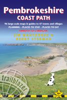
Wandelgids Pembrokeshire Coast Path | Trailblazer Guides
Goede wandelgids waarin met veel details alle etappes zijn beschreven. Tevens informatie over overnachtingen en openbaar vervoer. Practical guidebook to walking the Pembrokeshire Coast Path. The walk follows a National Trail around the coastline in south-west Wales. Includes maps, accommodation, pubs and restaurants, and what to see along the coastal path. 102 maps: 96 large-scale walking maps, 6 town plans, 10 stage with trail profiles and 2 overview maps. Detailed accommodation: B&Bs, campsites, pubs, hotels, bunkhouses. Where to eat: cafes, pubs and restaurants. Detailed public transport information with frequency of services. Downloadable GPS waypoints. Itineraries for all walkers, whether hiking the entire route or sampling highlights on day walks, weekends or short breaks.     96 walking maps – 1:20,000 (3-1/8 inches to 1 mile) – the largest-scale maps available.   10 stage maps with trail profiles and 2 overview maps Unique mapping features – walking times, directions, tricky ju…
19,95
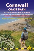
Wandelgids Cornwall Coast Path | Trailblazer Guides
Wandelgids met uitgebreide beschrijvingen wandelingen en praktische informatie met eenvoudige kaarten van de wandelroutes. Practical, complete hiking route guide, with maps and accommodation for the 288-mile footpath that runs around the entire coastline of Cornwall, from Bude to Plymouth; Part 2 of the South-West-Coast Path, a 630-mile National Trail from Minehead to Poole. Includes * 142 large-scale walking maps in TWO-COLOUR style (3 1/8inches to 1 mile), 15 town plans, guides to 81 towns and villages, 24 stage maps and overview map. * Itineraries for all walkers - whether walking the route in its entirety over a week to 10 days or sampling the highlights on day walks and short breaks * GPS waypoints * Practical information for all budgets - camping, bunkhouses, hostels, B&Bs, pubs and hotels; where to stay, where to eat, what to see.   * Comprehensive public transport information - for all access points on the coast path * Flora and fauna - 6 page full colour, flower, butterfly, bi…
20,95
Wandelgids West Highland Way | Trailblazer Guides
All the information you need to enjoy your hiking adventure along the West Highland Way in this fully revised 8th edition.   The West Highland Way passes through some of the most spectacular scenery in all of Britain. From the outskirts of Glasgow it winds for 96 miles (154.5km) along the wooded banks of Loch Lomond, across the wilderness of Rannoch Moor, over the mountains above Glencoe to a dramatic finish passing Ben Nevis - Britain's highest mountain - into the centre of Fort William.   4 large-scale town plans, 8 overview maps and 53 large-scale walking maps, in NEW two-colour style - at just under 1:20,000 - showing route times, places to stay, places to eat, points of interest and much more. These are not general-purpose maps but fully-edited maps drawn by walkers for walkers. Itineraries for all walkers - whether walking the route in its entirety over a week to 10 days or sampling the highlights on day walks and short break. Practical information for all budgets - camping, b…
18,50
Wandelgids Iceland Hiking with Reykjavik City Guide | Trailblazer Guides
Zeer goede wandelgids van IJsand met verrassend goede, schetmatige "spot-on" wandelkaartjes. Iceland offers a world of hiking opportunities like no other place on earth. The famous 55km Laugavegur Trek takes you past glaciers, volcanoes, steaming fumaroles and hot springs all set in a landscape of yellow rhyolite and black ash. This new guide gives you plenty of other options from hiking in the shadow of the largest ice-cap in Europe at Skaftafell to easier day hikes around the vibrant capital city of Reykjavik.41 detailed walking maps in the classic Trailblazer style - showing route times, gradients, where to stay Detailed Reykjavik city guide - and maps Itineraries for all walkers on 11 specially selected hikes - from day hikes around Reykjavik to more challenging 6-day treks including the 55km Laugavegur Trek Practical information for all budgets - where to stay (campsites, hostels and huts, B&Bs, lodges and hotels), where to eat, what to see Comprehensive background information - g…
23,50

Klanten-reviews van Wandelgids Kilimanjaro - A Trekking Guide to Africa's Highest Mountain | Trailblazer Guides

Er zijn nog geen beoordelingen voor dit productBen jij de eerste die een review plaatst?

Meer over Wandelgids Kilimanjaro - A Trekking Guide to Africa's Highest Mountain | Trailblazer Guides

Productomschrijving

Dat dit boek je met de planning helpt is geen loze kreet. Werkelijk alle facetten van de berg en zijn omgeving komen aan bod. De auteur geeft informatie over hoe je een reis naar de Kili kunt boeken, hoe je er komt, wat je er kunt verwachten en hoe je vervolgens de top kunt bereiken. Maar hij is ook erg duidelijk voor wat betreft het bereiken van die top: doe dat alleen onder begeleiding van een erkende gids en doe het op je gemak. Kilimanjaro is immers niet voor niets de hoogste berg van Afrika en daarmee één van de beruchte 'seven summits'. At 19,341ft Kilimanjaro is Africa's highest mountain. Yet with no mountaineering skills necessary to reach the summit, even non-climbers can experience the thrill of climbing one of the world's greatest peaks. Includes full practical details – getting to Tanzania and Kenya, town guides and maps to Nairobi, Dar es Salaam, Arusha, Moshi and Marangu. Routes covered on 35 detailed walking maps in the proven Trailblazer style; all walking times are indicated along with points of interest and gradients. This top selling guide from Trailblazer is now in its fifth edition.   Comprehensive trail guide and maps (with GPS waypoints also downloadable from the website) to the six major routes: Machame, Marangu, Rongai (Loitokitok), Lemosho, Shira and Umbwe by an author who's climbed them all numerous times   City guides – Where to stay, eat and what to see en route to Kili in: Dar es Salaam, Nairobi and gateway towns of Arusha, Moshi and Marangu   Planning your trip and booking a trek – when to go, how to book, full reviews of trekking agencies   Mount Meru – a popular pre-Kilimanjaro trek   Background information – Comprehensive history, geology, climate, flora and fauna, plus cultural information on the Chagga people Porters' rights – how to help   Health and safety  
Webshop.nl maakt gebruik van cookies. Ga je verder op onze website, ga dan akkoord met het plaatsen van cookies en de verwerking van deze data door ons en vermelde partners.