Wandelgids Julian Alps of Slovenia - Julische Alpen | Cicerone

0
Engelstalige wandelgids met 57 dagtochten en 4 trekkings door de Julische Alpen. Goede omschrijvingen van de tochten met alle noodzakelijke praktische info alsmede - beperkt - kaartmateriaal. Aanbevolen wandelkaarten bij deze gids Gebied 1 Wandelkaart 064 Julische Alpen - Alpi Giulie | Kompass 1:25.000 Wandelkaart Triglav - Kranjska Gora – Bohinj ...

Verkopers met dit product

Verkoper
Bezorging
Prijs
DeZwerver.nl logo
DeZwerver.nl
2,95
26,95

Anderen bekeken ook

Nieuw
Wandelgids Karawanken - Slovenie - Walking in the Karavanke | Cicerone
Goede wandelgids met veel dagtochten; redelijk kaartmateriaal en goede praktische informatie. This guidebook offers 23 walking routes set across the magnificent 120km-long Karavanke mountain range, which forms a natural border between Austria and Slovenia. Commonly known as 'the way the Alps used to be', as it is yet to experience the extent of commercial development known by the Western Alps, it is one of the longest ranges in Western Europe but it remains genuinely unspoilt and relatively unvisited by English-speaking hillwalkers. The guide's walks begin in pretty towns and villages, and most of them access the peaks from the relatively more gentle Slovenian side of the range, where forest-clad slopes lead to grassy summits where spectacular views can be enjoyed. Arranged by peak from west to east along the range, most of the summits can be reached by waymarked paths and trails. The guide gives all the practical details you need on transport, accessing the routes, accommodation and …
20,95
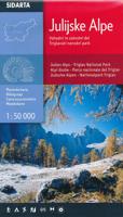
Wandelkaart Julische Alpen - Triglav National Park | Sidarta
Dit is de overzichtskaart 50.000 van de Julische Alpen, er zijn daarnaast van uitgever Sidarta nog 3 hele goede deelkaarten 25.000 van dit gebied.   Deze dubbelzijdige detailkaart (1:50.000) heeft ingetekende wandelroutes waarbij met verschillende kleuren de moeilijkheidsgraad wordt aangegeven, een aanduiding van de berghutten (met op de achterzijde meer informatie over deze hutten als openingstijden en capaciteit) en andere handige zaken voor wandelaars. Zelfs benzinepompen en busstops zijn vermeld.    Daarnaast kent de kaart veel topografische details als hoogtelijnen, terrein-informatie en naamsaanduidingen. Door graden-aanduiding aan de zijkant is de kaart GPS toepasbaar.   - Julian Alps- Julijske Alpe - Triglav National Park hiking map 1:50,000 Slovenie - All alpine paths graded easy, difficult, very difficult - Marked tourist paths around Bled, Kranjska Gora, Bovec, kobarid - 'Walks of Peace' trail marked a historical path round the frontline from the 1st World War (The isonco F…
14,95
Nieuw
Wandelgids Walking in the Alps | Cicerone
Geweldig overzichtswerk van prachtige wandelroutes in de Alpen. Suggests many routes, and covers the range from the Maritime Alps of southern France to the Julian Alps of Slovenia. Walks vary from undemanding to long and tough, and everything in between. Walking is unquestionably the best method of exploring, and it is the mountain walker for whom journeys in the Alps reveal some of the finest views, the greatest contrasts. This book then is a definitive guide to the many thousands of possible routes, with a geographical span that ranges from the Maritime Alps of southern France to the Julians of Slovenia, from Italy's Gran Paradiso to the little-known Turnitzer Alps of eastern Austria, from the ice-bound giants of the Bernese Oberland to the green rolling Kitzbuheler Alps and the bizarre towers of the Dolomites of South Tirol, showing the amazing diversity of this wonderful mountain chain. There are walks to suit every taste: gentle and undemanding, long and tough, and everything in …
33,95
Wandelgids The Swiss Alps | Cicerone
  The Swiss Alps are home to the highest and most spectacular mountains in Western Europe. This stunning guidebook describes each mountain area throughout Switzerland – the peaks, passes, valleys and bases – to help you identify the best destinations to plan your trip.   Questions such as ‘Where to walk, climb or ski?’, ‘What multi-day treks are available’ and ‘Where do they go?’, ‘Where are the mountain huts, what are their facilities, which peaks do they serve?’ And where are the most suitable valley bases?’ – all these and more are addressed in detail in this essential guidebook.   The Swiss Alps does not give detailed route directions but information is given about all the guides and maps available for every region.   The Swiss Alps by Kev Reynolds is the third book in Cicerone’s World Mountain Ranges series, which include The Pyrenees and Scotland.   descriptions of all the Swiss Alps, area-by-area from the Chablais Alps in the south west to the Silvretta in the north east classi…
34,95
Nieuw
Wandelgids 100 Hut Walks In The Alps | Cicerone
This guidebook has route descriptions for 100 day walks to suit alpine walkers of all abilities, with suggestions for some hut-to-hut tours. These routes take you through breathtaking scenery in the Maritime Alps, Julian Alps, Gran Paradiso, the Turnitzer Alps, Bernese Oberland, the Kitzbuheler Alps and the Dolomites of South Tirol. Extending in huge arc of more than 1000km (620 miles) from the Mediterranean coast near Nice to the low, wooded foothills outside Vienna, the Alps display the full gamut of mountain landscape features. All of the routes in this guide have been specially selected to show the amazing diversity of this wonderful mountain chain.   There are walks to suit every taste: gentle and undemanding, long and tough, and everything in between. Most of the routes avoid climbing of a technical nature except the odd scramble aided by a fixed rope. Glacier crossings where crevasses lurk for the unwary have also been avoided in the main, although just a small handful of walks…
22,95
Nieuw
Wandelgids Trekking in the Stubaier Alps | Cicerone
Uitstekende wandelgids van Cicerone over de Stubaier Alpen, waarbij de nadruk ligt op een tweetal meerdaagse routes: Huttentochten voor een gemiddelde en wat meer gevorderde wandelaar. Goede praktische informatie, kaartmateriaal beperkt. Aanbevolen wandelkaarten bij deze gids Schaal 1:25.000 Wandelkaart 31/1 Alpenvereinskarte Stubaier Alpen - Hochstubai Wandelkaart 31/2 Alpenvereinskarte Stubaier Alpen - Sellrain Of schaal 1:50.000 Wandelkaart 83 Stubaier Alpen Kompass A guidebook to three hut-to-hut treks in Austria’s Stubai Alps: the 79km Stubai Rucksack Route, the 60km Stubai Glacier Tour – plus a South Tirol extension, and the 67km Gschnitztal Runde Tour. Whereas the rucksack route requires only good fitness and mountain walking experience, the glacier tour involves glacier crossings. The Stubai Rucksack Route is presented in 9 stages, the Stubai Glacier Tour in 7 (with the extension bringing it to 11) and the Gschnitzal Runde Tour in 7.   Also included are optional ascents of nei…
24,95
Wandelgids - Klimgids - Klettersteiggids Via Ferratas of the French Alps | Cicerone
This guidebook covers 66 varied via ferratas in the French Alps. The routes are spread over six areas: Geneva and the Northern Alps, Chambéry, Tarentaise and Maurienne valleys, Grenoble and Briançon, amid the Mont Blanc, Vanoise and Queyras ranges. Difficulty ranges from easy, protected routes through to exposed, technical challenges. With some of the most beautiful scenery in the world, the French Alps have long been a popular destination for a wide range of outdoor activities. In recent years, the region has seen the arrival of a growing number of via ferrata routes.   Via ferrata climbing – using fixed cables, bridges and ladders to explore terrain that is normally only accessible to experienced rock climbers – combines elements of scrambling, mountaineering and rock climbing, yet is a very distinct pursuit. Increasingly popular, recent years have seen a surge in the number of routes being established in these iconic mountains.   The routes in this guidebook range from straightforw…
25,95
Nieuw
Wandelgids Walking in Italy's Stelvio National Park | Cicerone
Wandelgids voor de Stelvio Nationaal Park in de Rätische Alpen ( Alpi Retiche ) ten zuiden van de Splügenpas op de grens met het Zwitserse Graubünden. Engelstalige beschrijving van 38 dagwandelingen.   Aanbevolen wandelkaarten 1:25.000 voor deze gids Wandelkaart 008 Ortles - Cevedale - Ortlergebiet | Tabacco Editrice   Wandelkaart 045 Latsch - Martell - Schlanders- Laces - Val Martello - Silandro | Tabacco Editrice   Wandelkaart 048 Val di Peio - Val di Rabbi - Val di Sole | Tabacco Editrice   The wide range of 38 summer day walks in this guide explore the renowned Stelvio National Park in the Italian Rhaetian Alps. Bordering the Dolomites to the east, and Switzerland to the west, the Stelvio is one of the largest protected areas in all of the Alps. Its unspoilt landscape ranges from valley farmland to forested hillsides and alpine meadows, and up to a wilderness of rugged glaciated summits and ridges, the highest of which is Ortler, at 3905m.   The walks, a selection of routes from e…
20,95
Wandelkaart 064 Julische Alpen - Alpi Giulie | Kompass
Goede wandelkaart met vrijwel alle topografische details als hoogtelijnen, vegetatie, schaduwtekening maar ook de ingetekende wandelroutes en in veel gevallen ook fietsroutes (MTB). Gevaarlijke routes worden als zodanig weergegeven met een bepaalde markering. Berghutten en campings zijn goed terug te vinden op deze kaarten.   Daarnaast staan de toeristische bezienswaardigheden met symbolen vermeld. Kleurgebruik kan soms vrij fel overkomen, daardoor oogt deze detailkaart wellicht wat druk, maar het blijft een goed leesbare kaart. Sommige kaarten zijn geplastificeerd, maar helaas niet allemaal. De graden staan aan de zijkanten van de kaart, daardoor te gebruiken voor GPS.   Steden/dorpen/gebieden: Cave d. Predil (Raibl), Kranjska Gora (Kronau), Mojstrana, Bovec (Flitsch), Soca, Trenta, Stara Fuzina (Althammer)   Bergen/dalen: Jof di Montasio (Montasch), Mangart, Prisojnik, Triglav   Rivieren/meren: Soca, Bohinjsko Jezero (Wocheiner See)   Wanderkarte Julische Alpen, National…
16,95
Nieuw
Wandelgids Beieren - Walking in the Bavarian Alps | Cicerone
Wandelgids met dagtochten: goed beschreven met veel praktische informatie om de route te kunnen lopen, inclusief redelijke kaarten. Enorm veel keus in een groot gebied! This guidebook of walks explores Germany's Bavarian Alps. Lying along the German-Austrian border in a thin sliver of land roughly 300km long, this area contains some of the most spectacular walking and beautiful scenery that Germany has to offer. 70 graded walks explore mountain landscapes, wild mountain gorges and alpine meadows as well as the region's picturesque villages, opulent baroque churches and fairy-tale castles like Neuschwanstein. The walks are divided into six mountain areas, grouped around base towns to make planning a walking holiday as easy as possible. Bases include Oberstdorf, Garmisch-Partenkirchen, Mittenwald, Marquartstein, Inzell, Oberammergau and Ramsau among others. Mountain walks are mainly between 3 and 8 hours duration, though some longer walks are included staying at mountain huts. The guide…
24,95

Klanten-reviews van Wandelgids Julian Alps of Slovenia - Julische Alpen | Cicerone

Er zijn nog geen beoordelingen voor dit productBen jij de eerste die een review plaatst?

Meer over Wandelgids Julian Alps of Slovenia - Julische Alpen | Cicerone

Productomschrijving

Engelstalige wandelgids met 57 dagtochten en 4 trekkings door de Julische Alpen. Goede omschrijvingen van de tochten met alle noodzakelijke praktische info alsmede - beperkt - kaartmateriaal.

Aanbevolen wandelkaarten bij deze gids

Gebied 1 Wandelkaart 064 Julische Alpen - Alpi Giulie | Kompass 1:25.000

Wandelkaart Triglav - Kranjska Gora – Bohinj – Julische Alpen | Sidarta 1:25.000

Gebied 2 Wandelkaart Bohinj Triglav, Krn, Crna prst – Julische Alpen | Sidarta 1:25.000

Gebied 3 Wandelkaart Bovec Trenta - Julische Alpen | Sidarta

Gebied 4 Wandelkaart 2 Pocketmap Bled | Kartografija

Gebied 5 Wandelkaart - Fietskaart Posocje | Kartografija 1:40.000

Of

Voor vrijwel het hele gebied beschreven in de gids.

Wandelkaart 141 WK Julische Alpen | Freytag & Berndt  1:50.000


Over 60 walks which bring the best of Slovenia’s Julian Alps to the English-speaking walker. The walks are organized around five bases – Kranjska Gora, Bovec, Kobarid, Bled and Bohinj. The routes range from easy valley walks and rougher forest trails to high-mountain protected routes and multi-day treks.

This guidebook contains over 60 walks which explores the best of the Julian Alps of Slovenia. The walks and treks in this guidebook are organised around five bases in the Julian Alps - Kranjska Gora, Bovec, Kobarid, Bled and Bohinj - all of which have a range of accommodation and public transport facilities.   There is something here for everyone - from easy valley walks and rougher forest trails to high-mountain protected routes, some of which require Alpine mountaineering experience. Several possibilities for multi-day walks are included.    The Julian Alps are situated in the small independent republic of Slovenia, at the south-eastern end of the Alpine chain. Their highest peak, Triglav, at 2864m, may be smaller than some of the better-known western giants, but what the mountains lack in stature they make up for in interest and accessibility. The dramatic limestone peaks drop steeply through forests to flower meadows, and will give you a feast for the eyes no matter which direction you turn.

Verken gerelateerde categorieën

Webshop.nl maakt gebruik van cookies. Ga je verder op onze website, ga dan akkoord met het plaatsen van cookies en de verwerking van deze data door ons en vermelde partners.