Productomschrijving
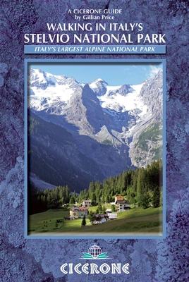
Wandelgids voor de Stelvio Nationaal Park in de Rätische Alpen ( Alpi Retiche ) ten zuiden van de Splügenpas op de grens met het Zwitserse Graubünden. Engelstalige beschrijving van 38 dagwandelingen. Aanbevolen wandelkaarten 1:25.000 voor deze gids Wandelkaart 008 Ortles - Cevedale - Ortlergebiet | Tabacco Editrice Wandelkaart 045 Latsch - Martell - Schlanders- Laces - Val Martello - Silandro | Tabacco Editrice Wandelkaart 048 Val di Peio - Val di Rabbi - Val di Sole | Tabacco Editrice The wide range of 38 summer day walks in this guide explore the renowned Stelvio National Park in the Italian Rhaetian Alps. Bordering the Dolomites to the east, and Switzerland to the west, the Stelvio is one of the largest protected areas in all of the Alps. Its unspoilt landscape ranges from valley farmland to forested hillsides and alpine meadows, and up to a wilderness of rugged glaciated summits and ridges, the highest of which is Ortler, at 3905m. The walks, a selection of routes from each of the Stelvio's valleys, are graded for difficulty and each is designed to fit into a single day, be it a couple of hours or a full day out. There is something here for many active holidaymakers, from easy strolls to strenuous climbs to panoramic peaks for experienced walkers. Also included are spectacular non-glacier summits that are accessible to walkers who want to go that bit further. A handful of walks do include brief stretches across rock faces aided by anchored cable. While they are not strictly climbing routes requiring specialist equipment, it is essential to keep away from them in bad weather. The guidebook also includes plenty of background information on local wildlife and cuisine, as well as planning details such as what to take and dos and don'ts. An extensive appendix also contains accommodation suggestions, including campsites, B&Bs, hotels and mountain huts – known locally as ‘rifugios’. 38 routes offering something suitable for all active holidaymakers, from easy strolls to strenuous climbs the first English-language guide to the area easily accessible from Milan, Verona and Innsbruck Seasons late June through to October Centres Bormio, S Caterina Valfurva, Sulden, Martell, St Gertraud, Peio, Rabbi, Malè Difficulty single day walking routes graded 1 to 3 to allow for beginners as well as experienced walkers ready for peaks. Walks easily extended into multi-day expereinces with overnight stays in alpine refuges Must See the thrilling Stelvio Pass on foot or by bus, the Forno glacier, the Ortler and Cevedale mountains, ibex and chamois in Val Zebrù, Martelltal and Valle di Rabbi, lammergeiers and eagles, traditional Ultental