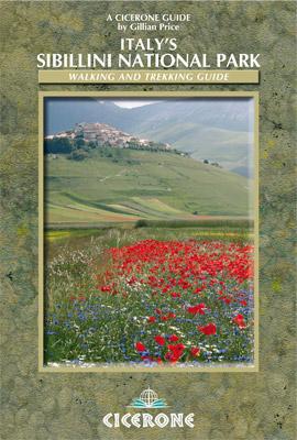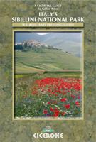
Wandelgids Italy's Sibillini National Park | Cicerone

0
Walking and trekking guidebook to Italy's Sibillini National Park in the Apennines. 21 day walks and an 8-stage multi-day trek, the 120km Grande Anello dei Sibillini are explored alongside sketch maps and plenty of practical information. Easily reached from airports on the Adriatic coast and Rome, the Sibillini straddles the Marche and Umbria.   S...

Verkopers met dit product

Verkoper
Bezorging
Prijs
DeZwerver.nl logo
DeZwerver.nl
2,95
19,95

Anderen bekeken ook

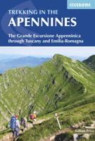
Wandelgids Trekking in the Apennines - Apennijnen | Cicerone
Uitstekende wandelgids die in etappes de route nauwkeurig beschijft; ook de zijtakken en alternatieve routes koman aan bod. Kaarten zijn schetsmatig en in onze ogen onvoldoende bij slechte weersomstandigheden. Wij raden dan ook om er losse kaarten bij te kopen, voor zover verkrijgbaar! Guidebook to the Grand Apennines Trek, or Grande Escursione Appenninica (GEA). Through Tuscany and Emilia-Romagna and two National Parks, this 400km, 23 day trail explores the mountains, forests and hills of central Italy. Suitable for a range of walkers, it can be split into shorter sections or day walks if needed. This guidebook describes the Grande Escursione Appenninica (GEA), a nearly 400km long, three week trek crossing the Appenines in 23 stages, from Bocca Trabaria to Passo Due Santi on the edge of Liguria. The route dips in and out of Tuscany and Emilia-Romagna, never dropping below 400 metres. Best walked between spring and autumn, it is suitable for any reasonably fit walker. Highlights inclu…
22,95
Wandelgids Walking in Tuscany - Toscane | Cicerone
Uitstekende wandelgids van Toscane. Goed beschreven met veel praktische informatie om de route te kunnen lopen, inclusief redelijke kaarten. Aanbevolen wandelkaarten De meeste wandelingen (maar lang niet allemaal!) in deze gids worden gedekt door wandelkaart: Wandelkaart - Fietskaart 2440 Toscana | Kompass Voor de andere gebieden staan de kaarten hier onder per gebied genoemd. A guidebook to walks in the Italian region of Tuscany. 43 graded routes range from 2.5 to 18km, and take in the Renaissance splendour of Florence and Siena, the World Heritage scenery of Val d'Orcia and San Gimignano and the stunning island of Elba. Alongside detailed route descriptions and clear mapping there is essential practical information on public transport and food and drink, as well as a comprehensive list of accommodation, and a useful Italian–English glossary. The guide is packed with interesting details about the area’s wildlife, landscape, culture and history, making it a perfect companion to gettin…
23,95
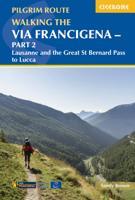
Wandelgids - Pelgrimsroute Via Francigena part 2 | Cicerone
Guidebook to the Via Francigena pilgrim route from Lausanne to Lucca. Starting at Lake Geneva (Lac Léman), the 725km route crosses the Alps at historic Great Saint Bernard Pass, descends the Po Valley, then climbs to cross the Cisa Pass into Tuscany. Described in 32 stages, with information on facilities and pilgrim hostels.   Seasons Suitable for walking in spring, summer and autumn. The Great Saint Bernard Pass is fully open to hikers only in August and September.   Centres Lausanne, Martigny, Great Saint Bernard Pass, Aosta, Ivrea, Vercelli, Pavia, Piacenza, Pontremoli, Pietrasanta, Lucca.   Difficulty Each stage is graded for difficulty (1-4). A few mountainous stages include steep and slippery slopes. No special gear is required to walk the Via Francigena in season, but off-season crossings of the Great Saint Bernard Pass require winter mountain gear and careful attention to changing mountain conditions.   Must See Dazzling Lake Geneva, the 1500-year-old Abbey of Sai…
24,95
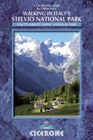
Wandelgids Walking in Italy's Stelvio National Park | Cicerone
Wandelgids voor de Stelvio Nationaal Park in de Rätische Alpen ( Alpi Retiche ) ten zuiden van de Splügenpas op de grens met het Zwitserse Graubünden. Engelstalige beschrijving van 38 dagwandelingen.   Aanbevolen wandelkaarten 1:25.000 voor deze gids Wandelkaart 008 Ortles - Cevedale - Ortlergebiet | Tabacco Editrice   Wandelkaart 045 Latsch - Martell - Schlanders- Laces - Val Martello - Silandro | Tabacco Editrice   Wandelkaart 048 Val di Peio - Val di Rabbi - Val di Sole | Tabacco Editrice   The wide range of 38 summer day walks in this guide explore the renowned Stelvio National Park in the Italian Rhaetian Alps. Bordering the Dolomites to the east, and Switzerland to the west, the Stelvio is one of the largest protected areas in all of the Alps. Its unspoilt landscape ranges from valley farmland to forested hillsides and alpine meadows, and up to a wilderness of rugged glaciated summits and ridges, the highest of which is Ortler, at 3905m.   The walks, a selection of routes from e…
20,95
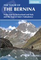
Wandelgids The Tour of the Bernina | Cicerone
Uitstekende wandelgids van een meerdaagse tocht in Zwitserland en Italië in het Bernina-gebied. Goede beschrijvingen, veel praktische informatie en redelijke kaarten al zullen deze niet helemaal voldoende zijn.   This guidebook explores two treks in the Bernina region of the Swiss-Italian Alps. The Tour of the Bernina is an 9-stage trek circling the Piz Bernina massif, 119km long and suitable for beginner trekkers. Also included in this guide is the 8-stage Alta Via Valmalenco just to the south of the Bernina. Although shorter, at 94km long, this is a more challenging route suitable for trekkers with more experience.   Whether skirting above St. Moritz and below snow-capped giants on the Tour of the Bernina, or climbing over wild, high passes and through isolated mountains in the Italian Valmalenco by Monte Disgrazia, the treks offer incredible experiences. Both feature spectacular peaks towering over snow fields and perfect alpine pastures, with accommodation in comfortable alpine gu…
24,50
Wandelgids Walking the Via Francigena part 3 Lucca to Rome | Cicerone
Guidebook to the final 400km of the Via Francigena pilgrim route from Lucca to Rome. Crossing Tuscany in the heartland of Italy, the route goes through two of the region's most important cities, Lucca and Siena, and visits San Gimignano, Monteriggioni, and Radicofani. Described in 18 stages, with information on facilities and pilgrim hostels. Certified by the Council of Europe as an official Cultural Route, the Via Francigena from Canterbury to Rome brings to the modern pilgrim the cultural heritage of four nations--England, France, Switzerland, and Italy--and highlights their natural beauty and their history. Each stage has route directions and 1:100,000 mapping, which shows the route line and the facilities available at different locations. The book details accommodation along the route, including invaluable information on low-cost pilgrim hostels. There are city maps for Lucca, Siena, Rome, and Viterbi, and a stage planning guide that lists intermediate distances between pilgrim ac…
24,95
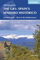
Wandelgids Spain's Sendero Historico: the GR1 | Cicerone
A step by step guide to walking the 1250km long Sendero Historico (the GR1) across northern Spain. Travelling from west to east, the GR1 starts at the Puerto de Tarna, on the border of Asturias and Castilla y Leon, heads east along the southern flank of the Cantabrian Mountains and the foothills of the Pyrenees before finishing on the Mediterranean coast near L'Escala. Arguably one of Spain's best long-distance paths, it follows gently graded paths, making a long but easy walk suitable for a reasonably fit walker. The complete trail requires around 53 days to complete end to end, but the guidebook splits the route into 7 sections, each with a start or endpoint that can be easily reached by train or bus, allowing walkers to explore the route in manageable chunks. The guidebook also describes how to extend the route to Finisterre and the Atlantic using GR routes. As well as extensive notes on the history of modern Spain, from medieval times to more recent events such as the Civil War, t…
26,50
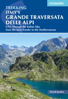
Wandelgids Italy's Grande Traversata delle Alpi GTA | Cicerone
Uitstekende beschrijving van de Grande Traversata della Alpi, een doorgaande meerdaagse wandeltocht door de Italiaanse ALpen aan de westkant. Goede routebeschrijving, schetsmatige kaarten, vol met nuttige en praktische informatie. A guidebook to Italy's Grande Traversata Delle Alpi (GTA) trek through the western Italian Alps. The 809km (503 mile) route is presented in 55 stages with each stage ranging from 7-26km (4-16 miles). Beginning at the Nufenen pass at the Swiss border the route traverses the Lepontine, Pennine, Graian, Cottian and Maritime Alps to finish at Ventimiglia on the Mediterranean coast. With nearly 60,000m of ascent this route is suitable for fit and experienced alpine trekkers. This guidebook contains route description and 1:00,000 mapping for each stage as well as information on the region's history, culture and wildlife. Accommodation, facilities and public transport information is also given to help with trek planning. Italy's western Alps is an area of high moun…
26,50
Wandelgids Walking in Abruzzo - Abruzzen | Cicerone
Uitstekende wandelgids van Abruzzo. Goed beschreven met veel praktische informatie om de routes te kunnen lopen, inclusief redelijke kaarten. The essential guidebook for walking in Abruzzo, a wild and beautiful region of Italy which includes the Maiella and Gran Sasso national parks and Sirente-Velino regional park. 40 walks include the Val di Rose, the Prati di Tivo, and an ascent of Corno Grande, the highest point in the Apennines of peninsular Italy. Walks range from 4km to 25km and there routes for all abilities. Alongside detailed route descriptions and maps there is advice on where to stay, access and parking information to get you to the start, and a useful Italian-English glossary.    Despite being close to Rome, Abruzzo is one of Italy’s least known and populated regions – a spectacular and harmonious blend of snowy mountains, grassy plains and forested canyons; of hillside olive groves, vineyards and long sandy beaches. Its stunning natural environments are protected in thre…
23,95
Wandelgids Trekking in the Alps | Cicerone
All the rich scenic diversity for which the Alps are renowned is celebrated here, while the 20 treks described include well-known classics as well as newly-created multi-day routes. The eight talented writers and photographers brought together to produce this book are among the most experienced of Alpine trekkers. Between them they have explored every corner of Europe’s premier mountain range, written dozens of guides and, in some cases, led trekking holidays there in order to share their enthusiasm for the Alps with other walkers. And that is the prime motivation for Trekking in the Alps – an inspiration and a celebration of the very best of these mountains. Best-known treks Tour of Mont Blanc; Tour of the Matterhorn; Tour of Monte Rosa; Walker’s Haute Route; Tour of the Jungfrau Region; Tour of the Vanoise; Dolomites AV 1 & 2 Longer trans-Alpine treks GR5 (Lake Geneva to Nice); Eastern Alps E5; Italian Alps GTA; Traverse of the Slovenian Alps For the Alpine adventurer Alpine Pass Ro…
28,95

Klanten-reviews van Wandelgids Italy's Sibillini National Park | Cicerone

Er zijn nog geen beoordelingen voor dit productBen jij de eerste die een review plaatst?

Meer over Wandelgids Italy's Sibillini National Park | Cicerone

Productomschrijving

Walking and trekking guidebook to Italy's Sibillini National Park in the Apennines. 21 day walks and an 8-stage multi-day trek, the 120km Grande Anello dei Sibillini are explored alongside sketch maps and plenty of practical information. Easily reached from airports on the Adriatic coast and Rome, the Sibillini straddles the Marche and Umbria.   Seasons Seasons Refuges open from mid-April to mid-October; August and midsummer weekends very busy; higher ridges may have snow until June; excellent winter walking with snowshoes or touring skis, best with a local guide   Centres Centres Amandola, Balzo, Castelluccio, Norcia, Nursia, Preci, Castelsantangelo, Visso, Ancona, Pescara, Perugia   Difficulty Difficulty Something for all abilities, low-level strolls, ridges and walkers' peaks; the GAS requires no mountaineering expertise   Must See Must See The Grande Anello dei Sibillini 8-day trek, Sibillini National Park, Monte Vettore, Monte Sibilla, Piano Grande, Monte Bove


THE GAS – GRANDE ANELLO DEI SIBILLINI

Stage 1 Visso to Cupi Stage 2 Cupi to Fiastra Stage 3 Fiastra to Garulla Stage 4 Garulla to Rubbiano Stage 5 Rubbiano to Colle di Montegallo Stage 6 Colle di Montegallo to Colle le Cese Stage 7 Colle le Cese to Campi Vecchio Stage 8 Campi Vecchio to Visso   SHORTER WALKS 1 Valle del Fiastrone 2 Lago del Fiastrone and the Lame Rosse 3 Cascate dell’Acquasanta 4 Bolognola Sentiero Natura 5 Upper Valle dell’Ambro 6 Val di Panico and Pizzo Tre Vescovi 7 Monte Priora 8 The Monte Bove Circuit 9 Gole dell’Infernaccio 10 Monte Sibilla Circuit 11 Monte Porche and Palazzo Borghese 12 Nocelleto to Forca di Gualdo 13 Preci and Sant’Eutizio 14 Monte Patino 15 Foce and Lago di Pilato 16 Castelluccio to Lago di Pilato 17 Monte Vettore 18 Monte delle Rose 19 Castelluccio and the Piano Grande 20 The Dogana Loop 21 I Pantani

Productinformatie

    Verken gerelateerde categorieën

    Webshop.nl maakt gebruik van cookies. Ga je verder op onze website, ga dan akkoord met het plaatsen van cookies en de verwerking van deze data door ons en vermelde partners.