webshop.nl
Categorieën
  Sluiten

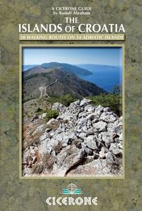
Wandelgids Islands of Croatia | Cicerone

This guidebook describes 30 day walks on the islands of the Croatian Adriatic, ranging from short, easy coastal strolls to more challenging, full day outings over rocky ridges and summits, with spectacular views of the Dalmatian coast. Featuring routes on 14 Croatian islands, including the islands of Hvar and Mljet, as well as quieter islands. From...
22,95

Webshops met dit product

Webshop
Bezorging
Prijs

Anderen bekeken ook

Wandelgids Walking in Cornwall | Cicerone
40 half to full day rambles on the coasts and inland hills of Cornwall are explored in this guidebook.  Routes range from short, 2 mile strolls to long, wild walks of over 8 miles. With plenty of opportunities to combine routes together, this guide provides a wealth of variety for walkers of all abilities.   The guidebook is divided into 6 sections, including walks on Bodmin Moor (for which good navigational skills are required), the North Coast, Penwith and West Cornwall, the Inland Mining Districts, Land's End and the Lizard and Roseland Peninsulas.    Cornwall has a lot to offer walkers; stunning coastal scenery and long stretches of wild moorland, with quiet estuaries cutting through high and rocky headlands. Birdlife and wildlife, from choughs to falcons to seals are found throughout the county, as are historical sites from the neolithic, to Iron Age hill forts and a long history of mining. The towns and villages of Cornwall, from the popular spots such as St Ives, Newquay and Pad…
19,95
Wandelgids Walking in Italy's Stelvio National Park | Cicerone
Wandelgids voor de Stelvio Nationaal Park in de Rätische Alpen ( Alpi Retiche ) ten zuiden van de Splügenpas op de grens met het Zwitserse Graubünden. Engelstalige beschrijving van 38 dagwandelingen.   Aanbevolen wandelkaarten 1:25.000 voor deze gids Wandelkaart 008 Ortles - Cevedale - Ortlergebiet | Tabacco Editrice   Wandelkaart 045 Latsch - Martell - Schlanders- Laces - Val Martello - Silandro | Tabacco Editrice   Wandelkaart 048 Val di Peio - Val di Rabbi - Val di Sole | Tabacco Editrice   The wide range of 38 summer day walks in this guide explore the renowned Stelvio National Park in the Italian Rhaetian Alps. Bordering the Dolomites to the east, and Switzerland to the west, the Stelvio is one of the largest protected areas in all of the Alps. Its unspoilt landscape ranges from valley farmland to forested hillsides and alpine meadows, and up to a wilderness of rugged glaciated summits and ridges, the highest of which is Ortler, at 3905m.   The walks, a selection of routes from ea…
20,95
Wandelgids The Isle of Skye | Cicerone
Uitstekende wandelgids, sommige meerdaags, voor dit uitdagende wandelgebied in Schotland. This third edition of Terry Marsh’s walking and scrambling guide to Skye, the Hebrides, northwest Scotland, updated using digital mapping and GPS. 87 walks and scrambles in Sleat and South-East Skye, Strath, Minginish, Duirinish, Waternish and Trotternish for all abilities. Each route describes local historical and geological points of interest. The fame of Skye, the most scenically awe-inspiring of Scotland's many islands, is widespread; you either love it, or hate it. There is no neutrality. For walkers and climbers this is the Promised Land, a place of raw elemental forces, a land barely scratched by man. Over-riding everything hangs an indefinable, almost supernatural, charisma that evokes a deep and abiding affection among those privileged to share Skye's secrets. To go in search of those secrets there is no better way than on foot, and in this collection of walks, Terry Marsh visits all corn…
22,50
Wandelgids Harris and Lewis - Outer Hebrides, Hebriden Schotland | Cicerone
Uitstekende wandelgids van dit geweldige gebied. goed beschreven met veel praktische informatie om de route te kunnen lopen, inclusief goede kaarten. This guidebook describes 30 day walks all over the Isles of Harris and Lewis, in the Outer Hebrides. The walks range from 2 and 14 miles (4 to 22km) in length, and are easily accessible from Stornaway or Tarbet.   Routes vary from short strolls to long wilderness hikes, high-level and low-level, and include the An Cliseam horseshoe, visits to ancient historic monuments like the stone circles of Calanais and the famous Butt of Lewis lighthouse, all illustrated with OS 1:50,000 maps and dramatic photography.   The routes take in most of the main summits as well as historical and geographical places of interest. A list of all the Marilyns (British hills of any height with a drop of at least 150m on all sides) on Harris, Lewis and St Kilda is included at the back. Tips are also included about walking on St Kilda, Berneray, Taransay, The …
23,95
Wandelgids The high mountains of Crete - Kreta | Cicerone
Guidebook to walking and trekking the high mountains of Crete. The largest of the Greek Islands, Crete's mountains provide breathtaking walking and wilderness to this popular island. The routes in this guidebook are graded for difficulty and range from short, easy strolls to challenging, multi-day treks and summit climbs, so there are options for walkers of all abilities.    All the mountain ranges of Crete feature high plains, gorges and ravines, but in the heart of the Lefka Ori there is something else. High above the treeline snow thaws by July to reveal a great circle of massive barren peaks, interspersed with ‘moonscape’ outcrops, or depressions, of sinkholes in black, grey or red rock. This high desert wilderness is seldom visited but covers some 960sqkm.   In central Crete, where the island is at its widest, the huge mass of Psiloritis (Mount Ida) dominates the whole region. Covering about 560sqkm this massif is different in that a single huge, partly scree-surfaced summit ridge…
26,50
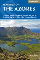
Wandelgids Walking on the Azores - Azoren | Cicerone
Uitstekende Engelstalige wandelgids waarbij de wandelingen goed beschreven staan met daarnaast een behoorlijke hoeveelheid praktische informatie als zwaarte, hoogtemeters maar ook bereikheid met OV en mogelijke eetgelegenheden. Kaartmateriaal - afhankelijk van het land - is duidelijk waarbij de route goed is ingetekend. De variatie in de wandelingen is vaak groot: van tamelijk eenvoudig tot loodzware dagtochten, veel keuze voor elke wandelaar.  A comprehensive guide to walking in the Portuguese Azores, an archipelago of nine lush green islands in the North Atlantic Ocean. The 70 routes cover the three island groups: the Eastern Group (São Miguel and Santa Maria), Central Group (Terceira, Graciosa, São Jorge, Pico and Faial) and Western Group (Flores and Corvo). Routes range from hour-long strolls to full-day outings and most use the islands' network of official waymarked trails, including sections of the multi-day GR1. Also included is an ascent of Pico, the highest mountain on Portugu…
23,95
Wandelgids Kroatië - Croatia | Sunflower books
Engelstalige wandelgids van Kroatie met routebeschrijving en kaartjes. - wandelingen voor iedere leeftijd en elk niveau - topografische wandelkaarten - autotochten en uitvouwbare wegenkaarten - korte wandelingetjes naar idyllische picknickplekjes - dienstregelingen voor het openbaar vervoer Contrasts and diversity sum up Croatia, one of the most beautiful and beguiling countries in Europe: tall forests, wind-combed prickly thornbush and juniper on the stony uplands, the miraculous waterfalls in the Plitvice Lakes and Krka national parks, the aridity of the karst landscapes, modern tourist resorts and timeless old villages, the deserted Krajina region and the intensively cultivated Neretva delta. The parks are particularly welcoming to walkers, with miles of waymarked and well-maintained paths and trails, some bringing seemingly inaccessible summits within quite easy reach.   From prehistoric times to the end of the 20th century, many empires and events have left their marks on the Croa…
20,95
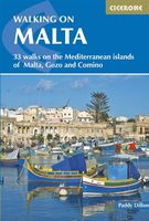
Wandelgids Walking on Malta | Cicerone
Wandelgids met 33 dagtochten op Malta, Gozo en Comino. Goede omschrijvingen, veel praktische informatie. Redelijk kaartmateriaal. (goede wandelkaart Kompass / zie landkaarten) The Maltese Islands of Malta, Gozo and Comino bask in sunshine at the heart of the Mediterranean, between Europe and Africa. History has ensured that the islands have been colonised time and time again, leaving them with a colourful and complex history and heritage. The islands are a popular tourist destination. They offer plenty of historic walks, stunningly beautiful and dramatic architecture, and a good amount of excellent scenery, especially around the cliffs and coastlines. This guidebook describes 33 walks on Malta and its neighbouring islands of Gozo and Comino. Walks generally range from 3 to 17 km, and include Valetta, heritage trails, coastal walks and explorations inland, including the 30km 'Victoria Lines' route between Mgarr and Bahar ic-Caghaq. Malta offers year-round walking. This guidebook describ…
21,95
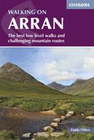
Wandelgids Walking on Arran | Cicerone
Uitstekende wandelgids voor dit uitdagende wandelgebied in Schotland. Dagtochten. The 45 walking routes in this Isle of Arran guidebook range from easy 3km (2 miles) nature trails to long arduous mountain routes with scrambles (up to 32km) providing thorough coverage of Arran, including the ascent of Goatfell and nearby Holy Isle. Most routes are 10km to 15km long but many give opportunities to create longer cross island walks. This guidebook presents a selection of 45 day walks on the popular and accessible Isle of Arran. The routes are between 2 miles (3km) and 20 miles (32km) in length, from easy waymarked forest trails to more arduous mountain walks, exposed ridge routes and scrambles. There are linear and circular walks to choose from, and opportunities to link routes together and create longer walks across the length and breadth of the island. With highlights including Goatfell, Beinn Tarsuinn, the Sannox Horseshoe, Glen Rosa and the Cock of Arran, there's something here to suit …
23,95
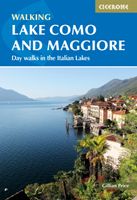
Wandelgids Lake Como and Maggiore | Cicerone
Uitstekende wandelgids van dit geweldige gebied. goed beschreven met veel praktische informatie om de route te kunnen lopen, inclusief redelijke kaarten. This guidebook describes 28 day walks and the Sentiero del Viandante trek around Lakes Como and Maggiore in Northern Italy. The day routes range from 3 to 20km in length are graded 1 to 3. The mini trek up the eastern shore of Lago di Como from Lecco to Colicocan can also be cut into one-day stages if desired.   There is something for everyone, from easy leisurely strolls for first-time walkers to strenuous climbs up panoramic peaks. The clear maps, inspirational photographs and information about accommodation and public transport options help to make this guidebook an ideal companion to exploring the exceptional scenery, views and culture of the Italian Lakes. A basic English-Italian glossary is also included.   Picturesque Lago Maggiore has been working its magic on writers and visitors for centuries. Blessed with a mild climat…
20,95

Klanten-reviews van Wandelgids Islands of Croatia | Cicerone

Er zijn nog geen beoordelingen voor dit productBen jij de eerste die een review plaatst?

Meer over Wandelgids Islands of Croatia | Cicerone

Productomschrijving

This guidebook describes 30 day walks on the islands of the Croatian Adriatic, ranging from short, easy coastal strolls to more challenging, full day outings over rocky ridges and summits, with spectacular views of the Dalmatian coast. Featuring routes on 14 Croatian islands, including the islands of Hvar and Mljet, as well as quieter islands. From short coastal strolls to full-day outings over rocky summits (suitable for all abilities), the walks in this guide cover an island chain of outstanding beauty. From the Kvarner Gulf (south of Rijeka) to southern Dalmatia (west of Dubrovnik), the Croatian islands feature limestone ridges and toothy knolls alternating with olive groves and lush green forest, while coastlines boast sun-drenched beaches and striking cliffs.   A superb network of trails covers the islands, and the views they offer are frequently spectacular. Yet, despite being near tourist hotspots, most see hardly any use. This guide has all the information walkers need to explore the islands fully and ensure these paths get the footfall they deserve.   30 varied walks on 14 beautiful Adriatic islands   information on history, culture, wildlife, public transport (including ferry routes) and accommodation useful glossary of Croatian terms and phrases   Seasons   suitable for walking year-round, with spring, summer and autumn being the best; May, June and September are the optimum months for walking, while July and August are the hottest   Centres   Krk, Rab, Cres, Lošinj, Unije, Pag, Ugljan, Dugi otok, Brač, Hvar, Vis, Korčula, Lastovo, Mljet   Difficulty   from short, easy coastal strolls with minimal elevation gain to more challenging, full day outings, over rocky summits, though all are well within the reach of the walker and no special equipment is required   Must See   well-developed network of trails around Baška (Krk), the rugged east coast of Rab, Osoršćica on Lošinj, popular Hvar, rugged Vis and remote Lastovo, Telašćica and Lastovo nature parks, and Mljet national park
Webshop.nl maakt gebruik van cookies. Ga je verder op onze website, ga dan akkoord met het plaatsen van cookies en de verwerking van deze data door ons en vermelde partners.