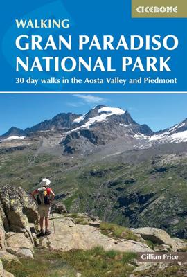
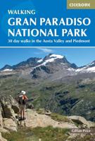
Wandelgids Gran Paradiso National Park | Cicerone

0

Verkopers met dit product

Verkoper
Bezorging
Prijs
DeZwerver.nl logo
DeZwerver.nl
2,95
23,95

Anderen bekeken ook

Wandelgids Italy's Sibillini National Park | Cicerone
Walking and trekking guidebook to Italy's Sibillini National Park in the Apennines. 21 day walks and an 8-stage multi-day trek, the 120km Grande Anello dei Sibillini are explored alongside sketch maps and plenty of practical information. Easily reached from airports on the Adriatic coast and Rome, the Sibillini straddles the Marche and Umbria.   Seasons Seasons Refuges open from mid-April to mid-October; August and midsummer weekends very busy; higher ridges may have snow until June; excellent winter walking with snowshoes or touring skis, best with a local guide   Centres Centres Amandola, Balzo, Castelluccio, Norcia, Nursia, Preci, Castelsantangelo, Visso, Ancona, Pescara, Perugia   Difficulty Difficulty Something for all abilities, low-level strolls, ridges and walkers' peaks; the GAS requires no mountaineering expertise   Must See Must See The Grande Anello dei Sibillini 8-day trek, Sibillini National Park, Monte Vettore, Monte Sibilla, Piano Grande, Monte Bove   THE GAS – GRANDE …
19,95
Wandelgids Trekking Gran Paradiso: Alta Via 2 : From Chardonney to Courmayeur in the Aosta Valley | Cicerone
A guidebook to trekking Alta Via 2, a route of 148km, from Chardonney and Courmayeur in the Gran Paradiso National Park. While not high on the difficulty scale, Alta Via 2 is strenuous, and best suited to trekkers with some alpine experience. Fittingly perfectly into a two-week time slot, the route is best undertaken between late June and late September.   The route is described across 12 stages (with a 4-stage extension option in place of Stages 6 and 7). Stages range from 5 to 18km, with stage ascent varying from 50m (Stage 8) to 1400m (Stage 9). Net ascent is 9630m. The route is described east to west so trekkers are rewarded with the beauty of Mont Blanc at the journey's end.   GPX files available to download Detailed information on travel logistics, the mountain hut network, as well as kit requirements Trek-specific Italian-English glossary included Information given on local alpine flora and wildlife Sized to easily fit in a jacket pocket
27,50
Wandelgids Walking in Italy's Stelvio National Park | Cicerone
Wandelgids voor de Stelvio Nationaal Park in de Rätische Alpen ( Alpi Retiche ) ten zuiden van de Splügenpas op de grens met het Zwitserse Graubünden. Engelstalige beschrijving van 38 dagwandelingen.   Aanbevolen wandelkaarten 1:25.000 voor deze gids Wandelkaart 008 Ortles - Cevedale - Ortlergebiet | Tabacco Editrice   Wandelkaart 045 Latsch - Martell - Schlanders- Laces - Val Martello - Silandro | Tabacco Editrice   Wandelkaart 048 Val di Peio - Val di Rabbi - Val di Sole | Tabacco Editrice   The wide range of 38 summer day walks in this guide explore the renowned Stelvio National Park in the Italian Rhaetian Alps. Bordering the Dolomites to the east, and Switzerland to the west, the Stelvio is one of the largest protected areas in all of the Alps. Its unspoilt landscape ranges from valley farmland to forested hillsides and alpine meadows, and up to a wilderness of rugged glaciated summits and ridges, the highest of which is Ortler, at 3905m.   The walks, a selection of routes from e…
20,95
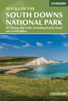
Wandelgids Walking in the South Downs National Park | Cicerone
Goede wandelgids uit de bekende Cicerone serie, dus met mooie foto's en duidelijke routebeschrijvingen en kaartjes. A guidebook to 40 circular day walks in the South Downs National Park. Exploring the beautiful chalk hills between Eastbourne and Winchester, there’s something for beginner and experienced walkers alike.   The walks range in length from 8 to 18km (5–11 miles), each is circular and where possible begins and ends at a place accessible by public transport.   1:50,000 OS maps are included for each walk Detailed information on public transport, accommodation and car parking Highlights include Beachy Head and Seven Sisters Easy access from Brighton and Worthing  
21,95
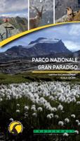
Wandelkaart Gran Paradiso National Park | Fraternali Editore
Officiele wandelkaart van het Nationaal park Gran Paradiso op schaal 1:25.000. For the realization of this paper map, hundreds of km has been walked on streets and paths, recording routes with gps technology This job technique allows us to obtain a precise collocation of all the useful elements for a hiker. The paper is based on the creation of a complete geographic database, organized on the GIS software with the following levels: Excursional informations (shelters, bivouacs, unwatched refuges, climbing walls, equipped areas, places of interest, routes fitted, dangerous passages, etc..) Cartographic legends and general information (entirely translated in English, French, German) Specific elements such us fountains, piles, crosses, access restrictions etc. Primary and secondary path network and fixed rope PNGP visiting centers Complete road network Lakes, rivers, canals National, regional, provincial, local borders, national parks Curves of 50m, 10m, 5m equidistance Build…
19,95
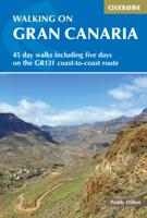
Wandelgids Walking on Gran Canaria | Cicerone
Uitgebreide wandelgids van dit deel van Gran Canaria: goede beschrijvingen, veel keuze, kaarten wat minder goed.   Guidebook describing 45 day walks on Gran Canaria, generally averaging 10 to 12km each. A long-distance coast-to-coast route on the GR131 is included, and shorter walks can be linked to form longer itineraries. One of the larger Canary Islands, Gran Canaria is a popular destination but offers many peaceful, rural areas perfect for walking.   Seasons High summer is popular, but too hot for walking. Good winter walking is possible, with only a very rare chance of snow on high mountains. Spring is ideal and autumn is tolerable.   Centres Most people stay in the city or resorts - Las Palmas, Maspalomas and Playa del Inglés - but there are quieter alternatives.   Difficulty Routes vary from short and easy to long and arduous. Many paths are rough and stony, so good footwear is required. The highest mountains are sometimes covered by low cloud, but sun protection wil…
20,95
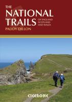
Wandelgids the National Trails - Great British Walks - Engeland, Wales en Schotland | Cicerone
Guidebook to Britain's National Trails - 19 long-distance walking routes through England, Wales and Scotland, describing what makes each of them so special and providing the practical information to help you plan your route. A definitive reference to the best of British walking. England South West Coast Path South Downs Way North Downs Way The Ridgeway Thames Path Cotswold Way Peddars Way & Norfolk Coast Path Cleveland Way Pennine Bridleway Hadrian's Wall Path Wales Pembrokeshire Coast Path Offa's Dyke Path Glyndwyrs Way Scotland Southern Upland Way Speyside Way West Highland Way Great Glen Way In 1965 as the first National Trail in the country was opened – ‘a Pennine Way from the Peak to the Cheviots’. Together, the National Trails cover well over 5000 kilometres (3100 miles), exploring the rich, scenic, historic countryside of Britain. Some trails are short and easy, while others are long and challenging. Some have a strong theme, following rugged coastlines or meandering rivers. Ot…
29,50
Wandelgids Scotland | Cicerone
Als je wilt wandelen in Schotland is dit het ultieme naslagwerk. A resource book covering the finest walks and climbs in Scotland, with its variety of wild landscapes ranging from the Southern Uplands to the great granite plateaus of the Cairngorms to the jagged arêtes of the Cuillin hills on the Isle of Skye. Whatever activity you are planning this guide has the information the independent mountain lover needs. Scotland is a mountainous country with a wide variety of wild landscapes: there are the rolling hills of the Southern Uplands, the great granite plateaus of the Cairngorms, the steep castellated rock peaks of Torridon and the jagged narrow aretes and spires of the Cuillin hills on the Isle of Skye. Of the many majestic summits, 284 reach 3000ft or more; these are the Munros, the ascent of which is the aim of many walkers. Below them lie splendid pine forests, beautiful lochs, deep glens, rushing rivers; a magnificent northern landscape. Whether you are planning a day scramble …
35,95

Klanten-reviews van Wandelgids Gran Paradiso National Park | Cicerone

Er zijn nog geen beoordelingen voor dit productBen jij de eerste die een review plaatst?

Meer over Wandelgids Gran Paradiso National Park | Cicerone

Productinformatie

    Verken gerelateerde categorieën

    Webshop.nl maakt gebruik van cookies. Ga je verder op onze website, ga dan akkoord met het plaatsen van cookies en de verwerking van deze data door ons en vermelde partners.