webshop.nl
Categorieën
  Sluiten

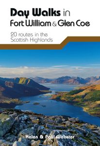
Wandelgids Day Walks in Fort William and Glen Coe | Vertebrate Publishing

Day Walks in Fort William & Glen Coe features 20 routes between 4.4 and 14.4 miles (7km and 23.2km) in length, spread across the Scottish Highlands. Researched and written by experienced and knowledgeable authors Helen and Paul Webster, founders of the Walkhighlands website, the walks range from gentle rambles to more challenging day walks, all thr...
20,95

Webshops met dit product

Webshop
Bezorging
Prijs

Anderen bekeken ook

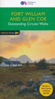
Wandelgids 07 Pathfinder Guides Fort William & Glen Coe | Ordnance Survey
Wandelgids van een deel Schotland. Deze gids bevat 28 dagwandelingen, variërend van korte tochten tot pittige dagtochten. De bijbehorende kaarten zijn uitstekend: men heeft de topografische kaarten van Ordnance Survey gebruikt waarop de route is ingetekend. Daarnaast praktische informatie over de wandeling en wat beschrijvingen van het gebied. Fort William and Glen Coe encompass one of the greatest areas of sea and mountain landscape in Scotland, backed by some of the biggest and most demanding peaks. This is Scotland's fjord land, a drowned coastland with long sea arms wending far inland, and steep climbs from sea level to Ben Nevis, the highest summit in Britain.   This walking guidebook contains 28 carefully selected walking routes around Fort William and Glen Coe of 5km (3 miles) to 16km (10 miles), each planned and tested by experienced walkers. Each route includes a full description, an extract of the OS Explorer 1 25 000 scale map, photos and notes of key features and wildlife t…
18,50
Wandelgids Ben Nevis and Glen Coe | Cicerone
Uitstekende wandelgids van Ben Nevis en Glen Coe. Goed beschreven met veel praktische informatie om de route te kunnen lopen, inclusief redelijke kaarten. This guidebook details 100 walking routes around Ben Nevis and Glen Coe, centred in 10 areas including Fort William and Glen Nevis, the Aonachs, the Mamores, Kinlochleven, Glen Coe, Glen Etive, Black Mount and Ben Cruachan. Routes are graded according to difficulty, and range between short, easy strolls and long, challenging walks with overnight bothy stays. The region's 44 Munro summits are covered, including 2 easy scrambles and the formidable traverse of Aonach Eagach's iconic jagged ridge.    Alongside step-by-step route descriptions and mapping, the guide presents practical advice on transport, access, safety and where to stay plus background information on the area's fascinating geology.     Many of the routes reflect the author's belief that the best rewards often lie off the popular tourist trails. Yet the highlights are all …
20,95
Wandelgids Walking The Munros Vol 1 Southern, Central and Western Highlands - Schotland | Cicerone
Uitstekende wandelgids van het zuiden, midden en westen van de Schotse Hooglanden. Goed beschreven met veel praktische informatie om de route te kunnen lopen, inclusief redelijke kaarten. Guidebook to walking the Munros in southern, central and western Highlands. Describes 69 challenging routes across 139 of the iconic 3000ft+ mountains covering areas such as Glencoe, Bridge of Orchy and Mull. Includes routes up Ben More, Ben Alder, Ben Lomond and Ben Nevis, the highest mountain in the British Isles. Volume 1 of two guidebooks.   Seasons The guide is intended for summer hillwalkers (usually April/May to October in Scotland). In winter conditions the routes become more serious mountaineering expeditions requiring appropriate skills, equipment and experience.   Centres Arrochar, Crianlarich, Killin, Pitlochry, Tyndrum, Glencoe, Fort William, Spean Bridge, Dalwhinnie, Braemar, Glenshee   Difficulty Most of the Munros are straightforward walks but some involve ridge walking, scr…
20,95
Wandelgids Day Walks in the Cairngorms | Vertebrate Publishing
Day Walks in the Cairngorms features 20 circular routes between 6.3 and 18.4 miles (10.2km and 29.6km) in length, spread across the Cairngorms National Park. Researched and written by local and experienced authors Helen and Paul Webster, founders of the Walkhighlands website, the walks range from gentle rambles to more challenging day walks, all through stunning and varied terrain. Enjoy riverside walks along the Spey and Dee, discover hidden lochans at Clais Fhearnaig, explore the ancient forests of Rothiemurchus or tackle the famous Munros of Braeriach, Ben Macdui and Cairn Gorm.   Examine geological features such as The Vat, see the results of rewilding projects at Glen Feshie and find tranquility at the breathtaking Uath Lochans. Together with stunning photography, each route features Ordnance Survey 1:25,000 maps, easy-to-follow directions, details of distance and navigation information, and refreshment stops and local information.  
20,95
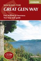
Wandelgids Great Glen Way | Trailblazer Guides
Goede wandelgids waarin met veel details alle etappes zijn beschreven. Tevens informatie over overnachtingen en openbaar vervoer. All-in-one, practical guide to walking the Great Glen Way long-distance footpath. The trail begins where the West Highland Way ends - at Fort William - and follows the Great Glen faultline to finish at Inverness after 79 miles (127km). The trail passes Loch Lochy, Loch Oich and Loch Ness and also follows the towpath of the Caledonian Canal.   It's a relatively easy week-long walk amongst beautiful Highland scenery but there's a high level option between Fort Augustus and Drumnadrochit that gives even better mountain views. This 2nd edition has been re-walked and fully updated. * Includes 38 detailed walking maps: the largest-scale maps available - at just under 1:20,000 (8cm or 31/8 inches to 1 mile) these are bigger than even the most detailed walking maps currently available in the shops * Unique mapping features - walking times, directions, tricky junctio…
19,95
Wandelgids The Great Glen Way | Cicerone
Uitstekende wandelgids van de Great Glen Way, waarbij naast alle noodzakelijke informatie ook gebruik gemaakt wordt van de echte topografische kaart. inclusief gidsje met routekaarten van 1:25000 (deze is hier ook los te bestellen)   Guidebook to walking the Great Glen Way, one of Scotland’s Great Trails that runs along the Great Glen between Fort William and Inverness. The guidebook - which includes both a guide to the route and a separate OS map booklet – describes the route in both directions.   Ideal as an introduction to long-distance walking, the 79-mile Great Glen Way is split into six stages easily walked within a week, with high- and low-level options given for two of these. An alternative route past the northern side of Loch Oich (via Invergarry) is also described.   The guidebook includes practical information, 1:100,000 OS mapping, step-by-step route descriptions for every stage of the walk and lists the facilities found along the way. A separate booklet of 1:25,000 OS mapp…
22,50
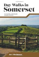
Wandelgids Day Walks in Somerset | Vertebrate Publishing
Day Walks in Somerset features 20 routes between 7 and 15 miles (11km and 24km) in length, spread across the county of Somerset, including the Exmoor National Park. Researched and written by experienced and local authors Jen and Sim Benson, the walks range from gentle rambles to more challenging day walks, all through interesting and varied landscapes.   Split into five sections – Exmoor; Quantock Hills & Blackdown Hills; Somerset Levels; Mendip Hills; and Bath & North East Somerset – this guidebook explores the best that Somerset has to offer.   Together with stunning photography, each route features Ordnance Survey 1:25,000 maps, easy-to-follow directions, details of distance and navigation information, and refreshment stops and local information.
20,95
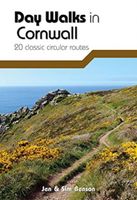
Wandelgids Day Walks in Cornwall | Vertebrate Publishing
Day Walks in Cornwall features 20 circular routes between 7.2 and 13.7 miles (11.6km and 22km) in length, suitable for hillwalkers of all abilities. Researched and written by experienced authors Jen and Sim Benson, and covering the extremities of this stunning peninsula, the walks reach areas from Bude to the Isles of Scilly, and from Rame Head near Plymouth to Lizard Point on the southernmost tip. Taking advantage of the South West Coast Path, discover a unique view of the charming coastline at every turn in this Area of Outstanding Natural Beauty.   Explore Chapel Porth caves, and countless coves, archways and waterfalls, or simply immerse yourself in a leisurely stroll along white sands and blue waters. Head for the Merry Maidens stone circle in Lamorna, examine the serpentinite rock formations at Lizard Point, watch over medieval Tintagel Castle and parade past Cromwell's Castle. Find serenity overlooking St Enodoc's Church or soak up the vibe of trendy fishing village St Mawes, ne…
20,95
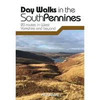
Wandelgids Day Walks in the South Pennines | Vertebrate Publishing
Day Walks in the South Pennines features 20 circular walks between 5 and 18 miles (8km and 29 km) in length, spread across West Yorkshire, Lancashire and Greater Manchester. Researched and written by knowledgeable and experienced author Paul Besley, the walks range from gentle rambles to more challenging day walks, all through striking and varied terrain. The routes are split into two geographical areas - Southern Walks, including routes around Dovestones, Ramsden Clough and Holmfirth; and Northern Walks, including routes around Hebden Bridge, Hardcastle Crags and Ilkley Moor.   Together with stunning photography, each route features Ordnance Survey 1:25,000 maps, easy-to-follow directions, details of distance and navigation information, and refreshment stops and local information.
20,95
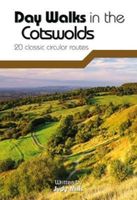
Wandelgids Day Walks in the Cotswolds | Vertebrate Publishing
Day Walks in the Cotswolds features 20 circular routes, between 7.1 and 12.6 miles (11.5km and 20.2km), suitable for hillwalkers of all abilities. Split across three areas - North-East Cotswolds, North-West Cotswolds and South Cotswolds - local author Judy Mills shares her favourite walks in this Area of Outstanding Natural Beauty. These walks take in a variety of local landmarks, including the World War II airfield and Roman villa at Chedworth; Neolithic long barrows such as Hetty Pegler's Tump; grand country estates like Badminton; magnificent Cotswold manor houses and historic churches; high points at Bredon Hill and North Nibley; and the many charming rural villages, such as the Duntisbournes and the Slaughters, for which the Cotswolds are famous.   Each route features Ordnance Survey 1:25,000 maps, easy-to-follow directions, details of distance and navigation information, and refreshment stops and local information. The walks are illustrated with stunning photography by outdoor ph…
20,95

Klanten-reviews van Wandelgids Day Walks in Fort William and Glen Coe | Vertebrate Publishing

Er zijn nog geen beoordelingen voor dit productBen jij de eerste die een review plaatst?

Meer over Wandelgids Day Walks in Fort William and Glen Coe | Vertebrate Publishing

Productomschrijving

Day Walks in Fort William & Glen Coe features 20 routes between 4.4 and 14.4 miles (7km and 23.2km) in length, spread across the Scottish Highlands. Researched and written by experienced and knowledgeable authors Helen and Paul Webster, founders of the Walkhighlands website, the walks range from gentle rambles to more challenging day walks, all through grand and impressive landscapes.   Split into four sections – Glen Coe & Glen Etive; Kinlochleven & the Mamores; Fort William & the Great Glen; and The Road to the Isles – this guidebook explores the best that the Highlands has to offer.   Together with stunning photography, each route features Ordnance Survey 1:25,000 maps, easy-to-follow directions, details of distance and navigation information, and refreshment stops and local information.

Verken gerelateerde categorieën

Webshop.nl maakt gebruik van cookies. Ga je verder op onze website, ga dan akkoord met het plaatsen van cookies en de verwerking van deze data door ons en vermelde partners.