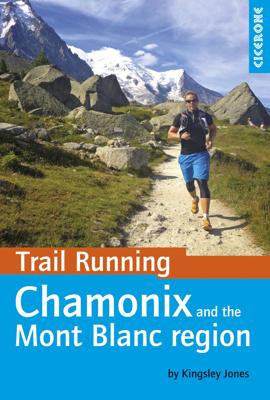
Wandelgids Chamonix & the Mont Blanc region Trail Running | Cicerone

0

Verkopers met dit product

Verkoper
Bezorging
Prijs
DeZwerver.nl logo
DeZwerver.nl
2,95
19,95

Anderen bekeken ook

Nieuw
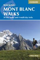
Wandelgids Mont Blanc Walks | Cicerone
Uitstekende wandelgids van dit geweldige gebied. goed beschreven met veel praktische informatie om de route te kunnen lopen, inclusief redelijke kaarten. A guide to walking and trekking routes, on both the French and Italian sides of Mont Blanc (Monte Bianco), from Chamonix or Courmayeur. Includes 50 day walks and 4 short multi-day treks for Vallorcine to Plaine Joux, Tour des Aiguilles Rouges, Vallorcine to Servoz and a circuit of the Italian Val Ferret. New, updated edition with 50 new route maps. Seasons Mid-June to mid-September is the main season; before this there will be snow at higher and possibly lower levels, and earlier and later the huts will not be open. Centres St Gervais, Les Contamines, Servoz, Les Houches, Chamonix, Argentiere, Vallorcine and Courmayeur on the Italian side Difficulty mainly day walks, with some shorter walks and 4 short treks; ranges from easy to tough routes for experienced high-mountain walkers Must See Lac Blanc, the balcony routes, the Chamonix Ai…
22,95
Nieuw
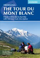
Wandelgids Trekking the Tour du Mont Blanc | Cicerone
Uitstekende wandelgids die in etappes de route nauwkeurig beschijft; ook de zijtakken en alternatieve routes koman aan bod. Kaarten zijn schetsmatig en in onze ogen onvoldoende bij slechte weersomstandigheden. Wij raden dan ook om er losse kaarten bij te kopen. A guidebook to hiking the Tour du Mont Blanc (TMB), a spectacular circuit around Mont Blanc, Western Europe's highest mountain. Covering 170km (105 miles), the TMB takes around 11 days to walk from its official start at Les Houches (France), passing through Courmayeur (Italy) and Champex (Switzerland) before returning to France via the Chamonix valley. A well-serviced introduction to high-level mountain trekking for walkers with good levels of fitness, it can also be run, fastpacked or hiked in 5–9 days.   The route is described in both directions in 11 daily stages between 7 and 21km (5–13 miles) in length. Variant routes and alternative stages are also provided, giving the option of visiting cols, refuges and viewpoints no…
25,95
Nieuw
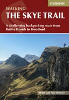
Wandelgids The Skye Trail | Cicerone
Guidebook to the Skye Trail, a challenging 80-mile (128km) trek that snakes its way north–south across the largest island in Scotland’s Inner Hebrides. This unofficial, week-long route is ideal for backpacking, camping wild each night, but can also be walked between overnight accommodation.   Unwaymarked route on sometimes-pathless terrain requires navigational skill, fitness and self-reliance, so is suitable for experienced mountain walkers Seven daily stages of 7–18 miles (11–29km) in length, with an optional 6-mile (11km) alternative route via the summit of Bla Bheinn, one of Skye’s most spectacular Munros Starts at Rubha Hunish at the northern tip of Skye, visits the capital Portree, follows Glen Sligachan between the Black Cuillin and Red Hills, before finishing in the south at Broadford Highlights include the Trotternish Ridge, the Quiraing, the Old Man of Storr, the mighty Cuillin and the abandoned village of Boreraig Clear route descriptions with full 1:50,000 OS mapping and e…
20,95
Nieuw
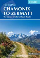
Wandelgids Chamonix to Zermatt | Cicerone
Uitstekende wandelgids die in etappes de route nauwkeurig beschrijft; ook de zijtakken en alternatieve routes koman aan bod. Kaarten zijn schetsmatig en in onze ogen onvoldoende, zeker bij slechte weersomstandigheden. Wij raden dan ook om er losse kaarten bij te kopen. A guidebook to the classic Chamonix to Zermatt trek from Mont Blanc to the Matterhorn. The 225km Walker's Haute Route through the French and Swiss Alps crosses 11 passes, gains more than 14,000m in height and is a strong contender for the title of Most Beautiful Walk in Europe. The high-level route is described in 14 day stages, with optional variants, and is suitable for walkers with a good level of fitness and some previous alpine trekking experience. The final approach to Zermatt adopts the dramatic Europaweg, a high-level traverse of the east wall of the Mattertal, crossing the 500-metre suspension bridge at Randa. An alternative valley route to Zermatt can be taken if this does not appeal. Alongside clear route des…
22,95
Nieuw
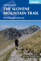
Wandelgids The Slovene Mountain Trail | Cicerone
Uitstekende wandelgids van de Slovenska Planinska Pot. Goed beschreven met veel praktische informatie om de route te kunnen lopen, inclusief redelijke kaarten. A guidebook to trekking the Slovene Mountain Trail, crossing Slovenia from Austria to the Adriatic. The 550km route is presented in a series of 12 3 to 6-day treks of all levels of difficulty, all featuring start and finish points that can be accessed by public transport. They can be completed as single sections or linked to create a longer trip. Each day is graded: low-grade walking is mostly on tracks or lanes with no steep ascents, whereas the most difficult stages may involve steep and technical terrain including fixed protection or sections of via ferrata, for which a helmet, self-belaying equipment and the appropriate experience are required.   In addition to clear route description and mapping, the guide provides all the practical information you will need to plan your trip, covering transport, accommodation and safet…
23,95
Nieuw
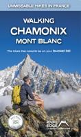
Wandelgids Walking Chamonix Mont Blanc | Knife Edge Outdoor
The 20 hikes in the Chamonix Valley that need to be on your Bucket List. No fillers. Only must-do hikes are included.   ► Real IGN Maps inside: 1:25,000 ► Detailed information on public transport, including cable cars ► Our secret tips on how to get away from the crowds ► Numbered waypoints linking the Real Maps to our clear descriptions ► Graded routes to suit all abilities ► Everything the hiker needs to know: route descriptions, difficulty, weather, how to get there, and more ► Information on Wildlife and Plants   Our walks have been carefully selected to enable easy access by public transport, including the Chamonix Valley’s incredible cable car network.   Chamonix is the most famous mountain town in the world. It is where mountaineering began.  Its peerless reputation owes everything to the mighty Mont Blanc, the highest peak in Western Europe: our hikes will take you to the finest viewpoints of the mountain and its glaciers.
19,50
Nieuw
Wandelgids Tour of the Jungfrau Region - Berner Oberland | Cicerone
Trekkinggids met de gedetailleerde beschrijving van de klassieke Jungfrau-trek, maar ook varianten. Goede etappe-beschrijvingen met veel praktische info. The Tour of the Jungfrau Region is described as a clockwise hut-to-hut circuit, beginning at Schynige Platte and ending at Wilderswil, broken into 10 stages (with a number of alternatives offered). The 111km trek takes you in a horseshoe loop through the Bernese Oberland's most spectacular mountain scenery, in the shadow of such iconic peaks as Wetterhorn, Eiger, Monch and Jungfrau. In a journey of 9 to 10 days the Tour visits pastures, ridges, summits and passes, skirts exquisite mountain lakes and gazes on waterfalls, gorges and glaciers. Accommodation is both plentiful and atmospheric, and the route has lots of bad-weather alternatives.  
20,95
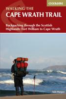
Wandelgids The Cape Wrath Trail | Cicerone
Uitstekende wandelgids die in etappes de route nauwkeurig beschijft.  A guidebook to the Cape Wrath Trail, a long-distance trek through the Scottish Highlands from Fort William to Cape Wrath. The Cape Wrath Trail is a 230-mile, three-week challenge through wild and magnificent landscapes, such as Morar, Knoydart, Torridon and Assynt. Crossing such empty country, it is for the experienced backpacker only. Activities Long-distance walking and backpacking   Seasons April, May and June are ideal months to walk the trail. September and October are also good, but there may be diversions due to deer stalking and military operations at the cape. In July and August the days are superbly long and the weather can be fine, but midges will be in full flight. The limited accommodation along the trail may also be booked up at this time of year   Centres Fort William, Glenfinnan, Barisdale, Kinloch Hourn, Shiel Bridge, Strathcarron, Kinlochewe, Dundonnell, Ullapool, Bridge of Orchy, Inchnadamph, Kyle…
25,95

Klanten-reviews van Wandelgids Chamonix & the Mont Blanc region Trail Running | Cicerone

Er zijn nog geen beoordelingen voor dit productBen jij de eerste die een review plaatst?

Meer over Wandelgids Chamonix & the Mont Blanc region Trail Running | Cicerone

Verken gerelateerde categorieën

Webshop.nl maakt gebruik van cookies. Ga je verder op onze website, ga dan akkoord met het plaatsen van cookies en de verwerking van deze data door ons en vermelde partners.