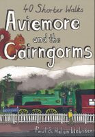
Wandelgids Aviemore and the Cairngorms | Pocket Mountains

0
Handige compacte wandelgids met 40 dagwandelingen. Deze gids bevat kleine kaartjes en leuke uitgebreide informatie over wat er langs de route te zien is. Goede wandelkaarten zijn echter we noodzakelijk voor deze tochten: de Ordnance Survey explorer maps of Landanger maps zijn zeer geschikt. 'Aviemore and the Cairngorms' features 40 shorter walks, ...

Verkopers met dit product

Verkoper
Bezorging
Prijs
DeZwerver.nl logo
DeZwerver.nl
niet bekend
10,95

Anderen bekeken ook

Wandelgids Loch Ness, Inverness, Black Isle and Affric | Pocket Mountains
Handige compacte wandelgids met 40 dagwandelingen. Deze gids bevat kleine kaartjes en leuke uitgebreide informatie over wat er langs de route te zien is. Goede wandelkaarten zijn echter we noodzakelijk voor deze tochten: de Ordnance Survey explorer maps of Landanger maps zijn zeer geschikt.   A guide to 40 favourite walks around Loch Ness, Inverness, Black Isle and Glen Affric. Loch Ness, with its legendary monster, is the most famous of all lochs. It holds more water than all the lakes of England and Wales combined and the countryside around it features an equally great variety of walks, with more waymarked trails and easy routes suitable for families than many other parts of the Highlands. Further north lies the magnificent Glen Affric - Scotland's most beautiful glen.   This is a wonderful area of the Highlands for walkers, having the highest mountains north of the Great Glen but also some splendid lower-level and forest walks. To the east is the fertile Black Isle, packed with cha…
10,95
Wandelgids The Munros | Pocket Mountains
The Munros are mountains in Scotland with a height of over 3000ft and take their name from the first list of such hills published in 1891 by Victorian mountaineer Sir Hugh Munro, 4th Baronet of Lindertis. Revised several times in the years since, the official list now features 282 peaks. This guide is for anyone who wants to climb these mountains and aims to provide reliable routes and tips for ascending them safely.   The Munros will ensure you reach parts of Scotland you might otherwise overlook, spend memorable evenings in pubs, bothies and wild camps, and have encounters with other walkers, locals and wildlife that enhance the adventure regardless of whether you get to the top of one Munro or all of them. Plaatsen in het boekje A’ Bhuidheanach Bheag, A’ Chailleach (Fannichs), A’ Chailleach (Monadhliath), A’ Chralaig, Ghlas-bheinn, A’ Mhaighdean, A’ Mharconaich, Am Basteir, Am Bodach, Am Faochagach, An Caisteal, An Coileachan, An Gearanach, An Riabhachan, An Sgarsoch, An Socach (De…
20,95
Wandelgids Isle of Skye | Pocket Mountains
The Isle of Skye (or Ant-Eilean Sgitheanach in its native Gaelic tongue) occupies an almost mythical place in the minds of many Scots. Romantic castles, magnificent sea-scapes, the alpine peaks of the Cuillin Ridge, marching pipe bands, scattered white crofters' cottages and a bloody history; the island has all these and more. This book features 40 moderate walks that take in much of this celebrated landscape, but reveal hidden gems too.   In spite of its popularity Skye is still rich in undiscovered treasures, from coastal caves and arches, ruined villages cruelly cleared of their inhabitants, to fossilised dinosaur footprints and a rich array of wildlife. Written by Skye residents Paul and Helen Webster, these walks will reveal both the wild and gentler sides of this dramatic landscape.   Plaatsen in het boekje An Aird, An Corran, Ardnish, Armadale, Arnish, Bearreraig Bay, Bioda Buidhe, Boreraig, The Braes, Broadford, Brochel Castle, Brothers' Point, Burma Road, Caisteal Maol, Calum…
10,95
Wandelgids Devon | Pocket Mountains
Handige compacte wandelgids met 40 dagwandelingen. Deze gids bevat kleine kaartjes en leuke uitgebreide informatie over wat er langs de route te zien is. Goede wandelkaarten zijn echter wel aan te raden voor deze tochten: de Ordnance Survey explorer maps of Landranger maps zijn zeer geschikt. From the crumbly rhubarb-and-cream-coloured cliffs of the Jurassic Coast in the southeast to the surf-stroked craggy coves in the north, across the wilderness and woodland of Dartmoor and Exmoor, and through the verdant valleys and great green grazing lands of the dairy belt - Devon is a county of exquisite contrasts and natural wonder. Whether you're looking for an easy afternoon stroll along the shore, a riverside ramble to an atmospheric country pub or a tor-topping trek on the moors, there's something to suit every boot in Patrick Kinsella's inspiring collection of 40 Devon coast and country walks. Plaatsen in het boekje Axminster, Baggy Point, Beer, Berry Camp, Bigbury-on-Sea, Bishop’s Walk,…
10,95
Wandelgids 100 outstanding British Walks | Ordnance Survey
Beschrijving van de 100 mooiste Pathfinder wandelingen in Engeland, Wales en Schotland. Uitstekende beschrijving van de route met een zeer duidelijke topografische kaart waarop de route is ingetekend.  This magnificent compendium of outstanding British walks brings together the finest selection of Pathfinder Walks in Britain s officially designated places of scenic beauty and historic interest: National Parks, Areas of Outstanding Natural Beauty, National Scenic Areas, Heritage Coast, National Trails and UNESCO World Heritage Sites. There are 100 walking gems in this collection, recommended by a group of experienced authors and guides. The walks span a range of distances and degrees of challenge and are organised by region with coverage across England, Wales and Scotland. 100 Outstanding British Walks is lavishly illustrated with stunning landscape photography and informative introductions to each of the walks. It is designed to be enjoyed at home, while the OS Maps app provides the p…
27,95
Wandelgids Walks Aviemore : Including Glenmore & Speyside | Hallewell Publications
This guide covers an upper stretch of the Spey Valley, from Grantown-on-Spey in the north to Newtonmore in the south.  The main walking centres are Aviemore and Glenmore; the bulk of the walking is in the Cairngorm Mountains, the pine woods around Loch Morlich, and the low and rolling Monadhliaths.  Walks range from 1 mile to 21 miles (1.5-34kms).  Routes include: Loch Garten, Cairn Gorm, Loch Morlich to Lairig Ghru, Loch an Eilein and Creag Bheag.  This book was previously published as Walks Speyside, but has been rewalked and revised.  
5,95
Wandelgids Wester Ross and Lochalsh | Pocket Mountains
Handige compacte wandelgids met 40 dagwandelingen. Deze gids bevat kleine kaartjes en leuke uitgebreide informatie over wat er langs de route te zien is. Goede wandelkaarten zijn echter we noodzakelijk voor deze tochten: de Ordnance Survey explorer maps of Landanger maps zijn zeer geschikt.     Wester Ross and Lochalsh are amongst the most popular areas for walks in the Scottish Highlands. The Lochalsh peninsula between the shores of Loch Duich and Loch Carron offers varied walking from villages such as Plockton as well as the region's main town at Kyle of Lochalsh. Across the dramatic Mam Ratagan pass is the remote and secluded Glenelg peninsula, a tranquil and peaceful haven far from busy routes.   Further north are Applecross and Lochcarron, with mountains that yield nothing in ruggedness to their more famous counterparts in Torridon, as well as attractive fishing villages and forest walks. Finally around Gairloch is an area that has long been famous for its fine sandy beaches, m…
10,95
Wandelgids Loch Lomond and the Trossachs | Pocket Mountains
Handige compacte wandelgids met 40 dagwandelingen. Deze gids bevat kleine kaartjes en leuke uitgebreide informatie over wat er langs de route te zien is. Goede wandelkaarten zijn echter we noodzakelijk voor deze tochten: de Ordnance Survey explorer maps of Landanger maps zijn zeer geschikt.     The new Loch Lomond National Park has ensured protection for what is not only Britain's largest freshwater lake, but one of its most beautiful, celebrated in ballad and song. West of Loch Lomond are the steep Arrochar Alps towering above Loch Long together with scores of much less visited lower hills stretching down to the seaboard. To the east is the Trossachs - a delightful landscape of forests, lochs and hills that has long been known as Scotland in miniature.   This latest pocket guide features 40 of the best walks in this popular area in an attractive and accessible format.
10,95
Wandelgids The Tweed | Pocket Mountains
Handige compacte wandelgids met 40 dagwandelingen. Deze gids bevat kleine kaartjes en leuke uitgebreide informatie over wat er langs de route te zien is. Goede wandelkaarten zijn echter we noodzakelijk voor deze tochten: de Ordnance Survey explorer maps of Landanger maps zijn zeer geschikt.   One of the world’s great salmon rivers, the Tweed cuts through the heart of the Scottish Borders and, in part, forms the historic boundary between Scotland and England. Rising in the rolling hills near Moffat, it weaves through a cherished landscape on its way to Berwick-upon-Tweed and the North Sea, passing through the proud Border towns of Peebles, Galashiels, Melrose, Kelso and Coldstream on the way.   There is no better way to discover the wildlife, architecture and history of this area of Scotland than to walk. Whatever your ability – walking at high or low level, following tough terrain or level paths – the 25 routes in this guide offer something for everyone.   Plaatsen in het boekje Abbot…
10,95
Wandelgids Shetland | Pocket Mountains
Handige compacte wandelgids met 40 dagwandelingen. Deze gids bevat kleine kaartjes en leuke uitgebreide informatie over wat er langs de route te zien is. Goede wandelkaarten zijn echter we noodzakelijk voor deze tochten: de Ordnance Survey explorer maps of Landanger maps zijn zeer geschikt. The most northerly of Britain's island groups, Shetland is so far removed from the rest of the UK that it usually appears as an inset on maps. Although relatively little known to those from outside the islands, Shetland is a magnificent terrain for walkers, especially those who love to really explore and get away from the beaten track. The coastal walking here includes some of the finest in the country, with superb cliffs, towering sea stacks, caves and natural arches seemingly around every corner. Added to this is Shetland's better known claim to fame for its spectacular seabird colonies, huge gannetries, moorland packed with arctic and great skuas, arctic terns in the more sheltered spots, and ev…
10,95

Klanten-reviews van Wandelgids Aviemore and the Cairngorms | Pocket Mountains

Er zijn nog geen beoordelingen voor dit productBen jij de eerste die een review plaatst?

Meer over Wandelgids Aviemore and the Cairngorms | Pocket Mountains

Productomschrijving

Handige compacte wandelgids met 40 dagwandelingen. Deze gids bevat kleine kaartjes en leuke uitgebreide informatie over wat er langs de route te zien is. Goede wandelkaarten zijn echter we noodzakelijk voor deze tochten: de Ordnance Survey explorer maps of Landanger maps zijn zeer geschikt.

'Aviemore and the Cairngorms' features 40 shorter walks, including many perfect for families, stretching from the ancient region of Badenoch and the uppermost reaches of the Spey Valley, through the outdoor hub of Aviemore to Grantown and Tomintoul, then over Ballater and Royal Deeside to Braemar.

Plaatsen in het boekje

Abernethy Forest, An Lochan Uaine, Anagach Woods, Aviemore, Badenoch Way, Ballater, Balmoral Estate, Balnagowan Wood, Black Wood, Boat of Garten, Braemar, Bridge of Brown, Burn o’Vat, Cairngorm Club Bridge, Cairngorm Ski Centre, Calder Bridge, Carn Daimh, Carrbridge, Castle Roy, Coire an t-Sneachda, Colonel’s Bed, Coylumbridge, Craigellachie Woods, Craigendarroch, Craigmore Wood, Creag Bheag, Creag Choinnich, Dell Woods, Delnabo Bridge, Druim an Aird, Ellan Wood, Falls of Truim, Farleitter Crag, Feshiebridge, Firmounth Road, Glen Avon, Glen Banchor, Glen Brown, Glen Feshie, Glen Lui, Glen Tanar, Glenlivet Estate, Glenmore, Glenmulliach Forest, Gorton Hill, Grantown-on-Spey, Insh Marshes, Inshriach Forest, Invercauld Estate, Inverey, Jock’s Road, Keiloch, Kingussie, Knock Castle, Lairig Ghru, Laggan, Linn of Dee, Linn of Quoich, Lion’s Face, Loch an Eilein, Loch Callater, Loch Garten, Loch Kinord, Loch Muick, Loch Morlich, Mar Lodge Estate, Meall a’Bhuachaille, Morrone, Muir of Dinnet, Nethy Bridge, Newtonmore, Pattack Falls, River Dee, River Spey, Rothiemurchus, Ryvoan, Speybridge, Speyside Way, Strath Mashie, Tom Baraidh, Tom Beag, Tomintoul, Uath Lochans

Verken gerelateerde categorieën

Webshop.nl maakt gebruik van cookies. Ga je verder op onze website, ga dan akkoord met het plaatsen van cookies en de verwerking van deze data door ons en vermelde partners.