webshop.nl
Categorieën
  Sluiten

Wandelgids Annandale Way | Rucksack Readers

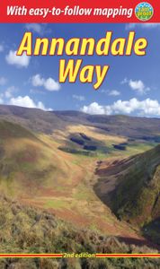
The Annandale Way is a charming long walk in a little-known, but very accessible, part of southern Scotland. Walked southward from source to the sea, it starts in the sheep town of Moffat, and runs for 56 miles (90 km) via Lochmaben, with superb views from the top of Almagill Hill. A slightly shorter branch of the route goes via Lockerbie and Eskri...
19,95

Webshops met dit product

Webshop
Bezorging
Prijs

Anderen bekeken ook

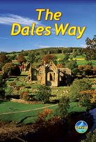
Wandelgids The Dales Way | Rucksack Readers
This charming walk runs for 79 miles (127 km) from Ilkley in the Yorkshire Dales to Bowness in the Lake District. The route heads north through Wharfedale, crisscrossing the river, and rises over high moorland to pick up River Dee through Dentdale. It joins River Lune briefly before heading west to Bowness on Lake Windermere. The LDWA has documented Link Routes for walkers beginning in Leeds, Harrogate and Bradford.   Along the Way, you’ll see impressive railway viaducts and fine stone bridges; Bolton Priory and many small churches; limestone scenery with stone walls, hay meadows and lime kilns; and heritage centres you can visit. Above all, the route is blessed with many small villages with B&Bs and welcoming pubs at strategic intervals. Gradients are modest and most people will complete it comfortably in 6 or 7 days.   This guidebook has all you need to plan and enjoy the Dales Way:   detailed directions for the main Way walked south to north detailed directions for the Bradford…
17,50
Wandelgids Cleveland Way | Rucksack Readers
“A testament to excellent research, writing and photography” - Malcolm Hodgson, Trail Manager   The Cleveland Way is one of England’s oldest and best-loved National Trails. It runs for 108 miles (174 km) around the North York Moors National Park, starting inland at Helmsley, offering panoramic views over the vales of York and Mowbray and from the Cleveland Hills. After reaching the coast at Saltburn, it heads south along the dramatic sea cliffs, with their tales of shipwrecks and smugglers, to end at Filey.   The route features ancient burial mounds, ruined castles, abbeys and Roman remains, with more recent traces of industrial history. Vast areas of heather moorland are host to a wide range of wildlife. The Cleveland Way is easily accessible by public transport and is divided into easy stages by villages of character with friendly pubs and accommodation. Above all, walkers are welcomed with warm Yorkshire hospitality.   Our new second edition has larger-scale mapping, several route u…
19,95
Wandelgids The Cleveland way and the Yorkshire Wolds way | Cicerone
Uitstekende wandelgids van de Cotswolds Way, waarbij naast alle noodzakelijke informatie ook gebruik gemaakt wordt van de echte topografische kaart. Inclusief gidsje met routekaarten van 1:25000 Guidebook to the Cleveland Way and Yorkshire Wolds Way National Trails, plus the Tabular Hills Walk link route. The guidebook also contains a 1:25,000 scale OS route map booklet of the Cleveland Way.   The Cleveland Way National Trail, described in seven day stages, is a fine 177km (110 miles) walk around the North York Moors National Park from Helmsley to Filey. The Yorkshire Wolds Way is one of the quietest of Britain's National Trails and wanders for 130km (80 miles) through gentle, cultivated and sparsely populated countryside. Described here in nine day stages, from Hessle near Redcar to Filey, it links end-to-end with the Cleveland Way on the coast. Also described is the three-day, 80km (50 mile) Tabular Hills Walk, a Regional Trail that allows walkers to close the loop of the Cleveland W…
25,95
Wandelgids Cumbria Way | Rucksack Readers
Lange afstandswandelgids van de Cumbria Way door het Lake district. Wandelgids met kaarten en beschrijving. op waterbestendig papier, in spiraalbinding. The Cumbria Way begins at Ulverston and heads north through the Lake District for 73 miles (123 km) through unspoiled dales, passing stone-built farms, going around charming lakes and running beneath rugged fells. Busy tourist towns and villages contrast with woodland, wild fellside, high passes and remote moorlands. The Way passes over the summit of High Pike (658 m/2158 ft) with panoramic views, and ends by descending to the historic border city of Carlisle.   This new edition covers various route updates (mostly near Ulverston), has larger scale mapping and includes many fresh photos. It is in our new, narrow format – more pocketable, with perfect binding sewn for extra robustness, lightweight and more rainproof than ever.   detailed description of the route from south to north Foreword by broadcaster Eric Robson geology, history…
19,95
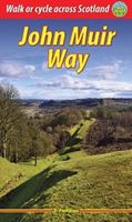
Wandelgids John Muir Way | Rucksack Readers
The John Muir Way runs for 134 miles (215 km) coast-to-coast across central Scotland, from Helensburgh on the Clyde to Dunbar on the North Sea. The route is as suitable for cyclists as for walkers, and it can be tackled as a coast-to-coast expedition or in sections - ten for walkers or five for cyclists.   The John Muir Way's appeal ranges from the Charles Rennie Mackintosh architecture of Helensburgh through the scenic grandeur of Loch Lomond, along two famous canals and past the amazing Falkirk Wheel, beside the Roman Antonine Wall, passing Linlithgow Palace, Blackness Castle and the Forth Bridges to the capital glories of Edinburgh. It goes beside the Firth of Forth to reach North Berwick, then heads inland to finish at Dunbar with its ruined castle and the John Muir birthplace.   This guidebook contains all you need to plan and enjoy your holiday on a bike or on foot:   background on John Muir's life, the canal heritage and wildlife detailed description of the route from west to …
23,95
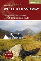
Wandelgids West Highland Way | Cicerone
Uitstekende wandelgids die in etappes de route nauwkeurig beschrijft; ook de zijtakken en alternatieve routes komen aan bod. Inclusief gidsje met topografische routekaarten van 1:25000  A guidebook to Scotland’s West Highland Way, a 95-mile walk from Milngavie near Glasgow to Fort William, passing Loch Lomond, crossing Rannoch Moor and finishing in the shadow of Britain’s highest mountain. The walk, which takes roughly one week to complete, is described in seven stages, with each stage ranging from 8 to 20 miles.  The guide details the ‘classic’ south-north direction but also provides a summary description for those wanting to walk the route in the opposite direction.   The guidebook, which features step-by-step route descriptions, 1:100K mapping, handy practical information as well as notes on the region’s history, culture and geography, is accompanied by a separate, pocket-sized 1:25K OS map booklet, providing all the mapping you need to walk the route.   Passing from the lowlands to…
20,95
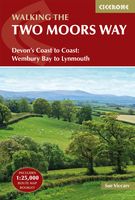
Wandelgids The Two Moors Way | Cicerone
Uitstekende wandelgids van de Two Moors Way, waarbij naast alle noodzakelijke informatie ook gebruik gemaakt wordt van de echte topografische kaart. inclusief gidsje met routekaarten van 1:25000 This guidebook to walking Coast to Coast across Devon, presents a 117 mile route incorporating the Two Moors Way and a section of the Erme-Plym Trail. Beginning at Wembury Bay on the south coast and finishing at Lynmouth, the 11-stage walk passes through the beautiful Devon countryside and across two of southwest England’s magnificent moorlands, Dartmoor and Exmoor. The schedule can be adjusted to give a one-week walk, or a more leisurely pace if preferred, and the book includes low-level bad-weather alternative routes for some moorland stretches.   A full route description is given for walking the route from south to north, with a summary description for walking in the opposite direction. 1:50,000 map extracts show the route and there is lots of practical information on public transport, refre…
23,95
Wandelgids Coast to Coast the Wainwright Route | Rucksack Readers
Lange afstandswandelgids van de Coast to Coast wandeling. Wandelgids met kaarten en beschrijving. op waterbestendig papier, in spiraalbinding. This challenging walk of 184 miles (296 km) crosses the north of England from St Bees on the Cumbria coast to Robin Hood’s Bay on the North Sea. It passes through three National Parks – the Lake District, Yorkshire Dales and North York Moors – with splendidly varied scenery. Many walkers complete it within 12 to 16 days, although some divide it into two separate week-long walks.   Devised by the legendary Alfred Wainwright, the Coast to Coast is justly famous as England's most popular walk. It is waymarked, has plenty of accommodation and features welcoming pubs. Both its ends and two midpoints (Kirkby Stephen and Richmond) are accessible by public transport.   The new edition features many photographs by the award-winning landscape photographer Karen Frenkel. It also has freshly commissioned mapping, which appears on 25 of its 126 pages. It cov…
22,50
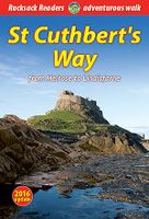
Wandelgids St. Cuthbert's Way | Rucksack Readers
Lange afstandswandelgids van de St. Cuthbert's Way wandeling. Wandelgids met kaarten en beschrijving. op waterbestendig papier, in spiraalbinding. Follow the footsteps of St Cuthbert in this easy-going walk of 63 miles (101 km) from Melrose Abbey in the Scottish Borders to the Holy Island of Lindisfarne in Northumberland. St Cuthbert's Way is one of Scotland's Great Trails, and it is also one of England's great trails. Starting from the ruins of Melrose Abbey, it winds alongside the River Tweed, and after about 31 miles you walk across the border into England on high ground.   The Way includes a section of Roman road and passes castles, hill forts and historic ruins along the way. Most people will complete it comfortably within 5 or 6 days. Its summit is Wideopen Hill (369m/1210ft), and its barefoot finale is the Pilgrim Way to Lindisfarne with its priory and castle.   The route is fully waymarked, the gradients are modest and it has welcoming B&Bs and pubs at strategic intervals.…
22,50
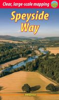
Wandelgids The Speyside Way | Rucksack Readers
Deze gids een goede beschrijving van de lange afstands route. De kaarten zijn schetsmatig maar wel duidelijk. The Speyside Way is one of Scotland’s Great Trails. It runs for 80 miles (128 km) from the fishing port of Buckie to Aviemore in the foothills of the Cairngorms. Following the lovely valley of the River Spey, you walk through countryside rich in malt whisky and wildlife, along riverside paths, railway trackbed and forest and moorland tracks.   The second edition was fully revised, with mapping from Footprint in six panels, updated plans of villages along the Way, including a fresh Grantown plan and directions from the terminus in Buckie. In 2016 we released the revised version of this essential trail guide, with fresh photos, new mapping and many other updates. These included documenting the 6.5-mile route extension to Kincraig, which opened in 2015, and 11-mile Badenoch Way.   This guidebook contains all you need to plan and enjoy the Speyside Way:   the Way step-by-step, …
22,50

Klanten-reviews van Wandelgids Annandale Way | Rucksack Readers

Er zijn nog geen beoordelingen voor dit productBen jij de eerste die een review plaatst?

Meer over Wandelgids Annandale Way | Rucksack Readers

Productomschrijving

The Annandale Way is a charming long walk in a little-known, but very accessible, part of southern Scotland. Walked southward from source to the sea, it starts in the sheep town of Moffat, and runs for 56 miles (90 km) via Lochmaben, with superb views from the top of Almagill Hill. A slightly shorter branch of the route goes via Lockerbie and Eskrigg Nature Reserve. The two branches rejoin north of Annan to reach the Solway Firth at Newbiebarns.  This guidebook contains everything you need to plan and enjoy your trip:   detailed route description for walking from north to south foreword by broadcaster Stephen Jardine background on the history and economy of Annandale seven pages of habitats and wildlife with superb images planning information for transport and accommodation seven pages of detailed mapping of the route at 1:44,000 summary of each section showing distance, terrain and food/drink stops concise directions for those who prefer to walk south to north lavishly illustrated, with over 100 colour photographs rucksack-friendly format, printed on rainproof paper.
Webshop.nl maakt gebruik van cookies. Ga je verder op onze website, ga dan akkoord met het plaatsen van cookies en de verwerking van deze data door ons en vermelde partners.