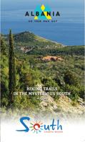
Wandelgids 801 Hiking trails in mysterious south Albania | Vektor

0
Kleine wandelgids van een deelgiebied in het zuiden van Albanië. Routes zijn redelijk beschreven en de kaarten die er bij gevoegd zijn, zijn ook van redelijk nivo.     ...

Verkopers met dit product

Verkoper
Bezorging
Prijs
DeZwerver.nl logo
DeZwerver.nl
2,95
10,50

Anderen bekeken ook

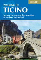
Wandelgids Walking in Ticino | Cicerone
Uitstekende wandelgids van dit gebied. Goed beschreven met veel praktische informatie om de routes te kunnen lopen, inclusief redelijke kaarten. This guidebook describes 38 walking routes in Ticino, the Swiss canton with a Mediterranean twist. Towering snowcapped mountains and lush, narrow valleys overlook stylish lakeside resorts with palm-fringed promenades and handsome Italianate architecture. It's not just the Italian language that sets Ticino apart: the food, sunny weather and stunning landscapes attract millions of visitors to this part of the southern Alps every year.   As for the walks, it's the variety - as much as the fabulous scenery - that provides the draw. In this book you'll find everything from level walks along the shores of Lakes Lugano and Maggiore, to more challenging trails through craggy, forested valleys with gushing waterfalls and ancient stone-built villages, to isolated mountain huts right at the permanent snowline. If you think you already know Switzerland, …
24,95
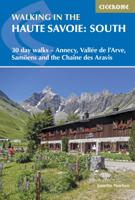
Wandelgids Walking in the Haute Savoie: South | Cicerone
Uitstekende wandelgids van dit geweldige gebied. goed beschreven met veel praktische informatie om de route te kunnen lopen, inclusief redelijke kaarten.   A guidebook of walks in the lovely Haute Savoie mountains of France. This guide describes 30 circular routes of between 7 and 20km, based around Annecy, La Clusaz, Grand Bornand, Plateau d'Assy, Samoëns, Sixt, Sallanches, Thônes, la Roche-sur-Foron. Graded from easy to difficult, there are walks to suit most abilities, but a few have some exposed sections and need a head for heights.   The guidebook is divided into 6 areas covering the Arve Valley, the Haut Giffre valley, the Chaîne des Aravis (north and south), Plateau de la Borne and Lake Annecy. Alongside a detailed route description and map, each walk has a summary of all you need to know before you set out (distance, time to walk, ascent, maximum altitude, grade and instructions for accessing the start). There is advice on travel, accommodation and equipment, as well as inform…
20,95
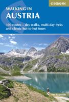
Wandelgids Oostenrijk - Walking in Austria | Cicerone
Uitstekende wandelgids van dit geweldige gebied. goed beschreven met veel praktische informatie om de route te kunnen lopen, inclusief redelijke kaarten. Bedenk wel - zie het overzicht- dat het voornamelijk routes zijn in het westen en zuiden van Oostenrijk. A comprehensive guidebook detailing walking routes in Austria. The 101 walks reflect the diversity of this popular region and cover Austria's magnificent Alps - including the Rätikon, Silvretta, Stubai and Zillertal - as well as the Dachsteingebirge, Hohe Tauern and the Karawanken. Graded according to difficulty and ranging from short walks of a few kilometres to day hikes and multi-day hut-to-hut tours, from the classic to the lesser-known, there is something to suit every level of ability and ambition.    A full description of each route is accompanied by clear sketch maps. This book has all the information you need to make the most of an active walking holiday in Austria, including information on public transport, accommodation…
24,95
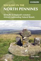
Wandelgids Walking in the North Pennines | Cicerone
Uitstekende wandelgids van dit geweldige gebied. goed beschreven met veel praktische informatie om de route te kunnen lopen, inclusief redelijke kaarten. This guidebook describes 50 day walks across the North Pennines, England's remotest Area of Outstanding Natural Beauty taking in parts of Cumbria, County Durham and Northumberland. Most of the routes are circular and they range from 5 to 14 miles, with something to suit all abilities. Route descriptions are accompanied by 1:50K OS mapping. A guidebook to day walks in the North Pennines Area of Outstanding Natural Beauty (AONB), across Cumbria, County Durham and Northumberland. The book includes 50 walks exploring England’s ‘last wilderness’, ranging from 5 miles (8km) to 14 miles (23km). Most are circular, though there are some linear routes, and there is something to suit all abilities over a variety of terrain. Route descriptions are illustrated with OS mapping and colour photographs, and the book includes details of local transpor…
19,95
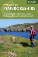
Wandelgids Walking in Pembrokeshire | Cicerone
Uitstekende wandelgids van dit mooie gebied aan de kust van Wales: het Pembrokeshire Coast national park. Goed beschreven met veel praktische informatie om de route te kunnen lopen, inclusief redelijke kaarten. Guidebook to 40 circular walks in Pembrokeshire in Wales. The routes, which range from 1 to 12 miles, take in the dramatic beauty of the national park and its coast, the Daugleddau and the Preseli Hills, while exploring wooded gorges, prehistoric hillforts and medieval castles.   Step-by-step route descriptions are accompanied by 1:50,000 mapping. For each route, information is also given regarding parking and public transport options, as well as toilets and refreshments available along the way. The guide also includes a useful route summary table, plus information on tides, the terrain, and weather in the region.   This collection of walks includes something for everyone, from novices to experienced ramblers. None of the walks demand technical skill and, in good weather, pose …
18,50
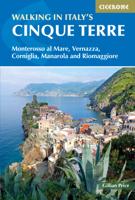
Wandelgids Walking in Italy's Cinque Terre | Cicerone
Uitstekende wandelgids van de Cinque Terre. Goed beschreven met veel praktische informatie om de routes te kunnen lopen, inclusief redelijke kaarten. This guidebook presents 16 graded walks exploring the world-famous Cinque Terre villages of Liguria in Italy. Suitable for beginners and experienced walkers, routes take in the villages of Monterosso, Vernazza, Manarola, Corniglia, Riomaggiore, as well as neighbouring Levanto, Campiglia and Porto Venere. It describes the most popular pathways as well as less trodden routes to hidden gems. Route descriptions and maps for each walk are accompanied by information on how to get around by public transport (train, ferry and bus), with background notes on history, culture, wildlife and flora, and suggestions on where to sleep and what to eat. In short, everything you could possibly need to get the most out of a holiday in this unique corner of the Italian Riviera. One of the best loved places in Italy, the Cinque Terre are UNESCO World Herita…
20,95
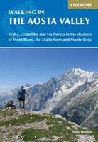
Wandelgids Walking in the Aosta Valley | Cicerone
Uitstekende wandelgids van Aosta en omgeving. Goed beschreven met veel praktische informatie om de routes te kunnen lopen, inclusief redelijke kaarten. Guidebook to hiking in the Aosta Valley, a stunning, autonomous region in the Italian Alps. Describes 32 scenic routes (ranging from 4 to 20km) within both the main valley and those to the north, including the Lys valley, Valpelline, Valtournenche, and Grand St Bernard. Also provides info on the via ferrata and trail running options in the region. A stunning, autonomous region in the Italian Alps, the Aosta valley is a walker's paradise. This guidebook describes 32 varied and scenic routes both within the main valley and those to the north (including the Lys valley, Valpelline, Valtournenche and Grand St Bernard). The routes vary in difficulty and distance, offering something for walkers of all ability. 1:50K mapping together with gradient profiles complement clear and concise route descriptions. Also included is invaluable practical i…
22,95
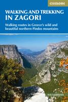
Wandelgids Walking and Trekking in the Zagori | Cicerone
Uitstekende wandelgids van Zagori. Goed beschreven met veel praktische informatie om de routes te kunnen lopen, inclusief redelijke kaarten. Zagori in Greece's Northern Pindos National Park is among the last relatively undiscovered and unspoilt hiking destinations in Europe. This guide presents a selection of thirty walks and three short treks showcasing the region's captivating scenery, from dramatic gorges to mystical forests, crystal-clear turquoise rivers, rugged alpine peaks and characterful mountain villages. Routes vary from easy walks on clear paths to strenuous ascents and mountain traverses, meaning that there is something to suit most ambitions and abilities. Clear mapping accompanies the route description, and the introduction to the guide covers all the practicalities, including getting to Zagori, accommodation, equipment, maps and safety. There is also a wealth of information about the region's rich history, architecture, geology, plants and wildlife, as well as fascina…
23,95

Klanten-reviews van Wandelgids 801 Hiking trails in mysterious south Albania | Vektor

Er zijn nog geen beoordelingen voor dit productBen jij de eerste die een review plaatst?

Meer over Wandelgids 801 Hiking trails in mysterious south Albania | Vektor

Productomschrijving

Kleine wandelgids van een deelgiebied in het zuiden van Albanië. Routes zijn redelijk beschreven en de kaarten die er bij gevoegd zijn, zijn ook van redelijk nivo. 


Productinformatie

    Verken gerelateerde categorieën

    Webshop.nl maakt gebruik van cookies. Ga je verder op onze website, ga dan akkoord met het plaatsen van cookies en de verwerking van deze data door ons en vermelde partners.