webshop.nl
Categorieën
  Sluiten

Atlas The Phantom Atlas | Simon & Schuster

Een fascinerend boekwerk met de grootste mythes, leugens en blunders die ooit op kaart zijn verschenen. In een luxe hardcover uitgave met mooie stofomslag. The Phantom Atlas is an atlas of the world not as it ever existed, but as it was thought to be. These marvellous and mysterious phantoms - non-existent islands, invented mountain ranges, mythica...
34,95

Webshops met dit product

Webshop
Bezorging
Prijs

Anderen bekeken ook

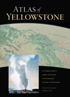
Atlas Atlas of Yellowstone | University of California
“Atlas of Yellowstone shows that good things happen when top-notch cartography, tasteful design, solid research, and compelling geography come together. The atlas will delight professional and armchair readers alike. Its treasure trove of maps explore wide-ranging topics—from geology to wildlife to people and the land. Better still, these well-orchestrated elements reveal a bigger idea: the place we call the Greater Yellowstone.” —Tom Patterson, former president, North American Cartographic Information Society “An extremely attractive, first-rate volume that is sure to become a fundamental resource for scholars and anyone who loves Yellowstone.”—Richard Marston, Kansas State University "While much has been written on the Yellowstone region, nothing compares to this volume in scope or presentation. This will become the standard reference and starting point for anyone interested in the history of Yellowstone."—Anthony Barnosky, author of Heatstroke: Nature in an Age of Global Warming U…
35,-
Wandelgids Landscapes of the Tatra Mountains (Polen en Slowakije) | Sunflower books
Wandelgids: vele dagtochten worden degelijk beschreven met openbaar vervoer informatie, goede routebeschrijvingen en kaartmateriaal. Tevens enkele autotochten. (Engelstalig) The go-to Tatra Mountains travel guide for discovering the best walks and car tours. Strap on your boots and discover Tatra Mountains on foot with the Sunflower Tatra Mountains travel guide. And on the days when your feet may have had enough, enjoy some spectacular scenery on one of our legendary car tours.   The Sunflower Tatra Mountains guide is indispensable for hiking in the Tatra Mountains or seeing Tatra Mountains by car. For those who love mountain walks, there can be few places where hikers are better catered for than in the Polish Tatras and the Slovakian Tatras. Skilfully constructed paths make hiking in very rough terrain comparatively easy; signposting and waymarking are almost universally excellent.   Hillwalkers will be in their element here, but there are often shorter, easy suggestions for the less …
23,50
Accommodatiegids Namibia Self-Drive Guide | Tracks4Africa
So, what is so special about the Tracks4Africa guide books? These are not guides written by armchair travellers or the personal experience of one person, but the combined experiences of a whole community of travellers. The T4A community travel far and wide – not by luxury bus or safari vehicle but on their own wheels. Sometimes they travel in groups and sometimes as lone rangers, but they always travel by motorbike, sedan or 4WD, therefore this guide is specifically aimed at self-drive travellers.   If you are a self-drive tourist, there are five things that you need to know when you are on the road: 1. Where to sleep. 2. Where to get fuel. 3. What to see and do. 4. Where to buy supplies. 5. Where to go in case of an emergency.   If you have the Tracks4Africa Self-Drive Guide as your travel companion, the answers to all these and many more questions will be at hand. If you are well prepared and well informed, you can really enjoy the unspoilt beauty of Africa! The Tracks4Afric…
52,50
Fietsgids Bikeline Iron Curtain Trail 3 - German-German Border Trail | Esterbauer
Praktische fietsgids met detailkaarten, ingetekende route, informatie over overnachten en fietsenmakers, zwaarte en hoogteprofiel. In spiraalbinding, Engelstalig   The Iron Curtain ran for about 7,000 km from the Barents Sea in the north straight through Europe to the Black Sea and divided the continent in East and West. Until the Velvet Revolution in Eastern Europe it was a physical and ideological border between two blocks which conceived each other as enemies. Not only were many neighbouring states divided, but Germany itself was divided into east and west. Today there are hardly any reminders that the wall ever existed.   The border in Germany was 1,400 km long. The former death strip was composed of 3.000 km of fences, car-trenches for 730 km, 830 observation towers, the brightly lit roads, walls and bunkers – most of it is gone. Remaining are the vehicle roads with their perforated paving stones and several observation towers. And in a few years the sparse vegetation will be supp…
17,95
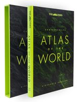
Atlas The Times Comprehensive Atlas of the World | Collins
De moeder aller atlassen in een nieuwe druk. Als je al een atlas wilt kopen, bezuinig dan niet en doe deze: veruit de beste meest complete atlas in een prachtige uitvoering met beschermdoos.   Now in its 16th edition, the world's most authoritative atlas has been extensively updated.   Detailing our world as it is today, it includes more than 200,000 place names. At 45 cm high, this impressive world atlas will become a treasured possession.   In addition to 263 pages of continuous mapping, there are a further 223 pages of extensive indexing, alongside a preliminary section containing essays from trusted academics who discuss topics ranging from global population, to climate change, and the composition of our solar system, to the water in our oceans.   It is a benchmark of cartographic excellence, trusted by governments, media and international organisations, as well as households around the world.   Updates include: New country names for Eswatini (formerly Swaziland) and North Macedoni…
226,50
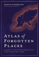
Atlas Atlas of Forgotten Places | White Lion Publishing
Explore the places that time forgot. Abandoned, mysterious, sleeping monuments around the world have been relegated to the margins of history, pushed off the map and out of sight. From ancient ruins and crumbling castles to more recent relics – an art deco New York subway station, a Soviet ghost town in the Arctic Circle, a flooded Thai mall teeming with aquatic life – Travis Elborough takes you on a journey into these strange, overlooked and disappearing worlds and immortalises their fates. Original maps and stunning colour photography accompany Travis Elborough’s moving historic and geographic accounts of each site. The featured locations are a stark reminder of what was, and the accounts in this investigative book help to bring their stories back to life, telling us what happened, when and why, and to whom. The book features 40 sites, including: Santa Claus, Arizona, USA: A festive tourist resort turned ghost town deep in the desert where once you could meet Santa Claus any day …
21,95
Fietskaart 14 Cycling guides Suffolk | Goldeneye
To be confronted with the variety and complexity of the cycling routes, trails and paths in Suffolk can be a bewildering experience.  For it appears that the Suffolk County Council and the three District Councils are all trying hard to promote their areas. This is indeed encouraging for the growth of cycling, but it can be confusing.  Our purpose is to provide clear, easy to use and easy to follow, cycling maps, and to illustrate these in a comprehensive form.    Suffolk must be one of the most charming of counties to explore by bicycle. When Al Churcher delivered his routes to us at Goldeneye we couldn’t keep him quiet, such was his enthusiasm and wonder at Suffolk’s country lanes and byways. He has cycled all over the UK, Canada, Mallorca, New Zealand and Sicily, but Suffolk remained a firm favourite.    The inland scenery is not spectacular for the county’s main glory lies with its attractive villages; the local architecture jealously preserved from modern depredation. There is an a…
15,95
Vogelgids Centraal Azie - Birds of Central Asia | Bloomsbury
Birds of Central Asia is the first field guide to include the former Soviet republics of Kazakhstan, Kyrgyzstan, Turkmenistan, Uzbekistan and Tajikistan, along with neighbouring Afghanistan. This vast area includes a diverse variety of habitats, and the avifauna is similarly broad, from sandgrouse, ground jays and larks on the vast steppe and semi-desert to a broad range of raptors, and from woodland species such as warblers and nuthatches to a suite of montane species, such as snowcocks, accentors and snowfinches. Birds of Central Asia includes 141 high-quality plates covering every species (and all distinctive races) that occur in the region, along with concise text focusing on identification and accurate colour maps. Important introductory sections introduce the land and its birds. Birds of Central Asia is a must-read for any birder or traveller visting this remote region.   "For a long time, there's been something of a gap in field-guide coverage across the Palearctic. Europe is we…
50,95
Reisgids Culture Smart! Slovenia - Slovenië | Kuperard
De Cultuur Bewust!-gids geeft toeristen en zakenlieden belangrijke informatie met betrekking tot de cultuur van alledag in het land van bestemming. Anders dan in de gebruikelijke reisgidsen wordt de lezer in deze reeks bijgespijkerd op het gebied van omgangsvormen, normen en waarden, hoe zich te gedragen en wat verwacht mag worden op zakelijk en sociaal gebied. Het zijn beknopte zakformaatgidsen met interessante wetenswaardigheden over het dagelijks leven. Een must voor iedereen die naar het buitenland gaat voor vakantie, studie of werk.   Culture Smart! provides essential information on attitudes, beliefs and behavior in different countries, ensuring that you arrive at your destination aware of basic manners, common courtesies, and sensitive issues. These concise guides tell you what to expect, how to behave, and how to establish a rapport with your hosts. This inside knowledge will enable you to steer clear of embarrassing gaffes and mistakes, feel confident in unfamiliar situations,…
14,95
Fietsgids Bikeline Cycling guide Provence | Esterbauer
Provence – The name alone sounds inviting to every traveller. The region’s wonderfully mild climate and many quiet paved roads makes it an ideal destination for bicycle tourists year round. Let yourself be enchanted by ancient towns and historic monasteries, by the scent from fields of rich lavender, the charm of tiny villages and French joie de vivre. Enjoy the contrasts presented by the peaceful expanses of the Camargue, with its glittering blue bays and herds of Camargue horses grazing in a landscape dotted with brilliantly white farmsteads. A refreshing plunge into the Mediterranean is just one of the many highlights of this bicycle tour. This Cycling Guide includes detailed maps of the countryside and of many cities and towns, precise route descriptions, information about historic and cultural sites as well as background information and a comprehensive list of overnight accommodations. The only thing this guide cannot provide is fine cycling weather, but we hope you find nothing b…
13,50

Klanten-reviews van Atlas The Phantom Atlas | Simon & Schuster

Er zijn nog geen beoordelingen voor dit productBen jij de eerste die een review plaatst?

Meer over Atlas The Phantom Atlas | Simon & Schuster

Productomschrijving

Een fascinerend boekwerk met de grootste mythes, leugens en blunders die ooit op kaart zijn verschenen. In een luxe hardcover uitgave met mooie stofomslag. The Phantom Atlas is an atlas of the world not as it ever existed, but as it was thought to be. These marvellous and mysterious phantoms - non-existent islands, invented mountain ranges, mythical civilisations and other fictitious geography - were all at various times presented as facts on maps and atlases. This book is a collection of striking antique maps that display the most erroneous cartography, with each illustration accompanied by the story behind it. Exploration, map-making and mythology are all brought together to create a colourful tapestry of monsters, heroes and volcanoes; swindlers, mirages and murderers. Sometimes the stories are almost impossible to believe, and remarkably, some of the errors were still on display in maps published in the 21st century. Throughout much of the 19th century more than 40 different mapmakers included the Mountains of Kong, a huge range of peaks stretching across the entire continent of Africa, in their maps - but it was only in 1889 when Louis Gustave Binger revealed the whole thing to be a fake. For centuries, explorers who headed to Patagonia returned with tales of the giants they had met who lived there, some nine feet tall. Then there was Gregor MacGregor, a Scottish explorer who returned to London to sell shares in a land he had discovered in South America. He had been appointed the Cazique of Poyais, and bestowed with many honours by the local king of this unspoiled paradise. Now he was offering others the chance to join him and make their fortune there, too - once they had paid him a bargain fee for their passage...  The Phantom Atlas is a beautifully produced volume, packed with stunning maps and drawings of places and people that never existed. The remarkable stories behind them all are brilliantly told by Edward Brooke-Hitching in a book that will appeal to cartophiles everywhere. 
Webshop.nl maakt gebruik van cookies. Ga je verder op onze website, ga dan akkoord met het plaatsen van cookies en de verwerking van deze data door ons en vermelde partners.