webshop.nl
Categorieën
  Sluiten

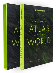
Atlas The Times Comprehensive Atlas of the World | Collins

De moeder aller atlassen in een nieuwe druk. Als je al een atlas wilt kopen, bezuinig dan niet en doe deze: veruit de beste meest complete atlas in een prachtige uitvoering met beschermdoos.   Now in its 16th edition, the world's most authoritative atlas has been extensively updated.   Detailing our world as it is today, it includes more than 200,0...
226,50

Webshops met dit product

Webshop
Bezorging
Prijs

Anderen bekeken ook

Atlas The Times Concise Atlas of the World | Collins
Het kleinere zusje van de grotere comprehensive atlas, maar nog steeds een imposante dikke verschijning! Gedetailleerde en prachtig uitgevoerde kaarten presenteren de perfecte combinatie van traditie, kennis en stijl. De kaarten zijn ontworpen in de bekroonde Times stijl, hierdoor is er een atlas geproduceerd in een hoogstaande, heldere kwaliteit. Prachtige satelietfoto's gecombineerd met foto's en grafieken geven een helder beeld van de hedendaagse wereld. De atlas is gevat in een elegante slipcase. A fully revised and updated fourteenth edition of this major world atlas in the authoritative and prestigious Times Atlas range. This beautifully designed atlas has all the information you need, whether planning a trip, keeping in touch with world news, solving quizzes and crosswords or just exploring the world from your armchair. Comprehensive reference mapping with 155,000 place names providing an amazingly detailed view of the world, and the illustrated thematic content covers the most…
89,95
Atlas The Times Mini Atlas of the World | Collins
De kleinste uitvoering van de beste atlas ter wereld! Ook deze mini uitvoering is mooi van kleur en uiterlijk: een leuke kado voor een schappelijke prijs. A pocket-sized Times Atlas of the World packed with the essentials. Fully revised and improved to take account of all recent changes from around the world. Complete map coverage of the world is provided with the accuracy and authority for which Times atlases are renowned. This new edition of The Times Mini Atlas of the World has been fully revised to bring all the maps and geographical information completely up to date. As with all the atlases in the Times range it offers great authority, outstanding quality and attention to detail. FULLY UPDATED The 117 pages of reference maps have been completely updated to provide accurate, accessible and attractive coverage of the whole world. The introductory section covers major world geographical themes -- from climate and environment to population and urbanization -- giving a global snapshot …
13,95
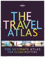
Atlas The Travel Atlas | Lonely Planet
This is the ultimate world atlas for globetrotters. Combining our extensive mapping experience and unrivalled destination insight and knowledge, our first dedicated altas makes it easy for you to plan adventures and discover remarkable places around the planet. With Lonely Planet's The Travel Atlas in your hands, you can explore every part of the world and plan upcoming trips with one simple and easy-to-use resource.   Inside, you'll find detailed maps to every country on Earth, with popular regions and destinations presented at greater scale. Each large page of mapping is accompanied with the area's top sights and activities, while our themed itineraries, ranging from two days to two weeks, will ensure you don't miss the best sights. You'll also find trip planning tools like climate information and transport hubs to help you get there and away.   About Lonely Planet: Lonely Planet is a leading travel media company and the world's number one travel guidebook brand, providing both inspi…
64,95
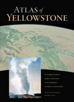
Atlas Atlas of Yellowstone | University of California
“Atlas of Yellowstone shows that good things happen when top-notch cartography, tasteful design, solid research, and compelling geography come together. The atlas will delight professional and armchair readers alike. Its treasure trove of maps explore wide-ranging topics—from geology to wildlife to people and the land. Better still, these well-orchestrated elements reveal a bigger idea: the place we call the Greater Yellowstone.” —Tom Patterson, former president, North American Cartographic Information Society “An extremely attractive, first-rate volume that is sure to become a fundamental resource for scholars and anyone who loves Yellowstone.”—Richard Marston, Kansas State University "While much has been written on the Yellowstone region, nothing compares to this volume in scope or presentation. This will become the standard reference and starting point for anyone interested in the history of Yellowstone."—Anthony Barnosky, author of Heatstroke: Nature in an Age of Global Warming U…
35,-
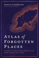
Atlas Atlas of Forgotten Places | White Lion Publishing
Explore the places that time forgot. Abandoned, mysterious, sleeping monuments around the world have been relegated to the margins of history, pushed off the map and out of sight. From ancient ruins and crumbling castles to more recent relics – an art deco New York subway station, a Soviet ghost town in the Arctic Circle, a flooded Thai mall teeming with aquatic life – Travis Elborough takes you on a journey into these strange, overlooked and disappearing worlds and immortalises their fates. Original maps and stunning colour photography accompany Travis Elborough’s moving historic and geographic accounts of each site. The featured locations are a stark reminder of what was, and the accounts in this investigative book help to bring their stories back to life, telling us what happened, when and why, and to whom. The book features 40 sites, including: Santa Claus, Arizona, USA: A festive tourist resort turned ghost town deep in the desert where once you could meet Santa Claus any day …
21,95
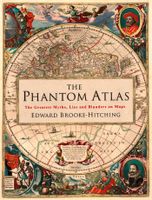
Atlas The Phantom Atlas | Simon & Schuster
Een fascinerend boekwerk met de grootste mythes, leugens en blunders die ooit op kaart zijn verschenen. In een luxe hardcover uitgave met mooie stofomslag. The Phantom Atlas is an atlas of the world not as it ever existed, but as it was thought to be. These marvellous and mysterious phantoms - non-existent islands, invented mountain ranges, mythical civilisations and other fictitious geography - were all at various times presented as facts on maps and atlases. This book is a collection of striking antique maps that display the most erroneous cartography, with each illustration accompanied by the story behind it. Exploration, map-making and mythology are all brought together to create a colourful tapestry of monsters, heroes and volcanoes; swindlers, mirages and murderers. Sometimes the stories are almost impossible to believe, and remarkably, some of the errors were still on display in maps published in the 21st century. Throughout much of the 19th century more than 40 different mapmak…
34,95
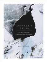
Atlas Antarctic Atlas | Particular Books
One of the least-known places on the planet, the only continent on earth with no indigenous population, Antarctica is a world apart. From a leading cartographer with the British Antarctic Survey, this new collection of maps and data reveals Antarctica as we have never seen it before. This is not just a book of traditional maps.   It measures everything from the thickness of ice beneath our feet to the direction of ice flows. It maps volcanic lakes, mountain ranges the size of the Alps and gorges longer than the Grand Canyon, all hidden beneath the ice. It shows us how air bubbles trapped in ice tell us what the earth's atmosphere was like 750,000 years ago, proving the effects of greenhouse gases.   Colonies of emperor penguins abound around the coastline, and the journeys of individual seals around the continent and down to the sea bed in search of food have been intricately tracked and mapped. Twenty-nine nations have research stations in Antarctica and their unique architecture is l…
47,50
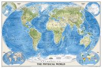
Wereldkaart 08 Natuurkundig - the world physical, 178 x 122 cm | National Geographic
Bijzonder fraaie natuurkundige kaart van National Geographic waarbij het accent ligt op de fysische aspecten van de aarde met veel details van de oceanen. Een schoonheid aan de muur! Our World Physical - Ocean Floor map highlights the Earth's land and undersea forms with exquisite hand-painted relief. Drawn in the Winkel Tripel projection to minimize distortion of the landforms. Two corner inset maps show the Earth's crust and world climatic zones. Scale: 1:24,031,000. Superb representation of the ocean floor makes this 175.5 x 121.5cm (5ft 9” x 4ft approx.) physical map of the world one of the most interesting titles in the National Geographic Society’s long list of wall maps. Drawn with great skill to achieve a 3-D effect, ocean floor plains, basins, continental shelves, trenches, ridges and fractures are shown with their names, indicating in many places their depth in metres. On land masses relief shading shows the mountain chains, whilst the colouring indicates different types of t…
52,95
Wereldkaart 09 Natuurkundig - the world physical, 178 x 122 cm | National Geographic
Bijzonder fraaie natuurkundige kaart van National Geographic waarbij het accent ligt op de fysische aspecten van de aarde met veel details van de oceanen. Een schoonheid aan de muur! Deze versie is geplastificeerd.   Our World Physical - Ocean Floor map highlights the Earth's land and undersea forms with exquisite hand-painted relief. Drawn in the Winkel Tripel projection to minimize distortion of the landforms. Two corner inset maps show the Earth's crust and world climatic zones. Scale: 1:24,031,000.  Superb representation of the ocean floor makes this 175.5 x 121.5cm (5ft 9” x 4ft approx.) physical map of the world one of the most interesting titles in the National Geographic Society’s long list of wall maps. Drawn with great skill to achieve a 3-D effect, ocean floor plains, basins, continental shelves, trenches, ridges and fractures are shown with their names, indicating in many places their depth in metres.    On land masses relief shading shows the mountain chains, whilst the co…
74,95
Wegenatlas Travel Atlas Indian Subcontinent | ITMB
Handzame wegenatlas op A5 formaat, helaas geen spiraalbinding. Maar voor deze regio is er op dit moment geen andere atlas beschikbaar.   This is our biggest atlas ever, with 152 pages of maps and 51 pages of place names indexing. The Indian Sub-Continent consists of Pakistan, India, Nepal, Bhutan, Bangladesh, Sri Lanka and Kashmir. Each country (Kashmir being considered shared) is presented as an entity, so Pakistan occupies 30 pages at 1:1,200,000 scale, and Nepal occupies 32 pages at 1:530,000 scale. In short, each country is shown in detail, but at scales appropriate for each country. The amount of detail on each page is impressive; equal to buying six maps at $12.95 each. The market is the traveller to the region, visiting several of these areas and wanting a compact way to have detailed mapping without having to carry half a dozen maps or spend a large amount of money on maps. Eleven city inset maps are included, as well as basic insets for the Andaman and Nicobar island chains. T…
16,50

Klanten-reviews van Atlas The Times Comprehensive Atlas of the World | Collins

Er zijn nog geen beoordelingen voor dit productBen jij de eerste die een review plaatst?

Meer over Atlas The Times Comprehensive Atlas of the World | Collins

Productomschrijving

De moeder aller atlassen in een nieuwe druk. Als je al een atlas wilt kopen, bezuinig dan niet en doe deze: veruit de beste meest complete atlas in een prachtige uitvoering met beschermdoos.   Now in its 16th edition, the world's most authoritative atlas has been extensively updated.   Detailing our world as it is today, it includes more than 200,000 place names. At 45 cm high, this impressive world atlas will become a treasured possession.   In addition to 263 pages of continuous mapping, there are a further 223 pages of extensive indexing, alongside a preliminary section containing essays from trusted academics who discuss topics ranging from global population, to climate change, and the composition of our solar system, to the water in our oceans.   It is a benchmark of cartographic excellence, trusted by governments, media and international organisations, as well as households around the world.   Updates include: New country names for Eswatini (formerly Swaziland) and North Macedonia (previously the Former Yugoslav Republic of Macedonia) More than 8000 place name changes with names comprehensively updated in Kazakhstan and Ukraine Addition of Maori names in New Zealand and restored indigenous names in Australia, the most notable being the renaming of Fraser Island in Queensland to its Butchulla name Kgari Administrative boundary updates in Ethiopia, Mali and Kazakhstan Added road, railway and airport infrastructure across the globe including the 4km-long Dardanelles Bridge (Turkey), the Fehmarn Belt road/rail tunnel alignment (Germany/Denmark) and the Sandoy Tunnel (Faroe Islands)   Produced in a high-quality finish this comprehensive atlas of the world comes in a protective slipcase with two ribbon markers for ease of use.      
Webshop.nl maakt gebruik van cookies. Ga je verder op onze website, ga dan akkoord met het plaatsen van cookies en de verwerking van deze data door ons en vermelde partners.