webshop.nl
Categorieën
  Sluiten

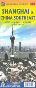
Stadsplattegrond Shanghai & China zuidoost | ITMB

Goede stadsplattegrond van Shanghai. Met register en suburban treinsysteem. De echte buitenwijken van deze megastad staan er niet op. daarnaast een overzichtskaart van zuidoost China. This updated map of rapidly-changing Shanghai has been enhanced in this edition by being printed on ITM waterproof plastic paper and by the addition of a separate map...
13,95

Webshops met dit product

Webshop
Bezorging
Prijs

Anderen bekeken ook

Wegenkaart - landkaart - Stadsplattegrond Montreal & Southern Quebec | ITMB
Stadsplattegrond van Montreal met register. Op de achterzijde een kaart van het zuiden van Quebec. 1:12,500/1:850,000 on waterproof paper. In this third, updated, edition of Canada's third largest city, we have added a user-friendly bonus. As is common now to most of our city maps, we have included a regional map of the hinterland of the urban area, so buyers won't have to purchase a second map to explore the environs of the city being presented. In the case of Montreal, being in a huge geographic country, this means Southern Quebec which, because of its size, dictates a map of more than one to a million scale. In the European context this would be the equivalent of Paris and all of France as a 'regional' map of the surrounds of Paris - but that's France and this is Canada.   Montreal (or Mont Royale in its original) was a village called Hochelaga when the early French explorers arrived in the early 1600s. They established a trading fort and, generally speaking, maintained good relatio…
13,95
Wegenkaart - landkaart 92G Lower Mainland British Columbia - Richmond and New Westminster | ITMB
Goede wegenkaart van British Columbia met topografische uitsnede van Richmond en Westminster. Topographic/Recreation Map 92G&92G2 and G3 - With the 2010 Winter Olympics bearing down on us, this very timely map presents a lovely regional map showing all of the Olympic venues (the Games are being held in Vancouver, Richmond, UBC, Whistler, and the Callaghan Valley – not just in Vancouver). The area of coverage is from Everett (just north of Seattle) in the USA to north of Pemberton, and from Victoria in the west to Chilliwack in the east on the one side, and a detailed 1:50,000 topo map of the Richmond/New Westminster/Surrey/Langley outer urban areas of Metro Vancouver. Both maps are Government of Canada NTS maps, overlaid with touristic and recreational information by ITMB, which holds the copyright on behalf of the Queen (I love being able to say that). The Lower Mainland portion is particularly useful, in that it includes the east coast of Vancouver Island, from Victoria to Nanaimo an…
13,95
Stadsplattegrond Beijing en de Chinese Muur - Great Wall | ITMB
Duidelijke stadskaart van Beijing en op de achterzijde een overzicht van de delen van de Chinese Muur. Beijing is on the must-see list for any visitor to China. This updated edition includes new information post-2008 Olympics, such as the new subway line (No. 4) that has just been opened, plus new information about further extensions and lines being developed. The other side of the map is just as interesting. It covers the portion of the Great Wall of China that all visitors see, near Badaling, and also shows those sections that have disappeared over time, or have fallen into disrepair. As well, the famous Ming tombs of former emperors is also shown, as well as the Marco Polo bridge on the western edge of Beijing, so-named in honour of the famous trader/explorer who set out from this point on his return trip to Europe. This time, we have printed our Beijing/great Wall map in durable ITM plastic; printed double-sided Legend Includes: Roads by classifications, public transport lines, mus…
13,95
Wegenkaart - landkaart China | ITMB
Een degelijke kaart met aanduidingen van o.a. nationale parken, vliegveld, benzinepomp, dirt-roads en kleine plattegrond van hoofdstad. Als overzichtskaart goed te gebruiken. Tweezijdig, op de ene kant West China en op de andere zijde Oost China. This edition is printed on waterproof, tear-resistant paper, and has a new cover picture showing a portion of the Great Wall. A cursory glance at the map will show an incredible number of motorways. We still show some as being under construction, but updating the road network is now essentially completed. The amazing rapid rail network is now also essentially complete and all such train lines are noted on the map in a red-dashed format. Inset maps of Beijing and Shanghai are shown on side 2, as well as a list of Top Attractions. We continue to show contentious political disputed territories based on practical administrative control, so India's northeast is shown as being under India's control, whereas parts of the northwest are shown under Chi…
13,95
Wegenkaart - landkaart - Stadsplattegrond China South - Zuid | ITMB
Een degelijke wegenkaart met aanduidingen van o.a. nationale parken, vliegveld, benzinepomp, dirt-roads. Als overzichtskaart goed te gebruiken.   China is a very large country. While our map of the entire country is fine for general travel and sells well, China is too large to show areas in detail. This map concentrates on the part of China from Shanghai south and all the way west to Lhasa and includes Taiwan and Hainan Island. We are not trying to make any sort of political comment here, but geographically, both Tibet and Taiwan fall within the area of coverage and are both included for this reason alone. The map also includes insets of Hong Kong, Guangzhou and Shanghai   Legend Includes: Roads by classification, Points of Interest, National Parks, Airports, Golf Courses, Beaches, Campsites, Waterfalls, Viewpoints, Churches, Surfing/Scuba Diving Spots, Fishing Spots, Hospitals, harbours/Ports, Lighthouses, Museums, Monuments, Caves, Mosques, Mountain Peaks, Botanic Gardens, Wildlife S…
13,95
Wegenkaart - landkaart Australia - Australie | ITMB
Een degelijke kaart - geplastificeerd en 2-zijdig bedrukt - met aanduidingen van o.a. nationale parken, vliegveld, Aboriginal-gebieden, gebieden waar koraal te vinden is, dirt-roads en een kleine plattegrond van Sydney. Als overzichtskaart goed te gebruiken. Australia Travel Reference Map 6th Ed. 2010 1:3,500,000 on waterproof ITM paper. This was a minor update to Australia, and we’ve kept the same cover picture. The changes may be less important than the price, which has been decreased for this edition only for the North American market to stimulate demand. As a result, the ISBN has changed. At $10.95, this map is a bargain – updated, double-sided, and printed waterproof paper for durability. The map also contains excellent inset maps of Brisbane, Melbourne, and Sydney. It never ceases to amaze me how many editions some of our maps have gone through. At the start of this new edition, we have sold 25,000 copies of this title and are on our way to 30,000. Legend Includes: Roads by class…
13,95
Stadsplattegrond Geneve en Zwitserland | ITMB
This map has been a long time in development preparation. The data for a sophisticated country like Switzerland needs delicate handling to do justice to this lovely country. We did not want to do 'just' another road map, similar to those available from a variety of European publishers. Our version shows the physical reality of this mountainous country to good advantage without obscuring the places of interest to visitors. The road/rail infrastructure within the country is well shown with perhaps more villages being included than would normally be the case. The road network in surrounding countries has been simplified to focus attention on Switzerland itself. Touristic points, such as castles, fortresses, ski areas, and museums have been included, but we removed a lot of data, such as gas stations, schools, post offices, most churches and police stations in an effort to avoiding cluttering the map with an over-load of information. The Geneva side of the map goes from the airport in the …
13,95
Stadsplattegrond Letland - Latvia & Riga | ITMB
Een degelijke kaart met aanduidingen van o.a. nationale parken, vliegveld, benzinepomp, dirt-roads en plattegrond van hoofdstad. Als overzichtskaart goed te gebruiken. This is a brand new mapping area for ITMB. We have had a map of Riga for years, but not the country of Latvia, which now graces one side of the sheet while Riga occupies the other. The country is larger than one might think, touristically friendly, historically significant, and strategically important. Wedged between Estonia on the north and Lithuania on the south, Latvia tends to be a fast north-south route through the Baltic States, but its strength lies in being an east-west country with a very long coastline. Riga itself is a very interesting city, and our map shows it to perfection. This map would be very useful for anyone going to the Baltic Sea countries and firs very well with our companion map of Estonia/Talinn
13,95
Wegenkaart - landkaart - Stadsplattegrond Fleximap Shanghai | Insight Guides
Geplastificeerde centrumkaart van Shanghai, met register. Voor de 'gewone' toerist een handige kaart, geen groot formaat, overzichtelijk met alle belangrijke plaatsen goed weergegeven.   Flexi Map Shanghai is laminated, tear-resistant comprising 2 separate maps featuring the city and its surroundings; each map has its own index which has been categorised for ease of use.    It includes a list - with descriptions and some photographs - of 37 recommended sights, divided by theme and linked to the mapping by numbered markers. There is also a handy information section with concise details on getting around, tourist offices, money, tipping, opening times, public holidays, telecommunications, emergency tel...ephone numbers and climate.   On one side is a street plan of the city's central districts at a scale of 1:18 500 (1cm = 0.18km). One way streets, car parks, train and metro routes are clearly shown, in addition a Metro map is located on the back cover for easy reference. Many promi…
9,95
Stadsplattegrond Jerusalem & Holy Land - Jeruzalem en Noord Israël | ITMB
Een goede kaart van Jeruzalem en op de andere zijde noord- Israel met een schaal van 1:225.000, gedrukt op scheur- en watervast papier. Let op: de index van de kaart bevat plaatsnamen van geheel Israël en bevat zodoende plaatsnamen die niet op deze kaart staan. Jerusalem is an ancient city and also a religious centre, revered by Christians and Muslims alike. Lan and I visited the city in January and updated minor changes to the old walled city. We also wanted to change the regional map, but not its coverage or content, so we changed its name to Holy Land, on the assumption that the market for this map rests with pilgrims and those following well-known Biblical place names: the Sea of Galilee, Bethlehem, Nazareth etc. On our trip, we also discovered Agamemnon, which I'd believed to be mythological, and the crusader fortress of Acre, on the coast. Israel/Palestine offers so much more than 'just' Jerusalem that a map of this nature is essential for anyone visiting this part of the world. …
13,95

Klanten-reviews van Stadsplattegrond Shanghai & China zuidoost | ITMB

Er zijn nog geen beoordelingen voor dit productBen jij de eerste die een review plaatst?

Meer over Stadsplattegrond Shanghai & China zuidoost | ITMB

Productomschrijving

Goede stadsplattegrond van Shanghai. Met register en suburban treinsysteem. De echte buitenwijken van deze megastad staan er niet op. daarnaast een overzichtskaart van zuidoost China. This updated map of rapidly-changing Shanghai has been enhanced in this edition by being printed on ITM waterproof plastic paper and by the addition of a separate map on the reverse side of all of South East China. The regional map covers from Nanning to Beijing, so perhaps covers a wider area than just Fujian and Guangdong provinces, but this is a much more detailed map than anything we have attempted before, and is an excellent aid to anyone based in Shanghai and thinking of travelling to Xi’an, or Guilin, as well as closer destinations. The Shanghai side has been updated with the latest road and subway additions including, for the first time on any map, the route of the new MAGLEV line being built through the southern part of the city. Double-sided, on ITM plastic, Legend Includes: Roads/highways, public transportation, points of interest, accommodation, temples, information, and other attractions.
Webshop.nl maakt gebruik van cookies. Ga je verder op onze website, ga dan akkoord met het plaatsen van cookies en de verwerking van deze data door ons en vermelde partners.